Touring Moore Park
The district Moore Park of in Sydney (New South Wales) is a subburb located in Australia about 152 mi north-east of Canberra, the country's capital place.
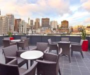
Need some hints on where to stay? We compiled a list of available hotels close to the map centre further down the page.
Being here already, you might want to pay a visit to some of the following locations: Sydney, Parramatta, Katoomba, Canberra and . To further explore this place, just scroll down and browse the available info.
Local weather forecast
Todays Local Weather Conditions & Forecast: 18°C / 64 °F
| Morning Temperature | 16°C / 62 °F |
| Evening Temperature | 17°C / 63 °F |
| Night Temperature | 16°C / 62 °F |
| Chance of rainfall | 4% |
| Air Humidity | 59% |
| Air Pressure | 1031 hPa |
| Wind Speed | Moderate breeze with 13 km/h (8 mph) from North |
| Cloud Conditions | Overcast clouds, covering 97% of sky |
| General Conditions | Light rain |
Friday, 3rd of May 2024
17°C (62 °F)
17°C (63 °F)
Moderate rain, moderate breeze, overcast clouds.
Saturday, 4th of May 2024
17°C (62 °F)
17°C (63 °F)
Moderate rain, gentle breeze, overcast clouds.
Sunday, 5th of May 2024
16°C (62 °F)
17°C (63 °F)
Heavy intensity rain, fresh breeze, overcast clouds.
Hotels and Places to Stay
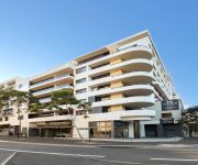
Meriton Suites Waterloo
Adina Sydney Surry Hills
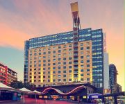
Mercure Sydney
Adina Sydney Central
Rydges Sydney Central
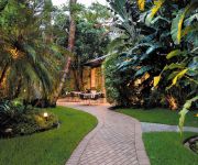
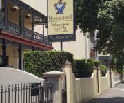
Manor House Boutique Hotel
57 Hotel
Shakespeare Hotel Surry Hills
Royal Exhibition Hotel
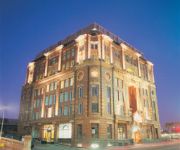
Central Railway Hotel
Videos from this area
These are videos related to the place based on their proximity to this place.
Sydney FC Cove Fans Sydney FC v Melbourne City 11/10/2014 are you there ??
Crazy fans cheering with Sydney Cove at Sydney FC opener 2014 against Melbourne City.
SYDNEY CITY Amazing View, OPERA HOUSE and HARBOUR BRIDGE from SYDNEY TOWER EYE..!!!
SYDNEY TOWER is Sydney's tallest free-standing structure, and the second tallest in Australia having height of 1014 ft. Great site to watch Opera House, Harbour Bridge and Sydney city from...
22 Ridge Street, Surry Hills | LJ Hooker Inner City
Original terrace with north-to-rear aspect and endless promise... Tightly held in the one family for more than 60 years, this completely original terrace presents an exceptionally rare opportunity...
LJ Hooker Inner City / Redfern, 21/1-7 Boronia Street
21/1-7 Boronia Street Redfern NSW Marketed by: LJ Hooker Inner City 9002 9888 innercity.ljhooker.com.au Contact: Brigitte Blackman Tel 02 9002 9882 | 0419 555 253, Email lchisholm@ljhooker.com ...
Off-grid urban home in Sydney reuses own sewage
Sustainable House Sydney produces power, water and even reuses its own sewage, right in the middle of Australia's biggest city. Original story here: http://faircompanies.com/videos/view/sydneys-sus...
LEGO City Police Bomber - Ultimate Toy Review 7279-7285-7286
I do toy reviews different to the others. A entertaining drama packed start, 3 LEGO Police sets reviewed 7279 7285 7286, some custom building and a insight into how I make my LEGO videos. All...
LJ Hooker Inner City / Redfern, 169 George Street
169 George Street Redfern NSW Marketed by: LJ Hooker Inner City 9002 9888 innercity.ljhooker.com.au Contact: Aaron Petrilli Tel 02 9002 9888 | 0416 954 912, Email lchisholm@ljhooker.com Brigitte ...
LJ Hooker Inner City / Waterloo, 505/8 Sam Sing Street
505/8 Sam Sing Street Waterloo NSW Marketed by: LJ Hooker Inner City 9002 9888 innercity.ljhooker.com.au Contact: Dominic Kuneman Tel 02 9002 9888 | 0424 988...
Brett Cavanough's video update on Secret City | Stablesmart
Get all the latest Racing Updates & Reports by Brett Cavanough on Secret City and other leading Horses, Trainers, Jockeys & Journalists on Stablesmart (http://www.stablesmart.com). On 14 August...
Videos provided by Youtube are under the copyright of their owners.
Attractions and noteworthy things
Distances are based on the centre of the city/town and sightseeing location. This list contains brief abstracts about monuments, holiday activities, national parcs, museums, organisations and more from the area as well as interesting facts about the region itself. Where available, you'll find the corresponding homepage. Otherwise the related wikipedia article.
Waterloo, New South Wales
Waterloo is an inner-city suburb of Sydney, New South Wales, Australia. Waterloo is located 4 kilometres south of the Sydney central business district and is part of the local government area of the City of Sydney.
Redfern, New South Wales
Redfern is an inner-city suburb of Sydney. Redfern is 3 kilometres south of the Sydney central business district and is part of the local government area of the City of Sydney. Strawberry Hills is a locality on the border with Surry Hills Redfern is subject to extensive redevelopment plans by the state government, to increase the population and reduce the concentration of poverty in the suburb and neighbouring Waterloo.
Surry Hills, New South Wales
For the Melbourne suburb, see Surrey Hills, Victoria Surry HillsSydney, New South Wales 270pxSurry Hills Library and Community Centre Population: 15,036 Postcode: 2010 Area: precision_format| 1.2/2.589988110336 | 1}} sq mi Location: 1 km south-east of Sydney CBD LGA: City of Sydney State/territory electorate(s): Sydney Federal Division(s): Sydney Suburbs around Surry Hills: Sydney CBD Darlinghurst Darlinghurst Haymarket Surry Hills Paddington Chippendale Redfern Moore Park Surry Hills is an inner-city suburb of Sydney, in the state of New South Wales, Australia.
Sydney Cricket Ground
The Sydney Cricket Ground (SCG) is a sports stadium in Sydney in Australia. It is used for Test cricket, One Day International cricket, Twenty20 cricket and Australian rules football, as well some rugby league football and rugby union matches. It is the home ground for the New South Wales Blues cricket team and the Sydney Swans of the Australian Football League. It is owned and operated by the SCG Trust that also manages the Sydney Football Stadium located next door.
Sydney Riot of 1879
The Sydney Riot of 1879 was a civil disorder that occurred at an early international cricket match. It took place in Sydney, New South Wales, Australia, at the Association Ground, Moore Park, now known as the Sydney Cricket Ground, during a match between a touring English team captained by Lord Harris and New South Wales, led by Dave Gregory, who was also the captain of Australia.
Alexandria, New South Wales
Alexandria is an inner-city suburb of Sydney, New South Wales, Australia. Alexandria is located 4 kilometres south of the Sydney central business district and is part of the local government area of the City of Sydney. The postcode is 2015. The rough boundaries of Alexandria are Botany Road to the east, Gardeners Road to the south, Mitchell Road and Sydney Park to the west, and Henderson Road to the north. It is approximately 2 km south of Central Station.
Zetland, New South Wales
Zetland is an inner-city suburb of Sydney, New South Wales, Australia. Zetland is located 4 kilometres south of the Sydney central business district, in the local government area of the City of Sydney. Zetland is a largely industrial suburb with medium to high density residential areas. Zetland is part of the Green Square district which is currently undergoing gentrification. This involves an urban renewal project that is constructing modern retail, business and residential developments.
Division of Sydney
The Division of Sydney is an Australian Electoral Division in the state of New South Wales. It is located around the central city area of Sydney, and includes many inner suburbs such as Darlinghurst, Surry Hills, Ultimo, Redfern, Camperdown, Glebe, Annandale, Balmain, Potts Point and the Sydney central business district itself. The Division also incorporates all the waters of Port Jackson, except for Middle Harbour and North Harbour. It also covers Lord Howe Island.
Strawberry Hills, New South Wales
Strawberry Hills is an urban locality in Sydney, in the state of New South Wales, Australia. Strawberry Hills is located within the suburbs of Surry Hills and Redfern which are part of the local government area of the City of Sydney. It is east of Central railway station. The locality features mostly commercial and business developments with some high rise residential developments.
Eastern Distributor
The Eastern Distributor, also identified as the M1, is a 6-kilometre long motorway in Sydney, New South Wales, Australia. Part of Metroad 1, it links the Sydney central business district (CBD) with the Airport. The centre-piece is a 1.7 km tunnel running from Woolloomooloo to Surry Hills. The motorway is tolled in one direction (northbound) with the toll plazas at Woolloomooloo and at the William Street exit.
Hordern Pavilion
The Hordern Pavilion is a building located in Moore Park, Sydney, New South Wales, Australia, on the grounds of the old Sydney Showground. "The Hordern", as it is affectionally known by Sydneysiders, has been an architecturally and socially significant Sydney landmark since its construction in 1924. Now best known as a dance party and rock concert venue, the Hordern Pavilion was originally constructed to meet the increasing demands for exhibition space at the Royal Easter Show.
Green Square railway station
Green Square railway station is an underground station on the Airport branch of the Airport and East Hills line in Sydney, Australia. It is located at Green Square, a complex road intersection at the northern tip of Alexandria. The station is accessible by disabled passengers and is generally staffed, except at later hours of the day.
Green Square, New South Wales
Green Square is a district in the inner-city of Sydney in the suburbs of Alexandria, Zetland, Waterloo and Beaconsfield. It is located 4 km south of the Sydney central business district and is part of the local government area of the City of Sydney. The centre of the Green Square district is at the junction of Bourke Road, Botany Road and O'Riordan Street. Green Square railway station on the Airport and East Hills Line is located at this junction.
Australian Film, Television and Radio School
The Australian Film, Television and Radio School (AFTRS) is Australia's national screen arts and broadcast school . The School is an Australian Commonwealth government statutory authority. It is a member of the "Australian Roundtable for Arts Training Excellence". AFTRS focus is to advance the success and sustainability of Australia's screen arts and broadcast industries by developing the skills and knowledge of talented individuals and undertaking leading-edge research.
Fire and Rescue NSW
Fire and Rescue NSW (previously known as New South Wales Fire Brigades), an agency of the Government of New South Wales, Australia, is responsible for firefighting, rescue and hazmat services in the major cities, metropolitan areas and towns across rural and regional New South Wales.
Sydney Showground (Moore Park)
The former Sydney Showground at Moore Park was the site of the Sydney Royal Easter Show in New South Wales, Australia from 1882 until 1997, when the Show was moved to the new Sydney Showground at Homebush Bay, which was built for the Sydney 2000 Olympics. The old site was then leased to News Corporation on a 99 year lease from the Government of New South Wales to be used for the site of Fox Studios Australia, and is now part of the The Entertainment Quarter.
Redfern Oval
Redfern Oval is an Australian football ground, located in Sydney suburb of Redfern, New South Wales. The South Sydney Rabbitohs Rugby League Football Club played at Redfern Oval between 1948 and 1987. Rabbitoh supporters often refer to Redfern Oval as "The Holy Land". The former National Rugby League ground had a main grandstand on the wing with seats on either side and a hill surrounding the rest of the ground with a few rows of seats near the fence.
Belvoir St Theatre
Belvoir St Theatre is an Australian theatre venue in Sydney. The venue in Belvoir Street, Surry Hills previously operated as the Nimrod Theatre, and was founded as "Belvoir St" in 1984 by Sue Hill and Chris Westwood. It is the home of the theatre company Belvoir.
Sydney Showground Speedway
Sydney Showground Speedway, originally known as the Speedway Royal and later the Speedway Royale but often referred to as just The Royale or The Showground, was a dirt Dirt track racing venue at the old Sydney Showground used from 1926 until 1996.
Sydney Girls High School
Sydney Girls High School (abbreviated as SGHS) is an academically selective, Public high school for girls, located at Moore Park, in the Eastern Suburbs of Sydney, New South Wales, Australia. Established in 1883 and operated by the New South Wales Department of Education and Training, the school currently caters for approximately 940 students from Years 7 to 12, and is situated next to its 'brother school', Sydney Boys High School.
The Entertainment Quarter
The Entertainment Quarter is an entertainment precinct in the Eastern Suburbs of Sydney, Australia. The Entertainment Quarter sits beside Fox Studios Australia in the suburb of Moore Park, located 3 kilometres south-east of the Sydney central business district and is part of local government area of the City of Sydney.
Albert Ground, Sydney
The Albert Ground was a cricket ground located in the Sydney suburb of Redfern between 1864 and 1877.
Victoria Park Racecourse, Sydney
For the park in Camperdown, Sydney, see Victoria Park, Sydney {{#invoke:Coordinates|coord}}{{#coordinates:-33.908|151.2105|dim:750|||||| |primary |name= }} Victoria Park Racecourse was a racecourse in Zetland, an inner-city suburb, south of Sydney, New South Wales, Australia. It was bordered by O’Dea Avenue, South Dowling Street, Epsom Road and Joynton Avenue. The site was originally a lagoon and swamp which was drained in the early 1900s to create the racecourse.
Royal South Sydney Hospital
Royal South Sydney Hospital was a hospital in the southern Sydney suburb of Zetland, New South Wales, Australia. Initial efforts to open a hospital in South Sydney began in 1908 when fundraising efforts by local residents saw James Joynton Smith, local businessman and racecourse owner, elected as provisional president of a future hospital. In 1912, construction of a 25 bed public hospital began and was opened in 1913.
The Crossways
The Crossways is a historic two-storey house, built in 1908 and designed by Waterhouse and Lake. It is located in the Sydney suburb of Centennial Park.


