Explore Marsfield
The district Marsfield of in Ryde (New South Wales) with it's 12,347 inhabitants Marsfield is located in Australia about 153 mi north-east of Canberra, the country's capital.
If you need a place to sleep, we compiled a list of available hotels close to the map centre further down the page.
Depending on your travel schedule, you might want to pay a visit to some of the following locations: Parramatta, Sydney, Katoomba, Canberra and . To further explore this place, just scroll down and browse the available info.
Local weather forecast
Todays Local Weather Conditions & Forecast: 15°C / 59 °F
| Morning Temperature | 13°C / 56 °F |
| Evening Temperature | 15°C / 59 °F |
| Night Temperature | 15°C / 59 °F |
| Chance of rainfall | 14% |
| Air Humidity | 90% |
| Air Pressure | 1029 hPa |
| Wind Speed | Light breeze with 3 km/h (2 mph) from North |
| Cloud Conditions | Overcast clouds, covering 100% of sky |
| General Conditions | Moderate rain |
Saturday, 4th of May 2024
16°C (62 °F)
14°C (57 °F)
Moderate rain, gentle breeze, overcast clouds.
Sunday, 5th of May 2024
15°C (59 °F)
15°C (59 °F)
Moderate rain, gentle breeze, overcast clouds.
Monday, 6th of May 2024
17°C (63 °F)
15°C (59 °F)
Moderate rain, moderate breeze, overcast clouds.
Hotels and Places to Stay
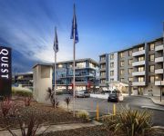
QUEST NORTH RYDE SERVICED APTS
Travelodge Macquarie Nth Ryde
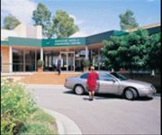
MGSM EXECUTIVE HOTEL AND CONFERENCE CENT
ROYAL PACIFIC FORMER PUNTHILL NTHSHORE
Medina North Ryde Sydney
MANTRA CHATSWOOD
Wyndel Apartments - Leura
QUEST MACQUARIE PARK
Courtyard Sydney-North Ryde
METRO INN RYDE
Videos from this area
These are videos related to the place based on their proximity to this place.
13 Sunden Way - North Epping (2121)
Welcome to 13 Sunden Way in Epping, a 5 bedroom house with a few special touches. from the door a central staircase sets the tone and from above, Juliette balconies add a touch of romance...
Swap Party - Angelena Locke - City Lights
Find out more about the Sustainability Swap Party www.mq.edu.au/swapparty.
The Indigenous Science Experience 2012
Modern Science and Indigenous Customary Knowledge: sharing information and experiences at the Australian Museum (10-12th August 2012) Aboriginal people have supported themselves here for ...
Match move and compositing test
Test of model compositing to a motion-tracked scene. Location of Epping Station in Sydney Australia, Filmed on a Canon D60, tracked with Syntheyes and Composited in After Effects CS3, using...
RC Road Train #6-1 Part 2, Onboard cam.
RC radio remote control roadtrain truck and six trailers, on board camera. Short trip around the block on a sunday afternoon. part 2.
RC Road Train #6-1 Part 3, Onboard cam.
RC radio remote control roadtrain truck and six trailers, on board camera. Short trip around the block on a sunday afternoon. part 2.
RC B Double #3 Brown's Waterhole
radio remote controlled truck and two trailers, road trip, on board camera.
cycle track at local park
radio remote controlled truck and three trailers, quick trip around the new cycleway at my local park.
Videos provided by Youtube are under the copyright of their owners.
Attractions and noteworthy things
Distances are based on the centre of the city/town and sightseeing location. This list contains brief abstracts about monuments, holiday activities, national parcs, museums, organisations and more from the area as well as interesting facts about the region itself. Where available, you'll find the corresponding homepage. Otherwise the related wikipedia article.
Macquarie University
Macquarie University is an Australian public teaching and research university located in Macquarie Park, New South Wales. Founded in 1964 by the New South Wales Government, it was the third university to be established in the metropolitan area of Sydney. The university comprises four faculties, and is the fourth largest University in Sydney. At present, the university offers 87 undergraduate courses and 124 different postgraduate courses to students.
Macquarie Centre
Macquarie Centre is a regional sized shopping centre located between Herring, Waterloo and Talevera Roads in the suburb of Macquarie Park in Sydney, New South Wales, Australia and opposite Macquarie University's main campus. The centre contains 250 retail stores over four-levels including Woolworths, Myer, Target, Big W, JB Hi-Fi, as well as Event Cinemas (a former Greater Union) cinema complex, and an ice rink. AMP Wholesale Shopping Centre Trust No.
Epping railway station, Sydney
Epping railway station is on the Northern Line of the CityRail network in Sydney, Australia. It serves the suburb of Epping, a significant commercial and residential area. Epping is a significant interchange station and is the western terminus of the Epping to Chatswood Line. Easy Access to all platforms is available via lifts.
North Epping, New South Wales
North Epping is a suburb of Sydney, in the state of New South Wales, Australia 19 kilometres north-west of the Sydney central business district in the local government area of Hornsby Shire. North Epping is in the Northern Suburbs region. Epping is a separate suburb to the south. North Epping is a leafy suburb, surrounded by bushland of the upper section of Lane Cove National Park. There are many walking trails, including the Great North Walk. One of the well known landmarks is Whale Rock.
Division of Bennelong
The Division of Bennelong is an Australian electorate in New South Wales. The division was created in 1949 and is named for Bennelong, an Aboriginal man befriended by the first Governor of New South Wales, Arthur Phillip. Bennelong is based in Northern Sydney, including the suburbs of Eastwood, Carlingford, Epping and Ryde, and was held by the Liberal Party from its creation until its swing to Labor in the 2007 election. The Liberal Party regained the seat at the 2010 election.
West Pymble, New South Wales
West Pymble is a suburb on the Upper North Shore of Sydney in the state of New South Wales, Australia 18 kilometres north-west of the Sydney Central Business District in the local government area of Ku-ring-gai Council. Pymble is a separate suburb to the east.
Epping Boys High School
Epping Boys' High School is a government high school located at Marsfield, Sydney, New South Wales, Australia. It was established in 1957. Tim O'Brien is the principal.
Macquarie Park railway station
Macquarie Park railway station is a station on the CityRail network in Sydney, New South Wales, Australia located in the suburb of Macquarie Park, Sydney at the intersection of Waterloo Road and Lane Cove Road. The station is an underground station. The station opened on 23 February 2009. Macquarie Park station has an island platform, but because the tunnels are spaced at the same distance apart as this island platform, there are no curves in the platforms.
Macquarie University railway station
Macquarie University railway station is a station on the CityRail network in Sydney, New South Wales, Australia located in the suburb of Macquarie Park. The station is an underground station. It is so named because it serves the nearby Macquarie University and Macquarie Centre. The station opened on 23 February 2009. Macquarie University station has an island platform, but because the tunnels are spaced at the same distance apart as this island platform, there are no curves in the platforms.
Eastwood railway station
Eastwood railway station is located on the Main North railway line in the suburb of Eastwood in the northern suburbs of Sydney, Australia. It is serviced by suburban trains of the CityRail Northern line and is a stop for intercity services on the Newcastle and Central Coast line.
Macquarie Park, New South Wales
Macquarie Park is a suburb in northern Sydney, New South Wales, Australia. Macquarie Park is located 12 kilometres north-west of the Sydney central business district in the local government area of the City of Ryde. Macquarie Park is part of the Northern Suburbs region. Macquarie Park was part of the suburb of North Ryde and many businesses still use North Ryde as the address.
Christie Park (Sydney, Australia)
For other meanings, see Christie Park (disambiguation). Christie Park is a sportsground located in the Northern Suburbs Sydney suburb of Macquarie Park. Christie Park was the home to the now defunct Northern Spirit FC. The park itself is owned by the Gladesville-Hornsby Football Association (GHFA). The ground is often used for more professional matches such as representative and national level games. It is also used for the amateur men's competition run by GHFA.
Marsfield, New South Wales
Marsfield is a suburb on the Northern Suburbs of Sydney, in the state of New South Wales, Australia. Marsfield is located 16 kilometres north-west of the Sydney central business district in the local government area of the City of Ryde.
Arden Anglican School
Visit www. arden. nsw. edu. au for more information Arden Anglican School is an independent, Anglican, co-educational day school, located in Beecroft and Epping, both north-western suburbs of Sydney, New South Wales, Australia. Established in 1922 as a preparatory, feeder school for the Presbyterian Ladies' College, Sydney, the school now caters for approximately 659 students from Pre-school to Year 12. Arden's first Year 12 class commenced in 2008.
South Turramurra, New South Wales
South Turramurra is a suburb on the Upper North Shore of Sydney in the state of New South Wales, Australia 18 kilometres north-west of the Sydney central business district, in the local government area of Ku-ring-gai Council. Turramurra and North Turramurra are separate suburbs.
Denistone East, New South Wales
Denistone East is a suburb in the Northern Suburbs of Sydney, in the state of New South Wales, Australia. Denistone East is 16 kilometres north-west of the Sydney central business district in the local government area of the City of Ryde. Denistone and Denistone West are separate suburbs.
Turramurra High School
Turramurra High School is a public comprehensive co-educational high school operated by the New South Wales Department of Education and Communities (DEC), located in South Turramurra, a residential area on the North Shore of Sydney, New South Wales, Australia. Established in 1967, although the current premises weren't occupied until 1968, it adjoins the Lane Cove National Park.
Hunters Hill Parish, Cumberland
Hunters Hill Parish is one of the 57 parishes of Cumberland County, New South Wales, a cadastral unit for use on land titles. The suburb of Hunters Hill, and the Municipality of Hunter's Hill are in the same area. {{#invoke:Coordinates|coord}}{{#coordinates:33|47|54|S|151|06|04|E|type:city |primary |name= }}
Macquarie University Library
The Macquarie University Library is the largest academic library in Northern Sydney. The library holds over 1.8 million print and electronic items, including books, journals, newspapers, reports, conference proceedings, working papers, maps, Macquarie postgraduate theses, computer software, multimedia, microfilm, microfiche and additional non-print resources. New items are regularly added to ensure high quality resources are available for learning, teaching and research.
Macquarie University Faculty of Business and Economics
The Faculty of Business and Economics is a constituent body of Macquarie University. The Faculty offers both undergraduate and postgraduate coursework degrees as well as research degrees. The Faculty encompasses five departments, one school and one centre. Their flagship course, the Bachelor of Commerce, received a 5 out 5 stars rating in The Good Universities Guide when it comes to above average incomes for graduates in first-time, full employment, particularly in business.
Macquarie University Hospital
The Macquarie University Hospital (abbreviated MUH) is a private teaching hospital. Macquarie University Hospital, together with ASAM, Australian School of Advanced Medicine of Macquarie University, will integrate the three essential components of an academic health science centre: clinical care, education and research. The Hospital is located within Macquarie University and is the first private hospital to be located on a university campus in Australia.
Australian School of Advanced Medicine
The Australian School of Advanced Medicine is the first and only medical school in Australia to award degrees for sub-specialties in surgery in addition to PhD research opportunities for doctors. The School brings together world class researchers, clinicians and educators to create an innovative competency-based training program, focused on future trends in medicine. The school is based within the University Clinic Building adjacent and connected to the Macquarie University Hospital.
Macquarie University Village
Macquarie University Village was originally developed by Macquarie University in 2001 for the purpose of housing students adjacent to the University campus and also housed Olympians for the Sydney 2000 Olympics. As of 2006, the village is now operated by Campus Living Villages, a company operating University Villages across Australia. The University Village contains 890 rooms and is located on land directly next to the campus proper.
The Hermitage, Ryde
The Hermitage in Denistone, Sydney, is an Australian colonial house of the Victorian era. It is listed by the New South Wales Heritage Council as a place of historical significance. It was built between 1838 and 1842 by John Blaxland who was a member of a prominent Australian family.
Morling College
Morling College is a Baptist theological college in Macquarie Park, New South Wales. It is an approved teaching institution of the Australian College of Theology and is a member of the South Pacific Association of Bible Colleges. It was established in 1916, and moved to its present location in 1961. In 1985 it was given its current name, in honour of Rev George Henry Morling, who served as principal from 1921 to 1960. The current principal is Ross Clifford.


