Explore Roseville Chase
The district Roseville Chase of in Ku-ring-gai (New South Wales) with it's 1,595 inhabitants Roseville Chase is located in Australia about 157 mi north-east of Canberra, the country's capital.
If you need a place to sleep, we compiled a list of available hotels close to the map centre further down the page.
Depending on your travel schedule, you might want to pay a visit to some of the following locations: Sydney, Parramatta, Katoomba, Canberra and . To further explore this place, just scroll down and browse the available info.
Local weather forecast
Todays Local Weather Conditions & Forecast: 18°C / 64 °F
| Morning Temperature | 13°C / 56 °F |
| Evening Temperature | 17°C / 62 °F |
| Night Temperature | 15°C / 59 °F |
| Chance of rainfall | 14% |
| Air Humidity | 75% |
| Air Pressure | 1023 hPa |
| Wind Speed | Light breeze with 4 km/h (3 mph) from North |
| Cloud Conditions | Overcast clouds, covering 100% of sky |
| General Conditions | Moderate rain |
Sunday, 5th of May 2024
17°C (62 °F)
16°C (60 °F)
Heavy intensity rain, fresh breeze, broken clouds.
Monday, 6th of May 2024
17°C (63 °F)
16°C (60 °F)
Heavy intensity rain, fresh breeze, overcast clouds.
Tuesday, 7th of May 2024
18°C (64 °F)
16°C (60 °F)
Light rain, gentle breeze, broken clouds.
Hotels and Places to Stay
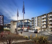
QUEST NORTH RYDE SERVICED APTS
ROYAL PACIFIC FORMER PUNTHILL NTHSHORE
Wyndel Apartments - Clarke Street
Wyndel Apartments - Shoremark
Wyndel Apartments - Encore
Wyndel Apartments - Abode
Wyndel Apartments - Herbert
Wyndel Apartments - Bertram
BEST WESTERN TWIN TOWERS INN
Castlepeak HomeStyle Accommodation
Videos from this area
These are videos related to the place based on their proximity to this place.
43 Clanwilliam Street Chatswood - Black Diamondz - Barbora Marcinkova 1
http://www.blackdiamondz.com.au 43 Clanwilliam Street Chatswood A new benchmark for quality design and family luxury Architecturally created to combine designer living spaces with an expansive...
Chatswood Communicators - About Us
A short video about Chatswood Communicators Toastmasters Club. A bit about what we enjoy about Toastmasters and how we can help you to become a better speaker and leader.
Grooming and Boarding at The Chatswood Cat Palace
I am Dr. Kim Kendall, Cat Vet and creator of http://www.thecatpalace.com.au in Roseville, Sydney. I've discovered there are three things that indicate to you that your cat needs a deep, cleansing...
Dumpling production line @ New Shanghai, Chatswood
A short clip of the two chefs / slaves who make the dumplings while everyone on the other side of the window eats it!
MY EXTRA 330 RC AIRPLANE AT ROSEVILLE CHASE
This was a snap trip to an oval in Roseville on the way to the pub.
CMA Abacus Demo - CMA Mental Arithmetic Australia
Free CMA Trial Class: http://www.cmaaust.com.au/free-cma-trial-class.html An introduction to CMA students performing Aural Arithmetic, Abacus Arithmetic and Mental Arithmetic. Learn more...
Videos provided by Youtube are under the copyright of their owners.
Attractions and noteworthy things
Distances are based on the centre of the city/town and sightseeing location. This list contains brief abstracts about monuments, holiday activities, national parcs, museums, organisations and more from the area as well as interesting facts about the region itself. Where available, you'll find the corresponding homepage. Otherwise the related wikipedia article.
Lindfield, New South Wales
Lindfield is a suburb on the Upper North Shore of Sydney in the state of New South Wales, Australia 13 kilometres north-west of the Sydney Central Business District in the local government area of Ku-ring-gai Council.
Chatswood, New South Wales
Chatswood is a suburb on the North Shore of Sydney, in the state of New South Wales, Australia 10 kilometres north of the Sydney central business district. It is the administrative centre of the local government area of the City of Willoughby. Chatswood West is a separate suburb. It is a well-known ethnic Chinese hotspot, second only to Haymarket, New South Wales.
Chatswood railway station
Chatswood railway station is an important CityRail station in Sydney, Australia, serving the North Shore business centre of Chatswood. The station is served by the North Shore line and Northern line.
City of Willoughby
The City of Willoughby is a local government area on the North Shore of Sydney, in the state of New South Wales, Australia. It is located 6 kilometres north of the Sydney central business district. The main commercial centre of the City of Willoughby is Chatswood, home to one of Sydney's suburban skyscraper clusters. Other commercial centres are the suburbs of Willoughby, St Leonards and Artarmon.
Roseville railway station
Roseville is a railway station on the CityRail network, Sydney, Australia. The station serves the North Shore suburb of Roseville and is used by Roseville College. As the station is connected to the adjacent streets on either side via stairs, Easy Access for wheelchairs is not available.
Forestville, New South Wales
Forestville is a suburb of northern Sydney, in the state of New South Wales, Australia. Forestville is 15 kilometres north-east of the Sydney central business district in the local government area of Warringah Council. Forestville is part of the Northern Beaches region and also considered to be part of the Forest District, colloquially known as The Forest.
Chatswood Oval
Chatswood Oval is located south of the Chatswood railway station in northern Sydney, Australia. It has four small pavilions and seating surrounding the oval. It is one of the Lower North Shore's largest sportsgrounds, and the home ground of the Gordon Rugby Football Club and Gordon District Cricket Club. One of the largest crowds was 8,127 when Gordon Rugby played Randwick in 1976. Gordon Rugby have been playing at Chatswood Oval since 1936.
Roseville Chase, New South Wales
Roseville Chase is a suburb on the Upper North Shore of Sydney in the state of New South Wales, Australia 11 kilometres north-west of the Sydney central business district, in the local government areas of Ku-ring-gai Council. Roseville is a separate suburb to the west.
Roseville, New South Wales
Roseville is a suburb on the Upper North Shore of Sydney in the state of New South Wales, Australia 12 kilometres north-west of the Sydney central business district. It is within the local government areas of Ku-ring-gai and Willoughby. Roseville Chase is a separate suburb to the east.
Middle Cove, New South Wales
Middle Cove is a suburb on the Lower North Shore of Sydney, in the state of New South Wales, Australia 7 kilometres north of the Sydney central business district, in the local government area of the City of Willoughby. Middle Cove is bounded to the north, east and south by Middle Harbour and to the west by Eastern Valley Way. Middle Cove shares its postcode, 2068, with the surrounding suburbs of Castlecrag and Willoughby North.
Killarney Heights, New South Wales
Killarney Heights is a suburb of northern Sydney, in the state of New South Wales, Australia. Killarney Heights is 15 kilometres north-east of the Sydney central business district in the local government area of Warringah Council. Killarney Heights is part of the North Shore and also considered to be part of the Forest District, colloquially known as The Forest. Killarney Heights has panoramic views of Middle Harbour from a few locations.
East Lindfield, New South Wales
East Lindfield is a suburb on the Upper North Shore of Sydney in the state of New South Wales, Australia. East Lindfield is located 13 kilometres north-west of the Sydney Central Business District in the local government area of Ku-ring-gai Council.
East Killara, New South Wales
East Killara is a suburb on the Upper North Shore of Sydney in the state of New South Wales, Australia. East Killara is located 15 kilometres north of the Sydney Central Business District in the local government area of Ku-ring-gai Council. Killara is a separate suburb to the south-west. East Killara is set in peaceful bushland. The main road is Koola Avenue which extends from Birdwood Avenue to Albany Crescent.
North Willoughby, New South Wales
North Willoughby is a suburb on the lower North Shore of Sydney, in the state of New South Wales, Australia 9 kilometres north of the Sydney central business district, in the local government area of the City of Willoughby. Willoughby and Willoughby East are separate suburbs.
Willoughby East, New South Wales
Willoughby East is a suburb on the lower North Shore of Sydney, in the state of New South Wales, Australia. Willoughby East is located 9 kilometres north of the Sydney central business district, in the local government area of the City of Willoughby.
2NSB
Northside Broadcasting (2NSB) was a community radio station based in Chatswood, Sydney, Australia. It operates on the FM 99.3 frequency and is referred to as the North Shore's FM99.3 on-air and for business purposes. In May 2008, FM99.3 celebrated its 25th anniversary, and from January 2009, began restructuring its programs and music content to community-based magazine shows, specialist music programs and a more mainstream playlist.
Roseville College
Roseville College is an independent, (or more strictly an 'inter-dependent') Anglican day school for girls, located in the suburb of Roseville, on the North Shore of Sydney, New South Wales, Australia. It is a member school of the Sydney Anglican Schools Corporation. Established by Isobel Davies in 1908, Roseville has a non-selective enrolment policy and currently caters for approximately 820 students from Kindergarten to Year 12.
Westfield Chatswood
Westfield Chatswood is a large shopping centre in the suburb of Chatswood in the North Shore area of Sydney. It is owned and managed by The Westfield Group. It originally opened in 1987 and was redeveloped in 1999 to incorporate a previously free standing Grace Bros store (later renamed Myer). Major stores in the centre include Myer, Coles, Aldi, Target, Toys 'R' Us, JB Hi-Fi and Rebel Sport. The centre also includes a 6 screen Hoyts cinema complex.
Killarney Heights High School
Killarney Heights High School is a coeducational, comprehensive high school located on Starkey Street, Killarney Heights near the Northern Beaches of Sydney. The school is situated in a quiet bushland setting within 20 minutes drive of the Sydney central business district. The school has a strong tradition of high academic achievement, catering for individual student needs and providing a broad co-curricular program.
St Pius X College
St Pius X College is a Roman Catholic, non-selective, independent high school for boys, located in Chatswood, a North Shore suburb of Sydney, Australia. Located in the heart of the Chatswood central business district, the school is relatively close to Westfield Shopping Centre and Chatswood railway station.
Roseville Bridge
Roseville Bridge crosses Middle Harbour in Sydney, Australia. It is the only crossing besides Spit Bridge. The bridge is 17.4 metres overhead. However, the adjacent Pipe Bridge has only 11 metres. This limitation, combined with only 1.5 metres depth of water, make it out of reach for most cruising vessels.
Willoughby Girls High School
Willoughby Girls' High School (WGHS) is a public, secondary, day school for girls, located in Willoughby, a lower North Shore suburb of Sydney, New South Wales, Australia. Established in 1934, Willoughby Girls' High currently enrols around 931 students from Years 7 to 12, and is the only comprehensive government girls' school situated on the lower north shore of Sydney.
Chatswood Public School
Chatswood Public School is a primary and public school that was founded in 1883, located in the suburb of Chatswood in Sydney, New South Wales, Australia. This school provides a playground which has been changed throughout the years, an Astroturf oval and four buildings.
Lindfield East Public School
Lindfield East Public School, (abbreviation LEPS) is a school located in East Lindfield Sydney, New South Wales, Australia. It is a co-educational Public school operated by the New South Wales Department of Education and Training with students from years Kindergarten to 6. It is the local government school for the East Lindfield and East Killara suburbs.
St Andrew's, Roseville
St Andrew's Anglican church, Roseville is an active Anglican church on the corner of Bancroft Avenue and Hill Street in Roseville, New South Wales, Australia. It is part of the Diocese of Sydney. The foundation stone for the current building was laid by Archbishop Howard Mowll in 1935. The rector of the time was W. J. Roberts. The building was designed by C. C. Finch, and built by S. C. Molineaux, and seats around 350. The original cost of the building was about £5500.


