Discover Riverstone
The district Riverstone of in Blacktown (New South Wales) with it's 6,096 citizens Riverstone is a district in Australia about 148 mi north-east of Canberra, the country's capital city.
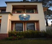
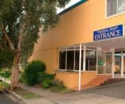
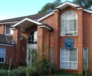
Looking for a place to stay? we compiled a list of available hotels close to the map centre further down the page.
When in this area, you might want to pay a visit to some of the following locations: Parramatta, Sydney, Katoomba, Canberra and . To further explore this place, just scroll down and browse the available info.
Local weather forecast
Todays Local Weather Conditions & Forecast: 14°C / 58 °F
| Morning Temperature | 11°C / 52 °F |
| Evening Temperature | 12°C / 54 °F |
| Night Temperature | 11°C / 53 °F |
| Chance of rainfall | 0% |
| Air Humidity | 51% |
| Air Pressure | 1024 hPa |
| Wind Speed | Moderate breeze with 10 km/h (7 mph) from North |
| Cloud Conditions | Overcast clouds, covering 89% of sky |
| General Conditions | Light rain |
Sunday, 19th of May 2024
15°C (60 °F)
9°C (48 °F)
Scattered clouds, gentle breeze.
Monday, 20th of May 2024
16°C (61 °F)
11°C (52 °F)
Sky is clear, gentle breeze, clear sky.
Tuesday, 21st of May 2024
14°C (57 °F)
11°C (51 °F)
Scattered clouds, gentle breeze, broken clouds.
Hotels and Places to Stay
Novotel Sydney Rooty Hill
Crowne Plaza HAWKESBURY VALLEY
Meurants Manor Bed and Breakfast
Cutmore Cottages - Bagala Bungalow
Windsor Motel
Windsor Terrace Motel
Highclaire House Bed and Breakfast
L'Auberge Angara Bed and Breakfast
Windsor Motel
Videos from this area
These are videos related to the place based on their proximity to this place.
EXERCISE: Kettle-bell Swings - Baxter Basics Personal Training
http://baxterbasics.com.au/ personal training quakers hill, personal training stanhope gardens, personal training rouse hill, personal training hills district, personal training kalina, personal...
EXERCISE: Dumbbell Piston Row - Baxter Basics Personal Training
http://baxterbasics.com.au/ personal training quakers hill, personal training stanhope gardens, personal training rouse hill, personal training hills district, personal training kalina, personal...
EXERCISE: Spider-climb Push Up - Baxter Basics Personal Training
http://baxterbasics.com.au/ personal training quakers hill, personal training stanhope gardens, personal training rouse hill, personal training hills district, personal training kalina, personal...
EXERCISE: Plyometric Power Box Jump Overs - Baxter Basics Personal Training
http://baxterbasics.com.au/ personal training quakers hill, personal training stanhope gardens, personal training rouse hill, personal training hills district, personal training kalina, personal...
EXERCISE: Power Jumping Jacks - Baxter Basics Personal Training
http://baxterbasics.com.au/ personal training quakers hill, personal training stanhope gardens, personal training rouse hill, personal training hills district, personal training kalina, personal...
EXERCISE: Bosu Push Up variation - Baxter Basics Personal Training
http://baxterbasics.com.au/ personal training quakers hill, personal training stanhope gardens, personal training rouse hill, personal training hills district, personal training kalina, personal...
Rhinoplasty Bangkok - Rhinoplasty Recovery Process
The question today at bangkok rhinoplasty is - what can I expect during Rhinoplasty Recovery. Claim your Rhinoplasty in Bangkok Cheat Sheet - http://bangkokrhinoplasty.com/free-rhinoplasty-guide/...
Sydney N/W Butcher Shop/Food Manufacturing
Commercial Retail property previously used as wholesale/retail butcher shop. Other food processing, manufacturing/commercial catering kitchen and retail uses (STCA). http://goo.gl/drtmN Around...
Riverstone a lawless suburb
Here I am in Riverstone like I am 2 or 3 times 6 days a week. Look at the flashing lights on the left side. The semi trailer turns left. When the railway gates are down there is a left turn...
Videos provided by Youtube are under the copyright of their owners.
Attractions and noteworthy things
Distances are based on the centre of the city/town and sightseeing location. This list contains brief abstracts about monuments, holiday activities, national parcs, museums, organisations and more from the area as well as interesting facts about the region itself. Where available, you'll find the corresponding homepage. Otherwise the related wikipedia article.
Division of Chifley
The Division of Chifley is an Australian Electoral Division in New South Wales. The division was created in 1969 and is named for Ben Chifley, who was Prime Minister of Australia 1945–49. It is located in the western suburbs of Sydney. On its original boundaries it was based on Blacktown, but now includes the suburbs of Minchinbury, Mount Druitt and Rooty Hill.
Quakers Hill, New South Wales
Quakers Hill is a suburb of Sydney, in the state of New South Wales, Australia. It is 40 kilometres west of the Sydney central business district, in the local government area of the City of Blacktown. Quakers Hill is part of the Greater Western Sydney. Quakers Hill is colloquially known as 'Quakers'.
Vineyard, New South Wales
Vineyard (pronounced "Vinyard") is a suburb of Sydney, in the state of New South Wales, Australia. Vineyard is located 50 kilometres west of the Sydney central business district, in the local government area of the City of Blacktown. Vineyard is part of the Greater Western Sydney region. It is bouned in the west by Eastern Creek until its confluence with South Creek, a tributary of the Hawkesbury River.
Quakers Hill railway station
Quakers Hill is a station on the CityRail Richmond Line, and serves a residential community. Two sets of points at the southern end of the station allow trains to terminate on either platform.
Riverstone railway station
Riverstone is a station on the Western railway line, Sydney, Australia. It serves Riverstone, a residential and commercial area in North-West Sydney. The station has a crossing loop with platforms on the main line and the crossing loop. The two side platforms have street access, providing the station with Easy Access for wheelchairs.
Vineyard railway station
Vineyard is a station on the Richmond line in the western suburbs of Sydney, Australia. It serves a sparsely populated area, and is the least used station on the Richmond line. The station is unattended and its station only facilities are a covered waiting area, emergency help point and portable platform boarding ramp. The is no ticket machine, so customers must purchase a ticket at their destination.
Schofields railway station
Schofields is a station on the Richmond branch of CityRail's Western Line. It serves the small town of Schofields as well as the north-west Sydney suburbs of Rouse Hill, The Ponds and Kellyville. The station is wheelchair accessible via lifts.
Oakhurst, New South Wales
Oakhurst is a suburb of Sydney, in the state of New South Wales, Australia 46 kilometres west of the Sydney central business district, in the local government area of the City of Blacktown. It is part of the Greater Western Sydney region.
Colebee, New South Wales
Colebee is a suburb of Sydney, in the state of New South Wales, Australia. Colebee is located 47 kilometres west of the Sydney central business district, in the local government area of the City of Blacktown and is part of the Western Sydney region.
Kings Park, New South Wales
Kings Park is a suburb of Sydney, in the state of New South Wales, Australia. Kings Park is located 40 km west of the Sydney central business district, in the local government area of the City of Blacktown and part of the Greater Western Sydney region.
Riverstone, New South Wales
Riverstone is a suburb of Sydney, in the state of New South Wales, Australia. Riverstone is 48 kilometres west of the Sydney central business district, in the local government area of the City of Blacktown. Riverstone (pronounced "Riverston") is part of the Greater Western Sydney region. Riverstone is colloquially known as 'Rivo'.
Schofields, New South Wales
Schofields is a suburb of Sydney, in the state of New South Wales, Australia. Schofields is located 45 kilometres west of the Sydney central business district, in the local government area of the City of Blacktown. Schofields is part of the Greater Western Sydney.
Windsor Downs, New South Wales
Windsor Downs is an affluent suburb of Sydney, in the state of New South Wales, Australia. It is the wealthiest part of the Hawkesbury electorate with the highest property values. Population: 1285 (Census 2001)
Rouse Hill, New South Wales
Rouse Hill is a suburb of Sydney, in the state of New South Wales, Australia. Rouse Hill is located 42 kilometres north-west of the Sydney central business district in the local government area of the City of Blacktown and The Hills Shire. Rouse Hill is part of Greater Western Sydney and is in the Hills District.
Oakville, New South Wales
Oakville is a suburb of Sydney, in the state of New South Wales, Australia. Oakville is located 49 kilometres north-west of the Sydney central business district in the local government area of the City of Hawkesbury.
Box Hill, New South Wales
Box Hill is a suburb of Sydney, in the state of New South Wales, Australia. Box Hill is located 42 kilometres north-west of the Sydney central business district in the local government area of The Hills Shire and part of the Hills District region. Box Hill is a rural area on the outskirts of Sydney.
The Ponds, New South Wales
The Ponds is a new suburb of Sydney, in the state of New South Wales, Australia. The Ponds is located 40 kilometres north-west of the Sydney central business district in the local government area of the City of Blacktown. The Ponds is part of north west Sydney and located in the Hills District.
Riverstone High School
Riverstone High School, is a co-educational, comprehensive high school located on the northwest fringes of Sydney, New South Wales, Australia. \t Riverstone High School was established in January 1962 at 71 McCulloch Street, Riverstone. The school has been recognised in the past for academic achievement and produced some outstanding students. The school is well known for its sporting success, particularly in football, hockey, netball, swimming, and athletics.
Quakers Hill High School
Quakers Hill High School is a school in the Quakers Hill/Parklea area in New South Wales, Australia. The school was built in 1993.
Rouse Hill Anglican College
Rouse Hill Anglican College, is an independent, co-educational, day school, located in Rouse Hill, New South Wales, Australia. The school is non-selective and currently caters for approximately 1,000 students from Kindergarten to Year 12, with plans to grow to 1,300 students.
Christ Church, Rouse Hill
Christ Church is an historic church building belonging to Rouse Hill Anglican Church of the Anglican Diocese of Sydney located on Windsor Road, Rouse Hill, in the north-west of Sydney, New South Wales, Australia. Christ Church was built in 1863 and is one of the oldest surviving buildings in Rouse Hill.
Baitul Huda, Sydney
The Baitul Huda (House of Guidance) is a Mosque in Sydney run by the Ahmadiyya Muslim Community (AMA) in Australia. The land for the mosque at Marsden Park (Sydney) was purchased in 1983. Mirza Tahir Ahmad, Khalifatul Masih IV. laid the foundation stone on the 30th of September on his first visit to Australia 1983. The first missionary, Mr. Shakil Ahmad Munir and his wife, Mrs. Naima Munir came to Australia on the 5th of July 1985.
RAAF Station Schofields
RAAF Station Schofields was an aerodrome built by the Royal Australian Air Force (RAAF) between 1942-1944 at Schofields, New South Wales, Australia during World War II. The aerodrome was constructed for use as a satellite aerodrome for RAAF Station Richmond. Identified as a base for the Royal Navy's Fleet Air Arm of the British Pacific Fleet on 5 February 1945 and commissioned as HMS Nabthorpe, later renamed HMS Nabstock.
Australian Christian College – Marsden Park
Australian Christian College is a co-educational school, located in Marsden Park, Northwest Sydney, New South Wales, Australia. The School has grades ranging from Kindergarten to Year 12. Year 12 students are able to complete their Higher School Certificate at the school. The vision of the School is to develop students who are equipped spiritually, academically, socially and physically to be a positive influence on the world in which they live.
Australian Christian College – Singleton
Australian Christian College – Singleton is a co-educational school, located in Singleton in the Upper Hunter Valley, New South Wales, Australia. The School has grades ranging from Pre-Kindergarten to Year 12. Year 12 students are able to complete their Higher School Certificate (HSC) at the school. The vision of the School is to develop students who are equipped spiritually, academically, socially and physically to be a positive influence on the world in which they live.


