Safety Score: 2,7 of 5.0 based on data from 9 authorites. Meaning we advice caution when travelling to United States.
Travel warnings are updated daily. Source: Travel Warning United States. Last Update: 2024-04-28 08:22:10
Discover Leitchfield Crossing
Leitchfield Crossing in Hart County (Kentucky) is a city in United States about 495 mi (or 796 km) west of Washington DC, the country's capital city.
Local time in Leitchfield Crossing is now 06:43 AM (Sunday). The local timezone is named America / Chicago with an UTC offset of -5 hours. We know of 9 airports in the vicinity of Leitchfield Crossing, of which 5 are larger airports. The closest airport in United States is Louisville International Standiford Field in a distance of 61 mi (or 98 km), North. Besides the airports, there are other travel options available (check left side).
There is one Unesco world heritage site nearby. It's Mammoth Cave National Park in a distance of 8 mi (or 13 km), South. Also, if you like golfing, there are a few options in driving distance. Looking for a place to stay? we compiled a list of available hotels close to the map centre further down the page.
When in this area, you might want to pay a visit to some of the following locations: Munfordville, Glasgow, Hodgenville, Brownsville and Elizabethtown. To further explore this place, just scroll down and browse the available info.
Local weather forecast
Todays Local Weather Conditions & Forecast: 23°C / 74 °F
| Morning Temperature | 17°C / 62 °F |
| Evening Temperature | 22°C / 72 °F |
| Night Temperature | 18°C / 64 °F |
| Chance of rainfall | 0% |
| Air Humidity | 65% |
| Air Pressure | 1020 hPa |
| Wind Speed | Fresh Breeze with 13 km/h (8 mph) from North |
| Cloud Conditions | Few clouds, covering 21% of sky |
| General Conditions | Few clouds |
Sunday, 28th of April 2024
22°C (71 °F)
17°C (62 °F)
Moderate rain, fresh breeze, overcast clouds.
Monday, 29th of April 2024
24°C (75 °F)
17°C (63 °F)
Heavy intensity rain, gentle breeze, scattered clouds.
Tuesday, 30th of April 2024
26°C (79 °F)
19°C (66 °F)
Light rain, gentle breeze, broken clouds.
Hotels and Places to Stay
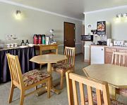
SUPER 8 MUNFORDVILLE KY
Videos from this area
These are videos related to the place based on their proximity to this place.
Kentucky Stonehenge
Monolithic wonder "Kentucky Stonehenge" in beautiful Munfordville, Kentucky ... deep in the heart of Amish country.
World War Z Trailer - Garry's Mod Version (HD)
This is just alittle something I worked on during a week end. I watched a movie called World War Z when it first came out in theaters, and I just thought it would be cool to make my own version...
Horse Cave KOA Campground
The Horse Cave KOA is located in the beautiful rolling hills of Eastern Kentucky and is one of the closest private campgrounds to Mammoth Cave National Park. Here, where millions come each...
White Blind Crayfish - Cave life
This white blind crayfish was at the Hidden River Caves in Horse Cave, KY.
TM Aliah - SE Arabian Mare
Gorgeous straight egyptian Arabian mare in foal for March 2010 to The Source cc (recently exported to New Zealand). At Sunset Ridge located in Horse Cave, Kentucky. Please call 270-786-4364...
Mediacom 1-866-462-1922 | Mediacom Cable TV, Internet and Phone Deals in Horse Cave, KY
Call 1-866-462-1922 for Mediacom in Horse Cave, KY and get the best prices on Internet, home phone and TV! Mediacom Mediacom HD Cable High-definition televis...
PASTOR SIDNEY SPENCER SERMON IF THE DEVIL HAD TO TELL THE TRUTH PT 1
PASTOR SIDNEY SPENCER OF GODS STOREHOUSE CHURCH IN HORSE CAVE KY, PREACHING ABOUT WHAT IT WOULD BE LIKE IF THE DEVIL HAD TO TELL YOU THE TRUTH!
PASTOR SIDNEY SPENCER SERMON IF THE DEVIL HAD TO TELL THE TRUTH PT 3
PASTOR SIDNEY SPENCER OF GODS STOREHOUSE CHURCH IN HORSE CAVE KY, PREACHING ABOUT WHAT IT WOULD BE LIKE IF THE DEVIL HAD TO TELL YOU THE TRUTH!
PASTOR SIDNEY SPENCER SERMON IF THE DEVIL HAD TO TELL THE TRUTH PT 2
PASTOR SIDNEY SPENCER OF GODS STOREHOUSE CHURCH IN HORSE CAVE KY, PREACHING ABOUT WHAT IT WOULD BE LIKE IF THE DEVIL HAD TO TELL YOU THE TRUTH!
Videos provided by Youtube are under the copyright of their owners.
Attractions and noteworthy things
Distances are based on the centre of the city/town and sightseeing location. This list contains brief abstracts about monuments, holiday activities, national parcs, museums, organisations and more from the area as well as interesting facts about the region itself. Where available, you'll find the corresponding homepage. Otherwise the related wikipedia article.
Hart County, Kentucky
Hart County is a county located in the U.S. state — or, more correctly, "Commonwealth" — of Kentucky. It was formed in 1819. As of 2000, the population was 17,445. Its county seat is Munfordville. The county is named for Captain Nathaniel G. S. Hart, a Kentucky militia officer in the War of 1812 who was wounded at the Battle of Frenchtown and died in the Massacre of the River Raisin.
Munfordville, Kentucky
Munfordville is a city in and the county seat of Hart County, Kentucky, United States. The population was 1,563 at the 2000 census.
Battle of Munfordville
The Battle of Munfordville (also known as the Battle of Green River) was an engagement in Kentucky during the American Civil War. Victory there allowed the Confederates to temporarily strengthen their hold on the region and impair Union supply lines. In late August 1862, Confederate Gen. Braxton Bragg's army left Chattanooga, Tennessee and marched into Kentucky. Pursued by Maj. Gen.
WLOC
WLOC is a radio station broadcasting a Country music format. Licensed to Munfordville, Kentucky, USA, the station serves the Bowling Green area. The station is currently owned by Forbis Communications, Inc..


