Safety Score: 2,7 of 5.0 based on data from 9 authorites. Meaning we advice caution when travelling to United States.
Travel warnings are updated daily. Source: Travel Warning United States. Last Update: 2024-05-20 08:01:38
Discover Chipps
Chipps in Solano County (California) is a city in United States about 2,403 mi (or 3,868 km) west of Washington DC, the country's capital city.
Local time in Chipps is now 04:44 PM (Monday). The local timezone is named America / Los Angeles with an UTC offset of -7 hours. We know of 8 airports in the vicinity of Chipps, of which 4 are larger airports. The closest airport in United States is Metropolitan Oakland International Airport in a distance of 28 mi (or 45 km), South-West. Besides the airports, there are other travel options available (check left side).
Also, if you like golfing, there are a few options in driving distance. We discovered 10 points of interest in the vicinity of this place. Looking for a place to stay? we compiled a list of available hotels close to the map centre further down the page.
When in this area, you might want to pay a visit to some of the following locations: Martinez, Fairfield, Oakland, Napa and San Francisco. To further explore this place, just scroll down and browse the available info.
Local weather forecast
Todays Local Weather Conditions & Forecast: 26°C / 79 °F
| Morning Temperature | 12°C / 53 °F |
| Evening Temperature | 23°C / 73 °F |
| Night Temperature | 16°C / 61 °F |
| Chance of rainfall | 0% |
| Air Humidity | 22% |
| Air Pressure | 1013 hPa |
| Wind Speed | Gentle Breeze with 9 km/h (5 mph) from East |
| Cloud Conditions | Clear sky, covering 0% of sky |
| General Conditions | Sky is clear |
Monday, 20th of May 2024
29°C (84 °F)
17°C (63 °F)
Sky is clear, moderate breeze, clear sky.
Tuesday, 21st of May 2024
27°C (81 °F)
14°C (57 °F)
Sky is clear, gentle breeze, clear sky.
Wednesday, 22nd of May 2024
27°C (80 °F)
13°C (56 °F)
Broken clouds, gentle breeze.
Hotels and Places to Stay
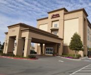
Hampton Inn - Suites Pittsburg
Days Inn And Suites Antioch
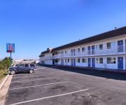
MOTEL 6 PITTSBURG
RAMADA ANTIOCH
Videos from this area
These are videos related to the place based on their proximity to this place.
Mary Rocha Unity in Community
Mary Rocha is on the steering committee for Unity in Community. She also part of he Brighter Beginnings staff. Mary is an Antioch City Councilmember. It was a very windy day which can make...
Anderson community Garden Anderson California October 19, 2013
Great job !!!!! Anderson Community Garden.
Behind the Scenes of Pittsburg Baseball
The Pittsburg High School Varsity Baseball team behind the scenes of the 2013-2014 year from Pittsburg, CA. Shoutout to Andrew Gaskin for the edits! Behind the scenes of Pittsburg Baseball....
Official Pest Control Pittsburg CA 925-392-3190 Bed Bugs Treatment
Visit: http://pittsburgpest.com/ Pest Control 925-392-3190 Pittsburg CA 94565 Serving Contra Costa California Since 2000. Pest control company, ant control, bed bugs, rodent removal, pest,...
Pest Management Insect Control 925-392-3190 Pittsburg CA
Visit: http://pittsburgpest.com/ Pest Control 925-392-3190 Pittsburg CA 94565 Serving Contra Costa California Since 2000. Pest control company, ant control, bed bugs, rodent removal, pest,...
Belmont Apartment Homes for rent in Pittsburg, CA - Fairfield Residential
For more information on Belmont Apartment Homes for rent in Pittsburg, California visit http://www.belmont1010-apts.com/ Belmont Apartment Homes 1010 Power Avenue Pittsburg, CA 94565 ...
Bed Bug Spraying in Pittsburg CA 925-392-3190 Bed Bug Bites
Visit: http://pittsburgpest.com/ Bed Bug Treatments by Official Pest Control in Pittsburg CA 925-392-3190 Free Bed Bug Inspection Serving Northern California since 2000 with over 33000 happy...
Offical Pest Control Pittsburg CA 925-392-3190 Spider, Wasp and Bee Control
Visit: http://pittsburgpest.com/ Official Pest Control 925-392-3190 Pittsburg CA 94565 Serving Contra Costa County California Since 2000. Pest control company, ant control, bed bugs, rodent...
2.4.13 - Pittsburg, CA - Crestview/Alvarado - Pedestrian Hit/Evac Helicopter 2
2.4.13 - Pittsburg, CA - At the intersection of Crestview and Alvarado [part 2] The main thing in this video is that the Evac helicopter takes off heading to John Muir.
Videos provided by Youtube are under the copyright of their owners.
Attractions and noteworthy things
Distances are based on the centre of the city/town and sightseeing location. This list contains brief abstracts about monuments, holiday activities, national parcs, museums, organisations and more from the area as well as interesting facts about the region itself. Where available, you'll find the corresponding homepage. Otherwise the related wikipedia article.
Pittsburg / Bay Point (BART station)
Pittsburg / Bay Point is a Bay Area Rapid Transit station in the town of Bay Point, California. As the terminal station of the Pittsburg / Bay Point – SFO Line, it serves all of northern and eastern Contra Costa County, including the cities of Pittsburg, Antioch, Oakley and Brentwood, as well as the Sacramento River Delta.
Pittsburg High School (California)
Pittsburg High School in Pittsburg, Contra Costa County, California is a suburban school serving all of Pittsburg. It has been in operation since 1924. Over 2,200 students attend the school, which used to be divided into three campuses: East Campus, Main Campus, and North Campus, but since the construction of the school the East campus was torn down. Students of each grade (9-12) attend both North and Main campus. Each grade has its own assistant principal.
Camp Stoneman
Camp Stoneman was a United States Army military facility located in Pittsburg, California. It served as a major staging area for the Army in World War II and the Korean War. Named after George Stoneman, a cavalry commander during the Civil War, the camp was activated in 1942 and decommissioned as a military post in 1954.
Ambrose, Contra Costa County, California
Ambrose is a former settlement in Contra Costa County, California. It was located on the Atchison, Topeka and Santa Fe Railroad 3.5 miles west of Pittsburg, at an elevation of 16 feet (5 m). It still appeared on maps as of 1918.
Cornwall, California
Cornwall (formerly, Cornwall Station) was an unincorporated community in Contra Costa County, California, before it was absorbed into the City of Pittsburg. It was located 7.25 miles east-southeast of Baypoint and 1 mile south of downtown Pittsburg, at an elevation of 39 feet ASL. The area appears to have been named after Pierre Barlow Cornwall who was an early California pioneer and president of the Black Diamond Coal Mining Company at nearby Nortonville, California from 1872 to 1904.
Diamond, California
Diamond is an unincorporated community in Contra Costa County, California. It lies at an elevation of 43 feet (13 m).
Rancho Los Medanos
Rancho Los Medanos was a 8,859-acre Mexican land grant in present day Contra Costa County, California given in 1839 by Governor Juan Alvarado to Jose Antonio Mesa and Jose Miguel Garcia. The name "los medanos" is derived from the sand hills located along the San Joaquin River on its northern boundary. Rancho Los Medanos was located at the junction of the San Joaquin River and the Sacramento River, extending eastward along the south shore of Suisun Bay to Antioch.
Montezuma, California
Montezuma is a former hamlet and township in Solano County, California, located in the California Delta region of the state; the township, which embraced the hamlet, and several other places, such as Bird's Landing--which still exists--included portions of the Montezuma Hills.


