Safety Score: 2,7 of 5.0 based on data from 9 authorites. Meaning we advice caution when travelling to United States.
Travel warnings are updated daily. Source: Travel Warning United States. Last Update: 2024-05-14 08:25:02
Delve into Nichols
Nichols in Contra Costa County (California) is a town located in United States about 2,407 mi (or 3,874 km) west of Washington DC, the country's capital town.
Time in Nichols is now 07:38 PM (Tuesday). The local timezone is named America / Los Angeles with an UTC offset of -7 hours. We know of 8 airports closer to Nichols, of which 4 are larger airports. The closest airport in United States is Metropolitan Oakland International Airport in a distance of 25 mi (or 41 km), South-West. Besides the airports, there are other travel options available (check left side).
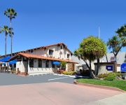
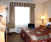
Also, if you like the game of golf, there are some options within driving distance. We saw 10 points of interest near this location. In need of a room? We compiled a list of available hotels close to the map centre further down the page.
Since you are here already, you might want to pay a visit to some of the following locations: Martinez, Fairfield, Oakland, Napa and San Francisco. To further explore this place, just scroll down and browse the available info.
Local weather forecast
Todays Local Weather Conditions & Forecast: 26°C / 79 °F
| Morning Temperature | 14°C / 57 °F |
| Evening Temperature | 20°C / 68 °F |
| Night Temperature | 15°C / 59 °F |
| Chance of rainfall | 0% |
| Air Humidity | 37% |
| Air Pressure | 1010 hPa |
| Wind Speed | Gentle Breeze with 7 km/h (5 mph) from North-East |
| Cloud Conditions | Clear sky, covering 4% of sky |
| General Conditions | Sky is clear |
Wednesday, 15th of May 2024
24°C (76 °F)
14°C (56 °F)
Sky is clear, gentle breeze, clear sky.
Thursday, 16th of May 2024
24°C (76 °F)
15°C (58 °F)
Sky is clear, gentle breeze, clear sky.
Friday, 17th of May 2024
23°C (73 °F)
13°C (56 °F)
Sky is clear, moderate breeze, clear sky.
Hotels and Places to Stay
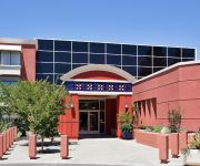
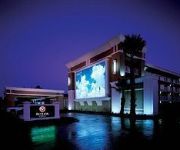
Crowne Plaza CONCORD/WALNUT CREEK
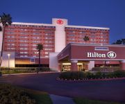
Hilton Concord
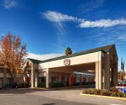
Clarion Hotel Concord
Residence Inn Pleasant Hill Concord
Homewood Suites by Hilton Pleasant Hill
BW HERITAGE INN
Premier Inns Concord
AMERICAS BEST VALUE INN
MOTEL 6 CONCORD CA
PLEASANT HILL INN
Videos from this area
These are videos related to the place based on their proximity to this place.
SparkPoint which offers financial advice at Ambrose Center was at 2012 Bay Point Unity event
sparkpoint offers financial advice, coaching, and workshops for free to everyone. sparkpoint's goals include allowing everyone to have a better financial con...
Mary Rocha Unity in Community
Mary Rocha is on the steering committee for Unity in Community. She also part of he Brighter Beginnings staff. Mary is an Antioch City Councilmember. It was a very windy day which can make...
Anderson community Garden Anderson California October 19, 2013
Great job !!!!! Anderson Community Garden.
Bay Point All-Stars Cheerleading - 14 and under Team Practice July 2012
The 14 and under Team of Bay Point All-Stars Cheerleading practicing at the Ambrose Community Center in Bay Point, California.
Bay Point Municipal Advisory Council Meeting July 2012
The Bay Point Municipal Advisory Council is seven individuals appointed by County Supervisor Federal Glover to advise him regarding issues concerning residents in Bay Point, California. The...
Bay Point All Star Cheerleaders at Unity in Community 2012
The Bay Point All Star Cheerleaders participated in the 2012 Unity in Community event held at the Ambrose Community Center on June 23. It was a very windy day which can make it difficult to...
52 Beach Drive, Bay Point, CA Presented by Marisa Suarez.
Click to see more: http://www.searchallproperties.com/listings/2059452/52-Beach-Drive-Bay-Point-CA/auto?reqpage=video 52 Beach Drive Bay Point, CA 94565 Contact Marisa Suarez for more ...
AMBROSE REC, CENTER bay point california
once again ambrose rec center do great event in bay point to benefit our community great job everyone thank you.
Basic Spanish Class In Bay Point California
this is a basic Spanish class in bay point California thanks to all people make this class possible in bay point ca 94565.
Bay Point Spring Easter Egg Hunt & Holiday Celebration March 30, 2013
ambrose conmunity center in bay point california once again do a great event to benefit our bay point thanks to all volunteers and staff work very hard to ma...
Videos provided by Youtube are under the copyright of their owners.
Attractions and noteworthy things
Distances are based on the centre of the city/town and sightseeing location. This list contains brief abstracts about monuments, holiday activities, national parcs, museums, organisations and more from the area as well as interesting facts about the region itself. Where available, you'll find the corresponding homepage. Otherwise the related wikipedia article.
Port Chicago disaster
The Port Chicago disaster was a deadly munitions explosion that occurred on July 17, 1944, at the Port Chicago Naval Magazine in Port Chicago, California, United States. Munitions detonated while being loaded onto a cargo vessel bound for the Pacific Theater of Operations, killing 320 sailors and civilians and injuring 390 others. Most of the dead and injured were enlisted African-American sailors.
Shore Acres, California
Shore Acres is a suburban unincorporated area in eastern Contra Costa County, California, in the San Francisco Bay Area, part of the Bay Point CDP and adjacent to the Concord Naval Weapons Station. Bus service is provided by Tri-Delta Transit and connects the community with job centers in Concord and BART in Bay Point. The ZIP Code is 94565 and the CDP has a population of 21,349. The community is inside area code 925.
Ambrose, Contra Costa County, California
Ambrose is a former settlement in Contra Costa County, California. It was located on the Atchison, Topeka and Santa Fe Railroad 3.5 miles west of Pittsburg, at an elevation of 16 feet (5 m). It still appeared on maps as of 1918.
Nichols, California
Nichols is an unincorporated community in Contra Costa County, California. It is on the Atchison, Topeka and Santa Fe Railroad 5.5 miles west of Pittsburg, at an elevation of 62 feet (19 m). The place is named for William H. Nichols, who was a landowner here.
McAvoy, California
McAvoy is an unincorporated community in Contra Costa County, California. It is located on the Atchison, Topeka and Santa Fe Railroad 4.25 miles west of Pittsburg, at an elevation of 23 feet (7 m).
Ohmer, California
Ohmer is a former settlement in Contra Costa County, California. It was located on the Oakland, Antioch and Eastern Railroad 6 miles east of Martinez, at an elevation of 62 feet (19 m). It still appeared on maps as of 1947.
Rancho Monte del Diablo
Rancho Monte del Diablo was a 17,921-acre Mexican land grant in present day Contra Costa County, California given in 1834 by Governor José Figueroa to Salvio Pacheco. The name "Monte del Diablo" means "thicket of the devil" in Spanish. The name was later incorrectly translated as Mount Diablo.
KVHS
KVHS (90.5 FM, "The Edge") is a non-profit high school radio station playing mostly hard rock, heavy metal and some other varying music formats. It is licensed to and broadcasts from Clayton Valley High School, Concord, California, USA and serves the Diablo Valley area.


