Safety Score: 2,7 of 5.0 based on data from 9 authorites. Meaning we advice caution when travelling to United States.
Travel warnings are updated daily. Source: Travel Warning United States. Last Update: 2024-05-10 08:04:54
Touring Perry
Perry in Santa Clara County (California) is a town located in United States about 2,409 mi (or 3,877 km) west of Washington DC, the country's capital place.
Time in Perry is now 04:03 AM (Friday). The local timezone is named America / Los Angeles with an UTC offset of -7 hours. We know of 8 airports nearby Perry, of which 3 are larger airports. The closest airport in United States is Norman Y. Mineta San Jose International Airport in a distance of 17 mi (or 28 km), North-West. Besides the airports, there are other travel options available (check left side).
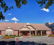
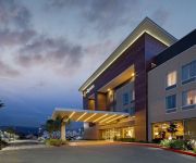
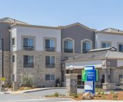
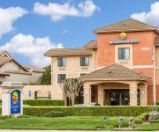
Also, if you like the game of golf, there are several options within driving distance. We collected 1 points of interest near this location. Need some hints on where to stay? We compiled a list of available hotels close to the map centre further down the page.
Being here already, you might want to pay a visit to some of the following locations: San Jose, Santa Cruz, Hollister, Salinas and Redwood City. To further explore this place, just scroll down and browse the available info.
Local weather forecast
Todays Local Weather Conditions & Forecast: 28°C / 82 °F
| Morning Temperature | 15°C / 59 °F |
| Evening Temperature | 20°C / 68 °F |
| Night Temperature | 13°C / 56 °F |
| Chance of rainfall | 0% |
| Air Humidity | 27% |
| Air Pressure | 1013 hPa |
| Wind Speed | Light breeze with 5 km/h (3 mph) from North-East |
| Cloud Conditions | Clear sky, covering 0% of sky |
| General Conditions | Sky is clear |
Friday, 10th of May 2024
29°C (84 °F)
13°C (56 °F)
Sky is clear, light breeze, clear sky.
Saturday, 11th of May 2024
28°C (82 °F)
12°C (54 °F)
Sky is clear, light breeze, clear sky.
Sunday, 12th of May 2024
26°C (78 °F)
12°C (53 °F)
Sky is clear, light breeze, clear sky.
Hotels and Places to Stay
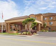
Courtyard San Jose South/Morgan Hill
Residence Inn San Jose South/Morgan Hill
Residence Inn San Jose South
LA QUINTA INN STE MORGAN HILL-SAN JOSE S
Holiday Inn Express & Suites SAN JOSE-MORGAN HILL
Comfort Inn Morgan Hill
Hampton Inn Morgan Hill CA
Quality Inn Morgan Hill
ECONOMY INN MORGAN
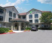
EXTENDED STAY AMERICA MORGAN H
Videos from this area
These are videos related to the place based on their proximity to this place.
EL COYOTE MICHEL GIROUD 2014
Entretien Fiction avec El Koyote 2014 Michel Giroud dit le coyote Plus sur l!artiste http://fr.wikipedia.org/wiki/Michel_Giroud_%28artiste%29.
Morgan Hill Kids Bass Fishing 5/30/2010
Fishing with Nightcrawler. Coyote cement bike trail a little bit after the old bridge there is a spot you can catch bass. This is the first time fishing there. I cant remember how many bass...
Fast Train Caltrain 156 Bailey Ave. San Jose
Caltrain #156 Is headed toward Morgan Hill. The last car in the consist is the MLB San Francisco Giants "Spring Training" wrap. #Trains #Caltrain #Coastline #SFGiants.
Fast Train Caltrain 156 At Palm Ave.
trains #caltrain Caltrain #156 is hauling butt as it goes south toward Morgan Hill at Palm Ave.
Amtrak Coast Starlight Train 11 Palm Ave.
The Coast Starlight runs south between San Jose and Morgan Hill, past the Palm Avenue crossing.
4K RC Airplane Crash
I was shooting aerials at a winery in California, I launched with flaps on and that along with a little tail heavy, that put me in the only tree on the property.
Airplanes Landing safely at Reno NV. with a pretty good crosswind
I hiked up Rattlesnake mountain about 600 feet above and south east of the airport at Reno Nevada. It was kinda windy, so the camera is not as stable as I would have liked.
Morgan Hill Fire - Dougherty Avenue
Fire in Morgan Hill at 514 Dougherty Avenue... shot around 4:40pm on the afternoon of June 6th 2009.
Videos provided by Youtube are under the copyright of their owners.
Attractions and noteworthy things
Distances are based on the centre of the city/town and sightseeing location. This list contains brief abstracts about monuments, holiday activities, national parcs, museums, organisations and more from the area as well as interesting facts about the region itself. Where available, you'll find the corresponding homepage. Otherwise the related wikipedia article.
Coyote Valley
Coyote Valley is a large expanse of farmland, orchards and homes, approximately 7,200 acres in size, located in a narrowing of the Santa Clara Valley, in the southernmost part of San Jose, California. The Coyote Valley is targeted for urban development and until March 2008 was undergoing the State of California Specific Plan process in which master planning of the area began.
Metcalf Energy Center
The Metcalf Energy Center is a 600 megawatt combined cycle power plant located in South San Jose, California in an area known as Coyote Valley. The power plant is owned by Calpine and powered by natural gas. Some of the power generated by the plant is sent to far away places via Path 15, a major electrical power transmission corridor that is connected to the power plant.
Coyote, California
Coyote, originally Burnett is an unincorporated community in a narrowing of Santa Clara Valley astride Coyote Creek, between San Jose and Morgan Hill, in Santa Clara County, California. Its ZIP Code is 95013; there is a small U.S. Post Office. Once the site of the Seventeen Mile House a stagecoach station on the Butterfield Overland Mail, Coyote is notable for its historic Grange Hall, close to the Post Office and the Metcalf Energy Center.
Coyote Grange
Coyote Grange is Chapter 412 of the California State Grange. Its headquarters are an historic hall and gardens in Coyote, California, near San Jose. The hall itself was built in 1902 on land deeded by Fiachro Fisher from his Coyote Valley estate. From its inception, the building was used as a community meeting place. The Coyote Grange Chapter was founded in 1925 and for many years rented the hall for its meetings.
Rancho Laguna Seca (Alvires)
Rancho Laguna Seca (also called "Refugio de la Laguna Seca") was a 19,973-acre Mexican land grant in present day Santa Clara County, California given in 1834 by Governor José Figueroa to Juan Alvires. "Laguna Seca" means "Dry Lake" in Spanish. The grant extended southward along Coyote Creek from Rancho Santa Teresa and Coyote to Rancho Ojo del Agua de la Coche and Morgan Hill.


