Safety Score: 2,7 of 5.0 based on data from 9 authorites. Meaning we advice caution when travelling to United States.
Travel warnings are updated daily. Source: Travel Warning United States. Last Update: 2024-05-05 08:24:42
Touring Glen Frazer
Glen Frazer in Contra Costa County (California) is a town located in United States about 2,417 mi (or 3,890 km) west of Washington DC, the country's capital place.
Time in Glen Frazer is now 11:18 PM (Sunday). The local timezone is named America / Los Angeles with an UTC offset of -7 hours. We know of 8 airports nearby Glen Frazer, of which 4 are larger airports. The closest airport in United States is Metropolitan Oakland International Airport in a distance of 19 mi (or 31 km), South. Besides the airports, there are other travel options available (check left side).
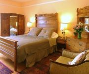
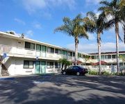
Also, if you like the game of golf, there are several options within driving distance. We collected 10 points of interest near this location. Need some hints on where to stay? We compiled a list of available hotels close to the map centre further down the page.
Being here already, you might want to pay a visit to some of the following locations: Martinez, Oakland, Fairfield, Napa and San Francisco. To further explore this place, just scroll down and browse the available info.
Local weather forecast
Todays Local Weather Conditions & Forecast: 18°C / 64 °F
| Morning Temperature | 9°C / 47 °F |
| Evening Temperature | 16°C / 61 °F |
| Night Temperature | 13°C / 55 °F |
| Chance of rainfall | 0% |
| Air Humidity | 38% |
| Air Pressure | 1020 hPa |
| Wind Speed | Moderate breeze with 9 km/h (6 mph) from East |
| Cloud Conditions | Broken clouds, covering 76% of sky |
| General Conditions | Broken clouds |
Monday, 6th of May 2024
20°C (69 °F)
15°C (59 °F)
Sky is clear, gentle breeze, clear sky.
Tuesday, 7th of May 2024
27°C (80 °F)
18°C (64 °F)
Sky is clear, gentle breeze, clear sky.
Wednesday, 8th of May 2024
28°C (82 °F)
19°C (67 °F)
Sky is clear, gentle breeze, clear sky.
Hotels and Places to Stay
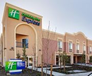
Holiday Inn Express BENICIA
BW PLUS HERITAGE INN
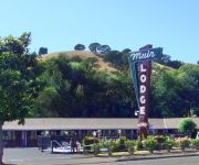
MUIR LODGE MOTEL MARTINEZ
Quality Inn Martinez
SUPER 8 MARTINEZ
UNION HOTEL
MOTEL 6 VALLEJO
Videos from this area
These are videos related to the place based on their proximity to this place.
Amtrak Coast Starlight: Morning Arrival in Martinez
This Coastal Starlight train started in Seattle, WA and was heading SB towrds L.A. This train was so long that two of the coach cars couldn't fit in the station. So the passengers had to get...
Amtrak #538 w/ bad bell and stupid driver at Martinez
Amtrak Capitol Corridor #538 arrives and departs Martinez w/ cab #6964 and F59PHI #2015, notice the bad bell and the stupid driver in the backround (C)Danapeople 2008.
Amtrak #534 meets #713 at Martinez
Amtrak Capitol Corridor #534 w/ cab #8303 and P42DC #70 meets San Joaquin #713 w/ B32-8BWH #2052 and cab #8310 at Martinez (C)Danapeople 2008.
Tehachapi Railfanning Trip Bonus Martinez Footage (3/25-3/27/13)
Bonus Amtrak footage at Martinez from my railfanning trip to Bakersfield and Tehachapi. - Train 1: Amtrak Coast Starlight #11 arrives at and departs Martinez behind P42DCs #152 and #87. ...
UP 8409 Leads the KOAMN through Martinez (6/27/12)
Union Pacific SD70ACe #8409 leads a surprise Oakland to Marion, AR stack train (KOAMN) through the Martinez Amtrak station.
Front Country
Front Country at Armando's January 16, 2015 With Jacob Groopman, Melody Walker, Adam Roszkiewicz, Jordan Klein, Leif Karlstrom, and Zach Sharpe http://www.frontcountryband.com Visit ...
Front Country
Front Country at Armando's January 16, 2015 With Jacob Groopman, Melody Walker, Adam Roszkiewicz, Jordan Klein, Leif Karlstrom, and Zach Sharpe http://www.frontcountryband.com Visit ...
Videos provided by Youtube are under the copyright of their owners.
Attractions and noteworthy things
Distances are based on the centre of the city/town and sightseeing location. This list contains brief abstracts about monuments, holiday activities, national parcs, museums, organisations and more from the area as well as interesting facts about the region itself. Where available, you'll find the corresponding homepage. Otherwise the related wikipedia article.
St. Catherine of Siena School (Martinez, California)
St. Catherine of Siena School in Martinez, California is a Catholic school in the Diocese of Oakland. The school has a Preschool and nine classes: Kindergarten to Eighth Grade. Sandy Wright serves as the school's principal, and Cindy Polizzi serves as its Vice-Principal. Anne Comiskey currently serves as the school's religious coordinator. Most graduates attend Alhambra High School (Martinez, California), Carondelet High School, or De La Salle High School (Concord, California).
Contra Costa Community College District
The Contra Costa Community College District is a community college district that encompasses three community colleges in Contra Costa County, California - Contra Costa College, Diablo Valley College and Los Medanos College. Headquarters office is located in the George R. Gordon Education Center in Martinez, California.
Martinez (Amtrak station)
Martinez Station is a union station in Martinez, California, the county seat of Contra Costa County. It is served by 44 Amtrak trains per day, including Capitol Corridor trains, San Joaquins, the California Zephyr and the Coast Starlight. (When Amtrak took over in 1971 none of its trains stopped at Martinez. ) The station is served by local County Connection bus service and connecting service from Benicia Breeze, WestCAT, and Tri-Delta Transit.
Alhambra High School (Martinez, California)
Alhambra Senior High School is a public high school in Martinez, California which was first established in 1897 (1). During the 2006-2007 academic year, the school had enrollment of approximately 1400 students. Alhambra plays an active role in the community, with students participating in extracurricular sports, theatre, music, mentoring, and outreach programs as well as numerous community events.
Franklin Canyon, California
Franklin Canyon is an unincorporated area located outside of Martinez, California in Contra Costa County. It is named for San Francisco pioneer Edward Franklin who came to California from England in 1849 for the California Gold Rush. The canyon lies adjacent to Franklin Ridge, which ends at Mount Wanda, and the Franklin Hills area. Franklin purchased the two-story Martinez Adobe ranch house from Vincente J. Martinez on October 6, 1853. Dr. John T.
Glen Frazer, California
Glen Frazer (formerly, Frazerville) is an unincorporated farming community in Contra Costa County, California, United States. It is located 8 miles north of Orinda, at an elevation of 299 feet (91 m). It was the name of the train station used by the Santa Fe Railroad. It is located along Franklin Canyon Road about 100 yards east of McHarry Ranch Rd. A sign still stands marking the location of the old station. nearest to the town of Martinez, CA.
Muir, Contra Costa County, California
Muir is an unincorporated community in Contra Costa County, California. It is located on the Atchison, Topeka and Santa Fe Railroad 8 miles north-northeast of Orinda, at an elevation of 118 feet (36 m).
Defense Fuel Support Point Ozol
The Defense Fuel Support Point Ozol (DFSP Ozol) is located at Ozol, California along the Carquinez Strait. It is a jet fuel bulk storage and transfer terminal operated by contractors on behalf of the Defense Logistics Agency's Defense Fuel Supply Center, which has recently been renamed DLA - Energy.


