Safety Score: 2,7 of 5.0 based on data from 9 authorites. Meaning we advice caution when travelling to United States.
Travel warnings are updated daily. Source: Travel Warning United States. Last Update: 2024-05-06 08:04:52
Delve into Christie
Christie in Contra Costa County (California) is a town located in United States about 2,419 mi (or 3,894 km) west of Washington DC, the country's capital town.
Time in Christie is now 02:38 AM (Monday). The local timezone is named America / Los Angeles with an UTC offset of -7 hours. We know of 8 airports closer to Christie, of which 4 are larger airports. The closest airport in United States is Metropolitan Oakland International Airport in a distance of 19 mi (or 31 km), South. Besides the airports, there are other travel options available (check left side).
Also, if you like the game of golf, there are some options within driving distance. We saw 10 points of interest near this location. In need of a room? We compiled a list of available hotels close to the map centre further down the page.
Since you are here already, you might want to pay a visit to some of the following locations: Martinez, Oakland, Fairfield, Napa and San Francisco. To further explore this place, just scroll down and browse the available info.
Local weather forecast
Todays Local Weather Conditions & Forecast: 17°C / 62 °F
| Morning Temperature | 8°C / 46 °F |
| Evening Temperature | 15°C / 60 °F |
| Night Temperature | 12°C / 53 °F |
| Chance of rainfall | 0% |
| Air Humidity | 43% |
| Air Pressure | 1020 hPa |
| Wind Speed | Moderate breeze with 9 km/h (6 mph) from East |
| Cloud Conditions | Broken clouds, covering 79% of sky |
| General Conditions | Broken clouds |
Monday, 6th of May 2024
19°C (66 °F)
14°C (57 °F)
Sky is clear, light breeze, clear sky.
Tuesday, 7th of May 2024
26°C (79 °F)
17°C (62 °F)
Sky is clear, gentle breeze, clear sky.
Wednesday, 8th of May 2024
26°C (79 °F)
18°C (65 °F)
Sky is clear, gentle breeze, clear sky.
Hotels and Places to Stay
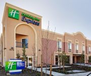
Holiday Inn Express BENICIA
BW PLUS HERITAGE INN
Motel 7
UNION HOTEL
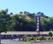
MUIR LODGE MOTEL MARTINEZ
Quality Inn Martinez
SUPER 8 MARTINEZ
MOTEL 6 VALLEJO
Videos from this area
These are videos related to the place based on their proximity to this place.
Lovin' It in Benicia 08/22/12
08/22/12- After an overnight at the Benicia guest dock, in the Carquinez Strait. Single reef.
Hercules Library 2010
Hercules Library, one of 26 Community Libraries as part of the Contra Costa Library in California, has received awards for its innovative design. This video includes the exterior and interior...
Jordan Bustos sophomore #24 Hercules High School - 2011 VARSITY TITANS- CA
2011 Titans Play Off year! Jordan #24 a Sophomore enters the Varsity Titans Squad.
Crockett shoreline ride
Mountain bike ride on the Crockett shoreline to just above Port Costa in Crockett, California. Filmed with the GoPro Helmet Hero in 1080p.
Carquinez Model Railroad Society Layout - 7/2011
The Carquinez Model Railroad Society (CMRS) is a non-profit California corporation made up of a diverse group of model railroad enthusiasts of many ages, professions and backgrounds. We...
Videos provided by Youtube are under the copyright of their owners.
Attractions and noteworthy things
Distances are based on the centre of the city/town and sightseeing location. This list contains brief abstracts about monuments, holiday activities, national parcs, museums, organisations and more from the area as well as interesting facts about the region itself. Where available, you'll find the corresponding homepage. Otherwise the related wikipedia article.
Cal-P Line
Cal-P is an unofficial term for the railroad line from Martinez to Sacramento, California (or perhaps for the whole line from Oakland to Sacramento via Martinez). (Officially the line is the Martinez Subdivision from 10th St Oakland to Roseville. ) It hosts several Amtrak passenger routes, such as the Capitol Corridor, Coast Starlight, and California Zephyr.
Oleum, California
Oleum is an unincorporated community in Contra Costa County, California. It is located on the Southern Pacific Railroad 6 miles east-southeast of Point Pinole, at an elevation of 203 feet (62 m). An oil refinery is located at Oleum, hence the name from "petroleum". Oleum is located on the Mexican land grant Rancho El Pinole made to Ygnacio Martinez. A post office operated at Oleum from 1910 to 1951.
Defense Fuel Support Point Ozol
The Defense Fuel Support Point Ozol (DFSP Ozol) is located at Ozol, California along the Carquinez Strait. It is a jet fuel bulk storage and transfer terminal operated by contractors on behalf of the Defense Logistics Agency's Defense Fuel Supply Center, which has recently been renamed DLA - Energy.


