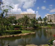
Delve into Puerto Rico Village
Puerto Rico Village in Saipan is a town located in Northern Mariana Islands a little west of Saipan, the country's capital town.
Time in Puerto Rico Village is now 11:53 AM (Saturday). The local timezone is named Pacific / Saipan with an UTC offset of 10 hours. We know of 4 airports closer to Puerto Rico Village, of which one is a larger airport. The closest airport in Northern Mariana Islands is Francisco C. Ada Saipan International Airport in a distance of 7 mi (or 11 km), South. Besides the airports, there are other travel options available (check left side).
We saw 3 points of interest near this location. In need of a room? We compiled a list of available hotels close to the map centre further down the page.
Since you are here already, you might want to pay a visit to some of the following locations: Saipan, San Jose, Yigo Village, Dededo Village and Tamuning-Tumon-Harmon Village. To further explore this place, just scroll down and browse the available info.
Local weather forecast
Todays Local Weather Conditions & Forecast: 27°C / 81 °F
| Morning Temperature | 28°C / 82 °F |
| Evening Temperature | 29°C / 84 °F |
| Night Temperature | 29°C / 83 °F |
| Chance of rainfall | 4% |
| Air Humidity | 78% |
| Air Pressure | 1014 hPa |
| Wind Speed | Moderate breeze with 12 km/h (8 mph) from North-West |
| Cloud Conditions | Overcast clouds, covering 100% of sky |
| General Conditions | Light rain |
Sunday, 28th of July 2024
29°C (84 °F)
28°C (83 °F)
Moderate rain, moderate breeze, scattered clouds.
Monday, 29th of July 2024
29°C (84 °F)
29°C (83 °F)
Light rain, light breeze, overcast clouds.
Tuesday, 30th of July 2024
28°C (83 °F)
29°C (83 °F)
Light rain, gentle breeze, overcast clouds.
Hotels and Places to Stay
Hyatt Regency Saipan
Hotel Galleria
Gold Beach Hotel
Heaven II
Kanoa Resort Saipan
Aquarius Beach Tower
Capital Hotel
Century Hotel
FIESTA RESORT AND SPA SAIPAN
AQUA RESORT CLUB SAIPAN
Videos from this area
These are videos related to the place based on their proximity to this place.
Saipan Pictures: Garapan Drive Through
Garapan was the major town of Saipan during the Spanish times, German times, Japanese times, and still is today. This drive takes you from American Memorial Park to the Old Japanese Jail. ...
2011_11 SAIPAN JP 2012 SUPER SPORT 118 & NP 2012 HELLCAT 6.7
この映像は2011年11月12日、13日にサイパンで行なわれた「10th MARIANAS CUP」の大会ランチタイムにヘッドカメラで撮りました。 海も空も綺麗で、し...
サイパン島周遊旅行記第1話(後) - Travelog in Saipan#02
実は米国大統領選挙投票日だったりします。果たしてオバマか!?マケインか!?(笑) *プライベート用に制作したものをWEB公開用に編集し直したも...
Saipan Pictures: Harbor
Saipan Harbor is next to American Memorial Park and is home to many beautiful boats. http://saipanpictures.blogspot.com/2008/07/harbor.html.
Saipan - Diving Paradise
Onde me encontrar... Link para o meu Facebook: http://goo.gl/aobTeh Link para minha galeria de imagens na Getty Images: http://goo.gl/sxtnfh.
Videos provided by Youtube are under the copyright of their owners.
Attractions and noteworthy things
Distances are based on the centre of the city/town and sightseeing location. This list contains brief abstracts about monuments, holiday activities, national parcs, museums, organisations and more from the area as well as interesting facts about the region itself. Where available, you'll find the corresponding homepage. Otherwise the related wikipedia article.
Mañagaha
Mañagaha is a small islet which lies off the west coast of Saipan within its lagoon. Although it has no permanent residents, Mañagaha is popular among Saipan’s tourists as a day-trip destination due to its wide sandy beaches and a number of marine activities including snorkeling, parasailing and jet skiing. It is also the burial ground of the famous Caroline Islands Chief Aghurubw.
Garapan
Garapan is the largest village and the center of the tourism industry on the island of Saipan, which is a part of the United States Commonwealth of the Northern Mariana Islands (CNMI). Garapan, as a Census Designated Place, has an area of 1.2 km² and a population of 3,588 (census of population, 2000).
National Register of Historic Places listings in the Northern Mariana Islands
This is a list of the buildings, sites, districts, and objects listed on the National Register of Historic Places in the Northern Mariana Islands. There currently 37 listed sites spread across the four municipalites of the Northern Mariana Islands. There are no sites listed on any of the islands that make up the Northern Islands Municipality. This National Park Service list is complete through NPS recent listings posted March 29, 2013.
Tanapag Harbor
Tanapag Harbor is the primary harbor of Saipan, and is located on the western side of the island. It is separated from the Philippine Sea by a barrier reef, located about 3 km (2 miles) off the shore. This reef forms the Saipan Lagoon. During World War II the harbor was occupied and used by Japan and later the United States. Following the war the harbor facilities have been significantly expanded to provide support for the U.S. Navy.
Mount Tapochau
Mount Tapochau is the highest point on the island of Saipan in the Northern Mariana Islands. It is located in the centre of the island, north of San Vicente village and northwest of Magicienne Bay, and rises to a height of 474 m (1554 ft). The mountain offers a 360 degree view of the island. Mount Tapochau was vital in World War II as a result of this.
KPXP
KPXP (99.5 FM, "Power 99 FM") is a radio station broadcasting a top 40 music format. Licensed to Garapan-Saipan, Northern Mariana Islands, it serves the Northern Mariana Islands area. The station is currently owned by Sorensen Pacific Broadcasting Inc. The station was assigned the KPXP call letters by the Federal Communications Commission on July 12, 1991.
Capital Hill, Saipan
Capital Hill (formerly Army Hill under the United States Navy) is a settlement on the island of Saipan in the Northern Mariana Islands. It has been the island group's center of government since 1962. It lies on the cross-island road between Tanapag and San Vicente. Capital Hill was originally built in 1948 by the Central Intelligence Agency as a base involved in covert training of Nationalist Chinese guerrillas.
Tanapag
Tanapag is a settlement on the island of Saipan in the Northern Mariana Islands. It is located close to Tanapag Beach on the northwest coast, just to the north of Capital Hill, the island group's centre of government. It lies on the Marpi road, which stretches the length of the island's northwest coast. The area around Tanapag Beach was the site of major fighting during the Battle of Saipan in 1944.


