Safety Score: 3,3 of 5.0 based on data from 9 authorites. Meaning please reconsider your need to travel to Nepal.
Travel warnings are updated daily. Source: Travel Warning Nepal. Last Update: 2024-04-26 08:02:42
Discover Bharatpur
Bharatpur in Central Region is a place in Nepal about 55 mi (or 89 km) west of Kathmandu, the country's capital city.
Current time in Bharatpur is now 02:11 PM (Friday). The local timezone is named Asia / Kathmandu with an UTC offset of 5.75 hours. We know of 8 airports near Bharatpur. The closest airport in Nepal is Bharatpur Airport in a distance of 2 mi (or 3 km), North. Besides the airports, there are other travel options available (check left side).
There are several Unesco world heritage sites nearby. The closest heritage site in Nepal is Chitwan National Park in a distance of 12 mi (or 19 km), South-West. If you need a hotel, we compiled a list of available hotels close to the map centre further down the page.
While being here, you might want to pay a visit to some of the following locations: Lamjung, Khudi, Pokhara, Kathmandu and Chame. To further explore this place, just scroll down and browse the available info.
Local weather forecast
Todays Local Weather Conditions & Forecast: 42°C / 107 °F
| Morning Temperature | 23°C / 73 °F |
| Evening Temperature | 41°C / 105 °F |
| Night Temperature | 28°C / 82 °F |
| Chance of rainfall | 0% |
| Air Humidity | 7% |
| Air Pressure | 1001 hPa |
| Wind Speed | Gentle Breeze with 8 km/h (5 mph) from North-East |
| Cloud Conditions | Clear sky, covering 0% of sky |
| General Conditions | Sky is clear |
Saturday, 27th of April 2024
43°C (109 °F)
29°C (85 °F)
Broken clouds, moderate breeze.
Sunday, 28th of April 2024
43°C (110 °F)
26°C (79 °F)
Sky is clear, fresh breeze, clear sky.
Monday, 29th of April 2024
42°C (108 °F)
27°C (81 °F)
Sky is clear, moderate breeze, clear sky.
Hotels and Places to Stay
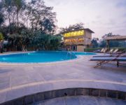
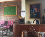
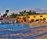
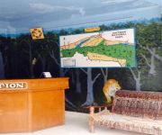
Green Park Chitwan
Landmark Forest Park
Hotel Jungle Crown
Chautari Garden Resort
Hotel Monalisa Chitwan
Chitwan Village Resort
Hotel Jungle Vista
Jungle Safari Lodge
Videos from this area
These are videos related to the place based on their proximity to this place.
Epic Rainbow is Epic!! yes!!
i took this video of this rainbow on 15th of feb 2014. This was the best rainbow i have ever seen and i have seen aloooooot of rainbows!! lol PS: i live in b...
How to create color splash effect in Photoshop CS5 - tutorial
Tutorial Photoshop CS5 English - color splash effect - how to make a photo in black and white leaving some zones colored. By PhotoshopLogger Facebook Page: ...
Sweater distribution
Sweater distribution on kota school for the students for covering this winter..
Riding Flappy to the river
Getting on Flappy the elephant and riding her into the river at Chitwan National Park ion Nepal.
Nepal 2007, Phakading
Phakading is a little village located in the Everest Region in between Lukla and Namche Bazar. This footage demonstrates the tough life of Nepali porters who carry huge loads for pittance...
Ripples of Change - a multi-use water system in Nepal
The multi-use water system increases access to water for rural and mountainous communities in Nepal through low-cost technology. This video case study, telling the story of a woman in Ramaroshan...
Videos provided by Youtube are under the copyright of their owners.
Attractions and noteworthy things
Distances are based on the centre of the city/town and sightseeing location. This list contains brief abstracts about monuments, holiday activities, national parcs, museums, organisations and more from the area as well as interesting facts about the region itself. Where available, you'll find the corresponding homepage. Otherwise the related wikipedia article.
Narayangarh, Chitwan
Narayangarh (also Narayangadh or Narayanghat) is a part of the city of Bharatpur in Chitwan District in the central part of Nepal, 146 km due west of Kathmandu, and 136 km from Pokhara, at the Narayani River where it leaves the Mahabharat Range. It is situated at a latitude of 27.70 deg. and longitude: 84.42 deg. Its area is 554.0 km².
Bharatpur Airport
Bharatpur Airport is an airport serving Bharatpur, a city in the Chitwan district in Narayani zone in Nepal. The airport is located 1 mile southwest of Bharatpur. It is operated by the Civil Aviation Authority of Nepal (CAAN) and is served by Nepal Airlines, the national airline which earns most of its revenue from this airport. Bharatpur Airport is the country's 4th busiest.


