Safety Score: 2,5 of 5.0 based on data from 9 authorites. Meaning we advice caution when travelling to Ireland.
Travel warnings are updated daily. Source: Travel Warning Ireland. Last Update: 2024-05-08 08:04:21
Explore Dartry
The district Dartry of Rathgar in Dublin City (Leinster) is located in Ireland about 2,701 mi north-west of Qeshlaq, the country's capital.
If you need a place to sleep, we compiled a list of available hotels close to the map centre further down the page.
Depending on your travel schedule, you might want to pay a visit to some of the following locations: Dublin, Tallaght, Swords, Wicklow and Naas. To further explore this place, just scroll down and browse the available info.
Local weather forecast
Todays Local Weather Conditions & Forecast: 17°C / 63 °F
| Morning Temperature | 11°C / 51 °F |
| Evening Temperature | 17°C / 62 °F |
| Night Temperature | 13°C / 55 °F |
| Chance of rainfall | 0% |
| Air Humidity | 65% |
| Air Pressure | 1027 hPa |
| Wind Speed | Light breeze with 4 km/h (3 mph) from East |
| Cloud Conditions | Broken clouds, covering 80% of sky |
| General Conditions | Broken clouds |
Thursday, 9th of May 2024
17°C (63 °F)
13°C (55 °F)
Overcast clouds, light breeze.
Friday, 10th of May 2024
20°C (67 °F)
12°C (53 °F)
Overcast clouds, light breeze.
Saturday, 11th of May 2024
20°C (67 °F)
13°C (55 °F)
Light rain, light breeze, overcast clouds.
Hotels and Places to Stay
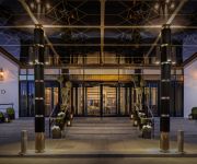
Conrad Dublin
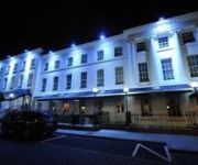
Hampton
PREMIER SUITES DUBLIN
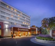
Clayton Hotel Burlington Road
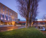
The Dean Dublin
Hilton Dublin
Harrington Hall
Camden Court
Uppercross
Albany House
Videos from this area
These are videos related to the place based on their proximity to this place.
Dublin City Marathon 2014
The Dublin City Marathon 2014. 14000 people took part, well done to everybody. Thanks to the support staff who ensured that most had a safe race, and the rest were taken care of.
Kenya Orphan Aid Kids-Singing in Dublin (I)
kenyaorphanaid@eircom.net Kenya Orphan Aid is an Irish registered Charity (CHY16128), which supports a home for orphaned children, living in Nairobi, Kenya. Among other projects Kenya Orphan...
LUAS Tram number 5024 - Milltown, Dublin
Luas tram number 5024 heading southbound towards Milltown station on the green line in Dublin city.
Ripples
an insignificant waterfall in a park, close to the city's hustle and bustle, can be a good place to stop and listen.
Ranelagh Hens - very close to the city...
Hens in Ranelagh. Very close to Dublin City Centre. Not much happens here. Hens are cute.
ABNER BROWNS - The Dublin City Rounders - Best Boots on the Bus
Video By: http://www.faceboo.com/razorcutsproductions.
Driving in Ireland - Nutgrove Avenue to Dartry Road, Dublin
Driving around Ireland. This is Nutgrove avenue to Dartry road via the Lower Churchtown road in Dublin on the 14th of October 2014.
Villagers - Down, Under the Sea (Live at Whelans 9thMay09)
Villagers performing 'Down, Under the Sea' at their sold out show in Whelans, Dublin on Saturday May 9th 2009. Debut EP 'Hollow Kind' is out now on Dublin indie label Any Other City. Video...
OpenJaw Technologies: The Three Way Synergy
Mark Lenahan, VP of Product Strategy, discusses the three way synergy available if airlines, loyalty programs and holiday or vacations companies work together. First presented at Airline Informati...
Rathmines Town Hall
Rathmines Town Hall, built in 1895 was designed by Irish architect Sir Thomas Drew. Its clock tower is a famous landmark in Rathmines. This video is designed as a resource for primary and...
Videos provided by Youtube are under the copyright of their owners.
Attractions and noteworthy things
Distances are based on the centre of the city/town and sightseeing location. This list contains brief abstracts about monuments, holiday activities, national parcs, museums, organisations and more from the area as well as interesting facts about the region itself. Where available, you'll find the corresponding homepage. Otherwise the related wikipedia article.
Ranelagh
Ranelagh is a residential area and urban village on the south side of Dublin, Ireland. It is in the postal district of Dublin 6. It is in the local government electoral area of Pembroke/Rathmines and the Dáil Constituency of Dublin South–East.
Rathgar
Rathgar (Irish: Ráth Garbh, meaning "rough ringfort") is a suburb of Dublin, Ireland, lying about 3 kilometres south of the city centre.
Rathmines
Rathmines is a suburb on the southside of Dublin, about 3 kilometres south of the city centre. It effectively begins at the south side of the Grand Canal and stretches along the Rathmines Road as far as Rathgar to the south, Ranelagh to the east and Harold's Cross to the west.
Churchtown, Dublin
Churchtown (Irish: Baile an Teampaill) is a largely residential suburb on the southside of Dublin, Ireland, between Dundrum and Rathfarnham. It is in the postal districts Dublin 14 and Dublin 16.
Gonzaga College
Gonzaga College is a private, state-subsidised Catholic boys' secondary school in Ranelagh, Dublin, Ireland, under the trusteeship of the Society of Jesus (the Jesuit Order). Founded in 1950, the curriculum is traditional, with a broad general programme of subjects including Latin and Greek at junior cycle and the opportunity in senior cycle to study eight subjects for the Leaving Certificate. Gonzaga College is one of five Jesuit schools in Ireland.
Glenmalure Park
Glenmalure Park, often simply known as "Milltown", was a football stadium on the Southside of Dublin city in Ireland. Located in the suburb of Milltown, it was home to Shamrock Rovers from 1926 to 1987, when it was sold to property developers by the club's directors. It is now a housing estate called Glenmalure Square.
Irish Jewish Museum
The Irish Jewish Museum (Irish: Músaem Giúdach na hÉireann) is a small museum located in the once highly Jewish populated area of Portobello, around the South Circular Road, Dublin 8, dedicated to the history of the Irish Jewish community. The museum was opened in June 1985 by Chaim Herzog who was then president of Israel and was born in Ireland. The museum is in a former Synagogue built in 1917 in two adjoining terraced house on Walworth Road, off the South Circular Road.
Nutgrove
Alternate uses: Nutgrove, St Helens Nutgrove (Irish: Ceathrú an Notaigh) is an area in Rathfarnham, County Dublin. It is a suburban area at the foot of the Dublin mountains between Churchtown and Rathfarnham around the Nutgrove Shopping Centre. It used to be the home of Rathfarnham HB, an ice cream company in Ireland. HB was originally an abbreviation for Hughes Brothers' Dairy, Rathfarnham, now produced by Unilever and part of the Heartbrand.
Sandford Park School
Sandford Park School Ltd. is a small private, state-subsidised, non-denominational, all-boys (co-educational after August 2013) secondary school, located in the inner suburbs in Dublin, Ireland, founded in 1922. [Ref Dáil Éireann Debate, Vol 773, No 3, 19 July 2012, url. ie/gse4].
De La Salle College Churchtown
De La Salle College is an all-male secondary school in Churchtown, a southern suburb of Dublin, in Ireland. It is a state school. De La Salle College, Churchtown was officially opened in 1952 and moved to its present location in 1957. Since then, the college has extended on two different occasions (in 1986 and 1997) to cater for the increase in the number of pupils wishing to attend. The college now has educational facilities to cater for about 500 pupils.
St Mary's College, Dublin
Saint Mary's College C.S. Sp. (Congregatio Sancti Spiritus) is an all-boys' primary & secondary school run by the Congregation of the Holy Spirit and located in Rathmines, County Dublin, Ireland. The school was founded in 1890, closed in 1916, and then reopened in 1926. Rugby is the major sport and the school colours are blue and white. The Senior School Principal is Denis Murphy and the Senior School Deputy Principal is Brian Moore.
The High School, Dublin
The High School is a co-educational school located in Rathgar, Dublin, Ireland. The school is Protestant managed and its general ethos is that of the Church of Ireland. It was founded in 1870 in Harcourt Street before moving to its current location in Rathgar in 1971 and amalgamated with The Diocesan School for Girls in 1974, thereby becoming co-educational.
Alexandra College
Alexandra College is a private, single-sex girl's school located in Milltown, Dublin, Ireland, operating under a Church of Ireland ethos. It serves girls from ages 4 to 18 as boarding or day pupils. The school is one of the most prestigious in Ireland and ranks highly in Leaving Certificate results tables. It is also one of the most exclusive fee-paying schools in all of Ireland.
Trinity Hall, Dublin
Trinity Hall is the main extramural hall of residence for students of the University of Dublin, Trinity College in Dublin, Republic of Ireland. It is located on Dartry Road in Dartry near Rathmines, about three miles south of the College.
Zion Parish Primary School
Zion Parish Primary School (ZPPS) is a Church of Ireland based national/primary school in Rathgar, Dublin, Ireland.
Harold's Cross Stadium
Harold's Cross Stadium is a greyhound racing stadium in the south Dublin city district of Harold's Cross, owned and operated by the Irish Greyhound Board. In the late 1990s, major redevelopment work saw the venue transformed from a basic gambling driven venue to a fairly well known social event venue. It currently opens on Mondays, Tuesdays and, more popularly, Fridays. It is one of two greyhound racing stadiums in Dublin, with Shelbourne Park being the other.
Windy Arbour
Windy Arbour is a small suburban village in the Dundrum area of Dublin, Ireland. Situated between Dundrum and Milltown, along the banks of the Slann or Slang river, Windy Arbour has amenities including a Costcutter supermarket (which includes a post office), two pubs, Ryan's Arbour House and The Corner House (formerly called Kyne's Corner House, J.D. 's Corner House, The Millrace and The Nine Arches), as well as a primary school known as Our Lady's National School, Clonskeagh.
Palmerston Park, Dublin
Palmerston Park (Irish: Páirc Bhaile Phámar) is a park in Rathmines, a suburb of Dublin, Ireland. The park is situated at the top of Palmerston Road, in Rathmines, Dublin 6. It is split into two sections, the east section consisting of open grass areas with a path around leading to a playground, the west section being more enclosed with a pond, flower beds and numerous routes to walk. No ball games are allowed at the park and dogs must be kept on a lead at all times.
Kildare Place National School
Kildare Place National School (KPNS) is a Church of Ireland primary school in Rathmines, a suburb of Dublin, Ireland http://www. dublin. ie/disp_list. aspx?catId=57&letter=K&noOfPages=19#. The school is linked to the training college of the Church of Ireland College of Education. Formerly located on Kildare Street in Dublin's City Centre, the school moved to Upper Rathmines Road in 1969.
Milltown Institute of Theology and Philosophy
The Milltown Institute of Theology and Philosophy is an institution of higher education and research, located in Dublin, Ireland. Milltown is run by the Jesuits and is located in Milltown/Ranelagh in Dublin. Since 1997 it has been a recognised college of the National University of Ireland, under the 1997 Universities Act, the Irish government removed the ban on the NUI awarding degrees in Theology which had stood since its foundation and its predecessor the Royal University of Ireland.
Church of Ireland College of Education
The Church of Ireland College of Education or C.I.C.E. as it is more commonly known (Irish: Coláiste Oideachais Eaglais na hÉireann) is one of five Irish Colleges of Education which provide a Bachelor of Education (B. Ed. ) degree, the qualification generally required to teach in Irish primary schools. Its degrees are awarded by Trinity College/University of Dublin just like Coláiste Mhuire, Marino and Froebel College of Education. The college is located in Rathmines in Dublin.
St. Josephs BNS
St. Josephs BNS is a boys primary school in Terenure, Dublin, Ireland founded on November 5, 1866, the school was then called Roundtown Boys' National School, at its opening the school had 174 pupils & 3 teachers. The school competes in Gaelic Football & Hurling.
Rathmines College of Further Education
Rathmines College is an educational institution in Rathmines, Dublin that offers various Further Education courses in areas such as business, computing, media studies, office administration etc. It is based in the former Rathmines Town Hall and 28/29 Leinster Road.
St. Luke's Hospital, Rathgar
St. Luke's Hospital, Rathgar, Dublin, Ireland, is a hospital which has specialised in treating cancer patients from throughout Ireland for over half a century. It is primary national centre for radiotherapy treatment. Opened in 1952, the Hospital was founded by the Cancer Association of Ireland on the recommendation of a consultative body set in place by the Minister for Health. The main building was designed by the Irish architect Thomas Kennedy.
Locks Brasserie
Locks Brasserie is a restaurant in Portobello, Dublin, Ireland. It is a fine dining restaurant that has received one Michelin star for 2013. The head chef of Locks Brasserie is Rory Carville.


