Safety Score: 2,5 of 5.0 based on data from 9 authorites. Meaning we advice caution when travelling to Ireland.
Travel warnings are updated daily. Source: Travel Warning Ireland. Last Update: 2024-04-27 08:23:39
Delve into Sandyford
Sandyford in Dún Laoghaire-Rathdown (Leinster) with it's 22,288 habitants is a town located in Ireland about 2,699 mi (or 4,344 km) north-west of Qeshlaq, the country's capital town.
Time in Sandyford is now 05:36 PM (Saturday). The local timezone is named Europe / Dublin with an UTC offset of one hour. We know of 9 airports closer to Sandyford, of which 4 are larger airports. The closest airport in Ireland is Dublin Airport in a distance of 10 mi (or 17 km), North. Besides the airports, there are other travel options available (check left side).
There is one Unesco world heritage site nearby. It's Brú na Bóinne - Archaeological Ensemble of the Bend of the Boyne in a distance of 40 mi (or 64 km), North-East. Also, if you like the game of golf, there are some options within driving distance. We saw 1 points of interest near this location. In need of a room? We compiled a list of available hotels close to the map centre further down the page.
Since you are here already, you might want to pay a visit to some of the following locations: Dublin, Tallaght, Swords, Wicklow and Naas. To further explore this place, just scroll down and browse the available info.
Local weather forecast
Todays Local Weather Conditions & Forecast: 10°C / 50 °F
| Morning Temperature | 3°C / 38 °F |
| Evening Temperature | 9°C / 47 °F |
| Night Temperature | 5°C / 41 °F |
| Chance of rainfall | 0% |
| Air Humidity | 70% |
| Air Pressure | 1006 hPa |
| Wind Speed | Gentle Breeze with 8 km/h (5 mph) from West |
| Cloud Conditions | Broken clouds, covering 51% of sky |
| General Conditions | Light rain |
Sunday, 28th of April 2024
11°C (52 °F)
9°C (48 °F)
Light rain, gentle breeze, few clouds.
Monday, 29th of April 2024
10°C (50 °F)
8°C (47 °F)
Moderate rain, moderate breeze, overcast clouds.
Tuesday, 30th of April 2024
10°C (50 °F)
8°C (47 °F)
Heavy intensity rain, moderate breeze, overcast clouds.
Hotels and Places to Stay
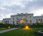
Radisson Blu St. Helen's
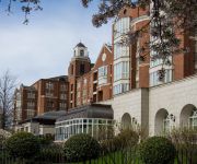
InterContinental Hotels DUBLIN
The Beacon
Hampton
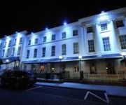
Waterloo House
Butlers Townhouse
Pembroke Townhouse Ballsbridge
Sandymount
Clayton Ballsbridge
HERBERT PARK HOTEL
Videos from this area
These are videos related to the place based on their proximity to this place.
Find Us by Luas
How to find the Clinic coming from the city center by Luas Stephen's Green to Stillorgan and then follow the light.
An Introduction to Sandyford Business District, in Dublin, Ireland.
Ireland's World-class Business District In this technologically-advanced, ultra-connected society, companies flourish in locations with a strong network, information-sharing and collaborative...
Hazel Avenue, Kilmacud, Co Dublin
Short car-cam tour of Hazel Avenue, Kilmacud, Co Dublin, on Monday 18th August 2014.
Dale Road Kilmacud
Short car-cam tour of Dale Road and Dale Drive, Kilmacud, Co Dublin, on Thursday 21st August 2014.
Rathmore Ave Kilmacud
Short car-cam tour of Rathmore Ave, Kilmacud, Co Dublin, on Thursday 21st August 2014. Best viewed on YouTube for HD.
Dublin floor sanding & lacquering
A school floor in Dublin , lacquered by floorsanders.ie, based in south county dublin, and servicing wicklow and greystones. We are one of Ireland's oldest floor sanding companies. Dublin...
BIM | Building Information Modelling
A Brief Explanation of Building Information Modelling (BIM) and it's importance to the Irish Construction Industry, provided by ArcDox, BIM specialist architectural practice - enabling and...
Introduction to Educational Videos l RCSI Leadership
This is an introductory video to a series of educational videos developed by RCSI Institute of Leadership to discuss areas related to Leadership, Healthcare, Management and Education. Each...
Videos provided by Youtube are under the copyright of their owners.
Attractions and noteworthy things
Distances are based on the centre of the city/town and sightseeing location. This list contains brief abstracts about monuments, holiday activities, national parcs, museums, organisations and more from the area as well as interesting facts about the region itself. Where available, you'll find the corresponding homepage. Otherwise the related wikipedia article.
Mount Anville Secondary School
Mount Anville Secondary School is a Roman Catholic, private all-girls post-primary school in Goatstown in Ireland. It was originally an all-boarding school, but in recent years due to decreased demand for such schools it has become a day-school. It has approximately 659 students, and is attached to Mount Anville Junior School, Mount Anville National School and Mount Anville Convent.
Dundrum Town Centre
"Dundrum Town Centre" is the name of a shopping centre located in Dundrum, Dublin, Ireland. It is Ireland's largest shopping centre with over 160 tenants, more than 80,000 square metres of floor space and over 3,400 car parking spaces. It is located just south of the town centre of Dundrum, on the site of the former Pye television factory which later became Dundrum Bowl which closed down due to flooding in the early 1990s. Since opening, over 70 million people have visited Dundrum Town Centre.
Wesley College (Dublin)
This article is about Wesley College in Dublin, Ireland. See Wesley College (disambiguation) for articles on other institutions named "Wesley College".
St Benildus College
St. Benildus College is a Catholic boys' secondary school located in Kilmacud, Dublin, Ireland. It was established in 1966 when free secondary education was introduced in Ireland. Founded in 1966, the College was named after the De La Salle Saint, Brother Benildus of Clermont, France.. As of 2005, 710 students were recorded as being current pupils at the school. Prospective students must pass an entrance test. It is located on the Upper Kilmacud Road in South Dublin on a 25 acre site.
Glencairn House
Glencairn House is the official residence of the British Ambassador to Ireland. Glencairn has been the official residence of successive British Ambassadors to Ireland since the 1950s. The house is situated on the Murphystown Road between Leopardstown and Sandyford in South County Dublin, adjacent to exit 14 of the M50 motorway.
Irish Management Institute
The Irish Management Institute (IMI) is an educational institute in Dublin, Ireland. The Institute was established in 1952 runs approximately 200 training courses annually at its 13-acre management training and conference facility at Sandyford. The Trinity-IMI Graduate School of Management, a joint venture between Trinity College, Dublin and the Irish Management Institute, runs the Masters in Management Practice and Business Administration Programme.
Kilmacud
Kilmacud (Irish: Cill Mhic Oda, meaning "The Church of the Son Of Oda") is a suburban area in Dublin in the local authority area of Dún Laoghaire-Rathdown. Kilmacud is the area west of Stillorgan. In essence, it is a collection of middle-class housing estates built in the 1950s by a range of small private construction companies to cater for the growing market of those able to raise mortgages of £3,000 approx to buy their own homes.
Naomh Ólaf CLG
Naomh Ólaf is a Gaelic Athletic Association club which was founded in 1981 to provide facilities for encouraging the sporting abilities of the people of the developing parish of Balally in South County Dublin, Ireland. A club house was built and players were recruited from around the area, most of them coming from the local schools of Queen of Angels, St Olaf's, St Benildus College, and St Tiernan's.


