Safety Score: 2,5 of 5.0 based on data from 9 authorites. Meaning we advice caution when travelling to Ireland.
Travel warnings are updated daily. Source: Travel Warning Ireland. Last Update: 2024-04-19 08:03:45
Delve into Whitehall
Whitehall in Dublin City (Leinster) is a town located in Ireland about 2,700 mi (or 4,345 km) north-west of Qeshlaq, the country's capital town.
Time in Whitehall is now 07:25 PM (Friday). The local timezone is named Europe / Dublin with an UTC offset of one hour. We know of 8 airports closer to Whitehall, of which 3 are larger airports. The closest airport in Ireland is Dublin Airport in a distance of 3 mi (or 5 km), North-West. Besides the airports, there are other travel options available (check left side).
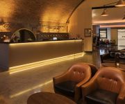
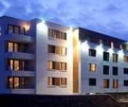
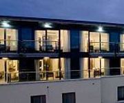
There is one Unesco world heritage site nearby. It's Brú na Bóinne - Archaeological Ensemble of the Bend of the Boyne in a distance of 35 mi (or 57 km), North-East. Also, if you like the game of golf, there are some options within driving distance. We saw 1 points of interest near this location. In need of a room? We compiled a list of available hotels close to the map centre further down the page.
Since you are here already, you might want to pay a visit to some of the following locations: Dublin, Swords, Tallaght, Wicklow and Naas. To further explore this place, just scroll down and browse the available info.
Local weather forecast
Todays Local Weather Conditions & Forecast: 11°C / 52 °F
| Morning Temperature | 9°C / 49 °F |
| Evening Temperature | 11°C / 52 °F |
| Night Temperature | 5°C / 41 °F |
| Chance of rainfall | 0% |
| Air Humidity | 86% |
| Air Pressure | 1020 hPa |
| Wind Speed | Moderate breeze with 10 km/h (6 mph) from South-East |
| Cloud Conditions | Broken clouds, covering 77% of sky |
| General Conditions | Light rain |
Saturday, 20th of April 2024
11°C (52 °F)
6°C (43 °F)
Few clouds, light breeze.
Sunday, 21st of April 2024
13°C (56 °F)
7°C (45 °F)
Few clouds, light breeze.
Monday, 22nd of April 2024
15°C (58 °F)
9°C (48 °F)
Light rain, gentle breeze, overcast clouds.
Hotels and Places to Stay
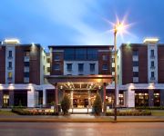
The Address at Dublin 1
The Croke Park Hotel
North Star
Dublin Central Suites
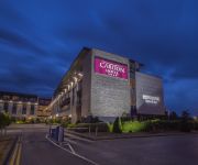
Carlton Hotel Dublin Airport
Dublin Skylon Hotel
Crowne Plaza DUBLIN AIRPORT
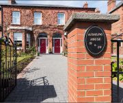
Aishling House
Metro Dublin Airport
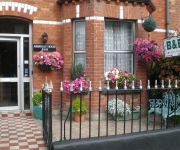
Abberley House
Videos from this area
These are videos related to the place based on their proximity to this place.
Welcome to English at Dublin City University
Welcome to English at Dublin City University. We constantly aim to be the best school with the best facilities in Ireland. Meet out teachers and other staff members, see our excellent facilities...
Number 16 Bus Route - Shantalla Road to Drumcondra, Dublin
Dublin Bus passenger point of view. This is the number 16 route from Shantalla road in Beaumont, to the Lower Drumcondra road in Dublin city, Ireland.
Kenya Orphan Aid - The Children Singing in Dublin (II)
kenyaorphanaid@eircom.net Kenya Orphan Aid is an Irish registered Charity (CHY16128), which supports a home for orphaned children in Nairobi, Kenya. Among other projects Kenya Orphan Aid...
DCU Epilepsy research
As part of our video series highlighting Irish epilepsy research during European Month of the Brain, Dr Veronica Lambert from Dublin City University and PhD students Stephanie O'Toole and Ailbhe...
Karting in Santry by Andis & Ivan & Stanislovas & Michail
Take part in the excitement of Kart City in Santry, Co Dublin real Motor Racing on your chosen track, suitable for all age groups. Karting is suitable for 10+ years of age (Minimum Height Restricti...
Motorbike riding Croke Park to Skerries north Dublin Ireland.
http://www.youtube.com/watch?v=H1UsbEmYG_w&feature=youtu.be Back in the saddle again for another installment of! Riding the motorbike in around and through Ireland and Dublin. What better...
Stop 6 Fairview Strand
East Wall History Group walking tour . " 1916 Rising and The Battle at Annesley Bridge stop 6 Fairview Strand . Tour Guide Hugo McGuinness . For more info www.eastwallforall.ie www.facebook.com...
Driving in Ireland - Dorset Street to Drumcondra Road, Dublin
Driving around Ireland. This is Lower Dorset street to Lower Drumcondra road in Dublin, on the 6th of March 2015.
Videos provided by Youtube are under the copyright of their owners.
Attractions and noteworthy things
Distances are based on the centre of the city/town and sightseeing location. This list contains brief abstracts about monuments, holiday activities, national parcs, museums, organisations and more from the area as well as interesting facts about the region itself. Where available, you'll find the corresponding homepage. Otherwise the related wikipedia article.
Dublin City University
Dublin City University (abbreviated as DCU) (Irish: Ollscoil Chathair Bhaile Átha Cliath) is a university situated between Glasnevin, Santry, Ballymun and Whitehall on the Northside of Dublin in Ireland. Created as the National Institute for Higher Education, Dublin in 1975, it enrolled its first students in 1980 and was elevated to university status (along with the University of Limerick) in 1989 by statute.
All Hallows College
This article is about All Hallows College in Dublin, Ireland. For Allhallows College in Dorset, England, see Allhallows College. All Hallows College Coláiste na Naomh Uile {{#invoke:InfoboxImage|InfoboxImage|image=|size=|sizedefault=frameless|alt=}} Latin: Collegium Omnium Sanctorum pro Missionibus exterisMotto Euntes Docete Omnes GentesMotto in English Go and teach all nationsEstablished 1842Type Private Roman CatholicChairman Dermot McCarthyPresident Dr. Patrick McDevitt, C.M. , Ph.
Santry
Santry (Irish: Seantrabh, meaning "Old tribe") is a suburb on the Northside of Dublin, Ireland, bordering Coolock, Glasnevin and Ballymun. Today it straddles the boundary of Dublin City and Fingal County Council area. The character of the area has changed in the last 100 years, from a district centred on a large estate, and later small village, to a modern, rather dispersed, mixed-use suburb.
St Vincents GAA
St Vincents is a Gaelic Athletic Association club based in Marino, on the northside of Dublin, Ireland. The club was founded in 1931, originally in Raheny, but it moved to its home in Marino in 1987. St Vincents merged with Marino Camogie Club in 1997 to form the St Vincents Hurling, Football and Camogie Club. They have twice won the All-Ireland Senior Club Football Championship, most recently in 2008.
O'Brien Institute
The O'Brien Institute is a building complex in Dublin, Ireland. It was built 1880–1883. The purpose of the building was to serve as an orphan home and school, financed by a trust that was founded by Bridget O'Brien in 1876. The last of the boarders (four in all) left in 1976,when the school was closed for good,at the time it was run by the Christian Brothers. The architect was John Joseph O'Callaghan (+ 1905).
Beaumont, Dublin
Beaumont is a suburb of Dublin, located on the Northside. It lies within the postal district Dublin 9, sometimes known as D9. The name derives from the French for "beautiful mount".
St. Vincent's Psychiatric Hospital, Fairview
St. Vincent's Psychiatric Hospital, Fairview is a small psychiatric hospital in Ireland. It is located in the north-central part of Dublin city and was founded in 1857 by The Daughters of Charity of St. Vincent de Paul, who were responsible for its operation until 2001. Although it retains a small private ward, its main role has evolved to provide in-patient and day-patient services for the Health Service Executive, Ireland's state health provider.
St. Aidan's C.B.S
St Aidan's C.B.S. is an Irish Christian Brothers secondary school under the trusteeship of the Edmund Rice Schools Trust located on Collins Avenue, Dublin. It is beside Dublin City University. Most St. Aidan's students have progressed from the local primary schools such as Larkhill Boys National School; Our Lady of Victories, Ballymun; St. Patrick's National School, Drumcondra; and St. Fiachra's School, Beaumont.
Coláiste Mhuire
Coláiste Mhuire Marino, which is part of the Marino Institute of Education (Institiúid Oideachais Marino), is a primary teacher training college which is affiliated with Trinity College, Dublin. It is located on Griffith Avenue, Dublin 9. Coláiste Mhuire is primarily focused on providing for pre-service primary education. Courses are provided in association with the Church of Ireland College of Education, Froebel College of Education and Trinity College, Dublin.
Omni Park Shopping Centre
Omni Park Shopping Centre is a major shopping centre and retail park in the Republic of Ireland. Located in Santry, in the north of Dublin close to the M50 motorway. It comprises over 7,300 square metres of retail space in 86 retail units over 2 floors of an indoor shopping mall and also several outlets externally. Units range from 49 square metres to 2,357 square metres . Omni Park also features a selection of eateries, an Oratory and an 11 screen cinema called Omniplex.
Whitehall Stadium
Whitehall Stadium is an Irish football ground located in the north Dublin suburb of Whitehall, bordering Drumcondra. It is currently the home ground of club Home Farm. Home Farm moved here in 1989 when Shelbourne acquired their previous home, Tolka Park. The stadium has hosted numerous international underage games including games in the 1994 UEFA European Under-16 Football Championship.
Na Gaeil Óga CLG
Na Gaeil Óga, CLG are a Dublin GAA, Irish-speaking gaelic football and hurling club based in Phoenix Park, Co. Dublin founded in 2011.


