Safety Score: 2,7 of 5.0 based on data from 9 authorites. Meaning we advice caution when travelling to United States.
Travel warnings are updated daily. Source: Travel Warning United States. Last Update: 2024-05-19 08:11:23
Explore Town Park Estates
The district Town Park Estates of Una in Davidson County (Tennessee) is located in United States about 562 mi west of Washington DC, the country's capital.
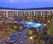
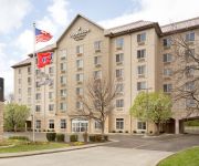
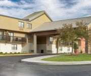
If you need a place to sleep, we compiled a list of available hotels close to the map centre further down the page.
Depending on your travel schedule, you might want to pay a visit to some of the following locations: Nashville, Franklin, Gallatin, Murfreesboro and Lebanon. To further explore this place, just scroll down and browse the available info.
Local weather forecast
Todays Local Weather Conditions & Forecast: 27°C / 81 °F
| Morning Temperature | 18°C / 64 °F |
| Evening Temperature | 27°C / 81 °F |
| Night Temperature | 21°C / 71 °F |
| Chance of rainfall | 0% |
| Air Humidity | 57% |
| Air Pressure | 1016 hPa |
| Wind Speed | Gentle Breeze with 6 km/h (4 mph) from North-East |
| Cloud Conditions | Scattered clouds, covering 36% of sky |
| General Conditions | Scattered clouds |
Tuesday, 21st of May 2024
28°C (82 °F)
22°C (72 °F)
Scattered clouds, gentle breeze.
Wednesday, 22nd of May 2024
29°C (84 °F)
23°C (74 °F)
Broken clouds, moderate breeze.
Thursday, 23rd of May 2024
27°C (81 °F)
22°C (72 °F)
Light rain, light breeze, overcast clouds.
Hotels and Places to Stay
Four Points by Sheraton Nashville Airport
Embassy Suites by Hilton Nashville Airport
Sheraton Music City Hotel
Radisson Hotel Nashville Airport
TownePlace Suites Nashville Airport
La Quinta Inn and Suites Nashville Airport
Nashville Air Country Inn and Suites by Radisson
Hampton Inn - Suites Nashville-Airport
Holiday Inn Express NASHVILLE AIRPORT
Home2 Suites by Hilton Nashville-Airport TN
Videos from this area
These are videos related to the place based on their proximity to this place.
White Lightning
Patterning 20, 30, 40 yards, Spectra Shot, Urbanhunting.net, Swamp City Media, Scott Davis.
NEW PRICE! 2540 Oak Forest Drive, Antioch, TN 37013, $134,500
NEW PRICE! 2540 Oak Forest Drive, Antioch, TN 37013, $134500, Stephanie Dooley and Lori W. Caste, RE/MAX Elite, Nashville Real Estate.
2214 Nashboro Blvd Nashville TN
http://www.exite-listings.com/33294 Welcome to 2214 Nashboro Boulevard A beautiful three bedroom two and a half bath townhome nestled along the 4th fairway of Nashboro Golf Club Back...
British Woods Apartments For Rent - Nashville, TN
Nashville apartments - British Woods apartments for rent in Nashville, TN. Get into the swing of things! Call 866.968.1987 or Visit http://www.apartments.com/search/oasis.dll?page=summary&property...
Hamilton Creek - Rock Garden in the snow
Went left at the start of advanced and had to walk the RG in the snow, but still a blast!
Nashville Rescue Mission
The members of Royal City Chapel International took a day of their 5th Anniversary to volunteer at the Nashville Rescue mission.
Videos provided by Youtube are under the copyright of their owners.
Attractions and noteworthy things
Distances are based on the centre of the city/town and sightseeing location. This list contains brief abstracts about monuments, holiday activities, national parcs, museums, organisations and more from the area as well as interesting facts about the region itself. Where available, you'll find the corresponding homepage. Otherwise the related wikipedia article.
Trevecca Nazarene University
Trevecca Nazarene University (TNU) is a private Christian liberal arts college located in Nashville, in the U.S. state of Tennessee.
Nashville Zoo at Grassmere
The Nashville Zoo at Grassmere is a 200-acre zoo and historic plantation farmhouse located 6 miles southeast of downtown Nashville, Tennessee. The Nashville Zoo at Grassmere is an accredited member of the Association of Zoos and Aquariums (AZA).
Donelson, Tennessee
Donelson is a neighborhood of Nashville, Tennessee located east of downtown Nashville along U.S. Route 70. It is named in honor of John Donelson, co-founder of Nashville and father-in-law of Andrew Jackson, Nashvillian and seventh President of the United States. It is incorporated as part of the Metropolitan Government of Nashville and Davidson County. Donelson began its development shortly after World War II.
WKRN-TV
WKRN-TV, virtual channel 2, owned by Young Broadcasting, is an ABC-affiliated television station located in Nashville, Tennessee, USA. WKRN-TV's studio and offices are on Murfreesboro Road in Nashville, and its transmitter is located in Brentwood, Tennessee.
Starwood Amphitheatre
Starwood Amphitheatre was the primary outdoor music venue in the Nashville, Tennessee area from 1985 to 2006. It was owned by Live Nation and had a capacity of 17,137. It had previously been owned by SFX Entertainment and Clear Channel Worldwide, both predecessors of Live Nation.
Percy Priest Lake
J. Percy Priest Lake is a reservoir in north central part of Tennessee. It is formed by J. Percy Priest Dam, located between miles six and seven of the Stones River. The dam (easily visible from Interstate 40) is located about 10 miles (16 km) east of downtown Nashville and impounds a lake 42 miles (68 km) long. The lake and dam are named for Congressman Percy Priest.
J. Percy Priest Dam
J. Percy Priest Dam is a dam in north central Tennessee at mile 6.8 of the Stones River, a tributary of the Cumberland. It is located about ten miles (16 km) east of downtown Nashville. The reservoir behind the dam is Percy Priest Lake. The Flood Control Act of 1946 commissioned the construction of a project under the name “Stewarts Ferry Reservoir”. Public Law 85-496, approved July 2, 1958, changed the name to J. Percy Priest in honor of the late Congressman from Tennessee.
Ezell Park
Ezell Park is an urban park in southeastern Nashville, Tennessee. The park is home to a soccer complex used by the Nashville Metros of the USL PDL, and is run by the Nashville Board of Parks and Recreation.
WFFH
WFFH and WFFI (93.7 FM) are radio stations simulcasting a Contemporary Christian format as "FM 94 The Fish", the "fish" referring to the traditional Christian symbol. Licensed to Smyrna, Tennessee and Kingston Springs, Tennessee respectively, the stations serve the ]]Nashville area. The stations air the same programming to provide maximum coverage of the Middle Tennessee area.
WKDA
WKDA is a radio station broadcasting a Spanish format. Licensed to Lebanon, Tennessee, USA, the station serves the Nashville area. The station is currently owned by Wilson County Broadcasting, Inc.
WCRT (AM)
WCRT is a Class B AM radio station licensed to the community of Donelson, Tennessee, near Nashville. Broadcasting a format of evangelical preaching and talk shows, WCRT is owned by Bott Communications, a Christian broadcaster, which bought the station, formerly WAMB, from longtime Nashville broadcaster Bill Barry (who now operates a new, lower-powered WAMB on the frequency of 1200 kHz). The WCRT callsign is derived from Christian Radio Tennessee.
Middle Tennessee Mental Health Institute
The Middle Tennessee Mental Health Institute, originally known as the Tennessee Hospital for the Insane and later as the Central State Hospital for the Insane, is a psychiatric hospital located in Nashville, Tennessee.
WECV
WECV is a radio station operated by Bott Radio Network, with a Christian talk/teaching format. Until 2011, the station was owned by Trevecca Nazarene University, and played Contemporary Christian music. A key figure in the station's history is former General Manager David Deese. Deese, who still teaches at the university, led the radio station as a student, the faculty member.
Global Mall at the Crossings
Global Mall at the Crossings, formerly Hickory Hollow Mall, is a regional indoor shopping mall in Antioch, Tennessee, a neighborhood of Nashville. The mall was built in 1978. In 1982, a JCPenney and several other stores were added. Another expansion project in 1991 resulted in a new building for Dillard's, with a mall expansion built within the former Dillard's location. The two-level mall is built in a cross pattern, with four wings situated around a central hub.
Berry Field Air National Guard Base
Berry Field Air National Guard Base is the military enclave of Nashville International Airport in Nashville, Tennessee. It has hosted the Tennessee Air National Guard 118th Airlift Wing (in various designations) since 1937. The base is home to Headquarters, Tennessee Air National Guard and the 118th Airlift Wing (118 AW), the latter serving as host wing for the installation.
Shelby Park (Nashville)
Shelby Park is a large urban park located approximately three miles (five km) east of downtown Nashville, Tennessee in East Nashville, along the Cumberland River. The park includes playgrounds, a dog park, baseball fields, two golf courses, and a community center. The park is located between the Lockeland Springs, Shelby Hills, and Rolling Acres neighborhoods. Until the 2011 opening of E. S. Rose Park, the Belmont Bruins baseball team played a portion of its home games at the park.
Antioch Comprehensive High School
Antioch High School (AHS) is a public high school located in Antioch, Tennessee, USA. It is located at 1900 Hobson Pike. It is a comprehensive high school for grades 9-12 and one of 19 high schools administered by Metropolitan Nashville Public Schools.
McGavock Comprehensive High School
McGavock Comprehensive High School (commonly McGavock or Big Mac) is a public high school located in Nashville, Tennessee. The school is very notable for its strong band program, having won the state championship 24 times: 1972-1979, 1982, 1987-1991, 1993-1994, 1997-2000, 2002-2005. This includes being grand champion at the annual Contest of Champions 12 times, more than any other high school since the contest began in 1962.
100 Oaks Mall
100 Oaks Mall (sometimes written out as One Hundred Oaks Mall) is a shopping mall located three miles south of downtown Nashville, Tennessee along Interstate 65 and Tennessee State Route 155.
Harding Mall
Harding Mall was a shopping mall located in suburban Nashville, Tennessee, southeast of downtown at the corner of Nolensville Pike US 31A/US 41A and Harding Place in the Paragon Mills neighborhood. It was the first completely enclosed shopping mall in the state of Tennessee. Built originally in 1969, the mall was demolished in 2006 and replaced with a Wal-Mart Supercenter. The mall was anchored by Castner Knott and a Carmike Cinemas multiplex.
Mill Creek (Davidson County, Tennessee)
Mill Creek is a 27.9-mile-long tributary of the Cumberland River that extends through Williamson and Davidson counties in the U.S. state of Tennessee. Via the Cumberland and Ohio rivers, it is part of the Mississippi River watershed. The creek begins near Nolensville, Tennessee, and continues into Metropolitan Nashville, winding through the Antioch, Cane Ridge, South Nashville, and Donelson neighborhoods, before flowing into the Cumberland about 2 miles upstream from downtown Nashville.
McGavock Elementary School
McGavock Elementary School (commonly McGavock Elementary, Little Mac) is a public school in Nashville, Tennessee, part of Metropolitan Nashville Public Schools. The school is named after the McGavock family, who were important in the early development of the city and who built the nearby Two Rivers Mansion. The school opened in fall 1956 and currently serves kindergarten through the fourth grade.
Cornelia Fort Airpark
Cornelia Fort Airpark was a privately owned, public-use airport located five nautical miles northeast of the central business district of Nashville, in Davidson County, Tennessee, United States. The 141-acre airport was located on a bend of the Cumberland River in East Nashville from 1944 until 2011, when the city of Nashville acquired it to include it as non-aviation part of Shelby Park.
Walden's Puddle
Walden's Puddle is a wildlife rehabilitation & education center located in Joelton, Tennessee, a suburb just outside Nashville. It provides care and treatment to sick, injured and orphaned native Tennessee wildlife and is the only professionally-staffed wildlife rehabilitation and education facility in Middle Tennessee. They do not charge for services.
WRMX-LP
WRMX-LP Is an Home Shopping Network-affiliated television station in Nashville, Tennessee. The station will permanently cease operations on a date yet to be announced, since the owners could not convert the station to digital, and possibly due to low budgeting and low ratings.


