Safety Score: 2,7 of 5.0 based on data from 9 authorites. Meaning we advice caution when travelling to United States.
Travel warnings are updated daily. Source: Travel Warning United States. Last Update: 2024-05-15 08:00:47
Delve into Rock City
Rock City in Contra Costa County (California) is located in United States about 2,408 mi (or 3,876 km) west of Washington DC, the country's capital town.
Current time in Rock City is now 10:40 AM (Wednesday). The local timezone is named America / Los Angeles with an UTC offset of -7 hours. We know of 8 airports close to Rock City, of which 4 are larger airports. The closest airport in United States is Metropolitan Oakland International Airport in a distance of 18 mi (or 29 km), South-West. Besides the airports, there are other travel options available (check left side).
Also, if you like playing golf, there are some options within driving distance. We encountered 10 points of interest near this location. If you need a hotel, we compiled a list of available hotels close to the map centre further down the page.
While being here, you might want to pay a visit to some of the following locations: Martinez, Oakland, Fairfield, Redwood City and San Francisco. To further explore this place, just scroll down and browse the available info.
Local weather forecast
Todays Local Weather Conditions & Forecast: 26°C / 79 °F
| Morning Temperature | 11°C / 51 °F |
| Evening Temperature | 19°C / 67 °F |
| Night Temperature | 12°C / 53 °F |
| Chance of rainfall | 0% |
| Air Humidity | 33% |
| Air Pressure | 1010 hPa |
| Wind Speed | Gentle Breeze with 6 km/h (4 mph) from East |
| Cloud Conditions | Clear sky, covering 0% of sky |
| General Conditions | Sky is clear |
Wednesday, 15th of May 2024
25°C (78 °F)
10°C (51 °F)
Sky is clear, gentle breeze, clear sky.
Thursday, 16th of May 2024
24°C (76 °F)
11°C (52 °F)
Sky is clear, gentle breeze, clear sky.
Friday, 17th of May 2024
22°C (71 °F)
9°C (49 °F)
Sky is clear, moderate breeze, clear sky.
Hotels and Places to Stay
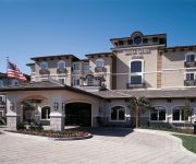
HYATT house San Ramon
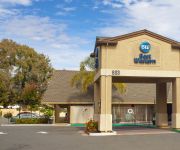
BW DANVILLE SYCAMORE INN
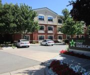
Extended Stay America San Ramon Bishop Ranch East
Videos from this area
These are videos related to the place based on their proximity to this place.
Grass Fire - Danville, Ca
2nd Alarm Grass Fire in Danville, Ca CDF 106, Helicopter, Air Tanker, Wildland.
Hidden Valley Neighborhood in Danville California CA 94526
A tour of the Hidden Valley neighborhood located in Danville, California narrated by Mary Robbins, Partner and Co-founder of Empire Realty Associates. Watch more area videos - http://www.citytou...
101 Acre French Country Estate
Located in the Foothills of Mt. Diablo in the exclusive community of Alamo, this amazing estate offers 26739 +/- sqft heated under the roof of luxury living and boasts a Pool House, Showcase...
Mount Diablo State Park - Descending Wall Point (Dusty Trail) to Stage Rd w/GoPro hero helmet
A quick 270 ft drop down the .5 mile lower portion of Wall Pt in Mt Diablo State Park. Santa Cruz Blur LT2 being chased by Pivot Mach 5 and Fisher HiFi 29er Pro. Wall Pt has some good exposed...
Rattlesnake on Mt Diablo Trail
We were frantically trying to warn this biker about the rattlesnake on the trail...we were yelling at him a lot longer than the video shows.
Paver patio designs stones in Diablo (415)325-2505
Our goal is to provide the best in quality home improvement solutions. We view each assignment as a challenge and opportunity to excel, to meet and then surpass the expectations of our customers....
French Country Manor
http://www.tourfactory.com/s643188/r_www.youtube.com ----- For more information, contact: Peggy Cortez, 9252093451, J Rockcliff Realtors ----- Perched on a knoll, this stunning French Country...
DIABLO 3 : ASDOMAN KILL / DEMON HUNTER / LITTLE GEAR/WEAP
Petite vidéo de moi qui tue Asmodan ! J'ai un petit stuff mais j'y arrive ! Et en + j'avais les 5 stack du buff drop !
Stations of the Cross on Mount Diablo I
Wall Point Trail on Mt. Diablo, March 15, 2008, led by Rev. Paulson, Pastor, St. Mary's Catholic Church, Walnut Creek. This 3.8 mile, 2000 ft climb ended up at Rock City. Mass and lunch followed.
Enterprising Chap on his Mountaineering Penny Farthing
Unusual encounter on Saturday, July 16, 2011 at Mount Diablo's North Gate Road. This chappie was seen to be descending Diablo's North Gate Road with the utmost dignity and panache from the...
Videos provided by Youtube are under the copyright of their owners.
Attractions and noteworthy things
Distances are based on the centre of the city/town and sightseeing location. This list contains brief abstracts about monuments, holiday activities, national parcs, museums, organisations and more from the area as well as interesting facts about the region itself. Where available, you'll find the corresponding homepage. Otherwise the related wikipedia article.
Mount Diablo
Mount Diablo is a mountain in Contra Costa County, California in the San Francisco Bay Area, located south of Clayton and northeast of Danville. It is an isolated upthrust peak of 3,864 feet, visible from most of the San Francisco Bay Area and much of northern California.
KTNC-TV
KTNC-TV, digital channel 14, is an Estrella TV affiliate, serving both the San Francisco Bay Area and the Sacramento Valley. KTNC is owned by New World TV Group and broadcasts at 40 kilowatts.
The Athenian School
The Athenian School is a college preparatory and boarding school located in Danville, California. Athenian educates students in grades 6-12 on a 75-acre campus at the base of Mt. Diablo, located near San Francisco in Northern California. Athenian was founded by Dyke Brown (1915–2006) in 1965. Athenian is composed of roughly 150 students in the middle school (grades 6-8) and 300 students in the high school (9-12). Approximately 40 students and 18 teachers live on campus full-time.
Mount Diablo meridian
The Mount Diablo meridian, established in 1851, is the main surveying reference point for much of northern California and Nevada. The initial point is the on the summit of Mount Diablo.


