Safety Score: 2,7 of 5.0 based on data from 9 authorites. Meaning we advice caution when travelling to United States.
Travel warnings are updated daily. Source: Travel Warning United States. Last Update: 2024-04-30 08:30:35
Delve into Rocky Hill
Rocky Hill in Calaveras County (California) is a city located in United States about 2,326 mi (or 3,743 km) west of Washington DC, the country's capital town.
Current time in Rocky Hill is now 04:47 PM (Tuesday). The local timezone is named America / Los Angeles with an UTC offset of -7 hours. We know of 10 airports closer to Rocky Hill, of which 5 are larger airports. The closest airport in United States is Oakdale Airport in a distance of 32 mi (or 52 km), South-West. Besides the airports, there are other travel options available (check left side).
Also, if you like playing golf, there are some options within driving distance. We saw 1 points of interest near this location. In need of a room? We compiled a list of available hotels close to the map centre further down the page.
Since you are here already, you might want to pay a visit to some of the following locations: Sonora, San Andreas, Jackson, Placerville and Modesto. To further explore this place, just scroll down and browse the available info.
Local weather forecast
Todays Local Weather Conditions & Forecast: 18°C / 65 °F
| Morning Temperature | 4°C / 40 °F |
| Evening Temperature | 16°C / 60 °F |
| Night Temperature | 7°C / 45 °F |
| Chance of rainfall | 0% |
| Air Humidity | 20% |
| Air Pressure | 1013 hPa |
| Wind Speed | Gentle Breeze with 7 km/h (5 mph) from East |
| Cloud Conditions | Clear sky, covering 7% of sky |
| General Conditions | Sky is clear |
Tuesday, 30th of April 2024
19°C (66 °F)
8°C (47 °F)
Sky is clear, gentle breeze, clear sky.
Wednesday, 1st of May 2024
20°C (68 °F)
9°C (48 °F)
Sky is clear, gentle breeze, clear sky.
Thursday, 2nd of May 2024
19°C (66 °F)
9°C (48 °F)
Sky is clear, gentle breeze, clear sky.
Hotels and Places to Stay
DUNBAR HOUSE 1880
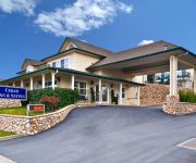
BEST WESTERN CEDAR INN
Murphys Inn Motel
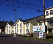
Murphys Suites
Gold Country Inn Angels Camp
Videos from this area
These are videos related to the place based on their proximity to this place.
Placer Varsity Girls Cross Country at Sac Joajuin Subsection 2014
Rough edit of video of Placer High School Varsity Girls Cross Country team competing in Division 3 of the Sac-Joaquin Subsections. Placer Varsity Girls were second place. The order of their...
Northern Flicker, Woodpecker
Photographed at my neighbor's house in Arnold, California. This Flicker followed her home from a walk, then stayed on the deck to be hand fed and handled. Very unusual. We cannot figure if...
Watching the Robot Clean the Pool at Willow Creek Ranch, Mountain Ranch, CA
Doesn't take much to make me happy. Just sitting here watching the robot clean the pool! Just watching the SmartKleen Robotic Pool cleaner clean the pool.
Murphys Irish Day 2015
Each year on the third Saturday in March, Murphys CA shuts down Main Street and prepares to celebrate like only the Irish can.
Moaning Caverns -- Adventure/Travel Host: Jasen Wade
Here is an adventurous tour of Moaning Caverns in Northern California. Dagen and I headed out to film some footage for a hosting reel I am putting together for Discovery Channel, and this...
2013 DISCRAFT ACE RACE at FEENEY PARK in MURPHYS, CALIFORNIA
Highway 4 Disc Golf Presents the 2013 Discraft Ace Race from Feeney Park in Murphys, Ca. Includes a quick look at the player package, photos and videos of the event, Ace Makers and the winner...
Videos provided by Youtube are under the copyright of their owners.
Attractions and noteworthy things
Distances are based on the centre of the city/town and sightseeing location. This list contains brief abstracts about monuments, holiday activities, national parcs, museums, organisations and more from the area as well as interesting facts about the region itself. Where available, you'll find the corresponding homepage. Otherwise the related wikipedia article.
Douglas Flat, California
Douglas Flat (formerly, Douglasflat and Douglass Flat) is an unincorporated community in Calaveras County, California. It lies at an elevation of 1965 feet (599 m) and is located at {{#invoke:Coordinates|coord}}{{#coordinates:38|06|52|N|120|27|18|W| | |name= }}. The community is in ZIP code 95229 and area code 209. Douglas Flat was a roaring mining camp of the early 1850s. In 1857 the Harper and Lone Star Claims produced $130,000 worth of gold.
Ironstone Vineyards
Ironstone is noted for several leading US brands. These include the Ironstone Vineyards brand, Leaping Horse Vineyards, Dog Tail Vineyards, and Sonoma Creek. As of 2004, Ironstone has been listed as the 17th largest winery (in terms of cases sold) in the US. Ironstone also sell significant amounts of wine in the international markets including the UK, Canada and 40 other countries.
Big Valley, Calaveras County, California
Big Valley is an unincorporated community in Calaveras County, California. It lies at an elevation of 2155 feet (657 m).
Indian Creek, California
Indian Creek is an unincorporated community in Calaveras County, California. It lies at an elevation of 2979 feet (908 m).
La Honda Park, California
La Honda Park is an unincorporated community in Calaveras County, California. It lies at an elevation of 1791 feet (546 m).
Rocky Hill, California
Rocky Hill is an unincorporated community in Calaveras County, California. It lies at an elevation of 2300 feet (701 m).
Wyldewood, California
Wyldewood is an unincorporated community in Calaveras County, California. It lies at an elevation of 2310 feet (704 m).
Brownsville, Calaveras County, California
Brownsville is a former settlement in Calaveras County, California, about 1 mile (1.6 km) east of Murphys. Brownsville, named for Alfred Brown, operated as a mining camp in the 1850s and 1860s.


