Safety Score: 3,0 of 5.0 based on data from 9 authorites. Meaning we advice caution when travelling to Malta.
Travel warnings are updated daily. Source: Travel Warning Malta. Last Update: 2024-04-25 08:17:04
Discover Freeport
The district Freeport of in Birżebbuġa is a district in Malta a little south of Valletta, the country's capital city.
Looking for a place to stay? we compiled a list of available hotels close to the map centre further down the page.
When in this area, you might want to pay a visit to some of the following locations: Birzebbuga, Marsaxlokk, Ghaxaq, Zejtun and Gudja. To further explore this place, just scroll down and browse the available info.
Local weather forecast
Todays Local Weather Conditions & Forecast: 17°C / 62 °F
| Morning Temperature | 15°C / 58 °F |
| Evening Temperature | 17°C / 62 °F |
| Night Temperature | 16°C / 61 °F |
| Chance of rainfall | 0% |
| Air Humidity | 68% |
| Air Pressure | 1015 hPa |
| Wind Speed | Moderate breeze with 11 km/h (7 mph) from North-West |
| Cloud Conditions | Overcast clouds, covering 89% of sky |
| General Conditions | Overcast clouds |
Saturday, 27th of April 2024
17°C (62 °F)
17°C (62 °F)
Sky is clear, strong breeze, clear sky.
Sunday, 28th of April 2024
17°C (63 °F)
17°C (63 °F)
Sky is clear, high wind, near gale, clear sky.
Monday, 29th of April 2024
18°C (64 °F)
17°C (62 °F)
Sky is clear, strong breeze, clear sky.
Hotels and Places to Stay
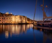
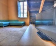
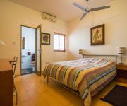
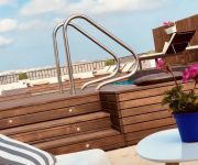
IBB Cugo Gran Macina Grand Harbour
Palazzo Consiglia Hotel
Phoenicia Malta
Casa Ellul
Holiday Apartments Malta Valletta
Labranda Riviera Premium Resort & Spa
Harbour View Host Family Bed & Breakfast
Valletta Merisi Suites
Park Lane
Julesy's BnB
Videos from this area
These are videos related to the place based on their proximity to this place.
Marsaxlokk, Malta
http://zoqy.net/blog We paid a visit to the very picturesque fishing village of Marsaxlokk, Malta.
QQLX - MALTA - Marsaxlokk - FISH MARKET - 2013 - FULL HD
QQLX - 2013 MALTA - Marsaxlokk Fish Market.
På tur til Marsaxlokk
Her reiser vi med åpen buss fra Valletta Bus Terminus og til Marsaxlokk - og tilbake via Blue Grotto.
Malta
A few clips from a holiday to Malta in October 2012. Starts in the fishing village of Marsaxlokk. You must eat here if you like your seafood! Then the sea ca...
Birzebbuga u l-festa taghha matul is-snin (Part 1 of 2)
Birzebbuga u l-festi Tagħha Matul is-snin (Part 1 of 2) Dan huwa feature imtella' mill-Ghaqda Storja u Kultura Birzebbuga, f'Settmebru tal-2008 f'Jum Birzebbuga. Dan ix-xoghol sar bil-hidma...
Birzebbuga u l-festa taghha matul is-snin (Part 2 of 2)
Birzebbuga u l-festi Tagħha Matul is-snin (Part 2 of 2) Dan huwa feature imtella' mill-Ghaqda Storja u Kultura Birzebbuga, f'Settmebru tal-2008 f'Jum Birzebbuga. Dan ix-xoghol sar bil-hidma...
Naqtgħu u Niwweldjaw - Marċ mill-Għaqda tan-Nar 22 ta' Frar Birżebbuġa
Fl-okkażjoni tal-festa ta' San Pietru Fil-Ktajjen 2014, l-Għaqda tan-Nar 22 ta' Frar tinawgura dan il-marċ ġdid bl-isem ta' "Naqtgħu u niwweldjaw". Kliem: Alex Azzopardi Mużika: David...
Videos provided by Youtube are under the copyright of their owners.
Attractions and noteworthy things
Distances are based on the centre of the city/town and sightseeing location. This list contains brief abstracts about monuments, holiday activities, national parcs, museums, organisations and more from the area as well as interesting facts about the region itself. Where available, you'll find the corresponding homepage. Otherwise the related wikipedia article.
Geography of Malta
The geography of Malta is dominated by water. Malta is an archipelago of coralline limestone, located in the Mediterranean Sea, approximately 93 kilometres south of Sicily, Italy, and nearly 300 km north (Libya) and northeast (Tunisia) of Africa. Although Malta is situated in Europe, it is located farther south than African Tunis, capital of Tunisia, Algiers, capital of Algeria, Tangier in Morocco and also Aleppo in Syria, and Mosul in Iraq in the Middle East.
Għar Dalam
Għar Dalam (pronounced ar dàlam in Maltese and meaning "Cave of Darkness") is a prehistorical cul de sac located on the outskirts of Birżebbuġa, Malta containing the bone remains of animals that were stranded and subsequently became extinct on Malta at the end of the Ice age. It has lent its name to the Għar Dalam phase in Maltese prehistory.
Medavia
Medavia (Mediterranean Aviation Co. Ltd) is an airline based in Luqa, Malta. It operates ad hoc charters and long term leases mainly in North Africa supporting the oil industry and the provision of VIP charters. Its main bases are Malta International Airport and Tripoli International Airport, Libya. Medavia has around 170 employees (as of 2007).
Fort Leonardo
Fort Leonardo also known as Fort St Leonardo, Fort San Leonardo and Fort San Anard is a fortification on the island of Malta. It stands between the villages of San Leonardo and Zonqor above the shore east of Grand Harbour. It was built between 1872 and 1878 by the British. Fort St Leonardo still exists, and is in reasonable repair, though a house has been built inside the ditch and the ditch in-filled to create an access. The seaward ditches are all in good repair.
St Thomas Tower
St Thomas Tower is a fortification on the island of Malta. It stands above the shore on the seaward face of the headland of Il-Hamriga. The tower was built by the Knights of Malta in 1614 during the reign of Grand Master Fra Alof de Wignacourt, and is one of the set of Wignacourt towers. It is a substantial fortification intended to prevent the landing of troops in the sheltered anchorages of Marsascala Creek and St Thomas Bay.
Mamo Tower
Mamo Tower is a fortification on the island of Malta. It stands on rising ground above St Thomas Bay on the east shore of Malta. The Mamo family built the tower in 1657, as a fortified residence. In 1940 the British Military requisitioned the tower and used it as a Regional Headquarters. In support of this role, they constructed a pillbox on the roof. After World War II it was again a private house until 1987, when the poor condition of the building rendered it unsuitable for habitation.
Fort Delimara
Fort Delimara is a fortification in Marsaxlokk, Malta.
St Lucian Tower
St Lucian Tower is a fortification on the island of Malta that stands above the shore of Marsaxlokk Bay on the headland between Marsaxlokk and Birzebbuga. It was built by the Knights of Malta between 1610 and 1611 and is one of a series of Wignacourt towers. The British substantially extended it and the original tower now forms the core of a Victorian era fortress. The tower is surrounded by a rock cut ditch, with caponiers, a sunken gate, and a curved entrance ramp.
Hypogeum of Ħal-Saflieni
The Hypogeum of Paola, Malta, literally meaning "underground" in Greek, is a subterranean structure dating to the Saflieni phase (3000-2500 BC) in Maltese prehistory. Thought to be originally a sanctuary, it became a necropolis in prehistoric times, as proven by the remains of more than 7,000 individuals that have been discovered during the course of the excavation. It is the only prehistoric underground temple in the world.
Fort Saint Michael
Fort St Michael was a fortification on the island of Malta. A fort of that name was built by the Knights of Malta between 1551 and 1565 on the peninsula then known as Isla St Michael formed by Dockyard Creek and French Creek in Grand Harbour. This area is still known as L-Isla, but is now occupied by the fortified city of Senglea.
Three Cities
The Three Cities is a collective description of the three fortified cities of Cospicua, Vittoriosa, and Senglea on the Island of Malta, which are enclosed by the massive line of fortification created by the Knights of St John, the Cottonera Lines. "Cottonera" is usually taken to include these Three Cities and Kalkara.
RAF Luqa
Royal Air Force Luqa was a flying station and location of RAF Mediterranean Command headquarters of the Royal Air Force on the island of Malta during World War II. Particularly during the Siege of Malta from 1941 to 1943, RAF Luqa was a very important base for British Commonwealth forces fighting against Italy and Germany for naval control of the Mediterranean and for ground control of North Africa.
Fort Tas-Silġ
Fort Tas-Silġ is a fortification on the island of Malta. It stands on high ground at the shoreward end of Delimara Point, above Il-Ħofra-z-Zgħira. It is a Polygonal fort and was built by the British. Its primary function was as a fire control point controlling the massed guns of Fort Delimara on the headland below. The fort is a classic example of the type. The gatehouse, and the shoreward ditch are in fair repair, but there has been considerable collapse of the inner face of the north ditch.
St Paul's Battery
St Paul's Battery is a fortification on the island of Malta. It stands on high ground at the shoreward end of Delimara Point, above Il-Ħofra-z-Zgħira. It is a polygonal fort and was built by the British. It commands a field of fire northwards over St Thomas' Bay and Marsaskala. The fort is currently in very poor condition. Approximately 300 m south is Fort Tas-Silg, a much larger polygonal style fortification.
Fort Benghisa
Fort Benghisa is a fortification on the island of Malta. It stands on high ground on the seaward face of Benghisa point, the southern arm of Marsaxlokk Bay. It is a Polygonal fort and was built by the British. The fort was the last polygonal fort built in Malta, built in 1909. The gatehouse, and the shoreward ditch are in fair repair.
Hibernians Ground
Hibernians Stadium is a multi-use stadium in Paola, Malta. The Hibernians football ground was inaugurated on 9 November 1986. Hibernians became the first Maltese club to have their own football pitch. Nonetheless, Hibernians play most of their league matches in the National Stadium in Ta' Qali, since nearly all the Maltese Premier League matches are played there. The ground is used by Hibernians for their everyday training sessions.
Xarolla Windmill
The Xarolla Windmill at Żurrieq, Malta is one of the windmills constructed by the Knights of Malta in the villages and towns of Malta. In 1674 Grand Master Nicolas Cotoner built five windmills around Malta. One of these was the windmill built in Nigret, Zurrieq, known as Tal-Qaret. In 1724, Grand Master Antonio Manoel de Vilhena built another windmill next to it, known as Ta' Marmara, which was the surname of the first person to work in the same windmill, Luret Marmara.
Cottonera Lines
The Cottonera Lines are a massive line of fortifications surrounding the Three Cities of Vittoriosa, Senglea, and Cospicua, in Malta. They are entirely built on four of the Bormla (Cospicua) hills. Grand Master Cottoner is still inked to Bormla with his surname's coat-of-arms now depicted in the emblem of the Bormla Local Council. They were designed by Italian engineer Antonio Maurizio Valperga in the 17th Century, and named after Grand Master Nicolau Cotoner.
Tarxien Temples
The Tarxien Temples are an archaeological complex in Tarxien, Malta. They date to approximately 3150 BC. The site was accepted as a UNESCO World Heritage Site in 1980 along with the other Megalithic temples on the island of Malta.
Ħal Far
Ħal Far, is one of the main industrial estates in Malta. It is at the southern extreme of Malta, between the localities of Birżebbuġa, Safi and Żurrieq. In the past, Ħal Far housed the RAF Hal Far airfield, which was known as HMS Falcon when in the service of the Royal Navy. The runway can still be seen and driven on, leading the Maltese to use for drag car racing. Parts of the airfield including the hangar have been converted into a refugee camp for illegal immigrants.
Bubaqra
Bubaqra is a small, rural area in Zurrieq, in the south-east of Malta. It is situated between the zones of Nigret and Hal-Far. Has a population of 2,000 people. Even though it is one of the oldest areas in this village, many new buildings are being constructed and this area is searched most by newly-weds who come to live in this quiet, airy area. At the centre of this zone, a small church is situated, dedicated to our Holy Mary.
RAF Hal Far
The RAF Hal Far airfield was the first permanent airfield to be built on Malta. It was opened on 1 April 1929 as HMS Falcon, a Royal Navy base, and was used by Royal Navy air crews. It was transferred to the Maltese Government and redeveloped as from January 1979. It is now closed and one of its runways is used by drag racing enthusiasts. The second runway is now a road leading to an industrial estate which was developed recently.
Wardija Tower
The Wardija Tower is one of thirteen towers that Grand Master Martin de Redin of the Knights of Malta had built along the coasts of Malta. The tower is between Zurrieq and Hal Far; the nearest tower to it is the Hamrija Tower to the south-east. The Wardija Tower was constructed and finished by June 1659 and was the last tower built. It is smaller than the other de Redin towers although it was armed with 2 cannon and 2 mortars. The tower's actual name was Torre della Guardia di Giorno.
Marsaxlokk Ground
Marsaxlokk Ground is a football pitch in Marsaxlokk, a traditional fishing village located in the south-eastern part of Malta. The ground is used mostly for football matches and is the home stadium of Marsaxlokk Football Club. Marsaxlokk FC uses this ground for training and practice matches.
Playmobil Park
Playmobil Park is the world's second largest Playmobil factory, located in Ħal Far in the extreme south of Malta. Although smaller than the Playmobil FunPark headquarters in Zirndorf, some 2 million Playmobils a week are made at the factory which also offers a 45-minute tour of the factory and facilities for children.


