Safety Score: 3,4 of 5.0 based on data from 9 authorites. Meaning please reconsider your need to travel to Indonesia.
Travel warnings are updated daily. Source: Travel Warning Indonesia. Last Update: 2024-05-13 08:03:22
Discover Samboja
Samboja in Banten is a town in Indonesia about 66 mi (or 106 km) west of Jakarta, the country's capital city.
Current time in Samboja is now 08:24 AM (Tuesday). The local timezone is named Asia / Jakarta with an UTC offset of 7 hours. We know of 5 airports near Samboja, of which one is a larger airport. The closest airport in Indonesia is Soekarno-Hatta International Airport in a distance of 52 mi (or 84 km), East. Besides the airports, there are other travel options available (check left side).
There is one Unesco world heritage site nearby. It's Ujung Kulon National Park in a distance of 68 mi (or 110 km), North-West. Looking for a place to stay? we compiled a list of available hotels close to the map centre further down the page.
When in this area, you might want to pay a visit to some of the following locations: Mekarsari, Ciparay, Kopibera, Cibunut and Kopibaru. To further explore this place, just scroll down and browse the available info.
Local weather forecast
Todays Local Weather Conditions & Forecast: 31°C / 88 °F
| Morning Temperature | 25°C / 77 °F |
| Evening Temperature | 29°C / 84 °F |
| Night Temperature | 26°C / 79 °F |
| Chance of rainfall | 1% |
| Air Humidity | 60% |
| Air Pressure | 1010 hPa |
| Wind Speed | Light breeze with 5 km/h (3 mph) from South-West |
| Cloud Conditions | Overcast clouds, covering 89% of sky |
| General Conditions | Light rain |
Wednesday, 15th of May 2024
32°C (89 °F)
26°C (79 °F)
Light rain, gentle breeze, broken clouds.
Thursday, 16th of May 2024
32°C (89 °F)
26°C (80 °F)
Light rain, light breeze, broken clouds.
Friday, 17th of May 2024
30°C (87 °F)
26°C (80 °F)
Light rain, light breeze, broken clouds.
Hotels and Places to Stay
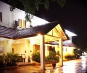
Aston Anyer Beach Hotel
JAYAKARTA ANYER
Videos from this area
These are videos related to the place based on their proximity to this place.
Anyer 2008, Pantai Marbella
Ini rekaman hape orvin waktu kita jalan ke anyer. naek motor berjumlah tiga kendaraan. yang ikut kesana adalah bu Tutut, Pak Joni, Tata, Elang, Orvin, Rendy dan Lift. Disana kita liburan...
CFC 201 TOURING BOGOR - ANYER BANTEN KOMUNITAS BARUDAK CIGE 201
REFRESING BARUDAK CIGE 201 (CFC) ABIS LEBARAN 2010.
Muka-muka orang susah naik mobil mewah.wmv
berikut tadi adalah cuplikan muka2 orang susah ketika naik atau merasakan nyaman nya mobil mewah..
Videos provided by Youtube are under the copyright of their owners.
Attractions and noteworthy things
Distances are based on the centre of the city/town and sightseeing location. This list contains brief abstracts about monuments, holiday activities, national parcs, museums, organisations and more from the area as well as interesting facts about the region itself. Where available, you'll find the corresponding homepage. Otherwise the related wikipedia article.
Anyer
Anyer (also Anjer) is a town in Banten, formerly West Java, Indonesia, fifteen kilometres south of Merak. It is home of a forty metre lighthouse built by King Willem III of the Netherlands in 1885 as a memorial for the townspeople killed by the eruption of Krakatau, which destroyed the town. It is also the starting point of the Great Post Road, built by the Dutch in the nineteenth century, which ran 1,000 kilometres to the eastern tip of Java.


