Safety Score: 2,8 of 5.0 based on data from 9 authorites. Meaning we advice caution when travelling to Canada.
Travel warnings are updated daily. Source: Travel Warning Canada. Last Update: 2024-05-01 08:01:32
Touring Okanagan Falls
Okanagan Falls in British Columbia is a town located in Canada about 2,041 mi (or 3,285 km) west of Ottawa, the country's capital place.
Time in Okanagan Falls is now 09:10 AM (Wednesday). The local timezone is named America / Vancouver with an UTC offset of -7 hours. We know of 9 airports nearby Okanagan Falls, of which one is a larger airport. The closest airport in Canada is Penticton Airport in a distance of 8 mi (or 13 km), North. Besides the airports, there are other travel options available (check left side).
Also, if you like the game of golf, there are several options within driving distance. Need some hints on where to stay? We compiled a list of available hotels close to the map centre further down the page.
Being here already, you might want to pay a visit to some of the following locations: Okanogan, Republic, Waterville, Colville and Ephrata. To further explore this place, just scroll down and browse the available info.
Local weather forecast
Todays Local Weather Conditions & Forecast: 15°C / 59 °F
| Morning Temperature | 3°C / 37 °F |
| Evening Temperature | 15°C / 59 °F |
| Night Temperature | 7°C / 45 °F |
| Chance of rainfall | 0% |
| Air Humidity | 25% |
| Air Pressure | 1015 hPa |
| Wind Speed | Gentle Breeze with 7 km/h (4 mph) from South-East |
| Cloud Conditions | Overcast clouds, covering 100% of sky |
| General Conditions | Overcast clouds |
Wednesday, 1st of May 2024
17°C (62 °F)
10°C (51 °F)
Sky is clear, gentle breeze, clear sky.
Thursday, 2nd of May 2024
17°C (63 °F)
12°C (54 °F)
Overcast clouds, moderate breeze.
Friday, 3rd of May 2024
15°C (60 °F)
11°C (52 °F)
Light rain, light breeze, overcast clouds.
Hotels and Places to Stay
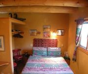
Bighorn Ridge Guesthouse
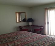
La Villa Motel
HOLIDAY BEACH RESOR
Videos from this area
These are videos related to the place based on their proximity to this place.
South of Penticton -- Vaseux Lake and Mountain Bighorn Sheep
Unbelievable scenery, accentuated with a large population of wild life. Bighorn sheep, mule deer, white tail deer, bear, mountain lion all roam the mountains along with western diamond back...
Summer Blast - Rafting in Penticton
Rafting on the Channel is one of the laziest ways to have a great time with family and friends in the Okanagan and there is only one place to do it,Penticton. People of all ages - yes we...
Linden Gardens July 4, 2008
South of Penticton, in Kaleden, this is how these perennial gardens were seen while strolling along the paths on this day. Highlights: the lilies, poppies, a water lily road for a blackbird,...
OtherPeoplesTrash Skaha Lake's West side KAYAKING-LOG: May11th2013
We have beautiful lakes in the Okanagan Valley but it is sad how many take our lakes for granted. Kayaking along Skaha Lake's West side from Penticton towards Kaleden. Didn't even make it 1/3...
BrassBalls Bobber Kit Ride
BrassBalls Bobbers put together an awesome kit. Rigid Kraft Tech frame, 107" Ultima engine with 6 speed Ultima transmission and open primary, DNA Springer front end. Last winter I built the...
My View Skaha Lake - Penticton, BC, Canada - November 25, 2012
No kayaking yet today.. but maybe I will when Kathy McA gets home. Here is slideshow of "My View", one month before Christmas, spend the day in the sunshine putting up Christmas lights. LogDate:...
Jan's sport lead climb at Skaha (helmet cam)
Sport lead climb of Hiking with Harry (10a) route at Skaha BC. 'Forward' helmet camera got tilted unknowingly at the crux and became a 'downward' helmet cam giving a different view of the...
Videos provided by Youtube are under the copyright of their owners.
Attractions and noteworthy things
Distances are based on the centre of the city/town and sightseeing location. This list contains brief abstracts about monuments, holiday activities, national parcs, museums, organisations and more from the area as well as interesting facts about the region itself. Where available, you'll find the corresponding homepage. Otherwise the related wikipedia article.
Christie Memorial Provincial Park
Christie Memorial Provincial Park is a provincial park in British Columbia, Canada, located in the town of Okanagan Falls at the south end of Skaha Lake. The park was established in 5 October 1965, in remembrance of RCAF Pilot Officer Robert G. Christie, DFM. Christie was serving as a Navigator with No. 97 Squadron RAF when he was killed in action 23 September 1943. As the only serviceman from Okanagan Falls killed in action during World War II, this Provincial Park was named after him.
Okanagan Falls Provincial Park
Okanagan Falls Provincial Park is a provincial park in British Columbia, Canada, located in the town of the same name, protecting the area around the waterfall of the same name, which lies below the outlet of Skaha Lake in the course of the Okanagan River.


