Safety Score: 2,8 of 5.0 based on data from 9 authorites. Meaning we advice caution when travelling to Canada.
Travel warnings are updated daily. Source: Travel Warning Canada. Last Update: 2024-04-27 08:23:39
Delve into Trail
Trail in British Columbia with it's 9,707 habitants is located in Canada about 1,961 mi (or 3,155 km) west of Ottawa, the country's capital town.
Current time in Trail is now 05:27 PM (Saturday). The local timezone is named America / Vancouver with an UTC offset of -7 hours. We know of 8 airports close to Trail, of which one is a larger airport. The closest airport in Canada is Trail Airport in a distance of 5 mi (or 8 km), South-East. Besides the airports, there are other travel options available (check left side).
Also, if you like playing golf, there are some options within driving distance. If you need a hotel, we compiled a list of available hotels close to the map centre further down the page.
While being here, you might want to pay a visit to some of the following locations: Colville, Republic, Newport, Sandpoint and Bonners Ferry. To further explore this place, just scroll down and browse the available info.
Local weather forecast
Todays Local Weather Conditions & Forecast: 7°C / 45 °F
| Morning Temperature | 7°C / 44 °F |
| Evening Temperature | 10°C / 49 °F |
| Night Temperature | 5°C / 42 °F |
| Chance of rainfall | 4% |
| Air Humidity | 94% |
| Air Pressure | 1015 hPa |
| Wind Speed | Light breeze with 3 km/h (2 mph) from North |
| Cloud Conditions | Overcast clouds, covering 100% of sky |
| General Conditions | Light rain |
Sunday, 28th of April 2024
6°C (43 °F)
3°C (37 °F)
Rain and snow, light breeze, overcast clouds.
Monday, 29th of April 2024
6°C (42 °F)
5°C (41 °F)
Light rain, light breeze, overcast clouds.
Tuesday, 30th of April 2024
7°C (45 °F)
5°C (40 °F)
Light rain, calm, overcast clouds.
Hotels and Places to Stay
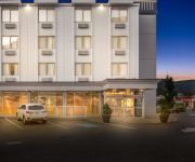
BEST WESTERN PLUS COLUMBIA RVR
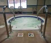
Glenwood Inn & Suites
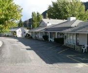
Trail Motel & RV Park
Ray Lyn Motel
Videos from this area
These are videos related to the place based on their proximity to this place.
Silver City Days 2014
On a recent visit from our good friends from Kelowna, we decided to head to Trail's annual Silver City Days.
Curious Marmots near Trail BC
We spotted these cute little marmots poking their heads out, while we were checking out the Waneta Dam near Trail, BC. Pretty cute! I wish I had watched them a bit longer, but we'd backed...
GreaterTrail Hike: Hike Canadian Flag
Do you enjoy hiking up to get a spectacular viewpoint? The following video shows an alternate hiking trail route up to the Canadian Flag located above the sub-division of Sunningdale in Trail...
Startseite für den Verkauf in Kanada British Columbia
Trail, British Columbia CANADA ist von Bergen umgeben. Die Columbia River fließt durch. Ein Weltklasse Skigebiet nur 10 km (6 miles) entfernt. Die USA Grenze ist nur 15 minute drive away....
Kanada-Haus für verkauf
Kanada-Haus für verkauf: Trail, British Columbia CANADA ist von Bergen umgeben. Die Columbia River fließt durch. Ein Weltklasse Skigebiet nur 10 km (6 miles) entfernt. Die USA Grenze ist...
Immobilien in British Columbia KANADA
Trail, British Columbia ist von Bergen umgeben. Die Columbia River fließt durch. Ein Weltklasse Skigebiet nur 10 km (6 miles) entfernt. Die USA Grenze ist nur 15 minute drive away. Trail ist...
Promo Video
Here is a glimpse into what we are about. Feel free to contact us via our website. URL: www.trailsmokeeaters.com.
Oh La La Oh Canada!
www.bchomes-for-sale.com Trail BC is surrounded by mountains. The Columbia river flows through the town. - created at http://animoto.com.
2010 Family Movie Night in the Park Announcement!
Kootenay Savings Movie Night in the Park is back this September! With shows in Kimberley, Trail and Nakusp, come see DreamWorks "How to Train Your Dragon" and enjoy the unique experience of...
Videos provided by Youtube are under the copyright of their owners.
Attractions and noteworthy things
Distances are based on the centre of the city/town and sightseeing location. This list contains brief abstracts about monuments, holiday activities, national parcs, museums, organisations and more from the area as well as interesting facts about the region itself. Where available, you'll find the corresponding homepage. Otherwise the related wikipedia article.
Warfield, British Columbia
Warfield is a village located in southern British Columbia in the West Kootenay region. It is located at the west end of Trail at the bottom of the Rossland hill.
Cominco Arena
The Cominco Arena is a 2,537-seat multi-purpose arena in Trail, British Columbia. It is home to the Trail Smoke Eaters of the British Columbia Hockey League. The arena was funded by donations from the community, particularly from local mining company Teck Resources (then known as Consolidated Mining and Smelting Company of Canada), and was built by tradesmen that volunteered their time. It was completed in 1949. The arena was also recently renovated.
Trail, British Columbia
Trail is a city in the West Kootenay region of the Interior of British Columbia, Canada.


