Safety Score: 2,8 of 5.0 based on data from 9 authorites. Meaning we advice caution when travelling to Canada.
Travel warnings are updated daily. Source: Travel Warning Canada. Last Update: 2024-05-18 08:26:29
Delve into Monte Creek
Monte Creek in British Columbia is located in Canada about 2,045 mi (or 3,291 km) west of Ottawa, the country's capital town.
Current time in Monte Creek is now 05:54 PM (Saturday). The local timezone is named America / Vancouver with an UTC offset of -7 hours. We know of 8 airports close to Monte Creek. The closest airport in Canada is Kamloops Airport in a distance of 22 mi (or 35 km), West. Besides the airports, there are other travel options available (check left side).
Also, if you like playing golf, there are some options within driving distance. If you need a hotel, we compiled a list of available hotels close to the map centre further down the page.
While being here, you might want to pay a visit to some of the following locations: Okanogan, Republic, Chilliwack, Colville and Waterville. To further explore this place, just scroll down and browse the available info.
Local weather forecast
Todays Local Weather Conditions & Forecast: 14°C / 57 °F
| Morning Temperature | 5°C / 41 °F |
| Evening Temperature | 18°C / 65 °F |
| Night Temperature | 8°C / 46 °F |
| Chance of rainfall | 0% |
| Air Humidity | 50% |
| Air Pressure | 1016 hPa |
| Wind Speed | Gentle Breeze with 7 km/h (4 mph) from South-East |
| Cloud Conditions | Overcast clouds, covering 99% of sky |
| General Conditions | Overcast clouds |
Sunday, 19th of May 2024
20°C (68 °F)
11°C (52 °F)
Broken clouds, gentle breeze.
Monday, 20th of May 2024
16°C (61 °F)
10°C (50 °F)
Light rain, light breeze, overcast clouds.
Tuesday, 21st of May 2024
9°C (48 °F)
9°C (48 °F)
Light rain, light breeze, overcast clouds.
Hotels and Places to Stay
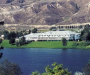
South Thompson Inn & Conference Centre
SOUTH THOMPSON INN
Videos from this area
These are videos related to the place based on their proximity to this place.
Cut of KPR gons going up the switchback in Campbell Creek, B.C.
Often the afternoon crew, after an evening arrival from Armstrong, will leave the main train on the grade above Campbell Creek and take the engines down the switchback behind Lehigh Crossing...
KPR Climbing out of Campbell Creek
am Departure from Campbell Creek (just East of Kamloops) on Tuesdays, Thursdays, and Saturdays always sees three to five Geeps pulling loads of the Kelowna...
First KPR movement after a week of silence...
After parent company Knighthawk Rail's bankruptcy on July 5th, the Kelowna Pacific Railway may be showing signs of coming back to life (we hope). Today, Friday the 26th, a crew was sent to...
Lone Tunnel on the Kelowna Pacific Route between Vernon and Kamloops
Cab-ride descending into Campbell Creek (Kamloops). Night time vid (sorry for poor cell-phone quality), tunnel is geographically north-south, so engine is facing basically north on its way...
A Sunday Drive - Between Pinantan Lake and Chase, British Columbia
Just a cruise through the British Columbian countryside on a road less travelled. :)
Videos provided by Youtube are under the copyright of their owners.
Attractions and noteworthy things
Distances are based on the centre of the city/town and sightseeing location. This list contains brief abstracts about monuments, holiday activities, national parcs, museums, organisations and more from the area as well as interesting facts about the region itself. Where available, you'll find the corresponding homepage. Otherwise the related wikipedia article.
Monte Creek Provincial Park
Monte Creek Provincial Park is a provincial park in British Columbia, Canada.
Monte Creek, British Columbia
Monte Creek is a rural locality on the South Thompson River east of Kamloops, British Columbia, Canada, approximately equidistant from Kamloops and the village of Chase, British Columbia. It is mostly notable as a major highway junction where British Columbia Highway 97 branches off from the Trans-Canada Highway south towards the Okanagan via Falkland and Westwold. Monte Lake, a recreational community on the shores of the lake of the same name, is a few miles south of the junction.


