Safety Score: 2,8 of 5.0 based on data from 9 authorites. Meaning we advice caution when travelling to Canada.
Travel warnings are updated daily. Source: Travel Warning Canada. Last Update: 2024-04-28 08:22:10
Touring Beach Grove
Beach Grove in British Columbia is a town located in Canada about 2,200 mi (or 3,540 km) west of Ottawa, the country's capital place.
Time in Beach Grove is now 05:40 PM (Sunday). The local timezone is named America / Vancouver with an UTC offset of -7 hours. We know of 8 airports nearby Beach Grove, of which 4 are larger airports. The closest airport in Canada is Boundary Bay Airport in a distance of 4 mi (or 6 km), North-East. Besides the airports, there are other travel options available (check left side).
There is one Unesco world heritage site nearby. The closest heritage site is Olympic National Park in United states at a distance of 92 mi (or 147 km). Also, if you like the game of golf, there are several options within driving distance. We collected 10 points of interest near this location. Need some hints on where to stay? We compiled a list of available hotels close to the map centre further down the page.
Being here already, you might want to pay a visit to some of the following locations: Friday Harbor, Bellingham, Victoria, Coupeville and Mount Vernon. To further explore this place, just scroll down and browse the available info.
Local weather forecast
Todays Local Weather Conditions & Forecast: 8°C / 47 °F
| Morning Temperature | 5°C / 41 °F |
| Evening Temperature | 10°C / 50 °F |
| Night Temperature | 9°C / 48 °F |
| Chance of rainfall | 1% |
| Air Humidity | 59% |
| Air Pressure | 1017 hPa |
| Wind Speed | Gentle Breeze with 8 km/h (5 mph) from East |
| Cloud Conditions | Few clouds, covering 22% of sky |
| General Conditions | Light rain |
Monday, 29th of April 2024
9°C (48 °F)
8°C (47 °F)
Overcast clouds, gentle breeze.
Tuesday, 30th of April 2024
10°C (50 °F)
10°C (50 °F)
Overcast clouds, moderate breeze.
Wednesday, 1st of May 2024
9°C (48 °F)
9°C (48 °F)
Moderate rain, moderate breeze, overcast clouds.
Hotels and Places to Stay
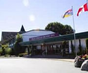
DELTA TOWN AND COUNTR
Beach Grove Motel
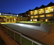
COAST TSAWWASSEN INN
Wild Goose
Delta Town And Country Inn
Videos from this area
These are videos related to the place based on their proximity to this place.
Centennial Beach, Tsawwassen in 1958
I grew up going to this beach as a kid, I had always assumed the Centennial name came from the 1967 Centennial but it must be because of the 1956 Centennial.
Metro Vancouver Palm Trees-Delta BC & Tsawwassen Express Bus Ride
http://www.vancesova.com Watch Metro Vancouver palm trees from an express bus ride going through Delta BC in Tsawwassen. Tsawwassen is a nice bedroom community of Metro Vancouver. This...
Point Roberts, WA One day trip from Vancouver
Point Roberts, Washington is the most unique places in the world to visit and Peaceful, quiet, lovely atmosphere. We just one day trip to Point Roberts on the March 29, 2013.
Hello, I'm In Delaware- City and Colour Cover
Thanks to everyone for coming out! Sat Jan 4, 2014 Tsawwassen Arts Center Jacob Melville.
1324 Enderby Avenue, Tsawwassen, BC
Custom built 2786 square foot 4 bedroom, 3 full bathroom home in Beach Grove. This stunning home offers an open floor plan with a great room that includes vaulted ceilings, floor to ceiling...
#104 1118 55th St Tsawwassen BC - Real Estate Virtual Tour - The Flex Rate Group
View http://flexrategroup.com/officelistings.html/listing.v1100531-1118-55th-street-tsawwassen-v4m-3j8.45210158/videos to see PRICE and more PHOTOS. Bright corner garden apartment in ...
Stamped Concrete Tsawwassen, BC, Canada
View more info: http://vancouverconcrete.net/stamped-concrete-tsawwassen-bc-canada.html Providing decorative stamped colored concrete in Tsawwassen, British Columbia, Canada and surrounding.
Videos provided by Youtube are under the copyright of their owners.
Attractions and noteworthy things
Distances are based on the centre of the city/town and sightseeing location. This list contains brief abstracts about monuments, holiday activities, national parcs, museums, organisations and more from the area as well as interesting facts about the region itself. Where available, you'll find the corresponding homepage. Otherwise the related wikipedia article.
Tsawwassen, British Columbia
Tsawwassen is a suburban, mostly residential community located on a peninsula in the southwestern corner of the Corporation of Delta, British Columbia, Canada. Tsawwassen provides the only road access to the community of Point Roberts, Washington via 56th Street. It is also the location of BC Ferries' Tsawwassen Ferry Terminal, built in 1959 to provide foot-passenger and motor vehicle access from the Lower Mainland to the southern part of Vancouver Island and the Southern Gulf Islands.
Maple Beach, Washington
Maple Beach is an unincorporated community in Whatcom County, Washington. Maple Beach is a neighborhood of Point Roberts, which is considered a geographical oddity because it is connected only with Canada. The community of Maple Beach is located on Boundary Bay and the border with Canada, across which is the Delta, British Columbia neighborhood of Boundary Bay.
Boundary Bay, British Columbia
Boundary Bay, named for the bay of the same name is a neighbourhood of Delta, British Columbia, Canada, located southeast of Tsawwassen adjacent to the Canada-United States border. South of it, across the border, is the community of Maple Beach, Washington, although there is no border crossing directly connecting the two communities (the border crossing is in Tsawwassen proper). The traditional name of the location in the Downriver dialect of the Halkomelem language is Chiltinm or Chiltenm.
Tsawwassen Indian Reserve
The Tsawwaseen Indian Reserve is the sole Indian reserve of the Tsawwassen First Nation, and is located in Delta, British Columbia, Canada, adjacent to the causeway of the Tsawwassen Ferry Terminal, bounded on the south by the Canada-United States border and on the north by Canoe Pass, an arm of the Fraser River. The band operates a park-and-ride for ferry customers, and also has a residential development housing non-natives called Tsatsu Shores just south of the causeway.


