Safety Score: 2,8 of 5.0 based on data from 9 authorites. Meaning we advice caution when travelling to Canada.
Travel warnings are updated daily. Source: Travel Warning Canada. Last Update: 2024-04-28 08:22:10
Discover Agassiz
Agassiz in British Columbia with it's 4,738 citizens is a place in Canada about 2,140 mi (or 3,444 km) west of Ottawa, the country's capital city.
Current time in Agassiz is now 09:29 PM (Sunday). The local timezone is named America / Vancouver with an UTC offset of -7 hours. We know of 11 airports near Agassiz, of which 4 are larger airports. The closest airport in Canada is Hope Airport in a distance of 15 mi (or 25 km), North-East. Besides the airports, there are other travel options available (check left side).
There is one Unesco world heritage site nearby. The closest heritage site is Olympic National Park in United states at a distance of 109 mi (or 175 km). Also, if you like playing golf, there are a few options in driving distance. If you need a hotel, we compiled a list of available hotels close to the map centre further down the page.
While being here, you might want to pay a visit to some of the following locations: Chilliwack, Bellingham, Mount Vernon, Everett and Coupeville. To further explore this place, just scroll down and browse the available info.
Local weather forecast
Todays Local Weather Conditions & Forecast: 8°C / 46 °F
| Morning Temperature | 4°C / 39 °F |
| Evening Temperature | 8°C / 47 °F |
| Night Temperature | 2°C / 36 °F |
| Chance of rainfall | 6% |
| Air Humidity | 83% |
| Air Pressure | 1017 hPa |
| Wind Speed | Light breeze with 5 km/h (3 mph) from North-East |
| Cloud Conditions | Overcast clouds, covering 100% of sky |
| General Conditions | Rain and snow |
Monday, 29th of April 2024
10°C (50 °F)
6°C (42 °F)
Light rain, light breeze, overcast clouds.
Tuesday, 30th of April 2024
14°C (56 °F)
8°C (47 °F)
Light rain, light breeze, overcast clouds.
Wednesday, 1st of May 2024
9°C (49 °F)
5°C (41 °F)
Moderate rain, calm, overcast clouds.
Hotels and Places to Stay
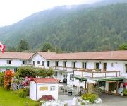
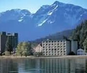
Harrison Lakeview Resort
Harrison Spa Motel
Harrison Village Motel
HARRISON BEACH HOTEL
HARRISON HOT SPRINGS RESORT
Videos from this area
These are videos related to the place based on their proximity to this place.
CP 2816 Agassiz, BC - Open Mainline - Heading East
After being delayed leaving Port Coquitlam, CP2816 gets the "All Clear" at Agassiz to head east towards the Fraser Canyon . Enjoy a brief run alongside CP2816 as she heads east. (Please excuse...
Hollywood comes to Agassiz: The making of a film set
During the months of August and September 2013, the TV series "Wayward Pines' film set was created in the town of Agassiz, BC. Director M. Night. Shyamalan was in Agassiz with lead actor Matt...
CP 2816 Get Me to the Church on Time! - Yale to Agassiz, BC, Canada
After exiting the Yale Tunnel CP2816 hurries towards Agassiz, BC, Canada to meet a time and place? ;-)
Cheam Wetland Bird Sanctuary, Agassiz, BC
I took the Mom's out for a day trip in the Fraser Valley and ended up at this location. The views of the falls were spectacular and the sanctuary was to good to pass up...I just so happened...
#436 Eastbound at Agassiz 2014 01 06
After our initial success at Bell Road (see #435) we decided to move to Arnold, about ten miles to the east. When we got there, however, a westbound coal train was in the siding, which is the...
CP Eastbound Empty Grain Agassiz BC 072509
An eastbound train of grain empties races full bore at 45 MPH through Agassiz, BC on Saturday July 23, 2009.
Agassiz HelmetCam | Brandon Baines, John Bowman
Fun little video i made from shots of John following me in till he got stuck behind some slower riders, and a bit of my helmet cam.
Videos provided by Youtube are under the copyright of their owners.
Attractions and noteworthy things
Distances are based on the centre of the city/town and sightseeing location. This list contains brief abstracts about monuments, holiday activities, national parcs, museums, organisations and more from the area as well as interesting facts about the region itself. Where available, you'll find the corresponding homepage. Otherwise the related wikipedia article.
Ferry Island Provincial Park
Ferry Island Provincial Park is a provincial park in British Columbia that is located on the south side of the Fraser River northeast of Rosedale. This park is northwest of Bridal Falls, British Columbia and adjacent to the Agassiz-Rosedale Bridge. The Ferry Island Park was established in 1963, and it has an area of about 29 hectares. Ferry Island Provincial Park is listed as a "Class C" provincial park which is governed by a local community board.
Agassiz, British Columbia
Agassiz is a small community located in British Columbia's Fraser Valley. The only town within the jurisdiction of the District Municipality of Kent, it contains the majority of Kent's population.
Agassiz railway station
Agassiz railway station is in Agassiz, British Columbia, Canada. The station is served by Via Rail's The Canadian three times per week as a flag stop (48 hours advance notice required). The station is only served by east-bound trains. West-bound trains call at the Chilliwack railway station.


