Explore Wadalba
The district Wadalba of in Wyong Shire (New South Wales) is located in Australia about 193 mi north-east of Canberra, the country's capital.
If you need a place to sleep, we compiled a list of available hotels close to the map centre further down the page.
Depending on your travel schedule, you might want to pay a visit to some of the following locations: Sydney, Parramatta, Katoomba, Canberra and . To further explore this place, just scroll down and browse the available info.
Local weather forecast
Todays Local Weather Conditions & Forecast: 15°C / 60 °F
| Morning Temperature | 9°C / 48 °F |
| Evening Temperature | 15°C / 60 °F |
| Night Temperature | 14°C / 58 °F |
| Chance of rainfall | 1% |
| Air Humidity | 55% |
| Air Pressure | 1022 hPa |
| Wind Speed | Moderate breeze with 12 km/h (7 mph) from North-East |
| Cloud Conditions | Clear sky, covering 1% of sky |
| General Conditions | Light rain |
Tuesday, 21st of May 2024
16°C (61 °F)
13°C (56 °F)
Light rain, moderate breeze, overcast clouds.
Wednesday, 22nd of May 2024
16°C (61 °F)
12°C (53 °F)
Sky is clear, gentle breeze, clear sky.
Thursday, 23rd of May 2024
16°C (61 °F)
12°C (54 °F)
Sky is clear, light breeze, clear sky.
Hotels and Places to Stay
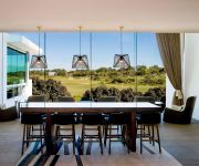
Pullman Magenta Shores Resort
Mercure Kooindah Waters Central Coast
Oaks Waterfront Resort
Lavender House B&B
Grand Hotel Wyong
Beachcomber Hotel
El Lago Waters Motel
ibis Styles The Entrance
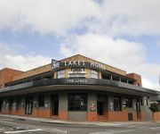
The Lakes Hotel
Videos from this area
These are videos related to the place based on their proximity to this place.
NSW Rail Vlog 22: Warnervale
Nice vlog at Warnervale with lots of speeding trains. Would come here again. Filmed on 19/01/2015.
CPL training class D airspace solo nav
Flying from Warnervale to Coffs Harbour via Williamtown airspace, then across to Tamworth and back to Warnervale. Nov09.
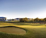
Kooindah Waters Golf Club Corporate Video
Kooindah Waters Golf Club. Specialists in corporate and group golf. Course designer Craig Parry explains the benefits of bring a corporate golf day to Kooindah Waters.
1st 2014 Central Coast HOG Run. Sun Jan 12 HD720p By Bronze.
This is the 1st HOG run for Central Coast Harley Owners Group for 2014. Leaving west Gosford Maccas for Mangrove Creek Dam, then down to C&C Leathers 5th Birthday and then finally onto Coast...
Wyong Shire's New Local Environment Plan 2013 (LEP 2013)
The future looks positive for Wyong Shire. With the introduction of a new Local Environment Plan (WSC LEP 2013), Wyong Shire Council will be evaluating today's development with modern guidelines.
Slotz-a-Fun Friday Night Slot Car Racing
A short video of out Friday Night Race Night Visit http://www.slotzafun.com.au & http://www.facebook.com/slotzafun.
Paul returns to Ephesus | Acts 19:1-20 | 29.05.2011
Pastor Murray Shanks preaching from Acts 19, "Paul returns to Ephesus", at Lakes Baptist Church on the 29th May 2011.
Videos provided by Youtube are under the copyright of their owners.
Attractions and noteworthy things
Distances are based on the centre of the city/town and sightseeing location. This list contains brief abstracts about monuments, holiday activities, national parcs, museums, organisations and more from the area as well as interesting facts about the region itself. Where available, you'll find the corresponding homepage. Otherwise the related wikipedia article.
Wyong, New South Wales
Wyong was proclaimed a town in 1888 and is a major northern suburb of the Central Coast region of New South Wales, located approximately 89 km NNE of Sydney. It is the administrative centre for the Wyong Shire local government area.
Tuggerah Lake
Tuggerah Lake, an intermittently open intermediate wave dominated barrier estuary, is located within the Wyong Shire local government area in the Central Coast region of New South Wales, Australia. The lake is located near Wyong and is situated about 90 kilometres north of Sydney.
Wyong Shire
Wyong Shire is a local government area located in the Central Coast region of New South Wales, Australia, north of Sydney. Wyong Shire is located around the coastal lake system of Tuggerah Lake, Budgewoi Lake and Lake Munmorah.
Watanobbi, New South Wales
Watanobbi is a suburb of the Central Coast region of New South Wales, Australia. It is part of the Wyong Shire local government area, and is part of the Warnervale development precinct.
Wyong railway station
Wyong railway station is located in Wyong on the Central Coast of New South Wales, Australia. The station is a side station with three platforms, including one for terminating intercity trains from Sydney, half of which terminate here (the other half continuing to Newcastle). The station is a hub for transport on the Central Coast with bus and taxi connections. The station is attended by station staff and is staffed from the first train service to the last.
Kanwal, New South Wales
Kanwal is a suburb of the Central Coast region of New South Wales, Australia. It is part of the Wyong Shire local government area. It is approximately 90 km north of Sydney, 55 km south of Newcastle and 6 km west of the Pacific Ocean.
Warnervale railway station
Warnervale railway station is located in Warnervale on the Central Coast of New South Wales, Australia on the Newcastle & Central Coast Line. The station has two platforms. The station is served by intercity trains to Sydney and Newcastle.
Tuggerah railway station
Tuggerah railway station is located in Tuggerah on the Central Coast of New South Wales, Australia on the Newcastle & Central Coast Line. The station has two platforms. The station is served by intercity trains to Sydney and Newcastle.
Tuggerah, New South Wales
Tuggerah is a suburb of the Central Coast region of New South Wales, Australia, situated on the Main North Line and Sydney-Newcastle Freeway about 90 km north of Sydney. It is part of the Wyong Shire local government area. Not to be confused with Tuggerah, QLD, Tuggerah was originally an Aboriginal word but its true meaning is not agreed upon by all sources. Some say that it originally meant 'cold' or 'cold place' and some say 'savannah grasslands'.
Gorokan, New South Wales
Gorokan is a suburb of the Central Coast region of New South Wales, Australia. It is part of the Wyong Shire local government area. There are two schools in the area, Gorokan Public and Gorokan High.
Chittaway Point, New South Wales
Chittaway Point is a suburb of the Central Coast region of New South Wales, Australia. It is part of the Wyong Shire local government area.
Hamlyn Terrace, New South Wales
Hamlyn Terrace is a suburb of the Central Coast region of New South Wales, Australia. It is part of the Wyong Shire local government area. The suburb was formerly part of Warnervale and is part of the Warnervale development precinct.
Lake Haven, New South Wales
Lake Haven is a lakeside suburb of Wyong on the NSW Central Coast and is located approximately 12 kilometres north east of the Wyong CBD. It is approximately 92 klm north of Sydney and 53 klm south of Newcaste. There is a local shopping and commercial centre that serves the district, with schools and all normal community facilities being available. Rail connections are available in Wyong and at Warnervale, where there is a connection to the F3 - Sydney to Newcastle freeway.
Mardi, New South Wales
Mardi is a suburb of the Central Coast region of New South Wales, Australia. It is part of the Wyong Shire local government area. The origin of the name is an Aboriginal word meaning 'stone knife'.
Rocky Point, New South Wales
Rocky Point is a suburb of the Central Coast region of New South Wales, Australia. It is part of the Wyong Shire local government area.
Tacoma South, New South Wales
Tacoma South is a suburb of the Central Coast region of New South Wales, Australia. It is part of the Wyong Shire local government area. The suburb, which is primarily bushland, is bordered by Wyong River and Tuggerah Nature Reserve. There is only one way in and out of the suburb.
Tacoma, New South Wales
Tacoma is a suburb of the Central Coast region of New South Wales, Australia. It is part of the Wyong Shire local government area. Tacoma is located on the northern bank of the Wyong River where it opens up onto Tuggerah Lake. It has a general store, a school, Tacoma Public School and a Fishermans Co-operative. It is also the home of the Wyong Lakes Magpies Australian Football Club.
Tuggerawong, New South Wales
Tuggerawong is a suburb of the Central Coast region of New South Wales, Australia. It is part of the Wyong Shire local government area.
Wallarah, New South Wales
Wallarah is a sparsely populated suburb of the Central Coast region of New South Wales, Australia. It is part of the Wyong Shire local government area. It is home to the Wallarah Creek interchange on the Sydney-Newcastle Freeway.
Woongarrah, New South Wales
Woongarrah is a suburb of the Central Coast region of New South Wales, Australia. It is part of the Wyong Shire local government area, as well as part of the Warnervale development precinct. It consists mainly of paddocks and rural properties, yet over the recent years, it has been urbanised, with housing estates being established, much like the neighbouring suburb Hamlyn Terrace as well as a planned railway station, and prominent town centre.
Wyongah, New South Wales
Wyongah is a suburb of the Central Coast region of New South Wales, Australia. It is part of the Wyong Shire local government area. Wyongah is mostly residential, although there is a small shopping area in the suburb. The area is close to Wyong Hospital and is serviced by Busways route 81, 82 and 83 buses. Routes 81 and 82 run from Lake Haven to Wyong and Tuggerah via Wyongah (and return) while the 83 is a local service from Lake Haven to Wyongah.
Gorokan High School
Gorokan High School, is a secondary school located in Lake Haven, New South Wales, Australia. Established in 1976, the school was housed in temporary buildings in Dudley Street on the site of what was to later become Gorokan Public School. It moved to its current location in Goobarabah Avenue in 1977. Its first principal was Gwen Foley, who was the first female high school principal on the NSW Central Coast. She retired in December 1982. Current student enrolment is more than 1,100.
Wadalba, New South Wales
Wadalba is a suburb of the Central Coast region of New South Wales, Australia. It is part of the Wyong Shire local government area. It contains Wadalba Community School as well as a mobile home village, a rural pet supply store, Mitre 10, a Coles shopping centre, a childcare centre, liquor store, golf range and caravan park.
Wyong Public School
Wyong Public School is a school situated on the Central Coast, north of Gosford, New South Wales. The township of Wyong was first established in 1887. The first Wyong School was opened on 2 July 1888 in temporary premises known as Watt's Concert Hall. In May 1889, the pupils moved to the Alison Road School. In September 1979, the new school opened at the present site in Cutler Drive, Wyong.
Halloran, New South Wales
Halloran is a sparsely populated suburb of the Central Coast region of New South Wales, Australia, located off the Sydney-Newcastle Freeway between Wyong and Morisset. It is part of the Wyong Shire local government area.


