Discover Adamstown Heights
The district Adamstown Heights of Newcastle in Newcastle (New South Wales) is a district in Australia about 219 mi north-east of Canberra, the country's capital city.
Looking for a place to stay? we compiled a list of available hotels close to the map centre further down the page.
When in this area, you might want to pay a visit to some of the following locations: Sydney, Parramatta, Katoomba, Canberra and Carrolls Creek. To further explore this place, just scroll down and browse the available info.
Local weather forecast
Todays Local Weather Conditions & Forecast: 18°C / 64 °F
| Morning Temperature | 16°C / 61 °F |
| Evening Temperature | 18°C / 64 °F |
| Night Temperature | 17°C / 63 °F |
| Chance of rainfall | 46% |
| Air Humidity | 82% |
| Air Pressure | 1025 hPa |
| Wind Speed | Fresh Breeze with 14 km/h (9 mph) from North-West |
| Cloud Conditions | Overcast clouds, covering 100% of sky |
| General Conditions | Heavy intensity rain |
Tuesday, 7th of May 2024
19°C (65 °F)
16°C (60 °F)
Light rain, moderate breeze, overcast clouds.
Wednesday, 8th of May 2024
20°C (67 °F)
15°C (60 °F)
Light rain, gentle breeze, few clouds.
Thursday, 9th of May 2024
17°C (63 °F)
15°C (60 °F)
Moderate rain, light breeze, overcast clouds.
Hotels and Places to Stay
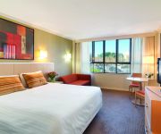
Mercure Charlestown
THE COSMOPOLITAN APARTMENTS
QUEST NEWCASTLE
Travelodge Newcastle
Newcastle Central Plaza
Cardiff Executive Apartments
BLUEGUM APARTMENTS
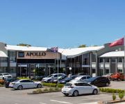
BEST WESTERN PLUS APOLLO INTL
Jesmond Executive Villas
Merewether Motel
Videos from this area
These are videos related to the place based on their proximity to this place.
Genesis headspace IN-GYM challenge
Who wants to take on Team Charlestown??? Challenge 1 - 200m row, 10 dead ball slams, 10 burpees, 10 laps x3 Challenge 2 - 100m row, 5 dead ball slams, 5 burpees, 5 laps x2 Gold coin donation...
Cobras VS Ducks highlights
From 27 Sept 2014 at St John Oval, Charlestown. The Big Red Cobras from Newcastle took on the Nepean Ducks and won the match 24-6. With thanks to Best Body Supplements, Crosbie Wealth ...
Truly independent
Transcript: Hi, my name's Luke Arms, and I'm running for Charlestown as an independent. Some independents are crazy. I'm not one of those. My policies are clear and realistic and easy to...
Better decisions
Transcript: Hi, my name's Luke Arms, independent for Charlestown. I'm running for office because I want to help government make better decisions. Decisions that will improve the lives of our...
Honda CB900F2B.mp4
Kicked over for the first time since buying it hadn't been started for 7 years! Going to strip it down and do a total restoration to original condition and then do a trip around Australia and...
Westpac Rescue Helicopter 1 (#08)
Westpac 1, VH-HRS Bell-412 landing at the John Hunter Hospital. This helicopter is based in Newcastle (YXFV). Westpac 1 & 2 frequency is 484.9500 and uses Warnervale CTAF 132.1000 at this ...
Westpac Rescue Helicopter 3 (#01)
Westpac 3 (VH-HRT) BK-117, landing at John Hunter Hospital. This helicopter is based in Tamworth (YSTW). Uses frequency 132.1000 Warnervale CTAF at this location.
Westpac Rescue Helicopter 1 (#02)
Westpac 1 (VH-HRS) Bell-412, becoming airborne from the John Hunter Hospital. This helicopter is based in Newcastle (YXFV). Westpac 1 & 2 frequency is 484.9500 and uses Warnervale CTAF ...
Jeep Patriot River Crossing
2009 Jeep Patriot Limited crossing Cobark River near Barrington Tops, NSW, Australia.
Videos provided by Youtube are under the copyright of their owners.
Attractions and noteworthy things
Distances are based on the centre of the city/town and sightseeing location. This list contains brief abstracts about monuments, holiday activities, national parcs, museums, organisations and more from the area as well as interesting facts about the region itself. Where available, you'll find the corresponding homepage. Otherwise the related wikipedia article.
Newcastle International Sports Centre
Newcastle International Sports Centre, known as Hunter Stadium from January 2012, is a multi-purpose sports stadium located in Newcastle, New South Wales, Australia. It is the home ground of the Newcastle Knights and the Newcastle United Jets teams. It is owned by the New South Wales government and administered by the Hunter Region Sporting Venues Authority. Due to past sponsorship deals, the ground has been previously known as Marathon Stadium, EnergyAustralia Stadium and Ausgrid Stadium.
Westfield Kotara
Westfield Kotara is a shopping centre located in the suburb of Kotara in Newcastle, New South Wales, Australia. It was opened in 1965 as Kotara Fair. In 2003 the shopping centre was purchased by the Westfield Group. The centre's major tenants include Coles, Target, Kmart, Woolworths, David Jones and a Toys "R" Us. It is often locally referred to as Garden City, reflecting its former title.
Charlestown, New South Wales
Charlestown is a suburb of Newcastle, New South Wales, Australia, and the largest town within the City of Lake Macquarie. It is approximately 10 kilometres west-south-west of the central business district of Newcastle. Charlestown has the largest business centre within the Lake Macquarie city, with a greater turnover than that of the neighbouring Newcastle CBD. The suburb serves as the district's transport hub.
Kotara, New South Wales
Kotara is a suburb of Newcastle, New South Wales, Australia, located 9 kilometres from Newcastle's central business district. It is part of the City of Newcastle local government area. The Australasia Coal Company operated a mine near Kotara, in the valley below the present-day northern entrance to the Tickhole railway tunnels. A private railway connected the screens with the Government line near the present-day triangle junctions north of Broadmeadow.
Merewether High School
Merewether High School is a co-educational, academically selective high school for students from Years 7-12. Located in the suburb of Broadmeadow in the city of Newcastle, New South Wales, it is the only academically selective school in the Lower Hunter Region. Since 1989 enrolment is determined by an academic selection process. The school has approximately 1,000 students with a planned capacity of 1,080 students (180 from each year from 7–12).
Kahibah Public School
Kahibah Public School is a government primary school in Kahibah, New South Wales, Australia. Originally established in 1938 in the Kahibah Memorial Hall, it moved to its current location in 1954. It caters for students from Kindergarten to Year 6 with a total enrolment of approximately 287. The school's Principal is Pam Richardson. The school is a registered war memorial.
Kahibah, New South Wales
Kahibah is a suburb of the City of Lake Macquarie in New South Wales, Australia, located 9 kilometres from Newcastle's central business district. Kahibah is the closest suburb to Glenrock Lagoon, and is drained by Flaggy and Little Flaggy creeks which flows into Glenrock Lagoon 2 km to the east. The suburb's name is from the Aboriginal name word "Ky-yee-bah", which meant either a place for games or to be active and eager.
Glenrock Lagoon
Glenrock Lagoon, an intermediate freshwater small coastal creek, is located within the Lake Macquarie local government area in the Newcastle and Hunter regions of New South Wales, Australia. The lake is located near the Newcastle suburbs of Adamstown and Dudley and is situated about 153 kilometres north of Sydney.
Belmont railway line
The Belmont railway line is an abandoned coal haulage and passenger rail line from Adamstown, New South Wales to Belmont, New South Wales. This was a private railway, being the property of the New Redhead Estate and Coal Company and was generally known as the Belmont Branch. It is in the process of being converted into a cycleway or rail trail - The Fernleigh Track.
Hunter School of the Performing Arts
Hunter School of the Performing Arts (HSPA) is a public, co-educational, selective primary and secondary school which offers a comprehensive curriculum with a performing arts specialty, located at Broadmeadow, New South Wales.
New Lambton, New South Wales
New Lambton is a suburb of Newcastle, in the Hunter Region of New South Wales, Australia. It is located about 6 km west of the Newcastle CBD. It includes two shopping districts, schools and other general facilities. At the 2006 Australian census it had a population of 9,236. Initially a coal mining township, New Lambton later became a municipality until it was eventually incorporated into Greater Newcastle.
Adamstown railway station
For the station in Ireland, see Adamstown railway station, Dublin.
Kotara railway station
Kotara is a railway station located in Newcastle, New South Wales, Australia on the Newcastle & Central Coast Line. The station has two platforms and opened on 12 November 1924. The station is serviced primarily by local services which operate between Newcastle and Morisset, and also by intercity trains between Sydney and Newcastle at times when local services do not operate. Kotara station has very limited sheltered area.
Broadmeadow railway station
Broadmeadow is a railway station in the suburb of Broadmeadow in Newcastle, New South Wales, Australia. The station opened on 15 August 1887 and has three platforms. Located on the Main Northern Line, the station is served by CityRail's Newcastle & Central Coast line with intercity trains to Sydney Central and local trains to Morisett, plus CountryLink services on the North Coast and Main North lines.
Charlestown Square
Charlestown Square is a major regional shopping centre in Charlestown, New South Wales, a suburb of the city of Lake Macquarie. It is owned and operated by General Property Trust. It was formerly managed by Lend Lease Corporation. Originally built in 1979 as a 2-story structure, the centre has undergone several extensions and renovations. It currently has over 170 stores and is one of the largest shopping centres in the Hunter Region. The centre now has 3 levels, and includes two food courts.
Lambton High School
Lambton High School 150px "Light The Way" Location Newcastle, New South Wales, Australia22x20px Coordinates coord}}{{#coordinates:32|55|8.8|S|151|43|13.5|E|type:edu_region:AU-NSW primary name= }} Information Type State run high school Established 1974 Principal Mr Martin Rosser Enrolment 1,107 Campus Urban Colour(s) Juniors-Navy Blue, Seniors-Fleece White Website Lambton High School Lambton High School is a co-educational, comprehensive, day school for students from Years 7-12 in the suburb of Lambton in Newcastle, New South Wales operated by the New South Wales Department of Education and Training.
Adamstown, New South Wales
Adamstown is a suburb of Newcastle, New South Wales, Australia, located 6 kilometres from Newcastle's central business district. It is part of the City of Newcastle local government area. It has a railway station, opened in 1887 with the Newcastle–Gosford section of the Main North line, on CityRail's Newcastle and Central Coast line. The now closed branch line to Belmont formerly left the main line just south of Adamstown Station.
Kotara South, New South Wales
Kotara South is a suburb of Newcastle, New South Wales, Australia 11 kilometres from Newcastle's central business district. It is part of the City of Lake Macquarie local government area. The public school in Kotara South opened in 1960.
Whitebridge, New South Wales
Whitebridge is a suburb of Newcastle, New South Wales, Australia, 11 kilometres from Newcastle's central business district on the eastern side of Lake Macquarie. It is part of the City of Lake Macquarie local government area.
New Lambton Heights, New South Wales
New Lambton Heights is a suburb of Newcastle, New South Wales, Australia, located 9 kilometres west of Newcastle's central business district. It is split between the City of Lake Macquarie and City of Newcastle local government areas.
Adamstown Heights, New South Wales
Adamstown Heights is a southern suburb of Newcastle, New South Wales, Australia, located 8 kilometres west-southwest of Newcastle's central business district along the Pacific Highway. It is split between the City of Lake Macquarie and City of Newcastle local government areas. The suburb contains two schools, Kotara High School, established in 1968 and containing 3 hectares of native bushland, and Belair Primary School.
Highfields, New South Wales
Highfields is a residential suburb of Newcastle, New South Wales, Australia, located 8 kilometres west-southwest of Newcastle's central business district near the Charlestown town centre. It is part of the City of Lake Macquarie local government area.
Merewether Heights, New South Wales
Merewether Heights is a suburb of Newcastle, New South Wales, Australia, located 6 kilometres southwest of Newcastle's central business district near the Glenrock State Recreation Area. It is part of the City of Newcastle local government area.
Broadmeadow Basketball Stadium
The Broadmeadow Basketball Stadium, also known as the Newcastle Sports Entertainment Centre, is an indoor basketball stadium located in Newcastle, New South Wales, Australia and was the original home of the Newcastle Falcons of the National Basketball League from the origin of the league in 1979 until they moved to the newly built Newcastle Entertainment Centre from the 1992 season.
Broadmeadow Locomotive Depot
Broadmeadow Locomotive Depot (NSW depot number 2) was a large locomotive depot consisting of two roundhouse buildings and associated facilities constructed by the New South Wales Government Railways adjacent to the marshalling yard on the Main North railway line at Broadmeadow. Construction of the locomotive depot at Broadmeadow commenced in 1923 to replace the existing crowded loco sheds at Woodville Junction at Hamilton, with the depot opening in March 1924.


