Safety Score: 2,7 of 5.0 based on data from 9 authorites. Meaning we advice caution when travelling to United States.
Travel warnings are updated daily. Source: Travel Warning United States. Last Update: 2024-05-04 08:22:41
Explore Northside Estates
The district Northside Estates of Clarksville in Montgomery County (Tennessee) is located in United States about 587 mi west of Washington DC, the country's capital.
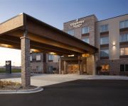
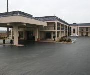
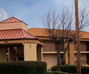
If you need a place to sleep, we compiled a list of available hotels close to the map centre further down the page.
Depending on your travel schedule, you might want to pay a visit to some of the following locations: Hopkinsville, Elkton, Charlotte, Erin and Ashland City. To further explore this place, just scroll down and browse the available info.
Local weather forecast
Todays Local Weather Conditions & Forecast: 26°C / 78 °F
| Morning Temperature | 17°C / 63 °F |
| Evening Temperature | 24°C / 75 °F |
| Night Temperature | 19°C / 67 °F |
| Chance of rainfall | 4% |
| Air Humidity | 67% |
| Air Pressure | 1014 hPa |
| Wind Speed | Light breeze with 4 km/h (3 mph) from North-East |
| Cloud Conditions | Broken clouds, covering 50% of sky |
| General Conditions | Light rain |
Sunday, 5th of May 2024
26°C (78 °F)
19°C (66 °F)
Moderate rain, moderate breeze, scattered clouds.
Monday, 6th of May 2024
25°C (77 °F)
21°C (69 °F)
Light rain, moderate breeze, broken clouds.
Tuesday, 7th of May 2024
24°C (75 °F)
22°C (71 °F)
Moderate rain, moderate breeze, overcast clouds.
Hotels and Places to Stay
Fairfield Inn & Suites Clarksville
TN Clarksville Country Inn and Suites by Radisson
Hampton Inn - Suites - Clarksville TN
TownePlace Suites Clarksville
Courtyard Clarksville
BAYMONT CLARKSVILLE NE
Home2 Suites by Hilton Clarksville-Ft Campbell
Rodeway Inn & Suites Clarksville
Riverview Inn
WoodSpring Suites Clarksville Ft. Campbell
Videos from this area
These are videos related to the place based on their proximity to this place.
Clarksville Tennessee Business Directory
http://businessinclarksville.com/ Clarksville Tennessee Business in Clarksville Tennessee Clarksville business directory find any business in Clarksville TN.
Clarksville TN Real Estate
226 Cunningham Lane Clarksville TN 37042 This home has had the same owner since 1983. Extremely well kept, maintained, clean, non-smoker with gazebo, hardwood floors, renovated kitchen and...
Sizzlin' Fat At This Clarksville Gym
Circuit Athletic clients sizzle fat and burn calories in a super fun workout at our Clarksville TN location. Our friends experience dramatic weight loss in just 16 weeks!
Gyms In Clarksville TN
http://circuitathletics.com/circuit-challenge-gyms-in-clarksville/ If you are ready for lasting change. Take the circuit Challenge. Watch the Video to learn more. See you on the other side....
Ride the Bull at the Electric Cowboy of Clarksville
Grand Opening at the Electric Cowboy of Clarksville. Lots of people took advantage of the Mechanical Bull. You can't leave the Electric Cowboy without riding the bull. Only $5 to ride.
Clarksville TN Real Estate
Enjoy Clarksvilles FIRST 3D imaging! The link below will take you to an amazing view of this beautiful home. 3506 Marthas chapel Rd offers over 3900 sq ft of living on over 6 private acres....
ClarksVillain RollerGirls VS Demolition City Roller Derby - 2
The Demolition City Roller Derby ladies came down from Evansville, Indiana and gave a hard fought battle as they defeated the clarksvillain rollergirls.
566 Briarwood Dr
For more details click here: http://www.visualtour.com/showvt.asp?t=3236217 566 Briarwood Dr Clarksville, TN 37040 $124500, 3 bed, 1.5 bath, 1460 SF, MLS# 1507160 COUNTRY SETTING IN THE...
Videos provided by Youtube are under the copyright of their owners.
Attractions and noteworthy things
Distances are based on the centre of the city/town and sightseeing location. This list contains brief abstracts about monuments, holiday activities, national parcs, museums, organisations and more from the area as well as interesting facts about the region itself. Where available, you'll find the corresponding homepage. Otherwise the related wikipedia article.
Montgomery County, Tennessee
Montgomery County is a county located in the U.S. state of Tennessee. The county seat is Clarksville. The population was 172,331 at the 2010 census. It is one of the four counties included in the Clarksville, TN–KY Metropolitan Statistical Area.
Fort Campbell North, Kentucky
Fort Campbell North is a census-designated place (CDP) in Christian County, Kentucky, United States. It contains most of the housing for the Fort Campbell Army base within the Kentucky portion of the base. The population was 13,685 at the 2010 census, down from 14,338 at the 2000 census. Fort Campbell North is part of the Clarksville metropolitan area.
Oak Grove, Kentucky
Oak Grove is a city in Christian County, Kentucky, United States, adjacent to the Fort Campbell Army base. The population was 7,064 at the 2000 census. It is part of the Clarksville, TN–KY Metropolitan Statistical Area. Oak Grove is one of Kentucky's most recently established cities. It was incorporated on September 24, 1974.
Trenton, Kentucky
Trenton is a city in Todd County, Kentucky, United States. The population was 419 at the 2000 census. Settled as Lewisburg in 1796, the city was renamed after Trenton, New Jersey in 1819.
Clarksville, Tennessee
Clarksville is a city in and the county seat of Montgomery County, Tennessee, and the fifth-largest city in the state. The population was 132,929 in the 2010 United States Census. Clarksville is the ninth-fastest growing city in the nation, of cities with a population over 100,000. It is the principal central city of the Clarksville, TN-KY metropolitan statistical area, which consists of Montgomery and Stewart counties, Tennessee; and Christian and Trigg counties, Kentucky.
Austin Peay State University
Austin Peay State University is a four-year public university located in Clarksville, Tennessee, and operated by the Tennessee Board of Regents. It is accredited by the Southern Association of Colleges and Schools (SACS) and is the fastest-growing university in Tennessee.
Fort Campbell
Fort Campbell is a United States Army installation located astride the Kentucky-Tennessee border between Hopkinsville, Kentucky, and Clarksville, Tennessee. Fort Campbell is home to the 101st Airborne Division and the 160th Special Operations Aviation Regiment. The fort is named in honor of Union Army Brigadier General William Bowen Campbell, the last Whig Governor of Tennessee.
Saint Bethlehem, Tennessee
Saint Bethlehem or St. Bethlehem, also called "St. B" by locals, is a community in Montgomery County, Tennessee, located just northeast of downtown Clarksville. St. Bethlehem has been incorporated into Clarksville city limits and is no longer a separate community, although locals still refer to that portion of Clarksville as "St. B". The main U.S. post office for Clarksville is in the St. Bethlehem community on U.S. Route 79 (Guthrie Road).
Dunbar Cave State Park
Dunbar Cave State Park is a 110 acre (450,000 m²) park in Clarksville, Tennessee, situated around Dunbar Cave. Dunbar Cave is the 280th largest cave complex in the world, stretching 8.067 miles (13 km) inward. In front of the cave entrance is a large concrete poured structure with three distinct arches. The cave is located in an area of karst topography, including sinkholes, springs, and limestone bedrock. The manmade Swan Lake also sits in front of the cave.
Dunn Center
The Winfield Dunn Center (officially the Winfield Dunn Health and Physical Education Building and Convocation Complex) is a 132,000 square-foot facility, located on the main campus of Austin Peay State University in Clarksville, Tennessee. Construction began on the (then) $5.3 million facility in 1973, and the building opened in 1975.
Clarksville-Montgomery County Regional Airport
Clarksville-Montgomery County Regional Airport, also known as John F. Outlaw Field or simply Outlaw Field, is a public use airport located six nautical miles (11 km) northwest of the central business district of Clarksville, a city in Montgomery County, Tennessee, United States. It is owned by the city of Clarksville and Montgomery County. The airport is located near Fort Campbell.
WEGI (AM)
WEGI is a radio station broadcasting a Classic Hits format. Licensed to Fort Campbell, Kentucky, USA, the station serves the Clarksville-Hopkinsville area. The station is currently owned by Saga Communications of Tuckessee, LLC. Its tower and transmitter located on Stateline Road in Oak Grove, Kentucky immediately outside the main gates of the Ft. Campbell, Kentucky military installation.
WKFN
WKFN (540 AM, "The Fan") is a radio station broadcasting a sports format. It is an affiliate of ESPN Radio. The station is licensed to Clarksville, Tennessee. The station is currently owned by Saga Communications. Saga Communications also operates WVVR 100.3 Country, WEGI 94.3 Classic Hits, WCVQ 107.9 Adult Contemporary, and WZZP 97.5 FM Active Rock from its main offices in Clarksville. WKFN-AM 540- “The Fan” had its beginnings as WDXN AM which stood for D) ixie N) etwork, the original owner.
WEGI-FM
WEGI-FM (94.3 FM, "The Eagle") is a commercial FM radio station licensed to Oak Grove, Kentucky with offices located in Clarksville, Tennessee. WEGI and its sister-stations are known as the "5 Star Radio Group" and is owned by Saga Communications, Inc.
Palmyra, Tennessee
Palmyra is an unincorporated community in Montgomery County, Tennessee. It is located along State Route 149, southwest of Clarksville. The town has its own post office with the ZIP Code of 37142. Palmyra has a rich Civil War history with Major General Joseph Wheeler of the Confederate army took position on the Cumberland River in late January 1863. His plan was to disrupt Union ships going to Fort Donelson at Dover, a few miles west of Palmyra.
Woodlawn, Tennessee
Woodlawn is an unincorporated community in Montgomery County, Tennessee. It is located along State Route 79 west of neighboring Clarksville. The community has a post office with the ZIP code of 37191. It is part of the Clarksville, TN–KY Metropolitan Statistical Area.
WAPX-FM
WAPX-FM is a radio station licensed to Clarksville, Tennessee, USA. The station is currently owned by Austin Peay State University.
Campbell Army Airfield
Campbell Army Airfield is a military airport at Fort Campbell, which is located near Hopkinsville, a city in Christian County, Kentucky, United States. Previously Campbell Air Force Base, a U.S. Air Force installation from 1947 to 1959, this U.S. Army airfield has two asphalt paved runways: 5/23 is 11,826 by 200 feet (3,605 x 61 m) and 18/36 is 4,500 by 150 feet (1,372 x 46 m).
Sabre Army Heliport
Sabre Army Heliport is a military use heliport located at Fort Campbell, seven nautical miles (13 km) northwest of the central business district of Clarksville, in Montgomery County, Tennessee, United States. Owned by the United States Army, it has one runway designated 4/22 with a concrete surface measuring 4,451 by 109 feet (1,357 x 33 m).
WJZM
WJZM (1400 AM, "Radio Clarksville") is a radio station broadcasting a news/talk/information format. Licensed to Clarksville, Tennessee, USA, the station serves the Clarksville-Hopkinsville area. The station is currently owned by Cumberland Radio Partners, Inc. and features programing from Fox Sports Radio.
WQZQ
WQZQ is a radio station broadcasting a sports format. Licensed to Goodlettsville, Tennessee, USA, the station serves the Clarksville-Hopkinsville area. The station is currently owned by Winston Communications, Inc.
Kenwood High School (Tennessee)
Kenwood High School is a high school located in Clarksville, Tennessee. It is part of the Clarksville-Montgomery County School System. It is home to the city's largest sports park, and the stadium is the largest high school/middle school stadium. Within this park are 7 soccer fields. These fields are used by many of the high and middle schools in the county for practice and elementary school games.
Greenwood, Clarksville, Tennessee
Greenwood is a neighborhood in the southern part of the city of Clarksville, Tennessee, USA. Located directly south of downtown, the neighborhood is often defined as the area delimited by South Riverside Drive on the west, the Mason Rodolph golf course on the east, Ashland city road on the south, and Crossland Avenue on the north. The neighborhood is one of if not the oldest neighborhoods in the city of Clarksville.
Southaven, Tennessee
Southaven is an unincorporated community in Montgomery County, Tennessee, United States.
Raymond C. Hand Park
Raymond C. Hand Park is a baseball venue in Clarksville, Tennessee, USA. It is home to the Austin Peay Governors baseball team of the NCAA Division I Ohio Valley Conference. The facility has a seated capacity of 777 spectators, with a total capacity of over 1,000. The facility opened on March 23, 1970, and is named for Clarksville businessman Raymond C. Hand.


