Safety Score: 2,7 of 5.0 based on data from 9 authorites. Meaning we advice caution when travelling to United States.
Travel warnings are updated daily. Source: Travel Warning United States. Last Update: 2024-05-11 07:34:58
Discover Rockwood
The district Rockwood of in Multnomah County (Oregon) is a district in United States about 2,338 mi west of Washington DC, the country's capital city.
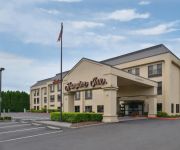
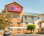
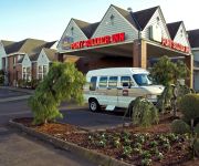
Looking for a place to stay? we compiled a list of available hotels close to the map centre further down the page.
When in this area, you might want to pay a visit to some of the following locations: Portland, Oregon City, Vancouver, Saint Helens and Hillsboro. To further explore this place, just scroll down and browse the available info.
Local weather forecast
Todays Local Weather Conditions & Forecast: 22°C / 72 °F
| Morning Temperature | 12°C / 53 °F |
| Evening Temperature | 20°C / 68 °F |
| Night Temperature | 12°C / 53 °F |
| Chance of rainfall | 0% |
| Air Humidity | 42% |
| Air Pressure | 1014 hPa |
| Wind Speed | Gentle Breeze with 7 km/h (4 mph) from South-East |
| Cloud Conditions | Clear sky, covering 0% of sky |
| General Conditions | Sky is clear |
Monday, 13th of May 2024
16°C (60 °F)
9°C (48 °F)
Overcast clouds, gentle breeze.
Tuesday, 14th of May 2024
19°C (67 °F)
11°C (53 °F)
Few clouds, light breeze.
Wednesday, 15th of May 2024
24°C (75 °F)
14°C (57 °F)
Sky is clear, light breeze, clear sky.
Hotels and Places to Stay
Shilo Inn Suites Hotel Portland Airport
McMenamins Edgefield
Staybridge Suites PORTLAND - AIRPORT
Four Points by Sheraton Portland East
Fairfield Inn & Suites Portland Airport
SpringHill Suites Portland Airport
Holiday Inn Express & Suites PORTLAND AIRPORT
Hampton Inn Portland East
Comfort Suites Portland Airport
Clarion Inn
Videos from this area
These are videos related to the place based on their proximity to this place.
Centennial High School Gresham OR Class of 1974
Centennial High School Gresham Oregon Class of 1974 Ten Year Reunion Visit.
1995-01 MAX Cabride between Main St in Gresham to 197th Ruby Jct in the snow
This video was a one off but today shows quite a bit of history relatively few decided to capture. Only 9 years after Light Rail began operation in Gresham, I took the video camera out for...
Truck 71 Responding Gresham Fire Department (2011 Pierce Arrow XT 105' HD Ladder All Steer)
Greshem Fire & Emergency Services Truck 71 responding from Station 71 in Gresham, Oregon (2011 Pierce Arrow XT 105' HD Ladder All Steer).
Truck 71 Responding Gresham Department (2011 Pierce Arrow XT 105' HD Ladder With All Steer)
Gresham Fire & Emergency Services Truck 71 responding from Station 71 in Gresham, Oregon. A 2011 Pierce Arrow XT 105' HD Ladder with All Steer.
Engine 71 Responding Gresham Fire Department (2006 Pierce Dash Pumper)
Gresham Fire & Emergency Services Engine 71 responding from Station 71 in Gresham, Oregon.
2576 NW 2nd Terrace, Gresham OR
A quick video walk through of a townhouse for rent in Gresham Oregon.
Ron Ruedi Rocks it out at Gresham car Cruise
Rock Around the Block 2013. There will be dancing https://www.facebook.com/chuck.fasst.
Portland RV Window Tint all types of RVs 503-969-1129
http://windowtintking.com/rv-window-tinting-motorhome-camper-fifth-wheel-window-tint-portland-or Portland Window Tinting Company also tints the windows of RV's, Motorhomes, Campers, Travel...
Videos provided by Youtube are under the copyright of their owners.
Attractions and noteworthy things
Distances are based on the centre of the city/town and sightseeing location. This list contains brief abstracts about monuments, holiday activities, national parcs, museums, organisations and more from the area as well as interesting facts about the region itself. Where available, you'll find the corresponding homepage. Otherwise the related wikipedia article.
Gresham City Hall (MAX station)
The Gresham City Hall station is a MAX light rail station in Gresham, Oregon. It serves the Blue Line and is the 24th stop eastbound on the eastside MAX branch. Located at the intersection of NW Division Street and NW Eastman Parkway, the station includes a park-and-ride lot. It is near the Gresham Station retail development, and is next to the new Gresham City Hall, which moved to its current location after MAX opened.
Ruby Junction / East 197th Avenue
The Ruby Junction/East 197th Avenue station is a MAX light rail station in Gresham, Oregon. It serves the Blue Line and is the 23rd stop eastbound on the eastside MAX line. The station is at the intersection of SE 197th Avenue and Burnside Street. The station's namesake, Ruby Junction, was a junction of electric interurban lines located immediately east of this location for many years and the name of an interurban stop.
Rockwood / East 188th Avenue
The Rockwood/East 188th Avenue station is a MAX light rail station in Gresham, Oregon. It serves the Blue Line and is the 22nd stop eastbound on the eastside MAX branch. The station is at the intersection of Southeast 188th Avenue and Burnside Street, within the Rockwood neighborhood. Until 2010, this station had staggered side platforms; however, the two platforms are now adjacent, both located to the west of SE 188th Avenue.
East 181st Avenue (MAX station)
The East 181st Avenue station is a MAX light rail station in Gresham, Oregon. It serves the Blue Line and is the 21st stop eastbound on the eastside MAX line. The station is at the intersection of NE/SE 181st Avenue and Burnside Street. This station has staggered side platforms, which sit on either side of the cross street, because the route runs around this station on Burnside Street in the median. Sterling Bank is by the Eastbound platfrom on Burnside and 181st.
East 172nd Avenue (MAX station)
The East 172nd Avenue station is a MAX light rail station in Gresham, Oregon. It serves the Blue Line and is the 20th stop eastbound on the eastside MAX line. The MAX system is owned and operated by TriMet, the major transit agency for the Portland metropolitan area. The station is at the intersection of East Burnside Street and NE/SE 172nd Avenue.
East 162nd Avenue (MAX station)
The East 162nd Avenue station is a MAX light rail station on the boundary between Portland and Gresham, Oregon. It serves the Blue Line and is the 19th stop eastbound on the current Eastside MAX branch. The station is at the intersection of E Burnside and 162nd Avenue. This station has staggered side platforms, which sit on either side of the cross street, because the route runs around this station on Burnside Street in the median.
East 148th Avenue (MAX station)
The East 148th Avenue station is a MAX light rail station in Portland, Oregon. It serves the Blue Line and is the 18th stop eastbound on the current Eastside MAX branch. The MAX system is owned and operated by TriMet, the major transit agency for the Portland metropolitan area.
Civic Drive (MAX station)
The Civic Drive station is a MAX light rail station in Gresham, Oregon on the Blue Line and is the 23rd stop eastbound on the current Eastside MAX Branch. The station opened on December 1, 2010. The foundations for the station's platforms were laid in 1996, as part of a planned Gresham Civic neighborhood development included in a 1993 Downtown Gresham Plan.
Gresham High School (Oregon)
Gresham High School is a public high school located in Gresham, Oregon.
United Airlines Flight 173
United Airlines Flight 173 was a scheduled flight from John F. Kennedy International Airport in New York to Portland International Airport in Portland, Oregon, with a scheduled stop in Denver, Colorado. On December 28, 1978, the aircraft operating the route crashed in a suburban Portland neighborhood near NE 158th Avenue and E Burnside Street after running out of fuel.
Oregon's 3rd congressional district
Oregon's 3rd congressional district covers most of Multnomah County, including Portland east of the Willamette River, Gresham, and Troutdale. It also includes the northern part of Clackamas County, including Milwaukie. Parts of northwest Portland also lie within the district. Before the 2002 redistricting, the whole of Multnomah County was included in the district; it lost southwest Portland to the 1st and 5th districts, but it gained most of its current portion of Clackamas County.
KFXX (AM)
KFXX (1080 AM, "1080 The FAN") is a class B clear channel AM radio station broadcasting from Portland, Oregon, United States. As of 2006 it is owned by Entercom Portland LLC and runs sports radio programming. KFXX is the local affiliate of the Seattle Mariners baseball team. It also carries The Dan Patrick Show, Colin Cowherd from ESPN Radio.
Franciscan Montessori Earth School & Saint Francis Academy
The Franciscan Montessori Earth School & Saint Francis Academy (FMES/SFA) is located in Portland, Oregon, United States. FMES/SFA is the only accredited pre-K through grade 8 Catholic Montessori school in the United States. It is operated by the Franciscan Sisters of the Eucharist from Bridal Veil, Oregon.
Centennial High School (Gresham, Oregon)
Centennial High School is a public high school located in Gresham, Oregon, United States.
KKSN (AM)
KKSN is a commercial radio station licensed to Vancouver, Washington, broadcasting to the Portland, Oregon and Clark County, Washington area on 910 AM. KKSN is owned by Entercom and airs a local music format branded as "94/7 too".
Centennial School District (Oregon)
Centennial School District is a school district in the U.S. state of Oregon. It serves the cities of Gresham and southeast Portland, with an enrollment of approximately 6,700 students.
Center for Advanced Learning
The Center for Advanced Learning (CAL) is a charter school in Gresham, Oregon, United States. The school also accepts students from Reynolds, Gresham-Barlow Centennial and Corbett school districts. At CAL students have four career fields to choose from: information technology, manufacturing/engineering, digital media/design and health sciences. Many of CAL's classes are entry-level college courses, granting credit through Mt. Hood Community College.
Gresham Police Department (Oregon)
The Gresham Police Department (GPD) is the law enforcement agency for the city of Gresham, Oregon, United States.
Jacob Zimmerman House
Jacob Zimmerman House was the home of Jacob and Lena Zimmerman, European American settlers who came west over the Oregon Trail in 1851 to what became Multnomah County in the U.S. state of Oregon. Built in 1874, the house was part of a 600-acre dairy farm. Members of the Zimmerman family lived on the farm from 1870 through 1992. The house and 1.58 acres were added to the National Register of Historic Places in 1986.
Rockwood, Gresham, Oregon
Rockwood is a neighborhood in the northwest section of Gresham, Oregon, bounded on the west by 162nd Avenue, on the north by the Columbia River, on the east by 202nd Avenue/Birdsdale Avenue, and on the south by SE Division. It is situated at an elevation of 76 meters .
Blue Lake Regional Park
Blue Lake Regional Park is a public park in Fairview, in the U.S. state of Oregon. The 101-acre park, near the south shore of the Columbia River in Multnomah County, includes many covered and uncovered picnic areas, playing fields for sports such as softball, and infrastructure related to lake recreation including swimming, boating, and fishing. Encompassing wooded areas, three ponds, and a wetland in addition to the lake, the park is frequented by migrating birds and other wildlife.
Reynolds Learning Academy
Reynolds Learning Academy is a public alternative school in Fairview, Oregon, United States.
Multnomah Greyhound Park
Multnomah Greyhound Park is a unused dog track located in Wood Village, Oregon, part of the Portland metropolitan area.
Gresham Library
The Gresham Library, also known as the Gresham Regional Library, is a branch of the Multnomah County Library in Gresham in the U.S. state of Oregon. The branch offers the Multnomah County Library catalog of two million books, periodicals and other materials.
Fairview-Columbia Library
The Fairview-Columbia Library is a branch of the Multnomah County Library, in Fairview in the U.S. state of Oregon. It serves residents of Fairview, Troutdale, Corbett, and elsewhere in the eastern part of the county. The branch offers the Multnomah County Library catalog of two million books, periodicals and other materials.


