Safety Score: 2,7 of 5.0 based on data from 9 authorites. Meaning we advice caution when travelling to United States.
Travel warnings are updated daily. Source: Travel Warning United States. Last Update: 2024-05-05 08:24:42
Discover Parkersville
Parkersville in Clark County (Washington) is a city in United States about 2,333 mi (or 3,754 km) west of Washington DC, the country's capital city.
Local time in Parkersville is now 06:48 AM (Sunday). The local timezone is named America / Los Angeles with an UTC offset of -7 hours. We know of 9 airports in the vicinity of Parkersville, of which 3 are larger airports. The closest airport in United States is Portland International Airport in a distance of 11 mi (or 17 km), West. Besides the airports, there are other travel options available (check left side).
Also, if you like golfing, there are a few options in driving distance. Looking for a place to stay? we compiled a list of available hotels close to the map centre further down the page.
When in this area, you might want to pay a visit to some of the following locations: Vancouver, Portland, Oregon City, Stevenson and Saint Helens. To further explore this place, just scroll down and browse the available info.
Local weather forecast
Todays Local Weather Conditions & Forecast: 7°C / 44 °F
| Morning Temperature | 6°C / 43 °F |
| Evening Temperature | 8°C / 47 °F |
| Night Temperature | 9°C / 47 °F |
| Chance of rainfall | 37% |
| Air Humidity | 98% |
| Air Pressure | 1011 hPa |
| Wind Speed | Gentle Breeze with 8 km/h (5 mph) from North |
| Cloud Conditions | Overcast clouds, covering 100% of sky |
| General Conditions | Moderate rain |
Sunday, 5th of May 2024
8°C (47 °F)
6°C (43 °F)
Moderate rain, gentle breeze, overcast clouds.
Monday, 6th of May 2024
12°C (53 °F)
5°C (41 °F)
Light rain, gentle breeze, overcast clouds.
Tuesday, 7th of May 2024
14°C (57 °F)
8°C (46 °F)
Overcast clouds, calm.
Hotels and Places to Stay
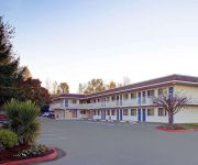
BW PLUS PARKERSVILLE INN STS
Comfort Inn Columbia Gorge Gateway
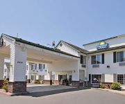
BW PLUS CASCADE INN SUITES
McMenamins Edgefield
PORTLAND-GRESHAM (former Holiday Inn)
Clarion Inn
Holiday Inn Express PORTLAND EAST - TROUTDALE
MOTEL 6 PORTLAND EAST - TROUTDALE
TRAVELODGE PORTLAND E GRESHAM
DAYS INN & SUITES GRESHAM
Videos from this area
These are videos related to the place based on their proximity to this place.
Real estate Companies in Camas | Real estate agent search in Camas
Real estate Companies in Camas | Real estate agent search in Camas The most important purchase or sale a person will ever make is their home. Don't trust it to chance, put a real professional...
SR 14 - Camas-Washougal Widening & Interchange in Washington
This Allan Block Retaining Wall project is being built with AB Vertical and has approx. 70000 sq. ft of block over a mile long span. Thanks to Central Oregon Block & Brick for shooting this...
Lacamas Creek Water Features
http://www.trail-hiking.com -- Enjoy some of the water features I encountered at Lacamas Creek Park in Camas, WA. Copyright (c)2010 www.trail-hiking.com.
River Tripin July 2009
River Trip with the crew July 2009. Cold water, waterfalls, and cliff jumping!!!
Easter - What a Difference Today Makes
No matter where your journey has taken you, wrong places, wrong expectations, or wrong actions, this can be your resurrection day! Get sermon notes and more at http://goo.gl/hCALod.
Washougal, WA Automobile Financing : Bad Credit No Money Down Car Loans for Older Cars / New Cars
Washougal Auto Loans at lower rates in Washington with No Cosigner at https://www.ezautofinance.net/free_car_loan_quote.php : EZ Auto Finance is the best auto loan company in Washington that...
Esther 10 - The Mark of a Great Leader
Find sermon notes and more at: http://parksidechurchcamas.org/esther-10-mark-great-leader-2015-01-11/ We are all leaders in some capacity. Great leaders consider their personal interests...
MOTOCROSS CRASH Washougal Amateur Days 2012
7-8 year old class at the Washougal Amateur Days the day before the AMA Pro Motocross 2012 Nationals. #56 comes up short on the Red Bull double. Hoping he has a quick recover!
2014 JCTRA Hangover Hare Scrambles at Washougal-Quads
The Jones Creek Trail Riders Association's Annual Hangover Hare Scrambles at Washougal MX Park in Washougal Washington on New Years Day. Basically a mix of open field, motocross and woods.
Videos provided by Youtube are under the copyright of their owners.
Attractions and noteworthy things
Distances are based on the centre of the city/town and sightseeing location. This list contains brief abstracts about monuments, holiday activities, national parcs, museums, organisations and more from the area as well as interesting facts about the region itself. Where available, you'll find the corresponding homepage. Otherwise the related wikipedia article.
Washougal, Washington
Washougal is a city in Clark County, Washington, United States. The population was 14,095 as of the 2010 Census.
Camas Potholes
The Camas Potholes is a popular place to jump from moderately high cliffs into the waters below. On a hot, weekend day, the potholes attract people of all ages. The Camas Potholes can be accessed via a trail from Lacamas Park. Lacamas Park is an especially popular destination in the Camas/Washougal area. The Potholes are featured by the Clark County Parks Department in their description of the park. http://www. cityofvancouver. us/parks-recreation/parks_trails/parks/lacamas.
Fallen Leaf Lake (Washington)
Fallen Leaf Lake, once called Dead Lake, is a lake in Camas, Washington. Once home to Dead Lake Cemetery, it and the area surrounding are now fenced off to the public. This property had been owned by the local Camas paper mill for decades. Currently, the mill is owned by the Georgia-Pacific Corporation, a subsidiary of Koch Industries, Inc. In 2011 the property surrounding Fallen Leaf Lake was purchased from Koch RP Holdings I, LLC by the City of Camas, Washington for use as a City Park.
Camas Cemetery
Camas Cemetery is a cemetery in Camas, Washington that was first used in 1860. The Camas Catholic Cemetery, also known as Dead Lake Cemetery, was located on NE Lake road near Lacamas Lake. In 1984 the graves from there were moved to the Camas Cemetery and a monument stands now with the names of those moved.
Round Lake (Washington)
Round Lake is a small lake in Camas, Washington, USA. The lake is connected at its north-west tip to Lacamas Lake. Lacamas Park includes access to Round Lake for fishing, picnicing, grilling, hiking, and jogging. The park includes a trail that goes entirely around Round Lake, and across the approximately 75-foot dam that controls the level of Lacamas Lake and Round Lake.
Portland-Troutdale Airport
Portland-Troutdale Airport is a public use airport located 10 nautical miles (19 km) east of the central business district of Portland, in Multnomah County, Oregon, United States. Also known as Troutdale Airport, it is located in Troutdale. It is one of four airports in the Portland metropolitan area owned and operated by the Port of Portland. The airport was purchased by the Port of Portland in 1942, serving as a reliever airport for nearby Portland International Airport (PDX) until the 1950s.
Camas High School
Camas High School is an American public high school located in Clark County, in the city of Camas, Washington. The current principal is Mr. Steve Marshall. It has a grade span of 9th through 12th, and contains a total of 1,950 students as of September 2012. It is operated by the Camas School District and includes a complement of 90 classroom teachers. The Camas High School colors are Red, Black, and White, and the mascot is a Mean Machine, and their team name is the Papermakers.
Multnomah County Poor Farm
The Multnomah County Poor Farm is a historic site in Troutdale, Oregon, United States. The former county poor farm is listed on the National Register of Historic Places. Today the site is operated as an entertainment and lodging complex under the name McMenamins Edgefield, one of many historic properties owned, restored, and operated by McMenamins.


