Safety Score: 2,7 of 5.0 based on data from 9 authorites. Meaning we advice caution when travelling to United States.
Travel warnings are updated daily. Source: Travel Warning United States. Last Update: 2024-04-27 08:23:39
Discover Image
Image in Clark County (Washington) is a place in United States about 2,342 mi (or 3,770 km) west of Washington DC, the country's capital city.
Current time in Image is now 08:40 PM (Saturday). The local timezone is named America / Los Angeles with an UTC offset of -7 hours. We know of 8 airports near Image, of which 3 are larger airports. The closest airport in United States is Portland International Airport in a distance of 2 mi (or 3 km), South-West. Besides the airports, there are other travel options available (check left side).
Also, if you like playing golf, there are a few options in driving distance. We encountered 7 points of interest in the vicinity of this place. If you need a hotel, we compiled a list of available hotels close to the map centre further down the page.
While being here, you might want to pay a visit to some of the following locations: Vancouver, Portland, Oregon City, Saint Helens and Hillsboro. To further explore this place, just scroll down and browse the available info.
Local weather forecast
Todays Local Weather Conditions & Forecast: 11°C / 52 °F
| Morning Temperature | 7°C / 44 °F |
| Evening Temperature | 11°C / 51 °F |
| Night Temperature | 7°C / 45 °F |
| Chance of rainfall | 1% |
| Air Humidity | 70% |
| Air Pressure | 1020 hPa |
| Wind Speed | Gentle Breeze with 7 km/h (4 mph) from North-East |
| Cloud Conditions | Broken clouds, covering 82% of sky |
| General Conditions | Light rain |
Sunday, 28th of April 2024
10°C (49 °F)
3°C (38 °F)
Moderate rain, gentle breeze, broken clouds.
Monday, 29th of April 2024
7°C (45 °F)
3°C (38 °F)
Moderate rain, gentle breeze, overcast clouds.
Tuesday, 30th of April 2024
15°C (58 °F)
7°C (44 °F)
Broken clouds, light breeze.
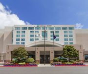
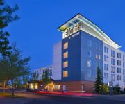
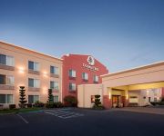
Hotels and Places to Stay
Sheraton Portland Airport Hotel
Embassy Suites by Hilton Portland Airport
Aloft Portland Airport at Cascade Station
DoubleTree by Hilton Vancouver Washington
Holiday Inn PORTLAND-AIRPORT (I-205)
Sonesta ES Suites Portland - Vancouver
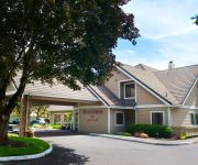
Residence Inn Portland Airport at Cascade Station
OR Portland Air Country Inn and Suites by Radisson
Radisson Hotel Portland Airport
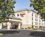
Hampton Inn Portland Airport
Videos from this area
These are videos related to the place based on their proximity to this place.
Sun Country Airlines Boeing 737-800 Lands At KPDX On Runway 10L
A Boeing 737-800 for Sun Country Airlines lands at Portland International Airport (KPDX) on Runway 10L.
Sun Country 737-800 Landing at Portland Airport
Sun Country Airlines Boeing 737-8Q8 (N801SY) landing at Portland International Airport (PDX). It's a ferry flight (no passengers) for a charter pickup.
jetBlue Airways Airbus A320 With The Real Salt Lake City Paint Job Takes Off From KPDX On Runway 28L
An Airbus A320 for jetBlue Airways with the Real Salt Lake City paint job takes off from Portland International Airport (KPDX) on Runway 28L.
Sun Country 737-800 N801SY Takeoff out of Portland Airport
Sun Country Airlines 737-8Q8 (N801SY) Takeoff out of Portland Airport (charter flight).
Sun Country Airlines Boeing 737-800 Lands At KPDX On Runway 10L
A Boeing 737-800 for Sun Country Airlines lands at Portland International Airport (KPDX) on Runway 10L.
portland oregon, Howard Johnson Airport Hotel
Portland food and travel playlist http://www.youtube.com/playlist?list=PLA8fY63qNlEuuB2U_V6Ot4YUMDBVjv0Vp Portland is a city located in the U.S. state of Oregon, near the confluence of the...
PDX Early Departure on WN
This is a take off video on board a Southwest 738 I believe with service to MDW from PDX. I would later connect there to fly to MCO for my spring break holiday.
Alaska Airlines CRJ-700 Takes Off From KPDX On Runway 10L
A CRJ-700 for Alaska Airlines takes off from Portland International Airport (KPDX) on Runway 10L.
Spirit Airlines Airbus A319 Takes Off From KPDX On Runway 28L
An Airbus A319 for Spirit Airlines takes off from Portland International Airport (KPDX) on Runway 28L.
How To Setup Your Yelp! Business Account
http://www.imconsultingservice.com, 866-910-1515, Shows you how to set up your Yelp! Business Account so that you can get reviews from your customers and/or clients. As we all know, today's...
Videos provided by Youtube are under the copyright of their owners.
Attractions and noteworthy things
Distances are based on the centre of the city/town and sightseeing location. This list contains brief abstracts about monuments, holiday activities, national parcs, museums, organisations and more from the area as well as interesting facts about the region itself. Where available, you'll find the corresponding homepage. Otherwise the related wikipedia article.
Portland International Airport
Portland International Airport is a joint civil-military airport and the largest airport in the U.S. state of Oregon, accounting for 90% of passenger travel and more than 95% of air cargo of the state. It is located within Portland's city limits just south of the Columbia River in Multnomah County, six miles by air and twelve miles by highway northeast of downtown Portland. Portland International Airport is often referred to by its IATA airport code, PDX.
Glenn L. Jackson Memorial Bridge
The Glenn L. Jackson Memorial Bridge, or I-205 bridge, is a segmental bridge that spans the Columbia River between Vancouver, Washington and Portland, Oregon. Planning for the structure began in earnest in 1964 when it was designated as part of the East Portland Freeway (later renamed Veteran's Memorial Freeway), Interstate 205. Construction began in August 1977. In order to avoid disrupting river traffic, the bridge was built one segment at a time.
Mount Hood Avenue (MAX station)
The Mount Hood Avenue station is a light rail station on the MAX Red Line in Portland, Oregon. It is the 3rd stop north on the Airport MAX. It is located at northern end of the Cascade Station development, a planned mixed-use development. The Cascade Station area is currently under development, and the traffic for this MAX station should increase once the area is completely built up. A Taget store is at the station.
Portland International Airport (MAX station)
The Portland International Airport station is a light rail station on the MAX Red Line in Portland, Oregon, located at Portland International Airport. It is the fourth (and final) stop north on the Airport MAX extension. Since opening on September 10, 2001, the station has handled 4.3 million riders. In 2006, it handled over 1 million passengers for the first time. The station is located outside the airport's baggage claim area, with easy access to check-in and ticketing.
Fort Vancouver High School
Fort Vancouver High School, known as FVHS, is a public high school located in Vancouver, Washington. It is named after Fort Vancouver, an early trading outpost (now restored and located near the banks of the Columbia River, a few miles from where the school is located). The FVHS symbol is the Trapper, in reference to the fur trade in the early 19th century by such groups as Hudson's Bay Company voyageurs.
Cascade Station
Cascade Station is a shopping center with office buildings, hotels located in Northeast Portland, Oregon along Airport Way and I-205. It features a maximum of 1,325,000 square feet of office space, 1,200 hotel rooms, 400,000 square feet of retail space and a 24-screen cinema on 120-acre land. Cascade Station was proposed in 2001.
Portland Air National Guard Base
Portland Air National Guard Base is a United States Air Force base, located at Portland International Airport, Oregon. It is located 5.5 miles northeast of Portland, Oregon.
PeaceHealth Southwest Medical Center
PeaceHealth Southwest Washington Medical Center is a community hospital located in Vancouver, Washington. The hospital has 450 licensed beds, and 386 are general beds. In 2010, the hospital had about 114,000 emergency room visits, 27,000 in-patient visits, and 3,000 child births. The emergency room is the busiest ER north of San Francisco on the west coast, and the birth center is the second busiest obstetrics unit in the Portland metropolitan area.


