Safety Score: 2,7 of 5.0 based on data from 9 authorites. Meaning we advice caution when travelling to United States.
Travel warnings are updated daily. Source: Travel Warning United States. Last Update: 2024-05-16 08:19:50
Discover North Highland
The district North Highland of Cartersville in Bartow County (Georgia) is a subburb in United States about 539 mi south-west of Washington DC, the country's capital city.
If you need a hotel, we compiled a list of available hotels close to the map centre further down the page.
While being here, you might want to pay a visit to some of the following locations: Dallas, Canton, Marietta, Calhoun and Rome. To further explore this place, just scroll down and browse the available info.
Local weather forecast
Todays Local Weather Conditions & Forecast: 18°C / 65 °F
| Morning Temperature | 19°C / 66 °F |
| Evening Temperature | 21°C / 70 °F |
| Night Temperature | 19°C / 66 °F |
| Chance of rainfall | 9% |
| Air Humidity | 94% |
| Air Pressure | 1013 hPa |
| Wind Speed | Gentle Breeze with 8 km/h (5 mph) from North-West |
| Cloud Conditions | Overcast clouds, covering 100% of sky |
| General Conditions | Moderate rain |
Saturday, 18th of May 2024
26°C (78 °F)
19°C (66 °F)
Heavy intensity rain, gentle breeze, overcast clouds.
Sunday, 19th of May 2024
23°C (73 °F)
19°C (65 °F)
Light rain, gentle breeze, overcast clouds.
Monday, 20th of May 2024
29°C (83 °F)
21°C (69 °F)
Light rain, light breeze, broken clouds.
Hotels and Places to Stay
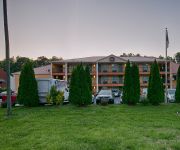
BEST WESTERN ALLATOONA INN
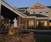
Hilton Garden Inn Cartersville
Fairfield Inn & Suites Cartersville
Cartersville
Hampton Inn Cartersville
Country Inn and Suites Jacksonville 1-95 South
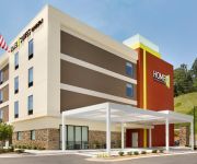
Home2 Suites by Hilton Cartersville
Americas Best Value Inn
Sky Suites Cartersville
Red Roof Inn Cartersville
Videos from this area
These are videos related to the place based on their proximity to this place.
CSX Q041-01 Southbound Tropicana/Intermodal Train @ Cartersville, GA
February 2, 2013 Cartersville, Georgia CSX W&A Subdivision Train Q041-01 Southbound C40-8 #7519 ES44DC #5266 Tropicana/Intermodal Freight Train Bound for Jacksonville, FL.
CSX Q540-08 Cartersville, GA October 8, 2011
A north bound freight passes the Booth Western Art Museum in Cartersville, GA. October 8, 2011 SD50 8523 SD40-2 8365 Length of train 4741. Total axles 300.
Cartersville St. Patrick's Day 2015 - Los Arcos Mexican Restaurant
http://www.arcosmexicanrestaurant.com/ We had a lot of fun on St. Patrick's Day, if you want to see ... --- Play the Video ! #SanPatrickDay @ #LosArcos #Mexican...
CSX Q042-30 Cartersville, GA October 1, 2011
The north bound Tropicana Juice train crosses West Felton Avenue in Cartersville, GA. They were just getting started from a stop signal at North Yard. October 1, 2011 ES44AC 850 CW40-8 7784...
CSX R144-11 Cartersville, GA November 12, 2011
Two UP units lead an intermodal train south bound past Junta Yard in Cartersville, GA. I've just found out this was a reroute from New Orleans due to a bridge fire in Alabama. November 12,...
CSX Q581-31 Cartersville, GA February 2, 2013
February 2, 2013 Cartersville, GA CSX W&A Sub Train Q581-31 Southbound SD70ACe 4849 CW40-8 7895 Mixed freight Length of train 4128. Total axles 284.
CSX N290-08 Cartersville, GA January 12, 2013
January 12, 2013 Cartersville, GA K&A Wye CSX Etowah Sub Train N290-08 Northbound CW44AC 597 ES44AC 992 Empty coal train Total axles 452. As local Y122-12 waits in the background an ...
7 Bruce St Cartersville GA
http://www.exite-listings.com/36401 Excellent starter home inside the city, very convenient to shopping, restaurants, hospitals and dining, minutes to I-75 and hwy 41, this cozy home has...
New Youtube Channel - WHAT DO YOU WANT TO SEE?
I'm making a new YouTube channel and i need your help! my new channel is http://www.youtube.com/breannefain.
CSX Q041-01 Cartersville, GA March 2, 2013
After meeting Q042, Q041 heads south at North Yard in Cartersville, GA. March 2, 2013 CSX Etowah Sub Train Q041-01 Southbound CW44AC 347 SD70ACe 4849 Tropicana intermodal Length of train ...
Videos provided by Youtube are under the copyright of their owners.
Attractions and noteworthy things
Distances are based on the centre of the city/town and sightseeing location. This list contains brief abstracts about monuments, holiday activities, national parcs, museums, organisations and more from the area as well as interesting facts about the region itself. Where available, you'll find the corresponding homepage. Otherwise the related wikipedia article.
Bartow County, Georgia
Bartow County is a county located in the U.S. state of Georgia. As of the 2010 census, the population was 100,157. A 31.8% increase in less than ten years. The county seat is Cartersville. Bartow County is included in the Atlanta-Sandy Springs-Marietta Metropolitan Statistical Area. It has a sole commissioner government, and is the largest county with a sole commissioner.
Emerson, Georgia
Emerson is a city in far southern Bartow County, Georgia, United States, on highways 41, 293, and 75. The population was 1,470 at the 2010 census, an increase of 34% over the 2000 count of 1,092. Emerson is a gateway to Red Top Mountain State Park, a Georgia state park, which is surrounded by Lake Allatoona.
Euharlee, Georgia
Euharlee is a city in Bartow County, Georgia, United States. The population was 4,136 at the 2010 census, an increase of 29% over the 2000 count of 3,208. Euharlee, Georgia is a bedroom community of Cartersville which is located 9 miles to the east. They are connected through Euharlee Road, and by a chain of subdivisions and homes. Euharlee is located next to Plant Bowen, which has the second largest generating capacity of any coal-fired power plant in the United States.
Kingston, Georgia
Kingston is a city in Bartow County, Georgia, United States. The population was 659 at the 2000 census; the 2005 official estimate listed a population of 868.
White, Georgia
White is a city in Bartow County, Georgia, United States. The population was 693 at the 2000 census. As of the 2005 census the population was estimated at 716. Although the population of White may look minor, the area just north and just south of White boost White's population to a staggering 4,200. White is considering extending their city limits. White is the stepping stone from extremely rural areas of Georgia, to areas just south of White that are considered urban or urbanizing.
WPXA-TV
WPXA-TV, virtual channel 14, is a television station on digital channel 51 in the metro Atlanta area, and carries Ion Television network programming. The station is licensed to Rome, with its transmitter and antenna on Bear Mountain, overlooking Lake Arrowhead near Waleska, near the Cherokee/Bartow county line several miles northwest of Atlanta. The TV studio was located in Marietta, next to Six Flags White Water along Cobb Parkway. It is owned and operated by ION Media Networks.
Battle of Allatoona
The Battle of Allatoona, also known as the Battle of Allatoona Pass, was fought October 5, 1864, in Bartow County, Georgia, as part of the Franklin-Nashville Campaign of the American Civil War. A Confederate division under Maj. Gen. Samuel G. French attacked a Union garrison under Brig. Gen. John M. Corse, but was unable to dislodge it from its fortified position protecting the railroad through Allatoona Pass.
Lake Allatoona
Lake Allatoona (rarely called Allatoona Lake, its government name) is a U.S. Army Corps of Engineers reservoir in Georgia, located in northwestern metro Atlanta. The lake is mostly in southwestern Cherokee County, but a significant part is in southeastern Bartow County, and a small part in Cobb County near Acworth. Cartersville is the nearest large town to the dam. Red Top Mountain State Park is located on its shores, on the peninsula between the Etowah and Allatoona arms of the lake.
Cassville, Georgia
Cassville is an unincorporated community in Bartow County in the U.S. state of Georgia. It was originally the county seat before the name was changed from Cass County. The seat was moved to Cartersville after General Sherman destroyed Cassville in his Atlanta Campaign of 1864. Cassville, although no longer incorporated, is said to encompass an area beginning at the Cassville Road-Firetower Road intersection and extending a mile in all directions.
Allatoona, Georgia
Allatoona was a town located in extreme southeastern Bartow County, Georgia. Built along Allatoona Creek, it was a gold mining area later in the first U.S. gold rush, which occurred in Georgia and North Carolina. Reaching its height in the 1840s, the Georgia Gold Rush continued into the 1850s even while the second gold rush was occurring in California. (Gold was also mined in nearby Woodstock. ) The Battle of Allatoona Pass took place here just after the fall of Atlanta in 1864.
Cartersville Airport
Cartersville Airport is a public use airport located three nautical miles (6 km) southwest of the central business district of Cartersville, in Bartow County, Georgia, United States. It is owned by the Cartersville Bartow Airport Authority. Although many U.S. airports use the same three-letter location identifier for the FAA and IATA, this facility is assigned VPC by the FAA but has no designation from the IATA.
Stilesboro, Georgia
Stilesboro is an unincorporated town in southern Bartow County, Georgia, United States.
Atco, Georgia
Atco is a small community on the northwestern side of Cartersville in southern Bartow County, Georgia, United States. Atco gets its name from the Atlantic Transportation Company (1866). At one time the neighborhood boasted its own post office, school and grocery store. There are numerous baseball and soccer complexes in the area, primarily along Sugar Valley and Cassville Roads, making it a popular destination for subdivisions.
Lake Acworth
Lake Acworth is a 90-acre man-made lake located southwest of the city of Acworth, Georgia. It is located in the extreme northwestern part of Cobb County. The lake impounds Proctor Creek (not the same as Proctor Creek in nearby Atlanta), and outflows into Lake Allatoona. The low dam is at the point where State Route 92 (Lake Acworth Drive) crosses. The city of Acworth operates Acworth Beach, a public beach and park along the northern shore of the lake.
WYXC
WYXC is a radio station broadcasting a News/Talk format. Licensed to Cartersville, Georgia, USA, the station is currently owned by NewsTalk Corporation: co-owners John and Brandi Underwood in partnership with Greg Detscher. Founded in 1961, WYXC's broadcast area included the NW corner of metro Atlanta and other areas of northwest Georgia.
WBHF
WBHF is a radio station broadcasting a nostalgic music format. Licensed to Cartersville, Georgia, USA, it serves the Atlanta area. The station is currently owned by the non-profit Anverse, Inc. and features nostalgia music programing from Jones and news from CNN Radio.
North Metro Technical College
North Metro Technical College (commonly North Metro Tech, or NMTC) was a two-year state technical college located in the state of Georgia, and governed by the Technical College System of Georgia. The college was accredited by the Commission on Colleges of the Southern Association of Colleges and Schools to award associate degrees since 2006. Since the beginning of July 2009, it is now the North Metro campus of nearby Chattahoochee Technical College.
Euharlee Covered Bridge
The Euharlee Covered Bridge, also known as the Euharlee Creek Covered Bridge or rarely the Lowry Bridge, is a wooden Town lattice covered bridge crossing Euharlee Creek in Euharlee, Georgia, United States, a small town west of Cartersville. The bridge was built after the raging creek swept away an old bridge on the property of Daniel Lowry. The collapse of the bridge killed one man. A new bridge was built using some materials provided by Lowry.
North Cobb Christian School
North Cobb Christian School is an independent, college preparatory school with a Christian based environment. It is located in Kennesaw, Georgia. It houses children from K3 through twelfth grade. The school offers a variety of Honors and AP classes, clubs, and a variety of middle school, junior varsity and varsity sports. In addition to academic requirements mandated by the school board, a minimum of 28 hours of community service is required to graduate from North Cobb Christian School.
The Old Mill Restaurant
The Old Mill Restaurant was restaurant in an 1870s former mill building located in the Downtown Historic District of Acworth, Georgia, U.S.
Cass High School
Cass High School is a four-year public high school located in Cartersville, Georgia, United States. They educate students grades 9-12. The current principal is Michael Nelson, a Cass High School graduate. Cass High School is one of five high schools in Bartow County.
Allatoona High School
Allatoona High School is one of sixteen public schools in the Cobb County School District. The institution opened in the Fall of 2008, and is currently the most recent high school in the district. It is located in the suburban Acworth, Georgia, north of Atlanta. The school sits near Lake Allatoona, and is so named after.
Bartow County School District
The Bartow County School District is a public school district in Bartow County, Georgia, USA, based in Cartersville, Georgia. It serves the communities of Adairsville, Atco, Cartersville, Cassville, Emerson, Euharlee, Kingston, Rowland Springs, Stilesboro, Taylorsville, and White, Georgia.
Cartersville City School District
The Cartersville City School District is a public school district in Bartow County, Georgia, USA, based in Cartersville, Georgia. It serves the city of Cartersville, Georgia and the surrounding communities in Bartow County, Georgia. The School Board maintains schools for pre-school to grade twelve. There are two elementary schools, a middle school, and a high school. The district has 226 full-time teachers and over 3,940 students.
Woodland High School (Cartersville, Georgia)
Woodland High School is a school in Bartow County, Georgia serving grades 9 through 12. It has an enrollment of 1,793 students and is primarily known in the region for its outstanding performing arts, marching band, cheerleading, and wrestling.


