Safety Score: 2,7 of 5.0 based on data from 9 authorites. Meaning we advice caution when travelling to United States.
Travel warnings are updated daily. Source: Travel Warning United States. Last Update: 2024-05-17 08:07:57
Delve into Fruitridge Manor
Fruitridge Manor in Sacramento County (California) is a town located in United States about 2,370 mi (or 3,814 km) west of Washington DC, the country's capital town.
Time in Fruitridge Manor is now 07:53 AM (Friday). The local timezone is named America / Los Angeles with an UTC offset of -7 hours. We know of 8 airports closer to Fruitridge Manor, of which 4 are larger airports. The closest airport in United States is Sacramento International Airport in a distance of 14 mi (or 23 km), North-West. Besides the airports, there are other travel options available (check left side).
Also, if you like the game of golf, there are some options within driving distance. We saw 4 points of interest near this location. In need of a room? We compiled a list of available hotels close to the map centre further down the page.
Since you are here already, you might want to pay a visit to some of the following locations: Sacramento, Woodland, Auburn, Stockton and Marysville. To further explore this place, just scroll down and browse the available info.
Local weather forecast
Todays Local Weather Conditions & Forecast: 27°C / 81 °F
| Morning Temperature | 12°C / 54 °F |
| Evening Temperature | 24°C / 76 °F |
| Night Temperature | 15°C / 60 °F |
| Chance of rainfall | 0% |
| Air Humidity | 37% |
| Air Pressure | 1011 hPa |
| Wind Speed | Gentle Breeze with 9 km/h (5 mph) from North-East |
| Cloud Conditions | Clear sky, covering 0% of sky |
| General Conditions | Sky is clear |
Friday, 17th of May 2024
28°C (82 °F)
13°C (56 °F)
Scattered clouds, moderate breeze.
Saturday, 18th of May 2024
26°C (80 °F)
15°C (58 °F)
Sky is clear, moderate breeze, clear sky.
Sunday, 19th of May 2024
29°C (84 °F)
18°C (64 °F)
Sky is clear, gentle breeze, clear sky.
Hotels and Places to Stay
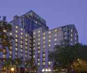
Hyatt Regency Sacramento
Courtyard Sacramento Midtown
Hampton Inn - Suites Sacramento at CSUS
Holiday Inn Express SACRAMENTO CONVENTION CENTER
Residence Inn Sacramento Downtown at Capitol Park
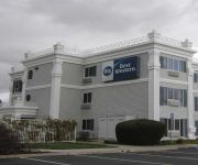
BEST WESTERN JOHN JAY INN
LARKSPUR LANDING SACRAMENTO
Quality Inn Sacramento Convention Center
Good Nite Inn Sacramento
Sky Riders Motel
Videos from this area
These are videos related to the place based on their proximity to this place.
Shop Florin Road
Florin Road, Sacramento, Ca http://florinroad.com - Florin Road Partnership Florin Road is a Great Place to Shop. Video produced for the Florin Road Partnership to increase holiday shopping...
California Storm Watch 2008
During the first week of 2008, three back-to-back-to-back storms plowed through California. The second of the three storms was the strongest, causing widespread flooding. This video is a sample...
Idle Hour Shooting
Video of a hit and run crash/shooting that occurred at the Idle Hour bar on Fruitridge Rd in the Colonial Village area.
Yemaso BJJ Grand Opening - Sacramento Jiu-Jitsu Academy
http://www.yemasobjj.com A video documenting some of the highlights of the grand opening of the new space for Yemaso Brazilian Jiu-Jitsu in Sacramento, CA. We had promotions, we had a huge...
Brazilian Jiu-Jitsu Purple Belt Demonstration - Yemaso BJJ | Sacramento Jiu-Jitsu Academy
Sacramento, CA BJJ Academy has two students demonstrate some of their techniques in a 4 minute video after they were promoted from the blue belt rank to the purple belt rank. Saturday, June...
Videos provided by Youtube are under the copyright of their owners.
Attractions and noteworthy things
Distances are based on the centre of the city/town and sightseeing location. This list contains brief abstracts about monuments, holiday activities, national parcs, museums, organisations and more from the area as well as interesting facts about the region itself. Where available, you'll find the corresponding homepage. Otherwise the related wikipedia article.
Parkway–South Sacramento, California
Parkway–South Sacramento is a former census-designated place (CDP) in Sacramento County, California, United States. It was part of the Sacramento–Arden-Arcade–Roseville Metropolitan Statistical Area. The area shared three boundaries with the City of Sacramento. The population was 36,468 at the 2000 census. The CDP was abolished before the 2010 census.
Cristo Rey High School (Sacramento)
Cristo Rey High School Sacramento is a private, Roman Catholic high school in the Fruitridge Manor neighborhood of Sacramento, California. It is on McMahon Dr between Stockton Boulevard and 65th street. It is located in the Roman Catholic Diocese of Sacramento.
West Campus High School
West Campus High School is a public college preparatory magnet high school in Sacramento, California. The school serves about 800 students in the Sacramento City Unified School District in grades 9-12. West Campus used to be a satellite school of nearby Hiram Johnson but became its own school for the 2002-2003 school year. The class of 2006 was the first class to graduate from West Campus having spent all four years at the school.
Tahoe Park, Sacramento, California
Tahoe Park is a neighborhood located within the city of Sacramento, California. The name "Tahoe Park" is generally used to refer to several official and unofficial neighborhoods that surround Tahoe Park proper, including Tahoe Park East, Tahoe Park South, Tahoe Terrace, and West Tahoe Park.
Christian Brothers High School (Sacramento, California)
Christian Brothers High School High School is a private, Roman Catholic, college-preparatory high school in Sacramento, California. It is located within the Roman Catholic Diocese of Sacramento.
Masjid Annur Islamic Center
Masjid Annur Islam Center in Sacramento, California is the largest mosque in the greater Sacramento area of Northern California.
Hiram W. Johnson High School
Hiram W. Johnson High School is a secondary school in the Sacramento City Unified School District, in the Tahoe Park South area of Sacramento, California, United States.
California State Fairgrounds Race Track
California State Fairgrounds Race Track was a dirt oval racing track located in Sacramento, California. The track was built in 1906 for horse racing on the site of the California Exposition. It was active for auto racing in 1907, 1912, and from 1946 until 1970. A 2.1-mile (3.4-km) road course was laid out in the parking lots surrounding the oval, and used for sports car racing between 1955 and 1969.


