Safety Score: 2,7 of 5.0 based on data from 9 authorites. Meaning we advice caution when travelling to United States.
Travel warnings are updated daily. Source: Travel Warning United States. Last Update: 2024-05-02 08:23:34
Discover Broderick
Broderick in Yolo County (California) is a town in United States about 2,373 mi (or 3,818 km) west of Washington DC, the country's capital city.
Current time in Broderick is now 02:21 AM (Thursday). The local timezone is named America / Los Angeles with an UTC offset of -7 hours. We know of 8 airports near Broderick, of which 4 are larger airports. The closest airport in United States is Sacramento International Airport in a distance of 8 mi (or 13 km), North-West. Besides the airports, there are other travel options available (check left side).
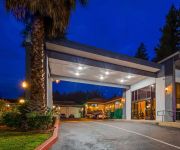
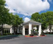
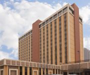
Also, if you like playing golf, there are a few options in driving distance. We discovered 2 points of interest in the vicinity of this place. Looking for a place to stay? we compiled a list of available hotels close to the map centre further down the page.
When in this area, you might want to pay a visit to some of the following locations: Sacramento, Woodland, Auburn, Yuba City and Marysville. To further explore this place, just scroll down and browse the available info.
Local weather forecast
Todays Local Weather Conditions & Forecast: 25°C / 77 °F
| Morning Temperature | 11°C / 51 °F |
| Evening Temperature | 23°C / 74 °F |
| Night Temperature | 16°C / 61 °F |
| Chance of rainfall | 0% |
| Air Humidity | 34% |
| Air Pressure | 1013 hPa |
| Wind Speed | Moderate breeze with 9 km/h (6 mph) from South-East |
| Cloud Conditions | Scattered clouds, covering 32% of sky |
| General Conditions | Scattered clouds |
Thursday, 2nd of May 2024
24°C (76 °F)
15°C (58 °F)
Sky is clear, moderate breeze, clear sky.
Friday, 3rd of May 2024
11°C (51 °F)
7°C (45 °F)
Moderate rain, moderate breeze, overcast clouds.
Saturday, 4th of May 2024
14°C (57 °F)
9°C (48 °F)
Light rain, gentle breeze, overcast clouds.
Hotels and Places to Stay
Embassy Suites by Hilton Sacramento Riverfront Promenade
Residence Inn Sacramento Airport Natomas
SURESTAY PLUS HOTEL SACRAMENTO NORTH
Hilton Garden Inn Sacramento-So Natomas
SpringHill Suites Sacramento Airport Natomas
Holiday Inn SACRAMENTO DOWNTOWN - ARENA
GOVERNORS INN HOTEL
Courtyard Sacramento Airport Natomas
BEST WESTERN SANDMAN MOTEL
La Quinta Inn Sacramento Downtown
Videos from this area
These are videos related to the place based on their proximity to this place.
Premier Railroad Museum - Old Sacramento, California
This extensive railroad museum features 21 exquisitely restored locomotives and railroad cars, some dating back to 1862. If you are a train lover, admirer, or just casually inquisitive about...
Discovery Park, Sacramento, on a 108 degree day
Lots of people enjoying the cool water near the confluence of the Sacramento and American rivers at Discovery Park on a hot day.
Sacramento's Ultimate 15 Minute Fat Burning Workout
This 15 minute fat burning workout is Sacramento's best. No fancy equipment necessary, just you, some dumbbells, and 15 minutes. This routine will strengthen your core, burn fat, tighten your...
Broderick | Burgers & Bar | West Sacramento | DinnerWire
A simple menu of hearty portions is the perfect compliment to any drink. From our signature burgers and sandwiches, to dressed fries and salads, the fare at BRODERICK will keep the working...
West Sac Warrants
Video of West Sacramento police and Davis SWAT serving warrants on several locations in West Sacramento related to recent gang activity occurring in the city.
Shuttle Flyover - Sacramento, CA
The shuttle Endeavour flying over Sacramento, California on September 21st, 21012. Filmed from the Raley Field parking lot in West Sacramento.
PSTE Thought Leadership Forum on Big Data, Telecom, and Security in the State of California
The Public Sector Technology Exchange (PSTE) hosted a government and industry thought leadership forum on Big Data, Telecom, and Security in the State of California on Thursday, September 4,...
Pedego FAQ: What's the difference between the Interceptor and the City Commuter?
Visit http://practicalcycle.com/pedego-electric-bikes for more information. Transcript: The Interceptor and City Commuter have more similarities than differences. Neither is better than the...
California Trip part 1
The summer of 2007, we went on a trip to California. Are first stop was near Yreka CA, This was a motel ware you sleep in cabooses. Sacramento CA. was are secant stop we stayed 2 night there...
Creating a Path for Transformation - Part 3
On Sept. 27, 2012, Sierra Health Foundation convened members of our Sacramento Region Health Care Partnership and other health care stakeholders to celebrate the release of a market analysis...
Videos provided by Youtube are under the copyright of their owners.
Attractions and noteworthy things
Distances are based on the centre of the city/town and sightseeing location. This list contains brief abstracts about monuments, holiday activities, national parcs, museums, organisations and more from the area as well as interesting facts about the region itself. Where available, you'll find the corresponding homepage. Otherwise the related wikipedia article.
West Sacramento, California
West Sacramento (also known as West Sac) is a city in Yolo County, California. It is contiguous with Sacramento, but is separated by the Sacramento River which is also the county line, so West Sacramento is in a different county than Sacramento. It is a fast growing community; the population was 48,744 at the 2010 census, up from 31,615 at the 2000 census.
Area code 916
The map to the right is now clickable; click on an area code to go to the page for that area code. The area code in red is Area Code 916; all others in blue are California area codes. Error: Image is invalid or non-existent. North American area code 916 is an area code based in Sacramento, California. The telephone area code was one of the first three original area codes established in California in October, 1947. It covered the far northern portion of the state.
Raley Field
Raley Field is the home of the Sacramento River Cats minor league baseball team in the Pacific Coast League. Raley Field was built on the site of old warehouses and railyards, in West Sacramento, California, USA across the Sacramento River from the California State Capitol.
Broderick, California
Broderick (formerly, Washington) is a former town in Yolo County, California, USA, now forming part of the City of West Sacramento. It is located just west of the Sacramento River in the eastern portion of the county. Broderick's ZIP Code is 95605 and its area code 916. It lies at an elevation of 23 feet (7 m).
Northwestern California University School of Law
Northwestern California University School of Law is an online correspondence based distance education institution founded in 1982. It is authorized by the California State Bar to award the Juris Doctor Degree upon completion of a California Bar Qualifying Program. It is registered as a law school with the Committee of Bar Examiners of the State Bar of California. As of 2012 the school offers the lowest annual tuition (currently $2850.00) of any online law school in California.
Tower Bridge (California)
The Tower Bridge is a vertical lift bridge across the Sacramento River, linking West Sacramento in Yolo County to the west, with the capital of California, Sacramento, in Sacramento County to the east. It was previously a part of U.S. Route 40 until that highway was truncated east of Salt Lake City.
California State Military Museum
The California State Military Museum is the official Military museum of the State of California. It is located in the Old Sacramento State Historic Park at 1119 Second Street. The museum was begun 1991 during the administration of California Governor Pete Wilson. 11 years later Governor Gray Davis made it a permanent museum under the California State Military Department, providing it permanent funding. On 13 July 2004, Governor Arnold Schwarzenegger made it the state's official military museum.
The Ziggurat
The Ziggurat is a ten-story, stepped pyramidal office building and adjacent 5 story concrete parking structure located in West Sacramento, California on the shore of the Sacramento River. Designed to resemble the ancient Mesopotamian ziggurats, the building was built by The Money Store in 1997 and is currently leased by the California Department of General Services (DGS). It is the headquarters to DGS.
CalSTRS
The California State Teachers' Retirement System (CalSTRS) provides retirement, disability and survivor benefits for California's 856,360 prekindergarten through community college educators and their families. CalSTRS was established by law in 1913 and is part of the California State and Consumer Services Agency. As of September 2011, CalSTRS is the largest teachers’ retirement fund in the United States. CalSTRS is also currently the eighth largest public pension fund in the world.
Peethill, California
Peethill is an unincorporated community in Yolo County, California. It is on the Sacramento Northern Railroad 1 mile (1.6 km) north-northeast of West Sacramento, at an elevation of 26 feet (8 m).
Weinstock's
Weinstock's was an American department store headquartered in Sacramento, California. The store was purchased by The Broadway in 1992, and later purchased by Federated Department Stores (now Macy's, Inc. ) in 1995. Shortly after the purchase, most of the Weinstock's stores were converted to Macy's, while the remaining stores were either closed or sold.
The Firehouse Restaurant
The Firehouse Restaurant is a fine dining establishment located in historic Old Sacramento.


