Safety Score: 2,7 of 5.0 based on data from 9 authorites. Meaning we advice caution when travelling to United States.
Travel warnings are updated daily. Source: Travel Warning United States. Last Update: 2024-05-18 08:26:29
Discover Al Tahoe
The district Al Tahoe of South Lake Tahoe in El Dorado County (California) is a subburb in United States about 2,287 mi west of Washington DC, the country's capital city.
If you need a hotel, we compiled a list of available hotels close to the map centre further down the page.
While being here, you might want to pay a visit to some of the following locations: Minden, Carson City, Virginia City, Reno and Yerington. To further explore this place, just scroll down and browse the available info.
Local weather forecast
Todays Local Weather Conditions & Forecast: 15°C / 58 °F
| Morning Temperature | 7°C / 44 °F |
| Evening Temperature | 11°C / 52 °F |
| Night Temperature | 6°C / 43 °F |
| Chance of rainfall | 0% |
| Air Humidity | 42% |
| Air Pressure | 1013 hPa |
| Wind Speed | Fresh Breeze with 15 km/h (9 mph) from East |
| Cloud Conditions | Scattered clouds, covering 31% of sky |
| General Conditions | Scattered clouds |
Monday, 20th of May 2024
12°C (54 °F)
6°C (44 °F)
Light rain, moderate breeze, clear sky.
Tuesday, 21st of May 2024
11°C (52 °F)
7°C (44 °F)
Sky is clear, moderate breeze, clear sky.
Wednesday, 22nd of May 2024
14°C (57 °F)
7°C (44 °F)
Few clouds, fresh breeze.
Hotels and Places to Stay
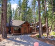
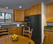
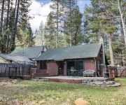
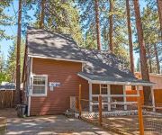
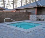
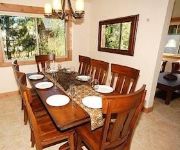
Cabin an Excellent Deal for Groups up to 8 by RedAwning
3195 Pasadena Avenue by RedAwning
TAHOE LAKESHORE LODGE AND SPA
1207 Omalley Drive by RedAwning
2684 Knox Avenue by RedAwning
Sierra Shores by RedAwning
2806 Springwood Drive by RedAwning
3373 Cape Horn Road by RedAwning
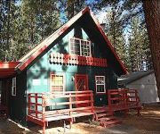
Adorable Tahoe Cabin Perfect Family Choice by RedAwning
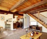
Lodge Pole Pine Cabin by RedAwning
Videos from this area
These are videos related to the place based on their proximity to this place.
South Lake Tahoe Rocks :-)
South Lake Tahoe is one of the most "happening" towns on earth at the most beautiful Lake in the World :-) Please share this video with your friends and family so they can check it out too!...
Winter Family Fun in South Lake Tahoe
From skiing and snowboarding to sleigh rides and ice skating, winter is fun for the whole family at Tahoe South! Plan your visit to Lake Tahoe at www.TahoeSouth.com today!
Snowboarding - Heavenly Powder Day - South Lake Tahoe, CA - April 2014
One of the best days of the season in early April at Heavenly.
Fall in South Lake Tahoe
Fall in South Lake Tahoe offers an explosion of colors - gold and yellow aspen leaves, brown bears, blue skies, and red and pink Kokanee salmon!
South Lake Tahoe Luxury Estate Vacation Rental
Brand new 2007 construction vacation home. Luxury features throughout the home. Blocks to Heavenly Valley Ski Resort and steps to miles of hiking and biking trails in acres of National Forest....
Sample the Sierra | South Lake Tahoe Farm to Fork Festival
A Farm to Fork Festival celebrating the best food, wine and art in the Sierra Nevada Region over Labor Day Weekend in South Lake Tahoe! TahoeChamber, the Lake Tahoe Visitors Authority, and...
Наши Роды в США South Lake Tahoe CA
Рожали 22 часа, вес 4 кг, девочка, блондинка)) Анастасия Роз Зуев.
South Lake Tahoe Vacation Rental Lighthouse Shore
Tahoe Vacation Home Location: South Lake Tahoe, Tahoe Keys Accommodations: Sleeps 12, 5 Bedroom, 4 Bathrooms This is one of the finest waterfront homes in the Tahoe Keys. It is in a private...
South Lake Tahoe - by motorcycle
Starting with the big Nevada casinos at Stateline, then crossing into California, passing the busy and expensive area of Heavenly Ski Resort and Edgewood Tahoe Golf Course. The town of South...
Videos provided by Youtube are under the copyright of their owners.
Attractions and noteworthy things
Distances are based on the centre of the city/town and sightseeing location. This list contains brief abstracts about monuments, holiday activities, national parcs, museums, organisations and more from the area as well as interesting facts about the region itself. Where available, you'll find the corresponding homepage. Otherwise the related wikipedia article.
South Lake Tahoe, California
South Lake Tahoe is the most populous city in El Dorado County, California, United States, in the Sierra Nevada Mountains. The population was 21,403 at the 2010 census, down from 23,609 at the 2000 census. The east end of the city, on the California-Nevada state line, is mainly geared towards tourism, with T-shirt shops, restaurants, hotels, and Heavenly Mountain Resort with the Nevada casinos just across the state line in Stateline, Nevada.
Zephyr Cove–Round Hill Village, Nevada
Zephyr Cove–Round Hill Village is a former census-designated place (CDP) in Douglas County, Nevada, United States. The population was 1,649 at the 2000 census. For the 2010 census, the area was split into the Zephyr Cove and Round Hill Village CDPs.
Stateline, Nevada
Stateline is a census-designated place (CDP) on the east shore of Lake Tahoe in Douglas County, Nevada, United States. The population was 842 at the 2010 census. The population swells considerably during the busy winter and summer seasons, due to the high number of hotel rooms and rental accommodations available.
Heavenly Mountain Resort
Heavenly Mountain Resort is a ski resort located on the California-Nevada border in South Lake Tahoe. It has 97 runs and 30 lifts that are spread between California and Nevada and four base facilities. The resort has 4,800 acres within its permit area, with approximately 33% currently developed for skiing, boasting the highest elevation of the Lake Tahoe area resorts with a peak elevation of 10,067 ft, and a peak lift-service elevation of 10,040 ft .
Zephyr Cove, Nevada
Zephyr Cove is a census-designated place (CDP) in Douglas County, Nevada, United States. The population was 565 at the 2010 census. Prior to 2010 it was part of the Zephyr Cove–Round Hill Village CDP.
Harrah's Lake Tahoe
Harrah's Lake Tahoe, is a resort casino, in South Lake Tahoe, at Stateline, Nevada. It is branded with the name of its former owner William Fisk Harrah and owned by Caesars Entertainment Corp.. The 18-story tower and 525 rooms, plus 65,000 sq ft of casino make it one of the largest resorts at South Lake Tahoe.
Lake Tahoe Basin Management Unit
The Lake Tahoe Basin is a geologic feature of the northern Sierra Nevada. Aside from its principal feature, Lake Tahoe, much of the land bordering the lake is administered by the United States government as the Lake Tahoe Basin Management Unit, a patchwork of public and private lands.
MontBleu
MontBleu Resort Casino & Spa, located in Stateline, Nevada, is owned and operated by Tropicana Entertainment. The property includes a 40,000 sq ft casino and a 437-room hotel on a 21-acre site. Montbleu is home to the AAA 4-Diamond Award Winning restaurant Ciera Steak + Chophouse.
Harveys Lake Tahoe
Harveys Lake Tahoe is a resort located in Stateline, Nevada. The hotel has 740 rooms and suites, as well as six restaurants, and a casino with 87,500 square feet of space. The hotel also has a wedding chapel, pool, convention center, and a full-service health club. It is owned by Caesars Entertainment, formerly Harrah's Entertainment.
Horizon Casino Resort
Horizon Casino Resort is a resort casino in Stateline, Nevada. Formerly the Sahara Tahoe and High Sierra Resorts, it is one of five major casino hotels in Stateline.
Lake Tahoe Airport
Lake Tahoe Airport is a public airport three miles southwest of South Lake Tahoe, in El Dorado County, California, USA. This general aviation airport covers 348 acres and has one runway. The airport is sometimes called Tahoe Valley Airport. During the early 1960s, this high elevation airport located in the Sierra Nevada Mountains just south of Lake Tahoe had few scheduled airline flights which included Lockheed L-049 Constellation prop airliner service flown by Paradise Airlines.
South Tahoe High School
South Tahoe High School (STHS) is a public secondary school in South Lake Tahoe, California that is part of the Lake Tahoe Unified School District. The school mascot is the Viking, and the school's colors are blue and gold. South Tahoe High School has an average attendance of 1,300 students and features an open-air campus. In 2004, the school underwent a massive renovation which featured the installation of heated sidewalks and a renovation of the offices.
KTHO
KTHO is a radio station broadcasting a classic rock format. Licensed to South Lake Tahoe, California, USA, it serves the Lake Tahoe Basin-Carson City-Carson Valley-Reno area, and simulcasts on South Lake Tahoe-based FM translator K241BK (96.1 FM). The station is currently owned by International Aerospace Solutions, Inc. , a company owned by long-time Southern California broadcaster Darrell Wampler, and features "Local Talk and Classic Rock" with network news from ABC Radio.
Al Tahoe, California
Al Tahoe is a former unincorporated community now incorporated in South Lake Tahoe in El Dorado County, California. It lies at an elevation of 6253 feet (1906 m). The community was named for the Al Tahoe Hotel, which was built in 1907 by Almerin R. Sprague.
Bijou, California
Bijou (formerly, Taylors Landing and Taylor's Landing) is a former unincorporated community now incorporated in South Lake Tahoe in El Dorado County, California. It lies at an elevation of 6243 feet (1903 m). The place was founded in 1864 by Almon M. Taylor, after whom it was named. The name was changed to Bijou with the arrival of the post office in 1888. The post office operated until 1967.
Bijou Park, California
Bijou Park is a former unincorporated community now incorporated in South Lake Tahoe in El Dorado County, California. It is located east of Bijou, at an elevation of 6237 feet (1901 m).
Camp Richardson, California
Camp Richardson is an unincorporated community in El Dorado County, California. It lies at an elevation of 6250 feet (1905 m). A post office operated at Camp Richardson from 1927 to 1973, with a closure from 1964 to 1965. The place is named after its first postmaster, Alonzo L. Richardson.
Kiva Beach, California
Kiva Beach is an unincorporated community in El Dorado County, California. It lies at an elevation of 6240 feet (1902 m).
Lake Valley, California
Lake Valley (formerly, Bigler Lake Valley) is an unincorporated community in El Dorado County, California. It extends for 8 miles along the Upper Truckee River from Lake Tahoe to Meyers, at an elevation of 6207 feet (1892 m). The place was founded in or before 1853.
Stateline, California
Stateline (formerly, Lakeside and Laphams) is a former unincorporated community in El Dorado County, California, now incorporated into South Lake Tahoe, California. It lies at an elevation of 6279 feet (1914 m). As its name suggests, it is at the border with Nevada. A post office operated at Stateline from 1901. The name Laphams commemorates William W. Lapham who opened a hotel here in the 1850s.
Tahoe Keys, California
Tahoe Keys is a former unincorporated community in El Dorado County, California, now incorporated in South Lake Tahoe. It lies at an elevation of 6240 feet (1902 m). Built in the 1960s, the community consists of over 1500 homes adjacent to a series of canals. Its construction destroyed half of the Upper Truckee Marsh, the primary filter for river water entering the lake, and has since been called the most environmentally damaging intrusion on lakeshore in Lake Tahoe's human history.
Tahoe Valley, California
Tahoe Valley is a former unincorporated community in El Dorado County, California, now incorporated into South Lake Tahoe. It lies at an elevation of 6270 feet (1911 m). Tahoe Valley is about the junction of U.S. Route 50 and California State Route 89.
Tallac Village, California
Tallac Village is an unincorporated community in El Dorado County, California. It lies at an elevation of 6263 feet (1909 m).
KOWL
KOWL (1490 AM, "NewsTalk 1490AM") is a radio station licensed to serve South Lake Tahoe, California, USA. The station, established in 1956, is currently owned by Cherry Creek Radio and the broadcast license is held by CCR-Lake Tahoe IV, LLC.
KRLT
KRLT is a radio station broadcasting an Adult Top 40 format featuring today's rock-based hits along with the best rock-based hits from the last 3 decades - KRLT 93-9 THE LAKE - HITS THAT ROCK! The Monday thru Friday On-Air line-up: 6-10am Howie Nave, 10am-2pm Steve Harness, 2-7pm Stacy Lynn, 7-10pm Dona Baxter. Licensed to South Lake Tahoe, California, USA, it serves the Lake Tahoe, California/Nevada, area. The station is owned by CCR-LAKE TAHOE IV, LLC - Joe Schwartz/CEO.


