Safety Score: 2,7 of 5.0 based on data from 9 authorites. Meaning we advice caution when travelling to United States.
Travel warnings are updated daily. Source: Travel Warning United States. Last Update: 2024-05-05 08:24:42
Explore Emerald Bay
Emerald Bay in El Dorado County (California) is a city in United States about 2,292 mi (or 3,689 km) west of Washington DC, the country's capital.
Local time in Emerald Bay is now 03:10 PM (Sunday). The local timezone is named America / Los Angeles with an UTC offset of -7 hours. We know of 11 airports in the vicinity of Emerald Bay, of which 5 are larger airports. The closest airport in United States is Lake Tahoe Airport in a distance of 7 mi (or 12 km), South-East. Besides the airports, there are other travel options available (check left side).
There is one Unesco world heritage site nearby. It's Yosemite National Park in a distance of 124 mi (or 200 km), South-East. Also, if you like golfing, there are multiple options in driving distance. We found 6 points of interest in the vicinity of this place. If you need a place to sleep, we compiled a list of available hotels close to the map centre further down the page.
Depending on your travel schedule, you might want to pay a visit to some of the following locations: Minden, Carson City, Virginia City, Reno and Placerville. To further explore this place, just scroll down and browse the available info.
Local weather forecast
Todays Local Weather Conditions & Forecast: 0°C / 33 °F
| Morning Temperature | -6°C / 22 °F |
| Evening Temperature | -0°C / 32 °F |
| Night Temperature | -4°C / 25 °F |
| Chance of rainfall | 0% |
| Air Humidity | 70% |
| Air Pressure | 1013 hPa |
| Wind Speed | Moderate breeze with 12 km/h (8 mph) from North-East |
| Cloud Conditions | Broken clouds, covering 51% of sky |
| General Conditions | Light snow |
Sunday, 5th of May 2024
5°C (40 °F)
0°C (32 °F)
Overcast clouds, gentle breeze.
Monday, 6th of May 2024
6°C (42 °F)
3°C (37 °F)
Sky is clear, light breeze, few clouds.
Tuesday, 7th of May 2024
8°C (46 °F)
4°C (40 °F)
Sky is clear, light breeze, clear sky.
Hotels and Places to Stay
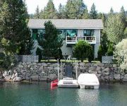
1873 Venice Drive by RedAwning
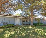
2073 Traverse Court by RedAwning
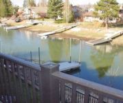
2081 Venice 277 by RedAwning
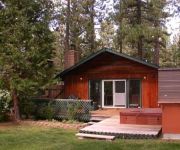
780 Gardner Lane by RedAwning
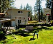
PINE CONE ACRE MOTEL
Videos from this area
These are videos related to the place based on their proximity to this place.
Emerald Bay - Lake Tahoe
Emerald Bay - Lake Tahoe - http://visitrenotahoe.com/video/area/ Appreciate the grandeur and subtleties of Reno, Nevada. Experience never-before-seen-images featuring the natural beauty...
Emerald Bay - Lake Tahoe with DJI Phantom 2 Drone
A quick compilation of some aerial shots with a DJI Phantom 2 and Gopro 3+ over Emerald Bay at Lake Tahoe. January 24, 2015.
South Lake Tahoe to Emerald Bay - Scenic Drive
A scenic drive on California Highway 89 (Emerald Bay Road) from South Lake Tahoe, California to Emerald Bay Download the original high resolution file at: http://vimeo.com/download/video:366507...
Emerald Bay, Lake Tahoe California
Fannette Island, Emerald Bay, the Tahoe Queen paddle-wheeler boat and a nice view of boats enjoying a gorgeous day on Lake Tahoe.
Emerald Bay Tea House, Lake Tahoe California
A flight to Fanette Island's Tea House using a QAV500 quadcopter. 4/12/2014 38.95401, -120.10062 No edits takeoff to landing using a fixed camera. http://www.flickr.com/photos/roadtripfpv/...
Photographer, Jon Paul, shares a stormy morning photo experience at Emerald Bay, Lake Tahoe
Large format landscape photographer, Jon Paul, shares a stormy morning photo experience at Emerald Bay, Lake Tahoe. With his 8x10 film camera set up, Jon Paul shares details of his subject...
DJI Phantom/Gopro Hero 3 Aerial Video Of Emerald Bay, Lake Tahoe
Brought my Phantom to Tahoe last week to get some nice aerial videos. This one was taken above Emerald Bay, California. Definitely need to get a gimbal for my rig as my video didn't come out...
Timelapse shot of the night sky over Emerald Bay, Nevada.
Cinematography equipment: http://www.videoslider.com Kickstarter: https://www.kickstarter.com/projects/dortch/autobot-timelapse-and-video-slider-tough-and-intel Purchase this clip here: (http://www...
Emerald Bay n Vikingsholms in South Lake Tahoe Northern California USA by Jazevox
Here is a quick video of the beautiful deep blue lake in Lake Tahoe overlooking Emerald Bay and Vikingsholms Island around Vikingsholms Trail Trailhead. Lake Tahoe is located at northern CA...
Videos provided by Youtube are under the copyright of their owners.
Attractions and noteworthy things
Distances are based on the centre of the city/town and sightseeing location. This list contains brief abstracts about monuments, holiday activities, national parcs, museums, organisations and more from the area as well as interesting facts about the region itself. Where available, you'll find the corresponding homepage. Otherwise the related wikipedia article.
Fannette Island
Fannette Island is the only island in Lake Tahoe, California/Nevada, United States. It lies within Emerald Bay. Over a long period of time, it was called many different names, including Coquette, Fanette, Baranoff, Dead Man's, Hermit's, and Emerald Isle. The island contains what is left of "Tea House", a building constructed by the owner of Vikingsholm, Mrs. Lora Josephine Knight. Fannette Island, along with Vikingsholm and Emerald Bay, is a part of Emerald Bay State Park.
Vikingsholm
Vikingsholm is a 38-room mansion on the shore of Emerald Bay at Lake Tahoe, in El Dorado County, California, U.S. , and on the National Register of Historic Places
Maggies Peak
Maggie's Peak is a mountain in the Sierra Nevada mountain range, to the west of Lake Tahoe. It is located in the Desolation Wilderness in El Dorado County, California. This mountain overlooks Lake Tahoe and affords very good views of the lake.
Eagle Falls Trailhead
The Eagle Falls Trailhead or Eagle Lake Trailhead is located on HWY 89 a few miles north of South Lake Tahoe, CA at Emerald Bay State Park on the western shore of Lake Tahoe. Some of the destinations most accessed by the trailhead are Eagle Lake as well as the Velma Lakes and the rest of the Desolation Wilderness. This trailhead provides great winter access to the wilderness. GPS Coords: {{#invoke:Coordinates|coord}}{{#coordinates:38|57|7|N|120|6|43|W|region:US-CA | |name= }} (estimated)
Spring Creek, California
Spring Creek is an unincorporated community in El Dorado County, California. It lies at an elevation of 6339 feet (1932 m).
Eagle Lake (Desolation Wilderness)
Eagle Lake is a backcountry lake in the Sierra Nevada mountain range, to the west of Lake Tahoe in the Desolation Wilderness. It can be reached by hiking west out of the Eagle Lake trailhead on HWY 89 at Emerald Bay State Park.
Emerald Bay, El Dorado County, California
Emerald Bay is an unincorporated community in El Dorado County, California. It lies at an elevation of 6319 feet (1926 m).
Frosts, California
Frosts is a former settlement in El Dorado County, California. It was located 3 miles south-southeast of Meeks, at an elevation of 6237 feet (1901 m). It still appeared on maps as of 1895.


