Safety Score: 2,7 of 5.0 based on data from 9 authorites. Meaning we advice caution when travelling to United States.
Travel warnings are updated daily. Source: Travel Warning United States. Last Update: 2024-05-18 08:26:29
Delve into Rubicon Properties
Rubicon Properties in El Dorado County (California) is located in United States about 2,292 mi (or 3,689 km) west of Washington DC, the country's capital town.
Current time in Rubicon Properties is now 02:13 PM (Saturday). The local timezone is named America / Los Angeles with an UTC offset of -7 hours. We know of 11 airports close to Rubicon Properties, of which 5 are larger airports. The closest airport in United States is Lake Tahoe Airport in a distance of 11 mi (or 17 km), South-East. Besides the airports, there are other travel options available (check left side).
There is one Unesco world heritage site nearby. It's Yosemite National Park in a distance of 128 mi (or 205 km), South-East. Also, if you like playing golf, there are some options within driving distance. We encountered 6 points of interest near this location. If you need a hotel, we compiled a list of available hotels close to the map centre further down the page.
While being here, you might want to pay a visit to some of the following locations: Minden, Carson City, Virginia City, Reno and Placerville. To further explore this place, just scroll down and browse the available info.
Local weather forecast
Todays Local Weather Conditions & Forecast: 18°C / 65 °F
| Morning Temperature | 9°C / 47 °F |
| Evening Temperature | 15°C / 59 °F |
| Night Temperature | 8°C / 47 °F |
| Chance of rainfall | 0% |
| Air Humidity | 25% |
| Air Pressure | 1011 hPa |
| Wind Speed | Fresh Breeze with 13 km/h (8 mph) from East |
| Cloud Conditions | Clear sky, covering 0% of sky |
| General Conditions | Sky is clear |
Saturday, 18th of May 2024
15°C (58 °F)
6°C (43 °F)
Scattered clouds, fresh breeze.
Sunday, 19th of May 2024
12°C (54 °F)
6°C (44 °F)
Light rain, moderate breeze, clear sky.
Monday, 20th of May 2024
11°C (52 °F)
7°C (44 °F)
Sky is clear, moderate breeze, clear sky.
Hotels and Places to Stay
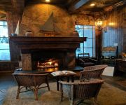
West Shore Cafe and Inn
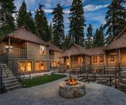
CEDAR CREST COTTAGES
Videos from this area
These are videos related to the place based on their proximity to this place.
HD Video! Jeeps on The Rubicon Trail Tahoe to Observation Point plus Helicopter Flyover
This isn't to show what good drivers we are or how tough this part of the trail is. After all the more difficult sections of The Rubicon are on the western half. I hope you watch this and think...
The kids decorate cookies
The kids baked Valentine's cookies the day before and now they got a chance to decorate them.
CampgroundViews.com - Sugar Pine Point State Park Tahoma California CA Campground
http://www.CampgroundViews.com takes user submitted videos combined with professional editing to provide tent and RV campers with a first person view of a campground or RV park. Sugar Pine...
Starting Down Desolation Trail, Meeks Bay Trail Head: Backpacking Tahoe to Whitney
This video starts your Tahoe to Whitney backpacking trip at the Meeks Bay Trail Head. This is the trail head for the Desolation Trail into the Desolation Wilderness. This is also the start...
Lakefront Alpenglow Meeks Bay - Rubicon Bay, California-2.wmv
See the Alpenglow from the end of this private pier on the West Shore, Lake Tahoe, Meeks Bay, Rubicon Bay, California Lakefront home. This is a million dollar view!
Videos provided by Youtube are under the copyright of their owners.
Attractions and noteworthy things
Distances are based on the centre of the city/town and sightseeing location. This list contains brief abstracts about monuments, holiday activities, national parcs, museums, organisations and more from the area as well as interesting facts about the region itself. Where available, you'll find the corresponding homepage. Otherwise the related wikipedia article.
Rubicon Peak
Rubicon Peak is a mountain in the Sierra Nevada mountain range to the west of Lake Tahoe in the Desolation Wilderness in El Dorado County, California.
Frosts, California
Frosts is a former settlement in El Dorado County, California. It was located 3 miles south-southeast of Meeks, at an elevation of 6237 feet (1901 m). It still appeared on maps as of 1895.
Glenridge Park, California
Glenridge Park is an unincorporated community in El Dorado County, California. It lies at an elevation of 6352 feet (1936 m).
Meeks Bay, California
Meeks Bay (formerly, Meigs Bay, Micks Bay, and Murphys) is an unincorporated community in El Dorado County, California. It lies on Lake Tahoe at the mouth of Meeks Creek, at an elevation of 6240 feet (1902 m). The place is named for John Meeks, who owned the land. The Meeks brothers baled 25 tons of wild hay in the meadows at the mouth of Meeks Creek in 1862. A post office operated at Meeks Bay from 1929 to 1972.


