Safety Score: 2,7 of 5.0 based on data from 9 authorites. Meaning we advice caution when travelling to United States.
Travel warnings are updated daily. Source: Travel Warning United States. Last Update: 2024-05-06 08:04:52
Delve into Echo Lake
Echo Lake in El Dorado County (California) is located in United States about 2,291 mi (or 3,688 km) west of Washington DC, the country's capital town.
Current time in Echo Lake is now 01:30 AM (Monday). The local timezone is named America / Los Angeles with an UTC offset of -7 hours. We know of 11 airports close to Echo Lake, of which 5 are larger airports. The closest airport in United States is Lake Tahoe Airport in a distance of 5 mi (or 8 km), North-East. Besides the airports, there are other travel options available (check left side).
There is one Unesco world heritage site nearby. It's Yosemite National Park in a distance of 116 mi (or 187 km), South-East. Also, if you like playing golf, there are some options within driving distance. We encountered 6 points of interest near this location. If you need a hotel, we compiled a list of available hotels close to the map centre further down the page.
While being here, you might want to pay a visit to some of the following locations: Minden, Carson City, Virginia City, Reno and Placerville. To further explore this place, just scroll down and browse the available info.
Local weather forecast
Todays Local Weather Conditions & Forecast: 5°C / 40 °F
| Morning Temperature | -2°C / 28 °F |
| Evening Temperature | 4°C / 40 °F |
| Night Temperature | 0°C / 32 °F |
| Chance of rainfall | 0% |
| Air Humidity | 85% |
| Air Pressure | 1017 hPa |
| Wind Speed | Gentle Breeze with 8 km/h (5 mph) from North-East |
| Cloud Conditions | Overcast clouds, covering 85% of sky |
| General Conditions | Overcast clouds |
Monday, 6th of May 2024
6°C (42 °F)
3°C (37 °F)
Sky is clear, light breeze, few clouds.
Tuesday, 7th of May 2024
8°C (46 °F)
4°C (40 °F)
Sky is clear, light breeze, clear sky.
Wednesday, 8th of May 2024
8°C (47 °F)
6°C (43 °F)
Sky is clear, moderate breeze, clear sky.
Hotels and Places to Stay
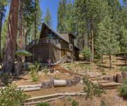
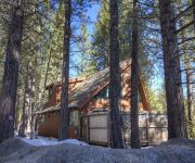
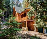
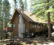
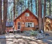
Glen Eagles Retreat by RedAwning
Next to National Forest by RedAwning Cabin with Hot Tub
The Tahoe Moose Lodge by RedAwning
0665 Yucatan by RedAwning
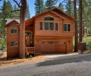
Tahoe Tree House by RedAwning
Hank Monk Chalet by RedAwning
1800 High Meadows Trail by RedAwning
High Meadow Lodge by RedAwning
3 BR Cabin in Montgomery Estates Neighborhood By RedAwning
Lindberg Chalet by RedAwning
Videos from this area
These are videos related to the place based on their proximity to this place.
Echo Lake Boat Launch and Marina. Tahoe area
By Timothy Ross White www.tahoefilmscout.com Lower Echo Lake Boat Launch and Marina. October 2012. Please, subscribe, comment and like! Thank you!
Echo Summit and Lake Trailheads
Video at the Echo Lake and Echo Summit backpacking trailheads. Entry into the Meiss Roadless Area South to the Carson Pass past Showers Lake. For more info, see the Tahoe to Whitney trail guide:.
Snowstorm and traffic at Echo Summit, on US50 outside of South Lake Tahoe.
The series of storms starting February 7th halted California's slide into the worst draught in recorded history. But, of course, it caused many headaches along with the blessings. Climbing...
Ralston Peak and Echo Lakes Skiing and Kite/Tarp Skiing on Echo Lakes (Lake Tahoe Area, March 2012)
After a rather short hike from Echo SNO Park we camped at Tamarack Lake and had an awesome party to celebrate Sergei's birthday. A storm came in around 3AM, but we decided to head for the peak.
The Bear's Den-Lake Tahoe Vacation Rental
Hello from Beautiful Lake Tahoe! The owners created the "Bears Den" at Lake Tahoe for the most discriminating vacationer and designed it as if they were checking in (and they are very picky)....
Echo Summit Fast
Fast forward drive over Echo Summit. Filmed on my GoPro as we drove on Hwy 50 in to South Lake Tahoe.
Time lapse 11 ft Packed Snow igloo build At Echo Lakes, Ca. Grand shelters Ice Box tool
5 Guys Build an 11 ft Packed snow Igloo at Echo Lakes CA on January 19th,2015 with the Grand shelters Ice Box igloo kit after a failed attempt in different snow 500 feet away.
Lincoln Log Cabin
Rarely used cabin in the woods! Only 3/4 of a mile from Sierra-at-Tahoe ski resort. Large 3 bedroom cabin with 2 full bathrooms, on almost 1 acre of river front land in the private gated community...
Christmas Valley fly-in movie (South Lake Tahoe, CA)
Check us out at laketahoerealestateblog.com for more fun and information about South Lake Tahoe. Video here is from our neighborhood fly-in series, where we fly you into every South Lake...
Videos provided by Youtube are under the copyright of their owners.
Attractions and noteworthy things
Distances are based on the centre of the city/town and sightseeing location. This list contains brief abstracts about monuments, holiday activities, national parcs, museums, organisations and more from the area as well as interesting facts about the region itself. Where available, you'll find the corresponding homepage. Otherwise the related wikipedia article.
Echo Lake (California)
Echo Lake, is the name of a glacial lake—summer reservoir located in El Dorado County, eastern California, United States.
Echo Lake, California
Echo Lake (formerly, Echo) is a small unincorporated community in El Dorado County, California, United States, along U.S. Highway 50 in the mountains of the Sierra Nevada. It is 1.5 miles north-northwest of Echo Summit. Echo Lake's nearest neighboring town is Little Norway. The ZIP code is 95721. The community is inside area code 530. The elevation of Echo Lake is 7539 feet (2298 m). The average snowpack per year is 10.5 feet, with over 15 feet of snow depositing in certain areas.
Angora Fire
The Angora Fire was a wind driven fire that started near North Upper Truckee Road subdivision near Angora Lakes, Fallen Leaf Lake, Echo Lake and South Lake Tahoe, California around 2:15 PM on Sunday, June 24, 2007 as a result of an illegal campfire. As of July 2, 2007, the fire was 100% contained, and 100% control (all interior fires extinguished) was achieved on July 10. The fire burned 3,100 acres (12.5 km²), destroyed 242 residences and 67 commercial structures, and damaged 35 other homes.
Phillips, California
Phillips (formerly, Phillip's and Vade Post Office) is a small unincorporated community in El Dorado County, California. It is located on the South Fork of the American River, 2.5 miles west of Echo Summit, at an elevation of 6,873 feet (2095 m). It is the site of the Sierra-at-Tahoe ski resort. The ZIP code is 95720. The community is inside area code 530. Joseph Wells Davis Phillips began cattle ranching here in 1859, and opened a hotel in 1863.
Little Norway, California
Little Norway (formerly, Phillips Station and Vade) is a small unincorporated community in El Dorado County, California. It is located 9 miles west of Meyers, at an elevation of 7326 feet (2233 m). The ZIP code is 95721. The community is inside area code 530. A post office was established at Little Norway in 1961.
Meyers, California
Meyers (formerly, Yanks, Yank's Station, and Tahoe Paradise) is a small unincorporated community in El Dorado County, California, United States, along U.S. Route 50 in the foothills of the Sierra Nevada south of South Lake Tahoe in the Lake Tahoe area. It lies at an elevation of 6352 feet (1936 m). Established in 1851 Meyers started out as a stagecoach stop, trading post and Pony Express station. The town is now registered as California Historical Landmark #708.
Nebelhorn, California
Nebelhorn (also, Nebenhorn) is a small unincorporated community in El Dorado County, California, United States. It lies at an elevation of 7401 feet (2256 m). Nebelhorn is just southwest of Echo Summit. The ZIP code is 95735. The community is inside area code 530.
Echo Summit
Echo Summit is a mountain pass (also known as Johnson Pass) located in eastern El Dorado County, California, USA. At an elevation of 7,382 ft, it is the highest point on U.S. Route 50 in California, which traverses it at postmile 66.48 between Twin Bridges and Meyers, south of Lake Tahoe. The "Sierra Nevada Southern Route" (aka the "Pioneer Route") of the Lincoln Highway, the first road across the United States of America, was routed over Echo Summit in 1913.


