Safety Score: 2,7 of 5.0 based on data from 9 authorites. Meaning we advice caution when travelling to United States.
Travel warnings are updated daily. Source: Travel Warning United States. Last Update: 2024-05-05 08:24:42
Delve into Clinton
Clinton in Amador County (California) is a town located in United States about 2,332 mi (or 3,753 km) west of Washington DC, the country's capital town.
Time in Clinton is now 09:13 AM (Sunday). The local timezone is named America / Los Angeles with an UTC offset of -7 hours. We know of 9 airports closer to Clinton, of which 3 are larger airports. The closest airport in United States is Oakdale Airport in a distance of 43 mi (or 70 km), South. Besides the airports, there are other travel options available (check left side).
Also, if you like the game of golf, there are some options within driving distance. We saw 1 points of interest near this location. In need of a room? We compiled a list of available hotels close to the map centre further down the page.
Since you are here already, you might want to pay a visit to some of the following locations: Jackson, San Andreas, Placerville, Sonora and Auburn. To further explore this place, just scroll down and browse the available info.
Local weather forecast
Todays Local Weather Conditions & Forecast: 11°C / 52 °F
| Morning Temperature | 4°C / 40 °F |
| Evening Temperature | 13°C / 56 °F |
| Night Temperature | 5°C / 41 °F |
| Chance of rainfall | 1% |
| Air Humidity | 52% |
| Air Pressure | 1017 hPa |
| Wind Speed | Light breeze with 5 km/h (3 mph) from East |
| Cloud Conditions | Broken clouds, covering 50% of sky |
| General Conditions | Light rain |
Sunday, 5th of May 2024
14°C (57 °F)
8°C (47 °F)
Overcast clouds, light breeze.
Monday, 6th of May 2024
17°C (62 °F)
9°C (49 °F)
Sky is clear, gentle breeze, clear sky.
Tuesday, 7th of May 2024
17°C (62 °F)
12°C (53 °F)
Sky is clear, gentle breeze, clear sky.
Hotels and Places to Stay
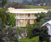
The Hotel Leger
Videos from this area
These are videos related to the place based on their proximity to this place.
Days of '49 Wagon Train Parade, Man Street, Jackson
The finale of the The Diamond Jubilee Wagon train commemorating the founding of Amador County in 1854 concludes with a parade on Main Street, Jackson on Sunday.
CampgroundViews.com - Jackson Rancheria RV Park Jackson California CA Casino
http://www.CampgroundViews.com takes user submitted videos combined with professional editing to provide tent and RV campers with a first person view of a campground or RV park. Jackson ...
Jackson wheels restoration
Silent home movie from approximately 1960 showing workers helping to restore one of the gold mine tailing wheels in Jackson, California. The original label on the film named Joe Sheiber and...
Trike ride in Jackson, CA from Rayley's to Mel's Diner
This is my Trike Recumbent out for a January winter, LOL ride it was actually warm so I went for a ride I am using my new GoPro Silver edition camera. Yes I do live here in Jackson, CA.
Chiropractor Jackson CA
Chiropractor Jackson CA Who can you call for a chiropractor in Jackson Ca? Are you looking for professional chiropractic care. Please consider our excellent chiropractor in Jackson for your...
Aristocrat All Stars Slot: Mystic Mermaid Bonus
spin, Jackson Rancheria @Jackson Look for #ThrowBackThursdays classic slots and #BigWinFridays every week!
Bally Alice and the Scattered Hearts Slot: Scattered Hearts Bonus
spin, Jackson Rancheria @Jackson Look for #ThrowBackThursdays classic slots and #BigWinFridays every week!
Veterans Day Parade Amador 2014
The American Legion Post 108 in Amador County, CA held its Third Annual Veterans Day Parade November 11, 2014 along Main Street in Jackson. Thanks to David Burrows for taking the video.
George Silva Lonesome Tonight
Elvis - Lonesome! This is the best Elvis impersonator I have ever seen or heard!
Videos provided by Youtube are under the copyright of their owners.
Attractions and noteworthy things
Distances are based on the centre of the city/town and sightseeing location. This list contains brief abstracts about monuments, holiday activities, national parcs, museums, organisations and more from the area as well as interesting facts about the region itself. Where available, you'll find the corresponding homepage. Otherwise the related wikipedia article.
Pine Grove, Amador County, California
Pine Grove is a census-designated place in Amador County, California. It lies at an elevation of 2513 feet (766 m). The population was 2,219 at the 2010 census. It is located at {{#invoke:Coordinates|coord}}{{#coordinates:38|24|47|N|120|39|32|W| | |name= }}, along State Route 88. The community is in ZIP code 95665 and area code 209. The current boundaries of Pine Grove include the former mining towns of Clinton and Irishtown. The town also is home to Indian Grinding Rock State Historic Park.
Clinton, California
Clinton (formerly, Sarahville, Sarahsville, and Lincoln) is an unincorporated community in Amador County, California. It is located 2.5 miles south of Pine Grove, at an elevation of 1972 feet (601 m). Clinton was the center of a placer mining community during the 1850s and of quartz mining as late as the 1880s. This town once decided Amador County elections as its votes were always counted last. Clinton is registered as a California Historical Landmark.
Milligan District, California
Milligan District (also, Slabtown and Hoodsville) is a former settlement in Amador County, California. It lay at an elevation of 1601 feet (488 m).
Pine Acres, California
Pine Acres is an unincorporated community in Amador County, California. It lies at an elevation of 2684 feet (818 m).
Armstrong's Mill, California
Armstrong's Mill is a former settlement in Amador County, California. It was 1 mile southwest of Pine Grove.


