Safety Score: 2,7 of 5.0 based on data from 9 authorites. Meaning we advice caution when travelling to Thailand.
Travel warnings are updated daily. Source: Travel Warning Thailand. Last Update: 2024-04-28 08:22:10
Discover Ban Doi Sa-ngo Bon
Ban Doi Sa-ngo Bon in Changwat Chiang Rai is a city in Thailand about 456 mi (or 734 km) north of Bangkok, the country's capital city.
Local time in Ban Doi Sa-ngo Bon is now 10:26 PM (Sunday). The local timezone is named Asia / Bangkok with an UTC offset of 7 hours. We know of 9 airports in the vicinity of Ban Doi Sa-ngo Bon, of which one is a larger airport. The closest is airport we know is Tachileik Airport in Myanmar in a distance of 11 mi (or 18 km). The closest airport in Thailand is Chiang Rai International Airport in a distance of 28 mi (or 18 km), North-West. Besides the airports, there are other travel options available (check left side).
Looking for a place to stay? we compiled a list of available hotels close to the map centre further down the page.
When in this area, you might want to pay a visit to some of the following locations: Chiang Saen, Mae Sai, Mae Fa Luang, Doi Luang and Mae Chan. To further explore this place, just scroll down and browse the available info.
Local weather forecast
Todays Local Weather Conditions & Forecast: 41°C / 106 °F
| Morning Temperature | 23°C / 74 °F |
| Evening Temperature | 34°C / 93 °F |
| Night Temperature | 31°C / 88 °F |
| Chance of rainfall | 0% |
| Air Humidity | 14% |
| Air Pressure | 1005 hPa |
| Wind Speed | Light breeze with 5 km/h (3 mph) from East |
| Cloud Conditions | Clear sky, covering 0% of sky |
| General Conditions | Sky is clear |
Monday, 29th of April 2024
41°C (107 °F)
30°C (86 °F)
Sky is clear, light breeze, clear sky.
Tuesday, 30th of April 2024
42°C (107 °F)
31°C (87 °F)
Sky is clear, gentle breeze, clear sky.
Wednesday, 1st of May 2024
42°C (108 °F)
31°C (87 °F)
Sky is clear, gentle breeze, clear sky.
Hotels and Places to Stay
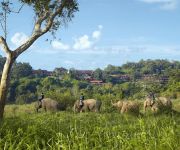
Anantara Golden Triangle Elephant Camp & Resort
Four Seasons Tented Camp
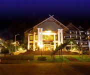
THE IMPERIAL GOLDEN TRIANGLE RESORT
Serene at Chiang Rai
Videos from this area
These are videos related to the place based on their proximity to this place.
Mae Sai, northernmost town of Thailand
a border-crossing point to Myanmar (Burma) http://thailandweihnacht2010.blogspot.com/
Running 999 Km for Charity Nam Nao Thailand National Park
Running in Nam Nao national Park. It is located high on a mountain and there is wild elephants. So you are actually running with the risk of running into a wild elephant but I did not sadly....
Puppy with distemper infection visited by Running 999 km for charity
These dogs have distemper infection and was brought from Bangkok all the way to north province of Lampang to the dog temple shelter run by a monk. They do not have a medical facility and we...
A visit to Chiang Saen - Temples and other sights
A visit to the town and several of its temples. January 2012.
Riding a motorbike, border town Tachileik
Motorcycle taxi in border town. Myanmar police working hard.
タイランド最北端の国境風景 Boarder Scene in Northern Most of Thailand
小川を挟んで2つの国が接している感覚は日本人には分かりません。川の手前がメーサイの町、向こうがミャンマーのタチレクの町。 Small river...
Videos provided by Youtube are under the copyright of their owners.


