Safety Score: 2,5 of 5.0 based on data from 9 authorites. Meaning we advice caution when travelling to Ireland.
Travel warnings are updated daily. Source: Travel Warning Ireland. Last Update: 2024-04-27 08:23:39
Discover Dalkey
Dalkey in Dún Laoghaire-Rathdown (Leinster) with it's 6,622 citizens is a city in Ireland about 2,694 mi (or 4,335 km) north-west of Qeshlaq, the country's capital city.
Local time in Dalkey is now 05:02 AM (Sunday). The local timezone is named Europe / Dublin with an UTC offset of one hour. We know of 9 airports in the vicinity of Dalkey, of which 4 are larger airports. The closest airport in Ireland is Dublin Airport in a distance of 12 mi (or 19 km), North-West. Besides the airports, there are other travel options available (check left side).
There is one Unesco world heritage site nearby. It's Brú na Bóinne - Archaeological Ensemble of the Bend of the Boyne in a distance of 36 mi (or 59 km), North-East. Also, if you like golfing, there are a few options in driving distance. We discovered 1 points of interest in the vicinity of this place. Looking for a place to stay? we compiled a list of available hotels close to the map centre further down the page.
When in this area, you might want to pay a visit to some of the following locations: Dublin, Swords, Tallaght, Wicklow and Naas. To further explore this place, just scroll down and browse the available info.
Local weather forecast
Todays Local Weather Conditions & Forecast: 11°C / 52 °F
| Morning Temperature | 3°C / 37 °F |
| Evening Temperature | 11°C / 51 °F |
| Night Temperature | 9°C / 48 °F |
| Chance of rainfall | 0% |
| Air Humidity | 54% |
| Air Pressure | 1006 hPa |
| Wind Speed | Gentle Breeze with 8 km/h (5 mph) from North-East |
| Cloud Conditions | Scattered clouds, covering 42% of sky |
| General Conditions | Light rain |
Monday, 29th of April 2024
10°C (50 °F)
9°C (48 °F)
Moderate rain, moderate breeze, overcast clouds.
Tuesday, 30th of April 2024
12°C (53 °F)
8°C (47 °F)
Heavy intensity rain, fresh breeze, overcast clouds.
Wednesday, 1st of May 2024
11°C (52 °F)
9°C (48 °F)
Light rain, moderate breeze, broken clouds.
Hotels and Places to Stay
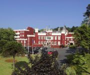
Fitzpatrick Castle
Royal Marine
Haddington House
Lynden B&B
Rochestown Lodge Hotel & Spa Dublin
Brookville Guest House
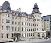
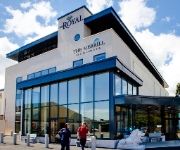
Royal Hotel & Merrill Leisure Centre
Esplanade
The Martello Hotel
Videos from this area
These are videos related to the place based on their proximity to this place.
Coliemore Harbour and Dillons Park Dalkey
from the corner note cafe to Coliemore Harbour, Dalkey Island, Dylans Park and back to Dalkey village.
Were you there in Joe Keegan's House Party 1992 ? /2
Captured Videos 20061992 00000 Can you see how young we all were ????? And the sound was soooo loud you could here it in the village :0)
Travelshake.com presents a short tour of Dalkey Heritage town.
http://www.travelshake.com/dalkey ....a short tour of Dalkey Heritage Town and Colimore Harbour. Just 25 min by train (the DART) from Dublin city centre. Great views of Dalkey Island and...
Scavenger Exertion again.
Here's another clip of Scavenger Exertion, HVS 5a in Dalkey Quarry, Dublin, Ireland. I took this clip to compare it against my previous clip of the same climb while i'm testing my new head...
IE 8300 Class Dart Train number 8324 - Vico Road Tunnel, Killiney
Irish Rail 8100/8300 class dart train number 8324 heads into the south end of the Vico road tunnel in Killiney, Dublin.
Dalkey Quarry Shortcut.MOV
Noel McLaughlin after leading the 'Honey Pot Crack' (S), takes a shortcut dander down Yorkshire Pudding.
Kiliney Park Hill with MagicShine MJ-880 bicycle light.
A quick shot of the MagicShine MJ-880 bicycle light at night on a faiirly dark path. Simply put - it works! I had no problems on the road but wasn't on full power on the road.
To the James Joyce Tower from the Corner Note Cafe Dalkey
A bicycle ride from Dalkey to the James Joyce tower including Bulloch Harbour and Sandycove.
Onboard an IE 8300 Class Dart Train - Dalkey to Killiney
Passenger eye view aboard an 8300 class dart train, travelling southbound from Dalkey station to Killiney in Dublin, Ireland.
Videos provided by Youtube are under the copyright of their owners.
Attractions and noteworthy things
Distances are based on the centre of the city/town and sightseeing location. This list contains brief abstracts about monuments, holiday activities, national parcs, museums, organisations and more from the area as well as interesting facts about the region itself. Where available, you'll find the corresponding homepage. Otherwise the related wikipedia article.
Forty Foot
The Forty Foot is a promontory on the southern tip of Dublin Bay at Sandycove, County Dublin, Ireland, from which people have been swimming in the Irish Sea all year round for some 250 years.
Dalkey Island
Dalkey Island (Irish: Deilginis meaning "thorny island") is an uninhabited island about 16 km (10 mi) south of Dublin, near the village of Dalkey, 3 km (2 mi) south of Dún Laoghaire harbour. Its name is a meld of the Irish deilg ("thorn") and the Old Norse øy ("island").
Dalkey railway station
Dalkey railway station serves Dalkey in Dún Laoghaire–Rathdown, Ireland.
James Joyce Tower and Museum
The James Joyce Tower and Museum is a Martello tower in Sandycove, Dublin, where James Joyce spent six nights in 1904. The tower was leased from the British War Office by Joyce's university friend Oliver St. John Gogarty, with the purpose of "Hellenising" Ireland. Joyce left after an incident in which Gogarty fired a gun in his direction. The opening scenes of Ulysses are set the morning after this incident.
Loreto Abbey, Dalkey
Loreto Abbey Dalkey is a Catholic secondary school for girls, under the auspices of the Sisters of Loreto. The school is owned by the Trust Board of the Sisters of Loreto. Adjoined is also Loreto Girls National School.
Dalkey Quarry
Dalkey Quarry is a disused granite quarry located in the Dublin suburb of Dalkey. It was used for quarrying during the 19th century, and is now part of Killiney Hill Park, a public park. It is one of Ireland's most significant rock-climbing crags.
Dalkey Hill
Dalkey Hill is the northernmost of the two hills which form the southern boundary of Dublin Bay (the other being Killiney Hill). Dalkey Hill is 140 metres high and offers beautiful views over the surrounding areas : Dublin to the northwest; the Irish Sea and the mountains of Wales (on a clear day) to the east and southeast; and Bray Head and the Wicklow Mountains to the south.
Bullock Harbour
Bullock Harbour also known as Bulloch Harbour is a small working harbour located near the Heritage Town of Dalkey on the southeast coast of Dublin Bay in Ireland. The harbour is constructed of local granite cut from nearby Dalkey Hill. History Bullock, a small fishing village, has been known to many races, since pre-Christian Druids first built a standing stone circle here (now alas quarried to build the Martello towers).
Manderley Castle
Manderley Castle, formerly "Victoria Castle" and "Ayesha Castle", is a large castellated Irish mansion built in Victorian style, in Killiney, County Dublin, Ireland. It is currently owned by the singer Enya. From the roof of the crenellated turret of the Castle, one may look beyond the Irish coast as far eastward as Wales. The building is surrounded by 14,000 m of manicured garden threaded with sylvan walks.
Killiney Hill
Killiney Hill (Irish: Cnoc Chill Iníon Léinín) is the southernmost of the two hills which form the southern boundary of Dublin Bay (the other being Dalkey Hill). Crowned by an obelisk, the hill is 153 metres high and offers beautiful views over the surrounding areas : Dublin to the northwest; the Irish Sea and the mountains of Wales (on a clear day) to the east and southeast; and Bray Head and the Wicklow Mountains to the south.


