Safety Score: 2,8 of 5.0 based on data from 9 authorites. Meaning we advice caution when travelling to Canada.
Travel warnings are updated daily. Source: Travel Warning Canada. Last Update: 2024-05-05 08:24:42
Discover Sevenoaks
Sevenoaks in British Columbia is a place in Canada about 2,223 mi (or 3,577 km) west of Ottawa, the country's capital city.
Current time in Sevenoaks is now 11:57 AM (Sunday). The local timezone is named America / Vancouver with an UTC offset of -7 hours. We know of 10 airports near Sevenoaks, of which 4 are larger airports. The closest airport in Canada is Victoria Harbour Seaplane Base in a distance of 3 mi (or 5 km), South. Besides the airports, there are other travel options available (check left side).
There is one Unesco world heritage site nearby. The closest heritage site is Olympic National Park in United states at a distance of 63 mi (or 101 km). Also, if you like playing golf, there are a few options in driving distance. We encountered 8 points of interest in the vicinity of this place. If you need a hotel, we compiled a list of available hotels close to the map centre further down the page.
While being here, you might want to pay a visit to some of the following locations: Victoria, Port Angeles, Friday Harbor, Port Townsend and Coupeville. To further explore this place, just scroll down and browse the available info.
Local weather forecast
Todays Local Weather Conditions & Forecast: 14°C / 57 °F
| Morning Temperature | 11°C / 52 °F |
| Evening Temperature | 9°C / 49 °F |
| Night Temperature | 8°C / 47 °F |
| Chance of rainfall | 0% |
| Air Humidity | 64% |
| Air Pressure | 1005 hPa |
| Wind Speed | Fresh Breeze with 15 km/h (9 mph) from East |
| Cloud Conditions | Overcast clouds, covering 98% of sky |
| General Conditions | Overcast clouds |
Sunday, 5th of May 2024
11°C (53 °F)
8°C (46 °F)
Moderate rain, fresh breeze, broken clouds.
Monday, 6th of May 2024
12°C (53 °F)
8°C (47 °F)
Broken clouds, fresh breeze.
Tuesday, 7th of May 2024
12°C (53 °F)
8°C (47 °F)
Broken clouds, moderate breeze.
Hotels and Places to Stay
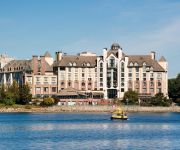
Delta Hotels Victoria Ocean Pointe Resort
Red Lion Inn & Suites Victoria
SUPER 8 VICTORIA BC
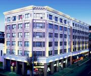
Hotel Rialto
Island Travel Inn
HOJO HOTEL VICTORIA ELK LAKE
SANDMAN HOTEL VICTORIA
Accent Inn Victoria
BEST WESTERN PLUS CARLTON PLZ
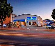
Vacation Inn Hotel & Convention Center
Videos from this area
These are videos related to the place based on their proximity to this place.
Victoria International High School Programs
Study in Canada. The Greater Victoria School District's Victoria International High School Programs offers academic and short-term high school programs to international students from around...
The Inner Journey of Tai Chi Chuan- Lesson 1
This 7 part series of lessons, originally produced for television, looks in great detail at internal aspects of Tai Chi practice seldom explained. Each lesson focuses on a different subject....
3480 Ripon Road, Uplands, Victoria British Columbia
Property Video shoot of 3480 Ripon Road, Uplands, Victoria British Columbia by PlatinumHD http://www.platinumhd.tv for Sotheby's International Realty Canada.
Birds of a Feather Victoria Oceanfront Bed and Breakfast
Birds of a Feather bed and breakfast in Victoria, British Columbia is a 5 star accommodation on the ocean with private entrances, private dock, canoes, kayaks and bicycles. Heated floors, fireplace...
Better in Victoria, BC
President & CEO of Tourism Victoria sings the praises of Victoria's better weather in the hopes that Albertans will turn off the video and book a trip to Victoria to escape the cold and, his...
Sim City Data Maps
Just a short video showing different Data Maps in the new Sim City 5/2013 whatever you want to call it. Done during Beta 2 Stress Test.
Salish Fusion Cowichan Sweaters - Shaw TV Victoria
Weaving and Knitting have a long history on Vancouver Island. Shaw TV's Meg Cuthbert meets with some knitters who are giving new life to this old art form.
garden city scooter run 2013
filmed over one day,saturday may 20th 2013 at the garden city scooter run.hosted by the capitol city scooter club,victoria bc canada ,may long weekend.
Blue Toyota Van - Turn Signal Challenge - Cook & Maplewood
The driver of this Blue Toyota van on Cook St at Maplewood doesn't seem to understand how turn signals work. He changes lanes at the last minute without signalling, then starts signalling but...
Author Grant McKenzie (1) on the long journey of a novel and being your own champion
Suspense novelist Grant McKenzie speaks about the long journey of getting his novel published and on the necessity of writers being champions of their own work. Interviewed by author coach...
Videos provided by Youtube are under the copyright of their owners.
Attractions and noteworthy things
Distances are based on the centre of the city/town and sightseeing location. This list contains brief abstracts about monuments, holiday activities, national parcs, museums, organisations and more from the area as well as interesting facts about the region itself. Where available, you'll find the corresponding homepage. Otherwise the related wikipedia article.
Saanich, British Columbia
The District of Saanich is a municipality on Vancouver Island in British Columbia. It is located north of the provincial capital, Victoria. It has a population of 109,752 people, making it the most populous municipality on Vancouver Island, and the seventh most populous in the province. The municipality is named after the Saanich First Nation, and means "emerging land" or "emerging people". Saanich is part of Greater Victoria and a member municipality of the Capital Regional District.
Point Ellice Bridge Disaster
On May 26, 1896 in Victoria, British Columbia, a streetcar crowded with 143 holidaymakers on their way to attend celebrations of Queen Victoria’s birthday, crashed through Point Ellice Bridge into the Upper Harbour. 55 men, women and children were killed in the accident, making this one of the worst disasters in British Columbia history and the worst accident in Canadian transit history. Only those passengers on the left side of the streetcar were able to escape.
Swan Lake Nature Sanctuary
Swan Lake Christmas Hill Nature Sanctuary is a nature reserve located in Saanich, British Columbia. The sanctuary includes a lake, adjacent marshy lowlands, and a nature centre, as well as a good part of the summit regions of Christmas Hill.
Reynolds Secondary School
Reynolds Secondary School is a public secondary school in the Greater Victoria suburb of Saanich, British Columbia, Canada. It has specialized programs including Flexible Studies, French Immersion, Band, and Centre for Soccer Excellence. Along with these, Reynolds also offers many Career Planning programs such as CP Theatre, CP Art, CP Recreation, CP Tourism, CP Journalism and CO-OP. Reynolds Marching Band is one of the best in the city.
Tillicum Centre
Tillicum Centre is a two-level shopping centre located in Victoria, British Columbia. Built in 1982, and expanded several times since, the shopping centre currently offers over 50 shops and services including Zellers, Home Outfitters, Old Navy, Safeway, Winners, Petcetera, and London Drugs. It also features a stand-alone SilverCity movie theatre, TD Bank, and Kelsey's/Montana's restaurants. Neighbours are Pearkes Arena and a branch of the Greater Victoria Public Library.
Stikine Region
The Stikine Region is an unincorporated area in northwesternmost British Columbia, Canada and is the only area in B.C. not in a regional district. The Stikine Region was left unincorporated following legislation that established the province's regional districts in 1968 and is not classified as a regional district, and contains no municipal governments which normally constitute the majority of seats on the boards of regional districts.
Spectrum Community School (British Columbia)
Spectrum Community School is a high school in the Greater Victoria suburb of Saanich, British Columbia, Canada. It is part of the Greater Victoria School District and serves the western portion of the district. Spectrum was established in 1974 as a replacement for Mount View High School and the school moved into the new facility in 1975. In 2005 a $5.5 million addition and renovation was completed. There are four computer labs and an active interactive whiteboard resources program.
Vancouver Island Regional Correctional Centre
The Vancouver Island Regional Correctional Centre (VIRCC) is a Regional Correctional Centre that is located in the District Municipality of Saanich, Vancouver Island, British Columbia, Canada. It lies within metropolitan Victoria, British Columbia, in its northwest suburbs. The centre offers grief counseling to the family members of prisoners' deceased victims. On October 26, 1977, approximately 20 inmates took a prison officer hostage with a knife, but released him peacefully the next day.


