Safety Score: 2,8 of 5.0 based on data from 9 authorites. Meaning we advice caution when travelling to Canada.
Travel warnings are updated daily. Source: Travel Warning Canada. Last Update: 2024-05-05 08:24:42
Discover Marigold
Marigold in British Columbia is a city in Canada about 2,223 mi (or 3,578 km) west of Ottawa, the country's capital city.
Local time in Marigold is now 04:44 AM (Sunday). The local timezone is named America / Vancouver with an UTC offset of -7 hours. We know of 10 airports in the vicinity of Marigold, of which 4 are larger airports. The closest airport in Canada is Victoria Harbour Seaplane Base in a distance of 3 mi (or 5 km), South. Besides the airports, there are other travel options available (check left side).
There is one Unesco world heritage site nearby. The closest heritage site is Olympic National Park in United states at a distance of 63 mi (or 102 km). Also, if you like golfing, there are a few options in driving distance. We discovered 7 points of interest in the vicinity of this place. Looking for a place to stay? we compiled a list of available hotels close to the map centre further down the page.
When in this area, you might want to pay a visit to some of the following locations: Victoria, Port Angeles, Friday Harbor, Port Townsend and Coupeville. To further explore this place, just scroll down and browse the available info.
Local weather forecast
Todays Local Weather Conditions & Forecast: 14°C / 56 °F
| Morning Temperature | 10°C / 50 °F |
| Evening Temperature | 10°C / 50 °F |
| Night Temperature | 9°C / 47 °F |
| Chance of rainfall | 0% |
| Air Humidity | 70% |
| Air Pressure | 1004 hPa |
| Wind Speed | Fresh Breeze with 15 km/h (9 mph) from East |
| Cloud Conditions | Overcast clouds, covering 100% of sky |
| General Conditions | Overcast clouds |
Sunday, 5th of May 2024
12°C (54 °F)
8°C (46 °F)
Moderate rain, fresh breeze, scattered clouds.
Monday, 6th of May 2024
11°C (51 °F)
8°C (46 °F)
Broken clouds, moderate breeze.
Tuesday, 7th of May 2024
11°C (53 °F)
9°C (48 °F)
Broken clouds, moderate breeze.
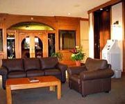
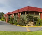
Hotels and Places to Stay
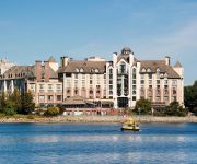
Delta Hotels Victoria Ocean Pointe Resort
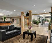
RAMADA VICTORIA
Accent Inn Victoria
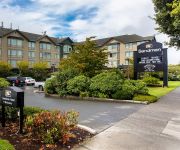
SANDMAN HOTEL VICTORIA
HOJO HOTEL VICTORIA ELK LAKE
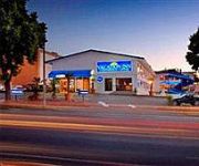
Vacation Inn Hotel & Convention Center
SUPER 8 VICTORIA BC
Econo Lodge Inn & Suites
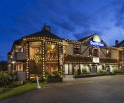
Days Inn Victoria Uptown
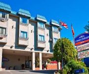
HOWARD JOHNSON HOTEL VICTORIA
Videos from this area
These are videos related to the place based on their proximity to this place.
The Inner Journey of Tai Chi Chuan- Lesson 1
This 7 part series of lessons, originally produced for television, looks in great detail at internal aspects of Tai Chi practice seldom explained. Each lesson focuses on a different subject....
Salish Fusion Cowichan Sweaters - Shaw TV Victoria
Weaving and Knitting have a long history on Vancouver Island. Shaw TV's Meg Cuthbert meets with some knitters who are giving new life to this old art form.
Structure Fire | McCauley East Apartments | Esquimalt, BC
vvvv~PLEASE READ THE DESCRIPTION~vvvv December 22nd, 2014 - Esquimalt Fire Crews were dispatched to a reported fully involved apartment fire at around 4:45pm this afternoon. Dispatch ...
Tudor House Pub Fire in Esquimalt, BC on July 16, 2013
The Tudor House pub on the corner of Esquimalt and Admirals roads was established on May 5, 1904. At the time, it was described as "the sailors' and soldiers' home, erected for the use of men...
Esquimalt High School's 4C Challenge Program
Esquimalt High School's 4C Challenge Program serves the unique needs of creative, gifted and talented learners by grouping students with similar intellectual abilities together in the same...
Looking Back On 100 Years of Esquimalt - Shaw TV Victoria
Shaw TV's Dan Kahan chats with local historian and author Sherri Robinson about the history of Esquimalt as the township prepares to celebrate its centennial.
Esquimalt Rd. Working Fire (April 4th, 2013)
Esquimalt Fire Rescue received reports of a fire at 912 Esquimalt Rd. at approx 4pm today (April 4th , 2013). Crews arrived on scene to find heavy smoke and flames from the restaurant at that...
FPV at Esquimalt Highschool
Flying a Diatone FPV250 Quadcopter with a KK2.1.5 flight controller and Fatshark gear.
Tudor House Pub Fire - Esquimalt, BC
This video was taken 10hours after the original call came in. At approx. 2am this morning (July 16th, 2013) Esquimalt Fire Rescue was dispatched to a fire at the Tudor House Pub. Upon arrival...
War Trophies in Esquimalt - Shaw TV Victoria
Shaw TV's Paul Beilstein visits Esquimalt Public Works where two WWI artillery guns, long since silenced, are being restored and readied to speak again.
Videos provided by Youtube are under the copyright of their owners.
Attractions and noteworthy things
Distances are based on the centre of the city/town and sightseeing location. This list contains brief abstracts about monuments, holiday activities, national parcs, museums, organisations and more from the area as well as interesting facts about the region itself. Where available, you'll find the corresponding homepage. Otherwise the related wikipedia article.
Saanich, British Columbia
The District of Saanich is a municipality on Vancouver Island in British Columbia. It is located north of the provincial capital, Victoria. It has a population of 109,752 people, making it the most populous municipality on Vancouver Island, and the seventh most populous in the province. The municipality is named after the Saanich First Nation, and means "emerging land" or "emerging people". Saanich is part of Greater Victoria and a member municipality of the Capital Regional District.
Swan Lake Nature Sanctuary
Swan Lake Christmas Hill Nature Sanctuary is a nature reserve located in Saanich, British Columbia. The sanctuary includes a lake, adjacent marshy lowlands, and a nature centre, as well as a good part of the summit regions of Christmas Hill.
École Victor-Brodeur
École Victor-Brodeur is a French first language K-12 school located in Esquimalt, British Columbia, Canada. It is designed to accommodate 540 students from the Greater Victoria area and to serve as a community centre for the local francophone community. It was named for Royal Canadian Naval officer Victor Brodeur, who was one of the first “group of six” officer cadets accepted into the RCN and also one of the 3% of Quebec born officers to reach the rank of Rear Admiral.
Craigflower Manor and Schoolhouse
The Craigflower Manor and Craigflower Schoolhouse are National Historic Sites of Canada located in View Royal, British Columbia near Victoria. The centerpiece of each historic site is a 19th century building — a manor and schoolhouse commissioned by the Hudson's Bay Company to provide education and lodging for their employees.
Tillicum Centre
Tillicum Centre is a two-level shopping centre located in Victoria, British Columbia. Built in 1982, and expanded several times since, the shopping centre currently offers over 50 shops and services including Zellers, Home Outfitters, Old Navy, Safeway, Winners, Petcetera, and London Drugs. It also features a stand-alone SilverCity movie theatre, TD Bank, and Kelsey's/Montana's restaurants. Neighbours are Pearkes Arena and a branch of the Greater Victoria Public Library.
Saanich Commonwealth Place
Saanich Commonwealth Place is a recreation centre located west of the Patricia Bay Highway and north of Royal Oak Drive in Saanich, British Columbia in Canada. It was originally constructed in 1993 for the August 1994 Commonwealth Games, and is currently a prominent facility in the community. In 2002, the original weightroom was completely renovated and it re-opened for operation in 2004.
223 Robert Street, Victoria, British Columbia
223 Robert Street, Victoria, British Columbia is a historic house in Victoria, British Columbia that was completed in 1905 and designated as a heritage building in 1990. It is a good example of the Queen Anne Style architecture.
Vancouver Island Regional Correctional Centre
The Vancouver Island Regional Correctional Centre (VIRCC) is a Regional Correctional Centre that is located in the District Municipality of Saanich, Vancouver Island, British Columbia, Canada. It lies within metropolitan Victoria, British Columbia, in its northwest suburbs. The centre offers grief counseling to the family members of prisoners' deceased victims. On October 26, 1977, approximately 20 inmates took a prison officer hostage with a knife, but released him peacefully the next day.


