Safety Score: 2,8 of 5.0 based on data from 9 authorites. Meaning we advice caution when travelling to Canada.
Travel warnings are updated daily. Source: Travel Warning Canada. Last Update: 2024-05-07 07:59:51
Explore Paldi
Paldi in British Columbia is a city in Canada about 2,239 mi (or 3,603 km) west of Ottawa, the country's capital.
Local time in Paldi is now 08:23 PM (Tuesday). The local timezone is named America / Vancouver with an UTC offset of -7 hours. We know of 10 airports in the vicinity of Paldi, of which 4 are larger airports. The closest airport in Canada is Nanaimo Airport in a distance of 19 mi (or 30 km), North. Besides the airports, there are other travel options available (check left side).
There is one Unesco world heritage site nearby. The closest heritage site is Olympic National Park in United states at a distance of 93 mi (or 150 km). Also, if you like golfing, there are multiple options in driving distance. We found 2 points of interest in the vicinity of this place. If you need a place to sleep, we compiled a list of available hotels close to the map centre further down the page.
Depending on your travel schedule, you might want to pay a visit to some of the following locations: Victoria, Port Angeles, Friday Harbor, Port Townsend and Coupeville. To further explore this place, just scroll down and browse the available info.
Local weather forecast
Todays Local Weather Conditions & Forecast: 15°C / 60 °F
| Morning Temperature | 7°C / 44 °F |
| Evening Temperature | 16°C / 61 °F |
| Night Temperature | 9°C / 48 °F |
| Chance of rainfall | 0% |
| Air Humidity | 55% |
| Air Pressure | 1028 hPa |
| Wind Speed | Light breeze with 5 km/h (3 mph) from South-West |
| Cloud Conditions | Broken clouds, covering 59% of sky |
| General Conditions | Broken clouds |
Wednesday, 8th of May 2024
21°C (71 °F)
14°C (57 °F)
Sky is clear, light breeze, clear sky.
Thursday, 9th of May 2024
26°C (79 °F)
16°C (61 °F)
Sky is clear, light breeze, clear sky.
Friday, 10th of May 2024
25°C (77 °F)
15°C (59 °F)
Sky is clear, gentle breeze, clear sky.
Hotels and Places to Stay
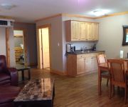
Sensational De Paradisio
Videos from this area
These are videos related to the place based on their proximity to this place.
Chic Trek: Vancouver Canada Travel, Cowichan Valley Creatives
Journalist Shana Ting Lipton travels to British Columbia's rustic and wildly creative Cowichan Valley on Vancouver Island. http://www.chictrek.com.
After The Rain - Mount Provost Flight
After the Rain....a short 'Stretch-your-legs' November afternoon flight in the Bushby Mustang ll C-GAIF from Nanaimo BC to Mount Provost, near Duncan BC and back along the east coast of Vancouver...
Hang Glide Vancouver Island
Hang Gliding with a hangover and a fear of heights the day after my bday when I went skiing at Whistler. I'm basically scared out of my mind here. Also, notice the SPORT GOOFY scream right...
Changes in Wine Legislation - Shaw TV Duncan
Shaw TV's Teri Church visits Averill Creek Vineyard, where there's a positive outlook following the approval of a bill which allows wine to be shipped across provincial borders.
Chantal @ Chemainus Secondary
Rock Stars Unlimited event @ Chemainus Secondary Recorded on February 11, 2011 using a Flip Video camcorder.
Fuller Lake Park
Fuller Lake Park, located in the Chemainus Area, features over 1 kilometre of walking trails, fishing, boat launch, tennis courts, outdoor volleyball court, picnic area and a covered walking...
Videos provided by Youtube are under the copyright of their owners.


