Safety Score: 2,5 of 5.0 based on data from 9 authorites. Meaning we advice caution when travelling to Barbados.
Travel warnings are updated daily. Source: Travel Warning Barbados. Last Update: 2024-04-25 08:17:04
Discover Coverly
Coverly in Christ Church is a place in Barbados a little east of Bridgetown, the country's capital city.
Current time in Coverly is now 08:54 PM (Thursday). The local timezone is named America / Barbados with an UTC offset of -4 hours. We know of 8 airports near Coverly. The closest airport in Barbados is Sir Grantley Adams International Airport in a distance of 1 mi (or 2 km), South-East. Besides the airports, there are other travel options available (check left side).
There are two Unesco world heritage sites nearby. The closest heritage site in Barbados is Historic Bridgetown and its Garrison in a distance of 75 mi (or 121 km), East. Also, if you like playing golf, there are a few options in driving distance. If you need a hotel, we compiled a list of available hotels close to the map centre further down the page.
While being here, you might want to pay a visit to some of the following locations: Oistins, Crane, Four Cross Roads, Bridgetown and Welchman Hall. To further explore this place, just scroll down and browse the available info.
Local weather forecast
Todays Local Weather Conditions & Forecast: 27°C / 81 °F
| Morning Temperature | 26°C / 79 °F |
| Evening Temperature | 27°C / 81 °F |
| Night Temperature | 26°C / 79 °F |
| Chance of rainfall | 1% |
| Air Humidity | 69% |
| Air Pressure | 1014 hPa |
| Wind Speed | Moderate breeze with 12 km/h (8 mph) from West |
| Cloud Conditions | Overcast clouds, covering 87% of sky |
| General Conditions | Light rain |
Friday, 26th of April 2024
27°C (81 °F)
25°C (77 °F)
Overcast clouds, moderate breeze.
Saturday, 27th of April 2024
28°C (82 °F)
26°C (79 °F)
Light rain, moderate breeze, clear sky.
Sunday, 28th of April 2024
28°C (82 °F)
26°C (79 °F)
Sky is clear, moderate breeze, clear sky.
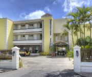
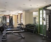
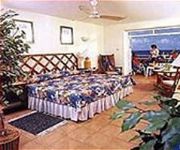
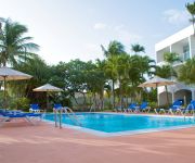
Hotels and Places to Stay
Sea Breeze Beach House by Ocean Hotels - All Inclusive
The Crane Resort
BOUGAINVILLEA BEACH RESORT
Sapphire Beach Club Resort
ROSTREVOR HOTEL
Time Out
Bonanza Apartments
The Terraces at Mangrove
DIVI SOUTHWINDS BEACH RESORT
Starlight Chalet & Health Spa
Videos from this area
These are videos related to the place based on their proximity to this place.
American Airlines takeoff from Barbados (AAL 602 - BGI- MIA)
American Airlines Boeing 757 200 takeoff from Grantley Adams Int'l Airport for Miami.
Service Air Cargo B727F Amazing Departure Barbados
Rotated by Charlie off to SanJuan Planespotting with Justin Catwell.
Landing in Barbados Virgin 747 Flight VS029 18/09/08
Virgin 747 named "English Rose" landing at Grantley Adams Airport in Barbados approaching the South of the Island in a Westerly direction then turning East to land (running 3 hours late) 18th...
Videos provided by Youtube are under the copyright of their owners.
Attractions and noteworthy things
Distances are based on the centre of the city/town and sightseeing location. This list contains brief abstracts about monuments, holiday activities, national parcs, museums, organisations and more from the area as well as interesting facts about the region itself. Where available, you'll find the corresponding homepage. Otherwise the related wikipedia article.
Christ Church Parish Church
The current Christ Church Parish Church located in Oistins, Christ Church, Barbados was built in 1935 and is the fifth parish church on the site. At various times the previous structures have all been destroyed by natural disasters including flood, fire or hurricanes. The original Parish church structure was built in 1629 and was located near Dover Beach. In 1669 the church was destroyed by a flood, which scattered coffins and bones from the church cemetery across the beach.
Bentleys
Bentleys is a village in Saint Philip Parish in Barbados.
Brereton, Barbados
Brereton is a village in Saint Philip Parish in Barbados.
Saint Martins, Barbados
Saint Martins is a village in Saint Philip Parish in Barbados.
Woodbourne, Barbados
Woodbourne is a village in both the Parish of Saint Philip and Christ Church in Barbados. It is the area where most of the crude oil is being currently produced in Barbados, by the Barbados National Oil Company (BNOC). BNOC was established in 1983, when the Barbados Government bought out the interest of Mobil Oil.
ABC Highway
The ABC Highway is the main urban highway in Barbados. Opened in 1989, it is named after three famous Barbadian politicians: John Michael Geoffrey Manningham ("Tom") Adams, Errol Barrow, and Hugh Gordon Cummins. From the east, the highway stretches from the Grantley Adams International Airport in Christ Church, to the western end at Cave Hill Road and University Drive, Cave Hill Campus, University of the West Indies, in Saint Michael.
Hopewell, Christ Church
Hopewell is a settlement in Christ Church Parish, Barbados.
Long Bay, Barbados
Long Bay is located on the southeast coast of Barbados, between Crane Bay and Cave Bay.


