Safety Score: 2,5 of 5.0 based on data from 9 authorites. Meaning we advice caution when travelling to Barbados.
Travel warnings are updated daily. Source: Travel Warning Barbados. Last Update: 2024-04-24 08:14:40
Delve into Four Cross Roads
Four Cross Roads in Saint John is a city located in Barbados a little north-east of Bridgetown, the country's capital town.
Current time in Four Cross Roads is now 07:11 PM (Wednesday). The local timezone is named America / Barbados with an UTC offset of -4 hours. We know of 8 airports closer to Four Cross Roads. The closest airport in Barbados is Sir Grantley Adams International Airport in a distance of 7 mi (or 11 km), South. Besides the airports, there are other travel options available (check left side).
There are two Unesco world heritage sites nearby. The closest heritage site in Barbados is Historic Bridgetown and its Garrison in a distance of 77 mi (or 123 km), East. Also, if you like playing golf, there are some options within driving distance. In need of a room? We compiled a list of available hotels close to the map centre further down the page.
Since you are here already, you might want to pay a visit to some of the following locations: Bathsheba, Welchman Hall, Crane, Oistins and Greenland. To further explore this place, just scroll down and browse the available info.
Local weather forecast
Todays Local Weather Conditions & Forecast: 28°C / 83 °F
| Morning Temperature | 27°C / 81 °F |
| Evening Temperature | 27°C / 81 °F |
| Night Temperature | 26°C / 80 °F |
| Chance of rainfall | 0% |
| Air Humidity | 68% |
| Air Pressure | 1015 hPa |
| Wind Speed | Moderate breeze with 13 km/h (8 mph) from West |
| Cloud Conditions | Few clouds, covering 13% of sky |
| General Conditions | Light rain |
Wednesday, 24th of April 2024
28°C (82 °F)
26°C (79 °F)
Light rain, fresh breeze, broken clouds.
Thursday, 25th of April 2024
27°C (81 °F)
26°C (79 °F)
Light rain, moderate breeze, scattered clouds.
Friday, 26th of April 2024
28°C (82 °F)
26°C (78 °F)
Overcast clouds, moderate breeze.
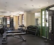
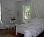
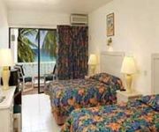
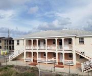
Hotels and Places to Stay
The Crane Resort
South Beach Hotel
SWEETFIELD MANOR BO
SOUTHERN PALMS HOTEL
Round House
Sapphire Beach Club Resort
The Terraces at Mangrove
Melbourne Inn
CHATEAU BLANC APARTMENTS ON SEA
COLONY CLUB HOTEL
Videos from this area
These are videos related to the place based on their proximity to this place.
St Johns Parish Church Barbados with the Bajan Tour Girl and Glory Tours
A visit to the St. Johns Parish Church with the Bajan Tour Girl from Glory Tours.
Monkey in Barbados
Stopped next to a monkey farm in Barbados on the Atlantic side of the island (on an Island Safari) and random a monkey jumps in through the window and sits on this guys lap (but unfortunatly...
Barbados, Sanctuary nature park. Monkeys in the trees !!!
Barbados Nature Sanctuary Park. Monkeys climbing the trees.
Caribe Claudia Gonçalves - Dez 2011.
Surf trip Barbados: Claudia Gonçalves Imagens e edição: Marcelo Morini Dovalo Canon t2i e Go pro.
Aquaponics explained in 54 seconds
Small scale, reliable, aquaponic systems for sale in the Caribbean,learn more on Face book https://www.facebook.com/pages/Bairds-Village-Aquaponics-Association/486848404729021.
Videos provided by Youtube are under the copyright of their owners.
Attractions and noteworthy things
Distances are based on the centre of the city/town and sightseeing location. This list contains brief abstracts about monuments, holiday activities, national parcs, museums, organisations and more from the area as well as interesting facts about the region itself. Where available, you'll find the corresponding homepage. Otherwise the related wikipedia article.
Barbados
Barbados is a sovereign island country in the Lesser Antilles. It is 34 kilometres in length and up to 23 kilometres in width, covering an area of 431 square kilometres . It is situated in the western area of the North Atlantic and 100 kilometres (62 mi) east of the Windward Islands and the Caribbean Sea; therein, it is about 168 kilometres east of the islands of Saint Vincent and the Grenadines, and 400 kilometres north-east of Trinidad and Tobago.
Geography of Barbados
Barbados is an Continental Island in the North Atlantic Ocean; and is located at 13°10' north of the equator, and 59°32' west of the Prime Meridian. As the easternmost isle of the Lesser Antilles in the West Indies, Barbados lies 100 kilometres (62 mi) east of the Windward Islands and Caribbean Sea. The maritime claim for Barbados is a territorial sea of 12 nmi, with an exclusive economic zone of 200 nmi, this gives Barbados a total maritime area of 183,436 km.
Saint George, Barbados
Statistics Parish:Saint George Area:44km² (17 sq. mi. ) Largest city:The Glebe Population (2008 est. ):19,530 inhab. Population Density:443.86 inhab/km² Parliamentary representation - House seats2 Map Parishes of Barbados The parish of Saint George ("St. George") is located in the interior of Barbados. It is one of two land-locked parishes, the other being Saint Thomas to the north.
Saint John, Barbados
Statistics Parish:Saint John Area:34 km² (13 mi²) Largest city:Four Roads Population (2008 est. ):9,765 inhab. Population density:287.21 inhab/km² Parliamentary representation - House seats1 Map Parishes of Barbados The parish of Saint John ("St. John") is a parish of Barbados on the eastern side of the island. It is home to one of the secondary schools on the island, The Lodge School. The parish is also the home of many districts such as Ashford and Kendal. It is also home to the St.
Saint Joseph, Barbados
Statistics Parish:Saint Joseph Area:26 km² (10 sq. mi. ) Largest City:Bathsheba Population (2008 est. ):8,370 inhab. Population Density:321.92 inhab/km² Parliamentary representation - House seats1 Map Parishes of Barbados The parish of Saint Joseph is a parish of Barbados on the eastern side of the island. The parish is home to two of the more notable botanic gardens in the country - Flower Forest and Andromeda Gardens. Parts of St.
Church Village, Saint Philip, Barbados
Church Village is a village in the parish of Saint Philip in Barbados.
Gun Hill Signal Station
Gun Hill Signal Station, St. George is the largest and most important of the military outposts in Barbados, with military associations from at least 1697. In the Militia Act of that year, when it was known as Briggs Hill, it was named as one of the four points where guns were to be placed to give alarm in the event of an invasion, so it is likely that the name Gun Hill goes back nearly 300 years.
St. Margaret's Church, Barbados
St. Margaret's Church is a church located in the parish of Saint John, Barbados. It was built in 1862.








!['Barbados Bicycle cam # 34 [Welchman Hall]' preview picture of video 'Barbados Bicycle cam # 34 [Welchman Hall]'](https://img.youtube.com/vi/cOmikUP4T-A/mqdefault.jpg)


