Safety Score: 2,7 of 5.0 based on data from 9 authorites. Meaning we advice caution when travelling to United States.
Travel warnings are updated daily. Source: Travel Warning United States. Last Update: 2024-04-29 08:03:39
Discover East Seattle
The district East Seattle of McGilvara in King County (Washington) is a subburb in United States about 2,318 mi west of Washington DC, the country's capital city.
If you need a hotel, we compiled a list of available hotels close to the map centre further down the page.
While being here, you might want to pay a visit to some of the following locations: Seattle, Tacoma, Port Orchard, Everett and Port Townsend. To further explore this place, just scroll down and browse the available info.
Local weather forecast
Todays Local Weather Conditions & Forecast: 10°C / 50 °F
| Morning Temperature | 5°C / 42 °F |
| Evening Temperature | 8°C / 46 °F |
| Night Temperature | 5°C / 42 °F |
| Chance of rainfall | 9% |
| Air Humidity | 69% |
| Air Pressure | 1018 hPa |
| Wind Speed | Gentle Breeze with 6 km/h (3 mph) from North |
| Cloud Conditions | Broken clouds, covering 75% of sky |
| General Conditions | Moderate rain |
Tuesday, 30th of April 2024
9°C (48 °F)
6°C (42 °F)
Overcast clouds, gentle breeze.
Wednesday, 1st of May 2024
12°C (54 °F)
9°C (48 °F)
Overcast clouds, gentle breeze.
Thursday, 2nd of May 2024
8°C (47 °F)
6°C (43 °F)
Moderate rain, light breeze, overcast clouds.
Hotels and Places to Stay
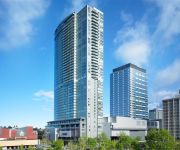
W Bellevue
The Westin Bellevue
Hilton Bellevue
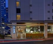
AC Hotel Seattle Bellevue/Downtown
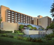
Hyatt Regency Bellevue
Seattle Marriott Bellevue
SILVER CLOUD INN - BELLEVUE
HOTEL BELLEVUE
Woodmark Hotel and Spa
Sheraton Bellevue Hotel
Videos from this area
These are videos related to the place based on their proximity to this place.
I-90 Floating Bridge, Bellevue to Seattle (Driving across)
(Driving across in semi Mack Truck) Driving across Lake Washington from Bellevue to Seattle through Mercer Island Tunnel on I-90 Floating Bridge and through Mount Baker Tunnel. The I-90, Lacey...
Mercer Island Parks & Recreation
The Mercer Island Parks & Recreation Department provides services that nurture our Island community, promoting a healthy, happy, and well-balanced place to live. We maintain more than 30...
Business at the Mercer Island Community and Event Center
The award-winning Mercer Island Community & Event Center (MICEC) is the perfect combination of affordability, beauty and professionalism. Situated conveniently between Seattle and Bellevue,...
Mercer Island Martial Arts Teen and Adult Class
Teen & Adult Class martial arts classes at mercer island martial arts. Check out our new location starting March 2010 2630 77th Ave SE, Suites 106-108 In the 77 Central Building.
Virtual Tour of the Mercer Island Community & Event Center
The award-winning Mercer Island Community & Event Center (MICEC) is the perfect event venue to marry, meet and celebrate with family, colleagues and friends. Situated conveniently between...
Special Events at the Mercer Island Community & Event Center
Are you searching for the perfect special event venue? If so, we invite you to take a look at the Mercer Island Community & Event Center. For more information, visit www.MarryOnMercer.com...
Stunning Mercer Island Penthouse Condo -- Price Reduced! Now $995,000
Stunning Mercer Island PENTHOUSE condo! Located at The Montesano, this one-of-a-kind luxury 1725 square foot, 2 bedroom, 2 bath plus den offers beautiful Lake Washington, Bellevue, and ...
Lucky at Luther Burbank Park | Mercer Island | WA State 2012
Life is good on Mercer Island. The park systems are well maintained. Art installations dot Luther Burbank Park, competing with the views of Lake Washington for your attention. The beach front...
Lucky appreciating Mercer Island Sculptures Along I 90
Mercer Island is spared the urban messiness that surrounds it. One route, I-90 goes through the northern end of the island, where these sculptures are carefu...
MI Exotic Vacations Travel Agent Mercer Island WA
Are you planning your wedding? Let us plan your honeymoon. Have you always dreamed of taking a cruise but thought they were just too expensive? Our travel ag...
Videos provided by Youtube are under the copyright of their owners.
Attractions and noteworthy things
Distances are based on the centre of the city/town and sightseeing location. This list contains brief abstracts about monuments, holiday activities, national parcs, museums, organisations and more from the area as well as interesting facts about the region itself. Where available, you'll find the corresponding homepage. Otherwise the related wikipedia article.
Medina, Washington
Medina is a city located in the Eastside, a region of King County, Washington, United States. Surrounded on the north, west, and south by Lake Washington, opposite Seattle, Medina is bordered by Clyde Hill and Hunts Point, as well as the satellite city of Bellevue. The city's population was 2,969 at the 2010 census. The city is mostly residential and includes Bill Gates' house. Medina has the third highest per-capita income in the state of Washington and the 49th highest in the United States.
Mercer Island, Washington
Mercer Island is a city in King County, Washington, United States and the name of the island in Lake Washington on which the city sits. The population was 22,699 at the 2010 census. The population was 22,690 at 2012 Estimate from Office of Financial Management. Located in the Seattle Metropolitan Area, it is the most populated island in a lake within the United States. The ZIP code 98040 is unique to Mercer Island.
Lake Washington
Lake Washington is a large freshwater lake adjacent to the city of Seattle. It is the largest lake in King County and the second largest natural lake in the state of Washington, after Lake Chelan. It is bordered by the cities of Seattle on the west, Bellevue and Kirkland on the east, Renton on the south and Kenmore on the north, and surrounds Mercer Island. The lake is fed by the Sammamish River at its north end and the Cedar River at its south.
Lacey V. Murrow Memorial Bridge
The Lacey V. Murrow Memorial Bridge is a floating bridge that carries the eastbound lanes of Interstate 90 across Lake Washington from Seattle to Mercer Island, Washington. Westbound traffic is carried by the Homer M. Hadley Memorial Bridge running parallel to it. The Lacey V. Murrow Memorial Bridge is the second longest floating bridge on Earth at 6,620 ft, whereas the longest is the Evergreen Point Floating Bridge just a few miles to the north on the same lake, built 23 years later.
Seward Park, Seattle
Seward Park is a neighborhood in southeast Seattle, Washington just west of the park of the same name. The park itself occupies all of Bailey Peninsula, a prominent, forested peninsula that juts into Lake Washington.
Seward Park (Seattle)
Seward Park is a 300 acre (120 ha) park in Seattle, Washington, U.S.A. , that occupies all of Bailey Peninsula, a forested peninsula off south Seattle that juts into Lake Washington. One approaches the park from the north by Lake Washington Boulevard S, from the south by Seward Park Avenue S. , or from the west by S Orcas Street. The main parking lot and a tennis court are located in the southwest corner. The most commonly used trail is a car-free loop around the park.
Madrona Park (Seattle)
Madrona Park is a 31.2 acre (126,000 m²) park located in the Madrona neighborhood of Seattle, Washington, bisected by Lake Washington Boulevard. It lies on the western shore of Lake Washington and features picnic areas, a swimming beach with bathhouse, and parking area. West of the campground is a tree-covered hillside and ravine featuring walking paths and Madrona Creek.
Leschi Park (Seattle)
Leschi Park is an 18.5 acre (75,000 m²) park in the Leschi neighborhood of Seattle, Washington, named after Chief Leschi of the Nisqually tribe. The majority of the park is a grassy hillside that lies west of Lakeside Avenue S. and features tennis courts, picnic tables, and a playground. Across Lakeside Avenue to the east is the western shore of Lake Washington and a small lawn with benches.
Frink Park (Seattle)
Frink Park is a 17.2 acre (70,000 m²) park in the Leschi neighborhood of Seattle, Washington. It is a heavily wooded hillside and ravine through which flows Frink Creek. Most of the park is bounded by 31st Avenue S. in the west, 34th Avenue S. in the east, and the rights-of-way of S. Main Street in the north and S. King Street in the south. Lake Washington Boulevard S. and S. Frink Place are recreational drives within the park. Frink Park borders Leschi Park in its northwest corner.
Homer M. Hadley Memorial Bridge
The Third Lake Washington Bridge, officially the Homer M. Hadley Memorial Bridge, is the fifth-longest floating bridge in the world, at 5,811 feet (1772 m). It carries the westbound and reversible lanes of Interstate 90 across Lake Washington between Mercer Island, Washington, and Seattle Washington.
Denny-Blaine, Seattle
Denny-Blaine is a neighborhood in east central Seattle, Washington. It is bounded on the east by Lake Washington; on the south by E. Howell Street, beyond which is Madrona; on the west by 32nd Avenue, beyond which is Madison Valley; and on the north by Lake Washington Boulevard E. , Hillside Drive E. , and E. Prospect Street, beyond which are Washington Park and Madison Park. The neighborhood's main thoroughfares are E. Denny Way and E. Harrison Street (east- and westbound) and Dorffel Drive E.
Viretta Park
Viretta Park is a 1.8-acre park in the Denny-Blaine neighborhood of Seattle, Washington at the foot of E. John Street at 39th Avenue E. , stretching down to Lake Washington Boulevard E. It was named by Charles L. Denny after his wife, Viretta Jackson Denny. It is located to the South of the former home of Kurt Cobain, where he died. Nirvana fans gather at the park on the anniversary of Cobain's death (April 5), and to a lesser extent on his birthday (Feb 20), to pay tribute to the musician.
Mercer Island School District
The Mercer Island School District is a public U.S. school district in Washington. Located in an affluent bedroom community of Seattle, Mercer Island, it has a strong academic reputation. The five schools on Mercer Island provide approximately 4000 students with primary and secondary education.
Mercer Island High School
Mercer Island High School (MIHS) is a public high school located in Mercer Island, Washington in the U.S. , as part of the Mercer Island School District. As of the 2011-2012 school year, the school had an enrollment of 1,448 students and 67.2 classroom teachers (on an FTE basis), for a student-teacher ratio of 21.7.
Colman Park (Seattle)
Colman Park is a 24.3-acre park in the Mount Baker neighborhood of Seattle, Washington, located just south of the Lacey V. Murrow Memorial Bridge along Lake Washington and inland to 31st Avenue S.
Madrona Creek
Madrona Creek is a stream in the Madrona neighborhood of Seattle, Washington, USA, located within Madrona Park. A daylighting project to restore the creekbed from above 38th Avenue downhill to Lake Washington is underway as of 2006.
Lake Washington Boulevard
Lake Washington Boulevard is a scenic, approximately 8-mile, route through Seattle, Washington, that hugs Lake Washington for much of the drive. There are views of the lake, small sections of rainforest, meadows, and views of the Cascade mountains. At its northern end, Lake Washington Boulevard runs through the length of the Washington Park Arboretum. The road begins at S. Juneau Street in Seward Park, running thence along the lake to Colman Park, just south of Interstate 90.
KMIH
KMIH is a high school radio station broadcasting a Rhythmic Contemporary Hit Radio format. Licensed to Mercer Island, Washington, USA, it serves the Seattle area. The station is currently owned by Mercer Island School District # 400. KMIH also has a translator at 94.5 (K233BU) transmitting from Capitol Hill to cover Downtown Seattle. This station is one of three high school radio stations in the Seattle Metro area, the other two being KNHC, and KASB.
Genesee Park (Seattle)
Genessee Park is a 57.7-acre park in the Rainier Valley neighborhood of Seattle, Washington. A waterway, Wetmore Slough, before the lowering of Lake Washington by nine feet in 1917 as part of the construction of the Lake Washington Ship Canal, it was purchased by the city in 1947 and used as a dump until 1963. Development of the park began in 1968. It also hosts Seafair hydroplane races and air shows every year.
Mercer Island Lid
The Mercer Island Lid, officially the Luther Burbank Lid, is a half-mile concrete and steel structure that covers a section of Interstate 90 from just west of W. Mercer Way to 76th Avenue S.E. The Lid is home to a landscaped park, Park on the Lid, in Mercer Island, Washington, USA The Lid is also, by extension, that part of the freeway under the park.
Graham Hill Elementary School
Graham Hill Elementary School is an elementary school located in the Seward Park neighborhood of Seattle, Washington, USA. The school serves students from Pre-K (3+ yrs) through 5th grade as part of the Seattle Public Schools district.
Mercer Island (Link station)
Mercer Island Station will be an at-grade Sound Transit East Link light rail station in the city of Mercer Island, Washington. It is expected to open along with the section of the line to Overlake in 2023.
Northwest Yeshiva High School
Located in Mercer Island, Washington, Northwest Yeshiva High School is the state's only Jewish High School. Its mission is to prepare its students to be “committed Jews who are well-rounded, broadly educated, intellectually engaged, and caring members of their community. ” The University of Washington, the most academically selective university in the state, ranks the high school 4th in the state.
Saint Thomas School
St. Thomas School is an independent school in Medina, an Eastside suburb of Seattle, Washington, USA.
Meydenbauer Beach Park
Meydenbauer Beach Park is a park located in Bellevue, Washington along Lake Washington. Named after William Meydenbauer, the park features paved and unpaved trails, picnic tables, a playground, a restroom facility and a beach.


