Safety Score: 2,7 of 5.0 based on data from 9 authorites. Meaning we advice caution when travelling to United States.
Travel warnings are updated daily. Source: Travel Warning United States. Last Update: 2024-04-26 08:02:42
Discover Mount Baker
Mount Baker in King County (Washington) is a town in United States about 2,320 mi (or 3,734 km) west of Washington DC, the country's capital city.
Current time in Mount Baker is now 02:01 AM (Friday). The local timezone is named America / Los Angeles with an UTC offset of -7 hours. We know of 9 airports near Mount Baker, of which 3 are larger airports. The closest airport in United States is Boeing Field King County International Airport in a distance of 3 mi (or 5 km), South. Besides the airports, there are other travel options available (check left side).
There is one Unesco world heritage site nearby. It's Olympic National Park in a distance of 17 mi (or 27 km), North-West. Also, if you like playing golf, there are a few options in driving distance. We discovered 10 points of interest in the vicinity of this place. Looking for a place to stay? we compiled a list of available hotels close to the map centre further down the page.
When in this area, you might want to pay a visit to some of the following locations: Seattle, Port Orchard, Tacoma, Everett and Port Townsend. To further explore this place, just scroll down and browse the available info.
Local weather forecast
Todays Local Weather Conditions & Forecast: 14°C / 57 °F
| Morning Temperature | 9°C / 49 °F |
| Evening Temperature | 13°C / 56 °F |
| Night Temperature | 10°C / 50 °F |
| Chance of rainfall | 2% |
| Air Humidity | 64% |
| Air Pressure | 1012 hPa |
| Wind Speed | Gentle Breeze with 7 km/h (4 mph) from North |
| Cloud Conditions | Overcast clouds, covering 97% of sky |
| General Conditions | Light rain |
Friday, 26th of April 2024
11°C (51 °F)
8°C (47 °F)
Light rain, gentle breeze, overcast clouds.
Saturday, 27th of April 2024
14°C (56 °F)
8°C (46 °F)
Light rain, moderate breeze, overcast clouds.
Sunday, 28th of April 2024
14°C (58 °F)
7°C (45 °F)
Light rain, gentle breeze, broken clouds.
Hotels and Places to Stay
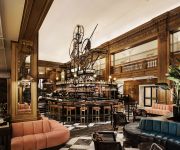
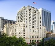
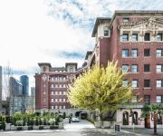
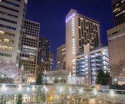
W Seattle
Fairmont Olympic Seattle
Alexis Seattle
INN AT THE WAC
Embassy Suites by Hilton Seattle Downtown Pioneer Square
Loews Hotel 1000
SORRENTO HOTEL
Hilton Seattle
The Arctic Club Seattle - a DoubleTree by Hilton
Kimpton Hotel Monaco Seattle
Videos from this area
These are videos related to the place based on their proximity to this place.
NB & SB Sound Transit Light Rail Testing At S. Walden Street & M.L. King Way S. Seattle, Wa.
NB & SB Sound Transit Light Rail Testing At S. Walden Street & M.L. King Way S. Seattle, WA Passenger Service Starts 18 July, 2009. ST The 18th & !9th Will Give Free Rides Between Westlake...
Seattle LINK Light Rail Mt Baker to Rainier Beach, Part 1
Ride along on Light Rail from Mt Baker Station to Rainier Beach Station, Part 1 of 2. Camcorder is the Kodak Zi6.
Craftsman Bungalow - 2726 34th Ave, Seattle, WA 98144
http://www.coldwellbanker.com/property?action=detail&brandType=CB&propertyId=278019651 Sweet Bungalow, Mt Baker, updated, remodeled, period charm kept, hardwoods, original details, built-ins ...
Amateur Cameraman Films Police Chase
Are you a cop? Check out http://ActionVids.blogspot.com At approximately 8:45 PM on July 14, 2007, Kirkland Police tried to stop a silver Subaru suspected of DUI (in Kirkland, Washington)....
video4.mov: Beacon Hill to Mio Posto/ Mt. Baker Playground
See the entire trip at http://www.everytrail.com.
Left Coast Tour presented by Tony Hawk & Birdhouse
evo went out to Tony Hawk & Birdhouse's Left Coast Tour at Jefferson Park Skatepark on Beacon Hill to watch Tony and some other pros going big in the bowl jam. Check out more pictures and...
2014 Seafair Cup Qualifying: J. Michael Kelly's Fast Lap
J. Michael Kelly qualified 3rd with a 149.756 MPH lap.
Victor Gamboa - 110m Hurdles(15.05sec) - 1st Place (4/07/12) - Class of 2013
Victor Gamboa - 110m Hurdles Race:15.05sec, Arnie Young Invitational, 07APR2012 Eagle Head Coach Beau Baldwin: "He has raw talent -- and you see it outside of football in track. He has ...
Community Video: Columbia City in Seattle, WA
Take a video tour of the Columbia City section of Seattle, WA. http://www.coldwellbanker.com/real_estate/neighborhood_info.
Jeff Perkins and Golden Child
First up is me, Jeff Perkins and then Kevin "Golden Child" Kemp from TFB going at it in the Jamal Crawford Pro Am Slam Dunk contest Follow me on Twitter: @2_Bouncee.
Videos provided by Youtube are under the copyright of their owners.
Attractions and noteworthy things
Distances are based on the centre of the city/town and sightseeing location. This list contains brief abstracts about monuments, holiday activities, national parcs, museums, organisations and more from the area as well as interesting facts about the region itself. Where available, you'll find the corresponding homepage. Otherwise the related wikipedia article.
Sick's Stadium
Sick's Stadium, also known as Sick's Seattle Stadium and later as Sicks' Stadium, was a baseball stadium located in Seattle, Washington's Rainier Valley at the corner of S. McClellan Street and Rainier Avenue S. The site was previously the location of Dugdale Park, a 1913 ballpark that was the home of the minor league Seattle Indians.
Mount Baker, Seattle
Mount Baker is a neighborhood in southeast Seattle. The neighborhood's name comes from the view of Mount Baker in Whatcom County, that is seen by looking north over Lake Washington. It is bounded by Lake Washington to the east, Interstate 90 and then Leschi to the north, Rainier Valley to the west, and Lakewood and Columbia City to the south. The neighborhood has a community club and a rowing team. It hosts Seattle's annual Seafair, which includes an airshow featuring the U.S.
Franklin High School (Seattle)
This article is about Franklin High School in Seattle, Washington. For others of a similar name, see Franklin High School (disambiguation) 40x40pxThis article appears to be written like an advertisement. Please help improve it by rewriting promotional content from a neutral point of view and removing any inappropriate external links. Franklin High School File:FranklinHSSeattleLogo. png Truth, Unity, Honor Address 3013 South Mt.
Center Park
Center Park, located at 2121 26th Avenue South, is a subsidized high-rise building complex located in the Mt. Baker neighborhood of Seattle, Washington, designed to provide living accommodation to physically or mentally challenged individuals and their caretakers. The apartments were built in the 1960s by Ida May Daly, a progressive woman with severe muscular dystrophy. She purchased an area of inexpensive land in the Rainier Valley neighborhood in south Seattle.
Colman Park (Seattle)
Colman Park is a 24.3-acre park in the Mount Baker neighborhood of Seattle, Washington, located just south of the Lacey V. Murrow Memorial Bridge along Lake Washington and inland to 31st Avenue S.
Lake People Park
Lake People Park is a 0.5-acre park located at 3070 S. Bradford Street in the Columbia City neighborhood of Seattle, Washington, just south of the intersection of Martin Luther King Jr. Way S. and Rainier Avenue S. In 2003, the land was donated to the Seattle Parks Foundation by Monte Powell, a developer who was responsible for much of the newer construction in the neighborhood. He was moved to make the donation after attending a presentation on community-established parks.
Northwest African American Museum
The Northwest African American Museum (NAAM) in Seattle, Washington, USA opened March 8, 2008. Intended to "document and exhibit the unique historical and cultural experiences of African Americans in Seattle and the Pacific Northwest", the museum is part of the new Urban League Village at the former Colman School (built 1909, and with official status as a City of Seattle landmark).
Genesee Park (Seattle)
Genessee Park is a 57.7-acre park in the Rainier Valley neighborhood of Seattle, Washington. A waterway, Wetmore Slough, before the lowering of Lake Washington by nine feet in 1917 as part of the construction of the Lake Washington Ship Canal, it was purchased by the city in 1947 and used as a dump until 1963. Development of the park began in 1968. It also hosts Seafair hydroplane races and air shows every year.
Mount Baker (Link station)
The Mount Baker Station is a Sound Transit Central Link light rail station in the Mount Baker neighborhood of Seattle. It opened on July 18, 2009 and is projected to have 3500 daily boardings in 2020 – although this number will increase with the completion of the University Link extension. The station is elevated with side platforms, and is located west of Rainier Ave South at Martin Luther King Jr. Way South, south of South Forest Street.
Cheasty Boulevard South
Cheasty Boulevard South is a 1.3-mile route along the eastern edge of Seattle, Washington's Beacon Hill neighborhood. It was declared a City of Seattle landmark on January 15, 2003. Designed in 1903 as part of Seattle's Olmstead parks system, the property was acquired in 1910. Originally named Jefferson Boulevard, it was renamed in 1914 after E.C. Cheasty of the Parks Board, a former commissioner of the Seattle Police Department and the Alaska-Yukon-Pacific Exposition.
Rainier (Link station)
Rainier Station will be an at-grade Sound Transit East Link light rail station at the south end of the Central District neighborhood of Seattle. It is expected to open along with the section of the line to Overlake in 2023.


