Safety Score: 2,7 of 5.0 based on data from 9 authorites. Meaning we advice caution when travelling to United States.
Travel warnings are updated daily. Source: Travel Warning United States. Last Update: 2024-05-11 07:34:58
Discover Twelvemile Corner
The district Twelvemile Corner of in Multnomah County (Oregon) is a district in United States about 2,336 mi west of Washington DC, the country's capital city.
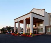
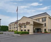
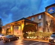
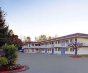
Looking for a place to stay? we compiled a list of available hotels close to the map centre further down the page.
When in this area, you might want to pay a visit to some of the following locations: Oregon City, Portland, Vancouver, Saint Helens and Hillsboro. To further explore this place, just scroll down and browse the available info.
Local weather forecast
Todays Local Weather Conditions & Forecast: 27°C / 80 °F
| Morning Temperature | 15°C / 59 °F |
| Evening Temperature | 24°C / 76 °F |
| Night Temperature | 15°C / 58 °F |
| Chance of rainfall | 0% |
| Air Humidity | 48% |
| Air Pressure | 1013 hPa |
| Wind Speed | Light breeze with 4 km/h (3 mph) from South-East |
| Cloud Conditions | Clear sky, covering 0% of sky |
| General Conditions | Sky is clear |
Sunday, 12th of May 2024
22°C (72 °F)
12°C (53 °F)
Sky is clear, gentle breeze, clear sky.
Monday, 13th of May 2024
16°C (60 °F)
9°C (48 °F)
Overcast clouds, gentle breeze.
Tuesday, 14th of May 2024
19°C (67 °F)
11°C (53 °F)
Few clouds, light breeze.
Hotels and Places to Stay
Clarion Inn
Four Points by Sheraton Portland East
Comfort Inn Columbia Gorge Gateway
Hampton Inn Portland East
BW PLUS CASCADE INN SUITES
PORTLAND-GRESHAM (former Holiday Inn)
McMenamins Edgefield
BW PLUS PARKERSVILLE INN STS
Holiday Inn Express PORTLAND EAST - TROUTDALE
MOTEL 6 PORTLAND EAST - TROUTDALE
Videos from this area
These are videos related to the place based on their proximity to this place.
Dish Network Gresham OR (503) 406-3786 DISH Network Deals
Dish Network Gresham OR https://www.silverstarsat.com/dish-network-gresham/ Dish Network in Gresham Oregon is easy with SilverStar Satellite your local Dish Network local Authorized Dish Network ...
651 NE 8th St., Gresham Oregon 97030
A quick video walk through of a town house for rent in Gresham Oregon.
1995-01 MAX Cabride between Main St in Gresham to 197th Ruby Jct in the snow
This video was a one off but today shows quite a bit of history relatively few decided to capture. Only 9 years after Light Rail began operation in Gresham, I took the video camera out for...
Truck 71 Responding Gresham Fire Department (2011 Pierce Arrow XT 105' HD Ladder All Steer)
Greshem Fire & Emergency Services Truck 71 responding from Station 71 in Gresham, Oregon (2011 Pierce Arrow XT 105' HD Ladder All Steer).
Truck 71 Responding Gresham Department (2011 Pierce Arrow XT 105' HD Ladder With All Steer)
Gresham Fire & Emergency Services Truck 71 responding from Station 71 in Gresham, Oregon. A 2011 Pierce Arrow XT 105' HD Ladder with All Steer.
Gresham Toyota Highlander USAA customer talks about the great service at Toyota of Gladstone
http://www.toyotaofgladstone.com (855) 565-6228 Gresham Toyota Highlander customers used the USAA auto buying program to get an amazing deal from Tom Angel at Toyota of Gladstone.
Engine 71 Responding Gresham Fire Department (2006 Pierce Dash Pumper)
Gresham Fire & Emergency Services Engine 71 responding from Station 71 in Gresham, Oregon.
Gresham Oregon Wedding Photographers | 503-481-5992 | Gresham OR Wedding Photography
Gresham Oregon Wedding Photographers | Gresham OR Wedding Photography http://photographersusax.blogspot.com/ http://gresham.katu.com/business-directory/professional-services/442479/tiger.
Chiropractor Gresham Oregon | Gresham Oregon Chiropractor 909 528 4079
chiropractor gresham oregon | Gresham Oregon Chiropractor 909 528 4079 http://tinyurl.com/chiropractorsinGresham CLICK! We live in stressful times. The economy is tough, global conflicts rage,...
Videos provided by Youtube are under the copyright of their owners.
Attractions and noteworthy things
Distances are based on the centre of the city/town and sightseeing location. This list contains brief abstracts about monuments, holiday activities, national parcs, museums, organisations and more from the area as well as interesting facts about the region itself. Where available, you'll find the corresponding homepage. Otherwise the related wikipedia article.
Multnomah County, Oregon
Multnomah County is one of 36 counties in the U.S. state of Oregon. It is part of the Portland metropolitan area and though smallest in area, it is the most populous county. Its county seat, Portland, is the state's largest city. As of the 2010 census, the county's population was 735,334.
Mt. Hood Community College
Mt. Hood Community College {{#invoke:InfoboxImage|InfoboxImage|image=|size=|sizedefault=frameless|alt=}}Established 1966President Michael HayStudents 32,433 (2011)Location Gresham, United StatesCampus 212 acres Website www. mhcc. edu Mt. Hood Community College (MHCC) is a public community college in Gresham, Oregon, United States, named after Mount Hood.
Cleveland Avenue (MAX station)
The Cleveland Avenue station is a MAX light rail station in Gresham, Oregon. The light rail station is the 26th and final stop eastbound on the current Eastside MAX line. It is the eastern terminus of the Blue Line. This station is a large park-and-ride station located just east of Cleveland Avenue in Gresham, between Northeast Division Street and East Powell Boulevard. Service began at this station in 1986, when the original Eastside MAX opened.
Gresham Central Transit Center
The Gresham Central Transit Center station, also known as Gresham Transit Center, is a TriMet transit center and MAX light rail station in Gresham, Oregon, United States. The center is a connection point for several bus routes and the MAX Blue Line. The light rail station is the 25th stop eastbound on the eastside MAX line, which was the Portland metropolitan area's first light rail line.
Gresham City Hall (MAX station)
The Gresham City Hall station is a MAX light rail station in Gresham, Oregon. It serves the Blue Line and is the 24th stop eastbound on the eastside MAX branch. Located at the intersection of NW Division Street and NW Eastman Parkway, the station includes a park-and-ride lot. It is near the Gresham Station retail development, and is next to the new Gresham City Hall, which moved to its current location after MAX opened.
Ruby Junction / East 197th Avenue
The Ruby Junction/East 197th Avenue station is a MAX light rail station in Gresham, Oregon. It serves the Blue Line and is the 23rd stop eastbound on the eastside MAX line. The station is at the intersection of SE 197th Avenue and Burnside Street. The station's namesake, Ruby Junction, was a junction of electric interurban lines located immediately east of this location for many years and the name of an interurban stop.
Rockwood / East 188th Avenue
The Rockwood/East 188th Avenue station is a MAX light rail station in Gresham, Oregon. It serves the Blue Line and is the 22nd stop eastbound on the eastside MAX branch. The station is at the intersection of Southeast 188th Avenue and Burnside Street, within the Rockwood neighborhood. Until 2010, this station had staggered side platforms; however, the two platforms are now adjacent, both located to the west of SE 188th Avenue.
Civic Drive (MAX station)
The Civic Drive station is a MAX light rail station in Gresham, Oregon on the Blue Line and is the 23rd stop eastbound on the current Eastside MAX Branch. The station opened on December 1, 2010. The foundations for the station's platforms were laid in 1996, as part of a planned Gresham Civic neighborhood development included in a 1993 Downtown Gresham Plan.
Reynolds High School (Troutdale, Oregon)
Reynolds High School is the only public high school in Troutdale, Oregon, and is in the Reynolds School District. It is one of the most populated high schools in the state of Oregon.
Gresham High School (Oregon)
Gresham High School is a public high school located in Gresham, Oregon.
National Register of Historic Places listings in Multnomah County, Oregon
The following list presents the full set of National Register of Historic Places listings in Multnomah County, Oregon. However, please see separate articles for listings in each of Portland's five quadrants. The National Register of Historic Places (NRHP) recognizes buildings, structures, objects, sites, and districts of national, state, or local historic significance across the United States.
Center for Advanced Learning
The Center for Advanced Learning (CAL) is a charter school in Gresham, Oregon, United States. The school also accepts students from Reynolds, Gresham-Barlow Centennial and Corbett school districts. At CAL students have four career fields to choose from: information technology, manufacturing/engineering, digital media/design and health sciences. Many of CAL's classes are entry-level college courses, granting credit through Mt. Hood Community College.
Mount Hood Medical Center Heliport
Mount Hood Medical Center Heliport is a private heliport located two miles northeast of Gresham in Multnomah County, Oregon, United States.
Gresham Police Department (Oregon)
The Gresham Police Department (GPD) is the law enforcement agency for the city of Gresham, Oregon, United States.
Gresham Pioneer Cemetery
Gresham Pioneer Cemetery, founded in 1859, lies on the east side of Southwest Walters Road in Gresham, Oregon, United States. The cemetery is bordered by the Springwater Corridor Trail and Johnson Creek on the south and by Escobar Cemetery, adjacent on the west and not clearly separated from Gresham Pioneer Cemetery. White Birch Cemetery, founded in 1888, lies on the west side of Southwest Walters Road across from the other two cemeteries.
East Buttes
The East Buttes are made up of several extinct volcanoes in and around Gresham, Oregon, United States, which are part of the Boring Lava Field. The Boring Lava Field became active at least 2.7 million years ago, and has been extinct for about 300,000 years. The buttes stretch from southeast Portland into Damascus. Included are Gresham Butte (also known as Walter's Hill), Gabbert Hill, and Towle Butte. The Gresham Butte Saddle Trail runs through open space owned by Metro and the City of Gresham.
Blue Lake Regional Park
Blue Lake Regional Park is a public park in Fairview, in the U.S. state of Oregon. The 101-acre park, near the south shore of the Columbia River in Multnomah County, includes many covered and uncovered picnic areas, playing fields for sports such as softball, and infrastructure related to lake recreation including swimming, boating, and fishing. Encompassing wooded areas, three ponds, and a wetland in addition to the lake, the park is frequented by migrating birds and other wildlife.
East Hill Church
East Hill Church is an evangelical Christian megachurch located in Gresham, Oregon, situated in East Multnomah County, affiliated with the International Church of the Foursquare Gospel. The church was chartered in 1938 by Aimee Semple McPherson. Weekly church attendance averages around 4,000, currently making it the largest church in the city. Former Marine Jason Albelo is the church's current senior pastor.
Reynolds Learning Academy
Reynolds Learning Academy is a public alternative school in Fairview, Oregon, United States.
Alpha High School
Alpha High School is a public alternative high school in Gresham, Oregon, United States. It specializes in school-to-work transition programs.
Multnomah County Poor Farm
The Multnomah County Poor Farm is a historic site in Troutdale, Oregon, United States. The former county poor farm is listed on the National Register of Historic Places. Today the site is operated as an entertainment and lodging complex under the name McMenamins Edgefield, one of many historic properties owned, restored, and operated by McMenamins.
Multnomah Greyhound Park
Multnomah Greyhound Park is a unused dog track located in Wood Village, Oregon, part of the Portland metropolitan area.
Gresham Library
The Gresham Library, also known as the Gresham Regional Library, is a branch of the Multnomah County Library in Gresham in the U.S. state of Oregon. The branch offers the Multnomah County Library catalog of two million books, periodicals and other materials.
Fairview-Columbia Library
The Fairview-Columbia Library is a branch of the Multnomah County Library, in Fairview in the U.S. state of Oregon. It serves residents of Fairview, Troutdale, Corbett, and elsewhere in the eastern part of the county. The branch offers the Multnomah County Library catalog of two million books, periodicals and other materials.
Troutdale Library
The Troutdale Library is a branch of the Multnomah County Library, in Troutdale in the U.S. state of Oregon. The library, part of the Cherry Park Market Center, offers the Multnomah County Library catalog of two million books, periodicals and other materials.


