Safety Score: 2,7 of 5.0 based on data from 9 authorites. Meaning we advice caution when travelling to United States.
Travel warnings are updated daily. Source: Travel Warning United States. Last Update: 2024-05-11 07:34:58
Delve into Powellhurst
The district Powellhurst of in Multnomah County (Oregon) is a district located in United States about 2,341 mi west of Washington DC, the country's capital town.
In need of a room? We compiled a list of available hotels close to the map centre further down the page.
Since you are here already, you might want to pay a visit to some of the following locations: Portland, Oregon City, Vancouver, Saint Helens and Hillsboro. To further explore this place, just scroll down and browse the available info.
Local weather forecast
Todays Local Weather Conditions & Forecast: 26°C / 79 °F
| Morning Temperature | 15°C / 59 °F |
| Evening Temperature | 24°C / 75 °F |
| Night Temperature | 15°C / 59 °F |
| Chance of rainfall | 0% |
| Air Humidity | 47% |
| Air Pressure | 1013 hPa |
| Wind Speed | Light breeze with 4 km/h (3 mph) from South-East |
| Cloud Conditions | Clear sky, covering 0% of sky |
| General Conditions | Sky is clear |
Sunday, 12th of May 2024
22°C (72 °F)
14°C (56 °F)
Sky is clear, gentle breeze, clear sky.
Monday, 13th of May 2024
17°C (62 °F)
10°C (49 °F)
Overcast clouds, gentle breeze.
Tuesday, 14th of May 2024
19°C (67 °F)
12°C (54 °F)
Sky is clear, light breeze, clear sky.
Hotels and Places to Stay
Courtyard Portland Airport
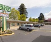
NORDIC MOTEL
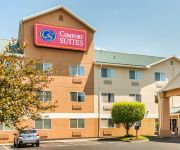
Comfort Suites Portland Airport
Fairfield Inn & Suites Portland Airport
SpringHill Suites Portland Airport
Holiday Inn Express & Suites PORTLAND AIRPORT
Hilton Garden Inn Portland Airport
Econo Lodge at Port of Portland
BEST WESTERN PONY SOLDIER INN
Comfort Inn Portland
Videos from this area
These are videos related to the place based on their proximity to this place.
9801 SE Lincoln St Portland OR
http://www.exite-listings.com/57713 Check out this artist retreat in the city, it is cool and funky! Explore your creative side in the studio, and work on...
11557 SE Powell Blvd., Portland, OR 97266
http://11557sepowellblvd.epropertysites.com?rs=youtube Great Investment home plus flat 1/2ac developable lot, R2A. Soil inspected engineered. City says build...
Chainsaw Repair Portland Oregon - Call Today 503-891-9214 For Portland Chainsaw
Chainsaw Repair Portland Oregon http://www.aaronshonestengine.com If you do a lot of DIY projects with your chainsaw in Portland Oregon or use it regularly for work, chainsaw repair is something...
Little League Aux Fashion Show
Kodiak Little League moms host a fashion show of Jantzen Swimsuits as a fundraiser for their boys. Check out this 1960's swim suits.
CherryWood Village - Retirement and Assisted Living in Portland, OR
This delightful campus offers retirees many housing choices including apartments, penthouses and cottage homes. Anywhere on campus and especially the heart of the community is connected by...
Gilbert Grade School class of 64 graduation
It's been 50 years since the Huskies of '64 walked across the stage to get their diplomas.
The Law Breaker and the Animal Control Officer
This fun little video was shot by a Multnomah County Animal Control Officer. All kidding aside, please do not feed raccoons. They should not be this comfortable near people.
A lesson in making breakfast gravy
Boy from Arkansas teaches his woman how to make true Southern gravy.
Generator Repair Portland Oregon - Call Today 503-891-9214
Generator Repair Portland Oregon http://aaronshonestengine.com Welcome to the generator repair service for Portland Oregon If you need help now give us a call at 503-891-9214 and we will...
Videos provided by Youtube are under the copyright of their owners.
Attractions and noteworthy things
Distances are based on the centre of the city/town and sightseeing location. This list contains brief abstracts about monuments, holiday activities, national parcs, museums, organisations and more from the area as well as interesting facts about the region itself. Where available, you'll find the corresponding homepage. Otherwise the related wikipedia article.
Cascade College
Cascade College was a private, four-year, liberal arts college associated with the Churches of Christ. Located in Portland, Oregon, United States, it was a branch campus of Oklahoma Christian University. Its mission was to emphasize spiritual growth and career preparation. Because of Cascade's ongoing financial problems, Oklahoma Christian University closed Cascade at the end of the 2009 academic year.
East 102nd Avenue (MAX station)
The East 102nd Avenue station is a MAX light rail station in Portland, Oregon. It serves the Blue Line and is the 16th stop eastbound on the current Eastside MAX branch. The station is at the intersection of E 102nd Avenue and Burnside Street. This station has staggered side platforms, which sit on either side of the cross street, because the route runs around this station on Burnside Street in the median.
East 122nd Avenue (MAX station)
The East 122nd Avenue station is a MAX light rail station in Portland, Oregon. It serves the Blue Line and is currently the 17th stop eastbound on the Eastside MAX branch. The MAX system is owned and operated by TriMet, the major transit agency for the Portland metropolitan area. The station is at the intersection of E 122nd Avenue and Burnside Street.
East 148th Avenue (MAX station)
The East 148th Avenue station is a MAX light rail station in Portland, Oregon. It serves the Blue Line and is the 18th stop eastbound on the current Eastside MAX branch. The MAX system is owned and operated by TriMet, the major transit agency for the Portland metropolitan area.
Gateway / Northeast 99th Avenue Transit Center
The Gateway/Northeast 99th Avenue Transit Center, commonly known as Gateway Transit Center, is a TriMet bus transit center and light rail station on the MAX Blue, Green and Red lines in Portland, Oregon, United States. It is the 15th stop eastbound on the current Eastside MAX. This station is where all three lines split eastbound. When opened in 1986, it was the busiest station on the Portland–Gresham MAX line, the only line in the system at that time, and was the terminus of 11 bus lines.
Leach Botanical Garden
Leach Botanical Garden is a 16-acre botanical garden located in outer southeast Portland, Oregon. It was acquired by the Portland Park Bureau in 1971. The garden was established in 1931 as landscaping for the private home of botanist Lilla Leach and pharmacist John Leach, and subsequently donated to the city. The garden was originally named Sleepy Hollow.
I-205 Transitway
The I-205 Transitway was a partially built busway along the wide right-of-way of the Interstate 205 freeway in Portland, Oregon. Although it never opened as a busway, its right-of-way is now in use by light rail lines. The transitway, which was physically separate from the parallel freeway lanes, was planned in the mid- and late-1970s as part of the final segment of I-205. Only a graded route with several entrance ramps and two underpass tunnels under I-205 were built.
Willamette National Cemetery
Willamette National Cemetery is a United States National Cemetery located about 10 miles southeast of the city of Portland, Oregon. The cemetery encompasses 269.4 acres straddling the county line between Multnomah and Clackamas Counties. Up to the end of 2005, there had been 126,561 interments.
David Douglas School District
David Douglas School District No. 40 is a school district in eastern Portland, Oregon, United States. Its administrative offices are at 1500 Southeast 130th Avenue. The district was formed in 1959 as a consolidation of the Gilbert, Powellhurst, and Russellville elementary school districts and the David Douglas Union High School District. As of 2012, it operates nine elementary schools, three middle schools and one high school with an alternative school campus.
Oregon's 3rd congressional district
Oregon's 3rd congressional district covers most of Multnomah County, including Portland east of the Willamette River, Gresham, and Troutdale. It also includes the northern part of Clackamas County, including Milwaukie. Parts of northwest Portland also lie within the district. Before the 2002 redistricting, the whole of Multnomah County was included in the district; it lost southwest Portland to the 1st and 5th districts, but it gained most of its current portion of Clackamas County.
Franciscan Montessori Earth School & Saint Francis Academy
The Franciscan Montessori Earth School & Saint Francis Academy (FMES/SFA) is located in Portland, Oregon, United States. FMES/SFA is the only accredited pre-K through grade 8 Catholic Montessori school in the United States. It is operated by the Franciscan Sisters of the Eucharist from Bridal Veil, Oregon.
Multnomah County Sheriff's Office Search and Rescue
Multnomah County Sheriff's Office Search and Rescue (MCSO SAR) is a non-profit volunteer search and rescue resource for the Multnomah County Sheriff's Office in Multnomah County, Oregon, United States. The agency also offers its 3,000-5,000 hours of volunteer service to other areas, including Clackamas, Columbia, Washington, Marion, Hood River, Wasco, Tillamook, and Clatsop counties in Oregon, and Skamania and Clark counties in Washington.
Mall 205
Mall 205 is an enclosed shopping mall located at the junction of Interstate 205 and S.E. Washington Street in Portland, Oregon, United States. The mall features over 40 stores and a food court; anchor stores include Bed Bath & Beyond, The Home Depot, Target, and 24 Hour Fitness. The mall's two-story Target store is the largest Target in the state of Oregon, and its Bed Bath & Beyond is the chain's second location to feature an interior mall entrance.
Multnomah County Sheriff's Office
Multnomah County Sheriff's Office (MCSO) serves the close to 700,000 residents of Multomah County, Oregon, United States. Multnomah County Sheriff's Office is a County Law Enforcement agency that handles 9-1-1 calls and assists other city agencies such as Portland Police Bureau. The current Sheriff is Daniel Staton. The cities of Maywood Park and Wood Village contract out the law enforcement services of Multnomah County Sheriff's Office.
Portland Adventist Medical Center Heliport
Portland Adventist Medical Center Heliport is a private Heliport located east of Portland in Multnomah County, Oregon, United States.
Woodland Park Hospital Heliport
Woodland Park Hospital Heliport is a private heliport located at Woodland Park Hospital in Portland, Oregon, United States.
Springwater Corridor
The Springwater Corridor Trail is a bicycle and pedestrian rail trail in the Portland metropolitan area in Oregon, United States. It follows a former railway line of the same name from Boring through Gresham to Portland, where it ends south of the Eastbank Esplanade. Most of the trail, about 21 miles long, is paved, though about 1 mile overlaps city streets in Sellwood, and about 2 miles near Boring is gravel.
Southeast Main Street (MAX station)
The Southeast Main Street station is a light rail station on the MAX Green Line in Portland, Oregon. It is the first stop southbound on the I-205 MAX branch, following the Green Line's split from the Red and Blue lines at the Gateway Transit Center. The station is located at the intersection of SE 96th Avenue and Main Street. It is adjacent to Interstate 205, and is located near Mall 205, Adventist Medical Center, and surrounding businesses.
Southeast Division Street (MAX station)
The Southeast Division Street station is a light rail station on the MAX Green Line in Portland, Oregon. It is the 2nd stop southbound on the I-205 MAX branch. The station is located at the intersection of Interstate 205 and Division Street, and offers connections to the I-205 Bike Path. It is adjacent to the I-205 exit ramps to Powell Boulevard. This station has a center platform.
Southeast Powell Boulevard (MAX station)
The Southeast Powell Boulevard station is a light rail station on the MAX Green Line in Portland, Oregon. It is the 3rd stop southbound on the I-205 MAX branch. The station is located off of SE 92nd Avenue and Powell Boulevard. It is adjacent to Interstate 205, and offers connections to the I-205 Bike Path. This station has a center platform, and is surrounded by a park-and-ride facility.
Southeast Holgate Boulevard (MAX station)
Southeast Holgate Boulevard station is a light rail station on the MAX Green Line in Portland, Oregon. It is the 4th stop southbound on the I-205 MAX branch. The station is at the intersection of Interstate 205 and Holgate Boulevard. This station has a center platform, and is surrounded by a park-and-ride facility. Also Lents park is by the station on 92nd and SW Hogate Blvd.
Lents Town Center / Southeast Foster Road
The Lents Town Center/Southeast Foster Road station is a light rail station on the MAX Green Line in Portland, Oregon. It is the 5th stop southbound on the I-205 MAX branch. The station is at the intersection of Interstate 205 and Foster Road. It is located in the Lents neighborhood's town center business district. It also provides access to the Springwater Corridor, which was once a transit line to the suburbs and is now a dedicated bikeway through southeast Portland.
Kelly Butte Natural Area
Kelly Butte Natural Area is a city park of about 23 acres in southeast Portland in the U.S. state of Oregon, just east of Interstate 205. The park is named after pioneer Clinton Kelly, who settled the area east of the Willamette River in 1848. The butte contains a now-sealed concrete bunker built as a civil defense emergency operations center in 1955-56 and later used for emergency dispatching. It appears in the film A Day Called X.
Fubonn Shopping Center
The Fubonn Shopping Center is an enclosed shopping mall in Portland, Oregon. The mall claims to be the largest Asian mall in Oregon and lists 29 stores as tenants in November 2011. The mall is located at SE 82nd Avenue and Division Street. It is anchored by the Fubonn Supermarket, a large Asian grocery and housewares store. The Oregonian calls it "the eastside's answer to Uwajimaya". The mall was opened in 2006 by owner, President and CEO Michael Liu. Construction cost a reported $15 million.
Eastport Plaza
Eastport Plaza is a shopping mall located in Portland, Oregon on SE 82nd Avenue. Construction began on October 20, 1959 by the Anderson–Westfall Construction Company. It was one of the biggest construction projects in the Pacific Northwest at the time and cost $5 million dollars. It opened on October 27, 1960. It was a dead mall until recently, with most of the former stores moving to the new Clackamas Town Center during the 1990s.


